October 13 Summer Breeze For Ravens Hosting Commanders Game Then Cold Surge And First Frost This Week
Sunday, October 13, 2024
Sunday Morning Report
This weekend will end with what may be the last taste of summer. A strong wind will build in from the South, allowing a surge into the 80s across metro areas.
Temps will be very warm at the Ravens football game in Baltimore hosting the nearby Washington Commanders. The wind will be picking up across the field and may help you feel more comfortable in all outdoor activities. If you are shaded from the wind, it may feel hot!
That will change with a series of cold fronts. The first push of cooler winds on Monday may lead to rain and snow showers in the high mountains to our west. Then, a reinforcing shot on Tuesday will drop our temps into the deep Fall Levels.
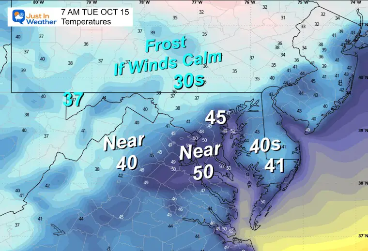
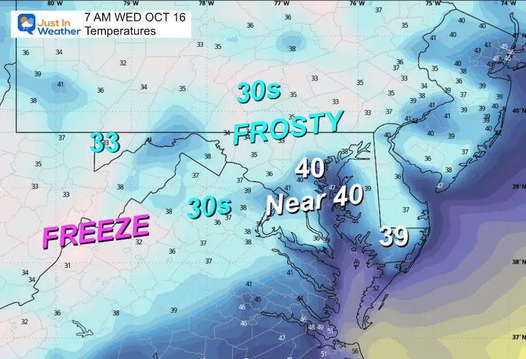
We may get our first frost this week… away from the cities. While temperatures support this on Tuesday morning, the wind may still be too strong. A calmer wind and colder temperatures will likely bring the frost on Wednesday morning.
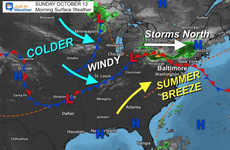
Morning Surface Weather
High Pressure will shift to allow winds from the South to push in warmer air. A small Low Pressure riding the warm front to our north should keep the storms to our north in central PA to New York and New England.
This will enhance the wind pulling in FROM THE SOUTH.
A series of cold fronts will arrive Monday and Tuesday. This will surge in colder air for a few days and bring in deep fall chill and maybe the first frost for many this week.
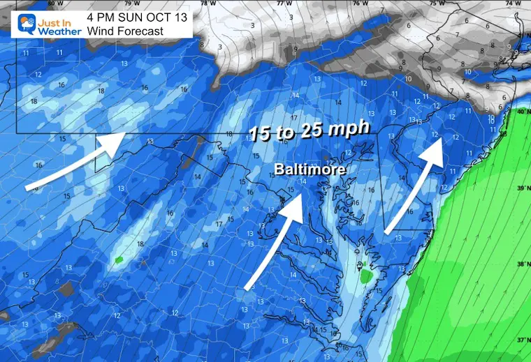
Wind Forecast Noon to Midnight
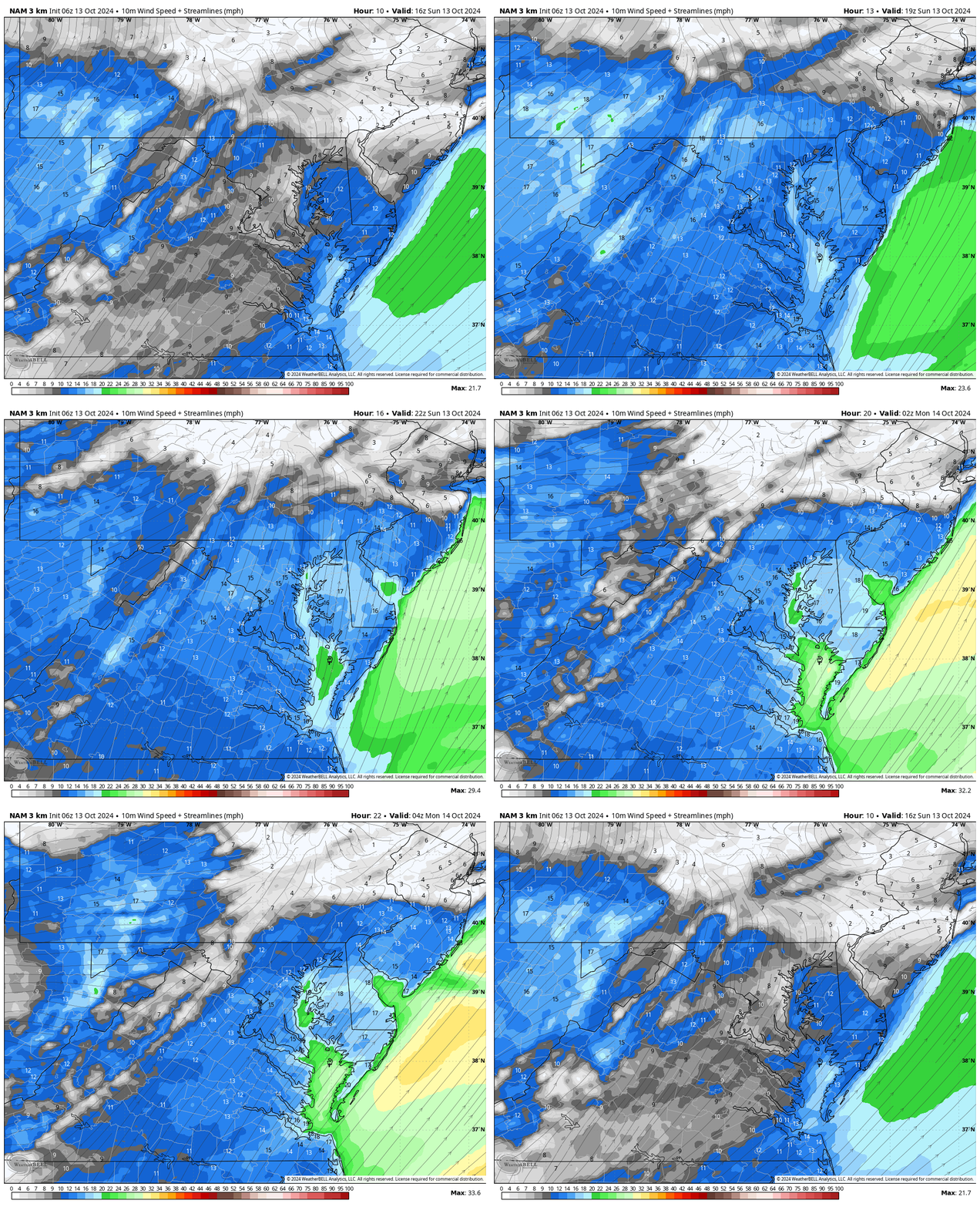
Snapshot 4 PM
Gusts 15 to 25 mph FROM THE SOUTH
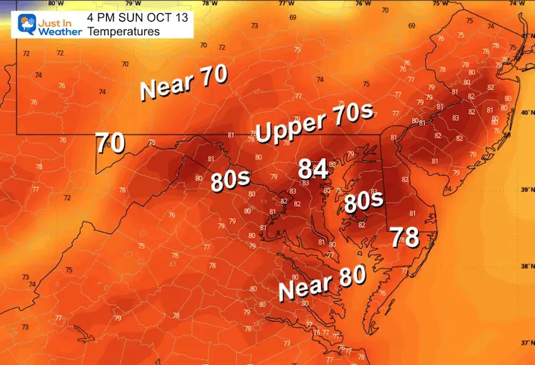
Afternoon Temperatures
Last taste of summer?
Comet A3 Viewing
This special sky show event has completed its turn around the sun and is now on its way back into deep space. It is passing the closest it will be to Earth this weekend and will be climbing higher in the sky for viewing. Here is all the info I posted on my Facebook page if you want more.
CLIMATE DATA: Baltimore
TODAY October 13
Sunrise at 7:15 AM
Sunset at 6:30 PM
Normal Low in Baltimore: 48ºF
Record 32ºF in 1957, 1988; 2006
Normal High in Baltimore: 69ºF
Record 89ºF 1954
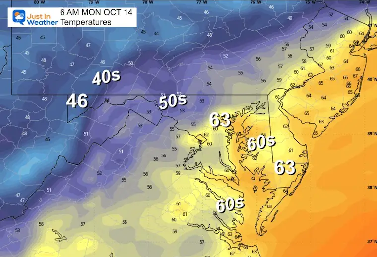
MONDAY OCTOBER 14
Morning Low
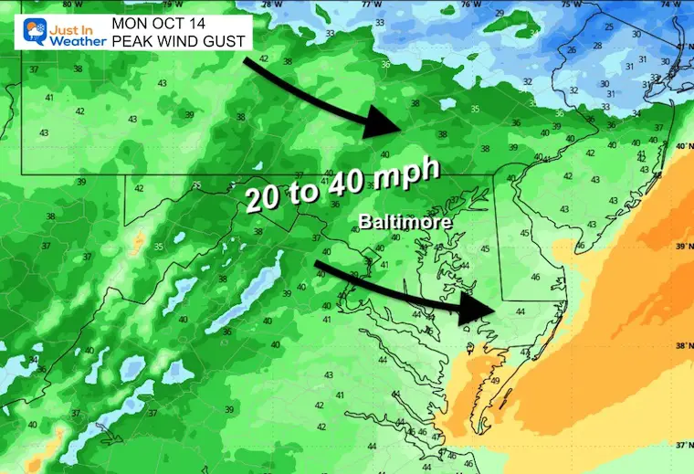
Wind Forecast 6 AM to Midnight
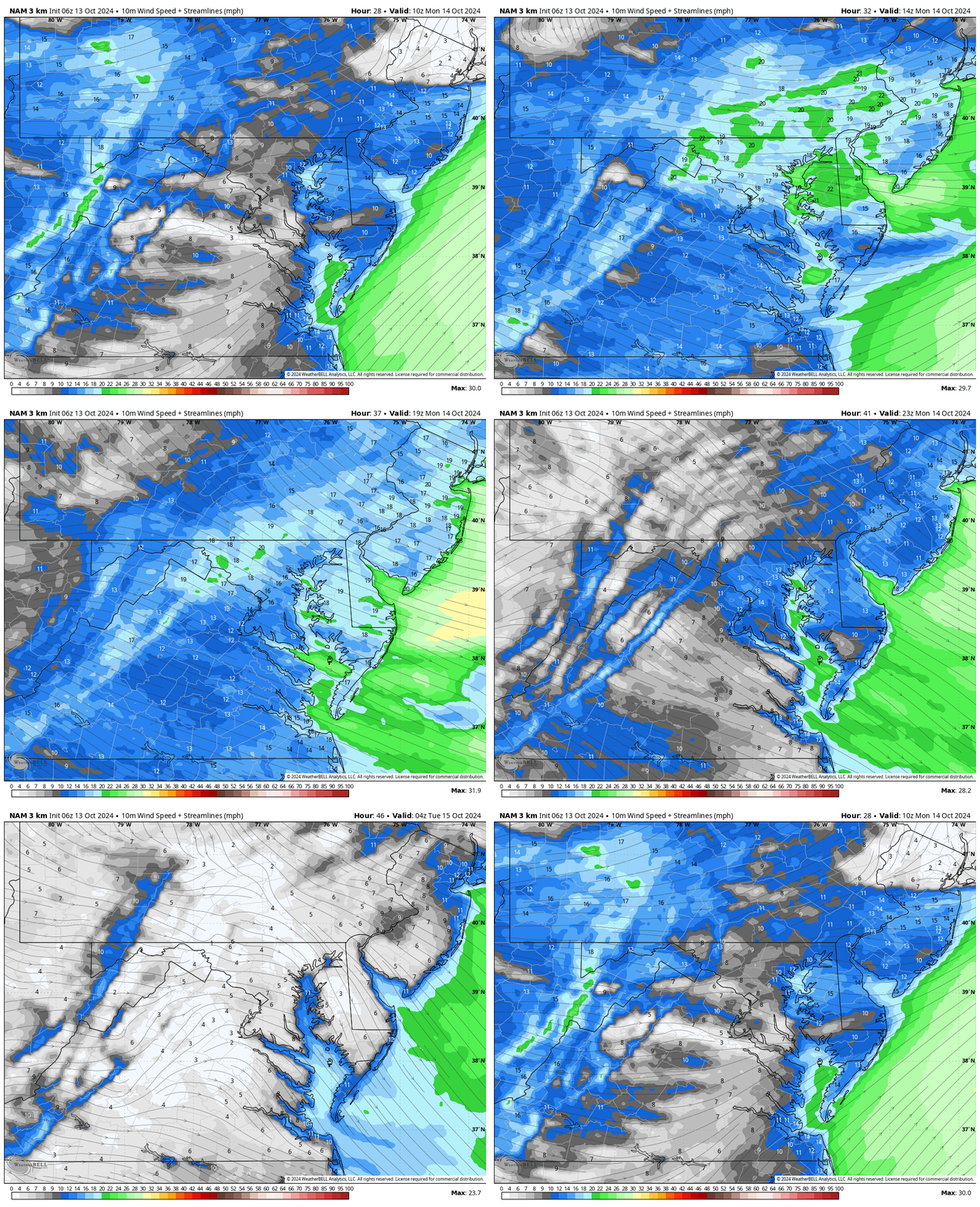
Snapshot 2 PM
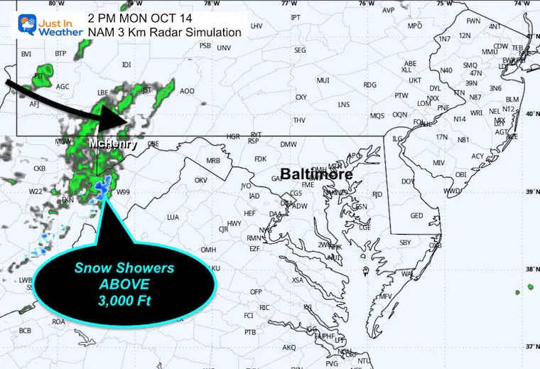
Radar Simulation at 2 PM
Lake-effect style showers will reach the mountains and may mix with snow above 2,500 to 3,000 Ft.
This may include parts of Garrett County in western Maryland to the mountains around Canaan Valley in WV.
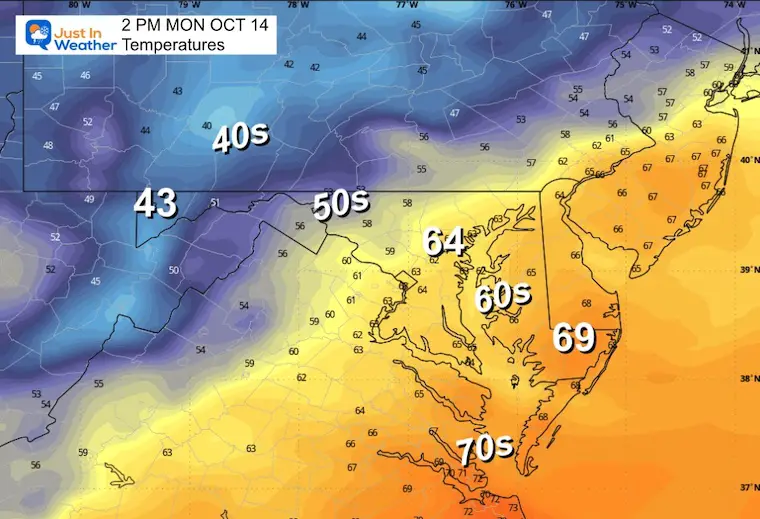
Afternoon High
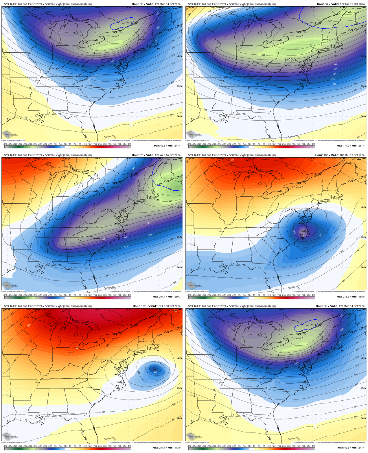
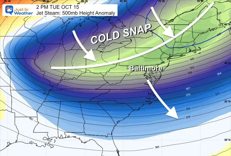
Looking Ahead: Jet Stream: Monday To Friday
A taste of Fall arriving in the Eastern US this week.
Snapshot Tuesday Afternoon
The leading edge of the new Canadian airmass will push through the Mid-Atlantic to the deep south with strong winds from the North.
This may bring the first frost to the Mid-Atlantic and Deep South.
Frosty Mornings?
Tuesday Morning Temperatures
Wednesday Morning Temperatures
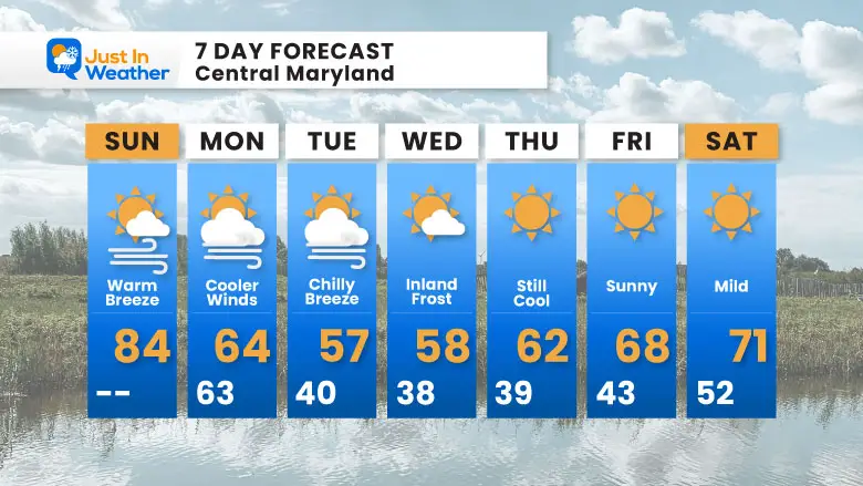
7 Day Forecast
After the last burst of summer, we will quickly shift to deep fall and maybe the first frost inland on Tuesday or, more likely, Wednesday morning.
Please share your thoughts and best weather pics/videos, or just keep in touch via social media.
-
Facebook: Justin Berk, Meteorologist
-
Twitter
-
Instagram
SCHEDULE A WEATHER BASED STEM ASSEMBLY
Severe Weather: Storm Smart October and next spring
Winter Weather FITF (Faith in the Flakes): November To March
Click to see more and send a request for your school.
ALSO SEE
Equinox NOT Equal Daylight… Yet
SECOND OF FOUR FULL SUPERMOONS
THANK YOU:
Baltimore Magazine Readers Choice Best Of Baltimore
Maryland Trek 11 Day 7 Completed Sat August 10
We raised OVER $104,000 for Just In Power Kids – AND Still Collecting More
The annual event: Hiking and biking 329 miles in 7 days between The Summit of Wisp to Ocean City.
Each day, we honor a kid and their family’s cancer journey.
Fundraising is for Just In Power Kids: Funding Free Holistic Programs. I never have and never will take a penny. It is all for our nonprofit to operate.
Click here or the image to donate:
RESTATING MY MESSAGE ABOUT DYSLEXIA
I am aware there are some spelling and grammar typos and occasional other glitches. I take responsibility for my mistakes and even the computer glitches I may miss. I have made a few public statements over the years, but if you are new here, you may have missed it: I have dyslexia and found out during my second year at Cornell University. It didn’t stop me from getting my meteorology degree and being the first to get the AMS CBM in the Baltimore/Washington region.
One of my professors told me that I had made it that far without knowing and to not let it be a crutch going forward. That was Mark Wysocki, and he was absolutely correct! I do miss my mistakes in my own proofreading. The autocorrect spell check on my computer sometimes does an injustice to make it worse. I also can make mistakes in forecasting. No one is perfect at predicting the future. All of the maps and information are accurate. The ‘wordy’ stuff can get sticky.
There has been no editor who can check my work while writing and to have it ready to send out in a newsworthy timeline. Barbara Werner is a member of the web team that helps me maintain this site. She has taken it upon herself to edit typos when she is available. That could be AFTER you read this. I accept this and perhaps proves what you read is really from me… It’s part of my charm. #FITF


