G4 Severe Geomagnetic Storm Forecast Satellite Risk And Aurora:Thursday Night Northern Lights
Thursday October 10 2024
The Space Weather Prediction Center, a division of NOAA has issued a G4 Severe Geomagnetic Storm Forecast. This is second highest level and can produce The Northern Lights/Auroras in locations through The Mid Atlantic and even to The Gulf Coast, Texas, and California.
While we may be hoping for a beautiful display of colors at night, this warning is for the potential disruption to Power Grids and Satellite communication. See more below.
STORM FORECAST

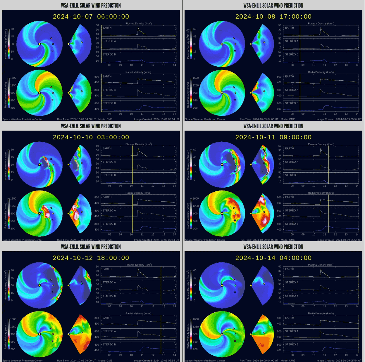
Solar Wind
See the leading edge pulse at 15:00 Hours. This means we should begin to see the Planetary Kp index increase mid day and this afternoon. Setting us up for the potential show tonight.
Forecast Planetary Kp Index: Auroa
These forecast are suggestions and not perfect.
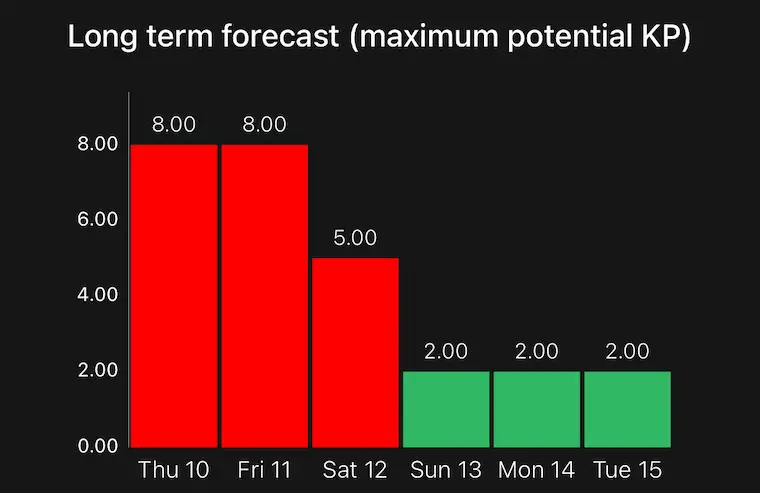
Up to Kp=8 Thursday Night AND Friday.
Time Breakdown
NOAA Kp index forecast 10 Oct – 12 Oct
Based on the chart below, I believe the Friday forecast is better for after midnight tonight in the early morning hours. There may be another chance Friday night that I am not seeing, but I would focus on tonight if you want to chase it.
Highlights in Red Are Best Viewing Opportunities in The Western Hemisphere.
UTC Is Universal Time Code. It is 4 hours ahead of Eastern Daylight Time. (12 UT = 8 AM EDT)
Time Oct 10 Oct 11 Oct 12
00-03UT 1.67 7.67 5.33
03-06UT 2.33 8.00 5.00
06-09UT 5.00 7.33 4.67
09-12UT 7.00 6.67 4.33
12-15UT 7.67 6.33 4.33
15-18UT 8.33 6.33 5.33
18-21UT 8.00 6.00 4.67
21-00UT 7.67 5.33 4.33
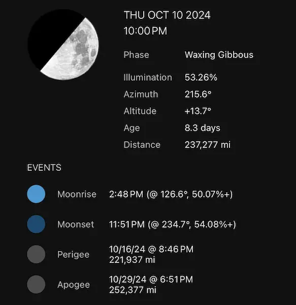
Moon 1/2 Visible
This light may get in the way of seeing fainter colors. This forecast for Baltimore at 10 PM shows it in the lower Southwestern Sky. It will set just before midnight (11:51 PM) improving chances for seeing more colors afterwards.
Mid Atlantic Viewing
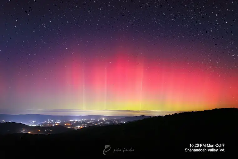
This was the view from Shenandoah National Park on Monday night. That was a Burt to Kp7.
Peter Forister (@forecaster25) and a seasoned veteran capturing many Northern Light events with amazing photography like this. His prints are available by clicking here.
Where To Look?
I know this may sound silly, but the Northern Lights are best seen Looking NORTH. You may also want to get away from city lights and any obstructions like buildings or trees.
Getting higher in altitude will also improve your chances in lower latitudes.
Aurora Viewing Forecasts
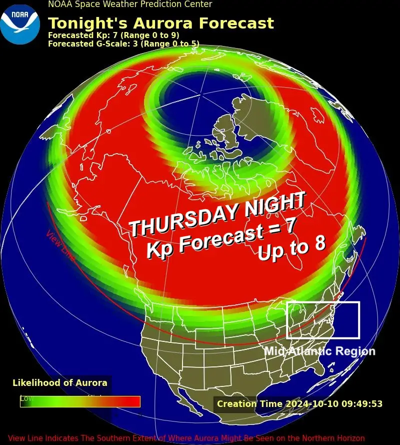
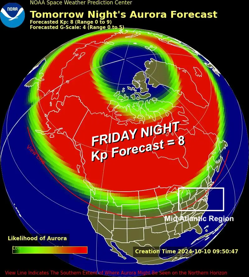
I’ve highlighted the Mid Atlantic region. The Red Line is the Horizon line for the potential aurora. It may be seen in the this region and perhaps if conditions are right farther south into the Gulf Coast states, Texas, and California.
Thursday Night
Sky Forecast
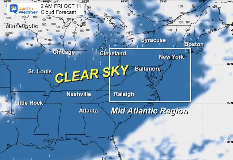
Friday:
Pretty Lights AND Technology Disruption
During storms, the heat they create increases “density and distribution of density in the upper atmosphere, causing extra drag on satellites in low-earth orbit,” the Space Weather Prediction Center said.
The local heat the storms create can also “modify the path of radio signals and create errors in the positioning information provided by GPS,” according to the center.
“Satellite navigation (GPS) degraded or inoperable for hours, Radio – HF (high frequency) radio propagation sporadic or blacked out.”
The power grid may also be affected by “possible widespread voltage control problems,” according to the SWPC.
The Official G4 Scale Projected Effects:
This occurs 60 days per each 11 Year Cycle
Planetary Kp Index can reach 8 or 9-. This would support the southern viewing opportunity.
Power systems: Possible widespread voltage control problems and some protective systems will mistakenly trip out key assets from the grid.
Spacecraft operations: May experience surface charging and tracking problems, corrections may be needed for orientation problems.
Other systems: Induced pipeline currents affect preventive measures, HF radio propagation sporadic, satellite navigation degraded for hours, low-frequency radio navigation disrupted, and aurora has been seen as low as Alabama and northern California (typically 45° geomagnetic lat.).
In Case You Missed It
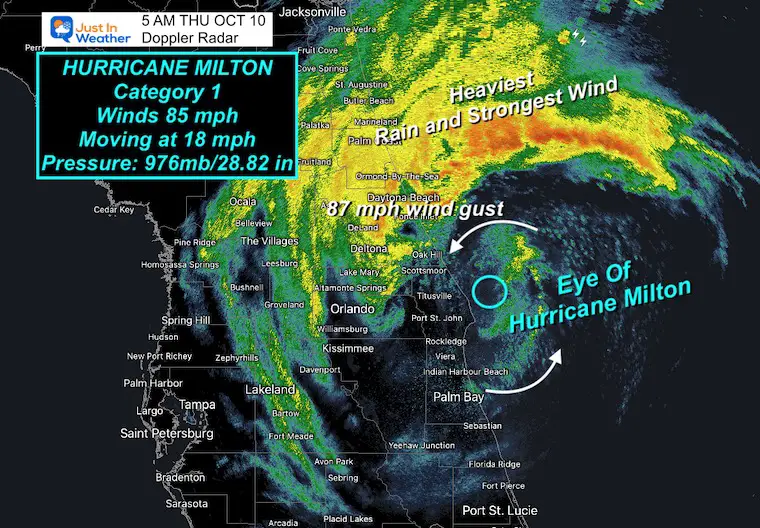
Hurricane Milton Morning Report: Back Over The Water In The Atlantic
Please share your thoughts and best weather pics/videos, or just keep in touch via social media.
-
Facebook: Justin Berk, Meteorologist
-
Twitter
-
Instagram
SCHEDULE A WEATHER BASED STEM ASSEMBLY
Severe Weather: Storm Smart October and next spring
Winter Weather FITF (Faith in the Flakes): November To March
Click to see more and send a request for your school.
ALSO SEE
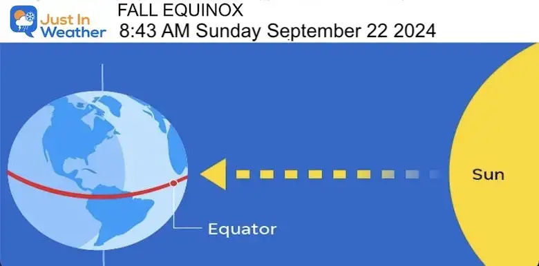
Equinox NOT Equal Daylight… Yet
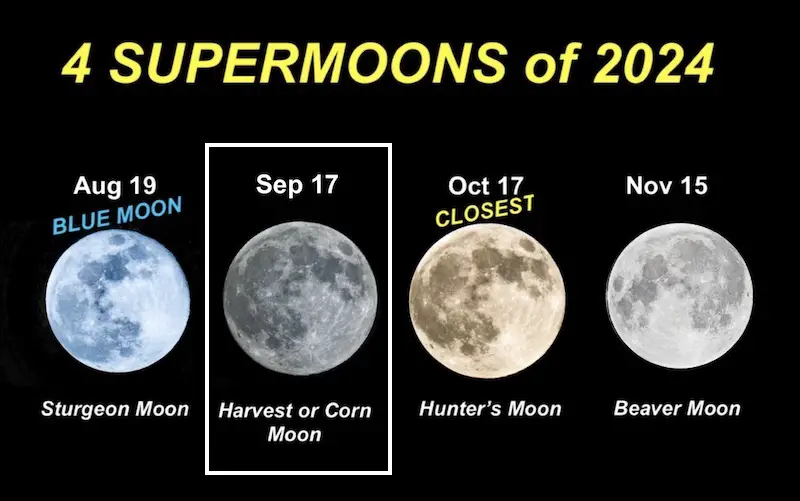
SECOND OF FOUR FULL SUPERMOONS
THANK YOU:
Baltimore Magazine Readers Choice Best Of Baltimore
Maryland Trek 11 Day 7 Completed Sat August 10
We raised OVER $104,000 for Just In Power Kids – AND Still Collecting More
The annual event: Hiking and biking 329 miles in 7 days between The Summit of Wisp to Ocean City.
Each day, we honor a kid and their family’s cancer journey.
Fundraising is for Just In Power Kids: Funding Free Holistic Programs. I never have and never will take a penny. It is all for our nonprofit to operate.
Click here or the image to donate:
RESTATING MY MESSAGE ABOUT DYSLEXIA
I am aware there are some spelling and grammar typos and occasional other glitches. I take responsibility for my mistakes and even the computer glitches I may miss. I have made a few public statements over the years, but if you are new here, you may have missed it: I have dyslexia and found out during my second year at Cornell University. It didn’t stop me from getting my meteorology degree and being the first to get the AMS CBM in the Baltimore/Washington region.
One of my professors told me that I had made it that far without knowing and to not let it be a crutch going forward. That was Mark Wysocki, and he was absolutely correct! I do miss my mistakes in my own proofreading. The autocorrect spell check on my computer sometimes does an injustice to make it worse. I also can make mistakes in forecasting. No one is perfect at predicting the future. All of the maps and information are accurate. The ‘wordy’ stuff can get sticky.
There has been no editor who can check my work while writing and to have it ready to send out in a newsworthy timeline. Barbara Werner is a member of the web team that helps me maintain this site. She has taken it upon herself to edit typos when she is available. That could be AFTER you read this. I accept this and perhaps proves what you read is really from me… It’s part of my charm. #FITF


