October 8 Cool Air Mass Directs Hurricane Milton And The Northern Lights Overnight
Tuesday, October 8, 2024
Morning Report
While still tracking historic Hurricane Milton in the Gulf Of Mexico and the path into Florida, I wanted to briefly cover our local weather in the Mid-Atlantic region. It is this fresh Canadian Air Mass that brought us a cool down that is responsible for two other things:
The clear sky overnight allowed many to view the latest aurora. The Northern Lights did grace Central Maryland, with some reports as far south as Texas.
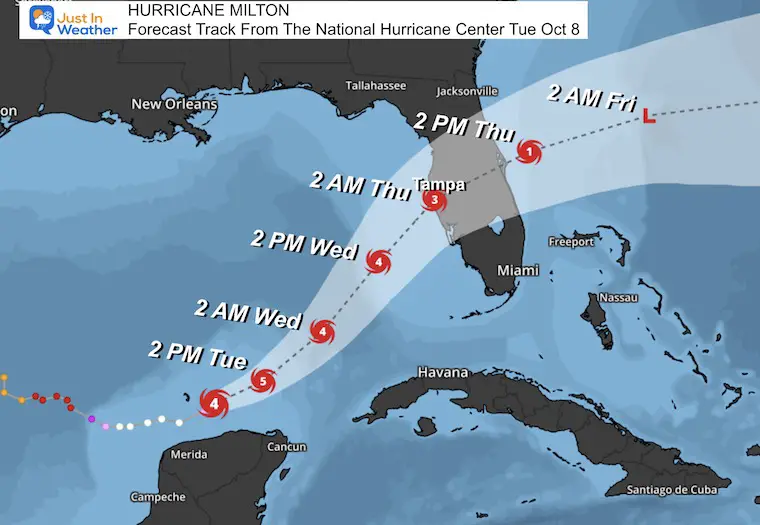
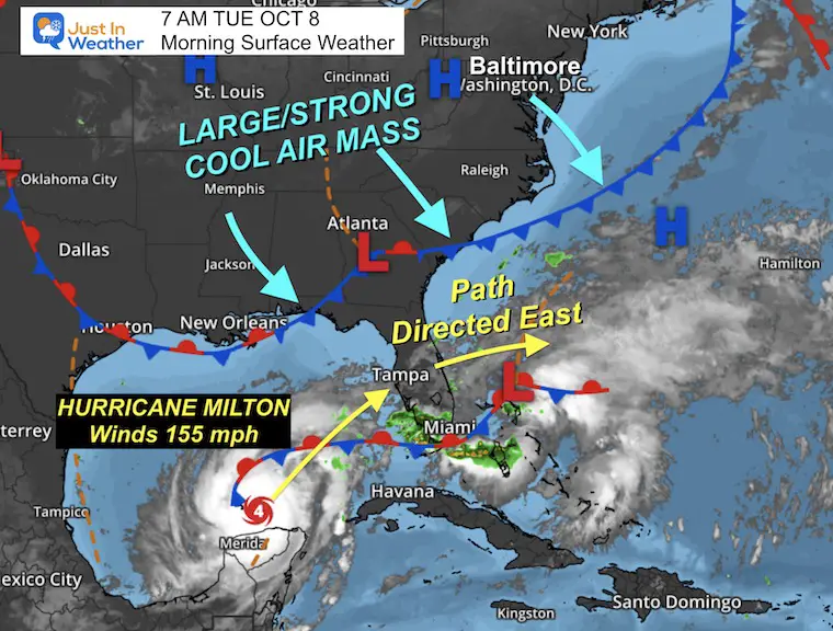
The jet stream bringing us this cool air is also helping direct Hurricane Milton to the East across Florida. This is rare but not unheard of. Sadly, it is the worst-case scenario for the Tampa Bay Area, which has been rated the most vulnerable shoreline for surge flooding.
Northern Lights Overnight
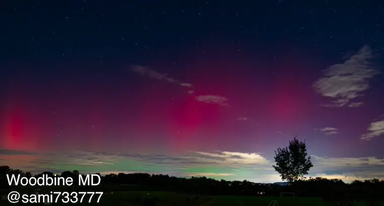
The peak display was around 1 AM. Thanks to all who shared these photos.
This video was recorded in Howard County:
I captured this breathtaking timelapse of the Auroras erupting over Ellicott City, Maryland.@spacewxwatch @capitalweather @MatthewCappucci @spann @TonyPannWBAL @DCNewsLive @JustinWeather pic.twitter.com/YCRsN3tqmy
— Sami (@sami733777) October 8, 2024
Morning Surface Weather
High Pressure across the Mid-Atlantic and Midwest has reached Georgia and South Carolina. This will BLOCK Hurricane Milton and prevent it from moving up the coast.
Jet Stream Forecast Tuesday To Friday
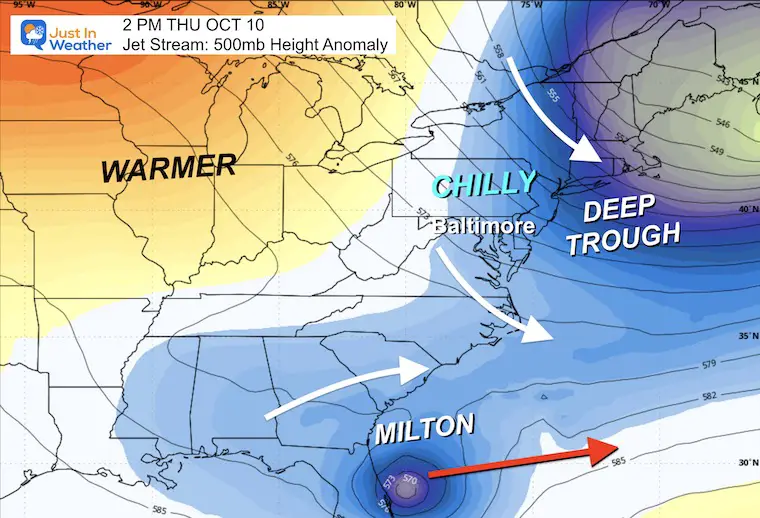
We can see the trough in the Eastern US (blue) and Hurricane Milton’s circulation across the bottom of the loop image.
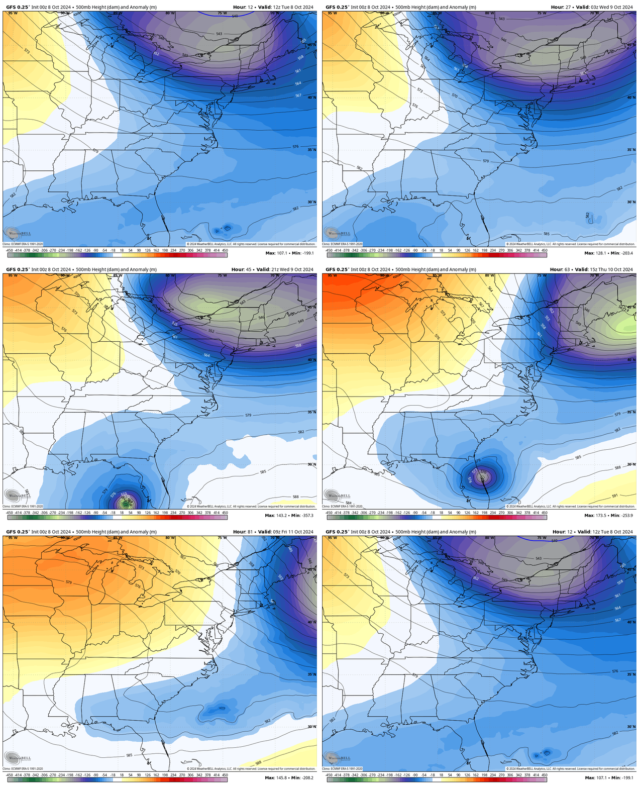
Snapshot Thursday Afternoon
Here is the upper-level influence that will help direct Milton from West to East across Florida and then out farther into the Atlantic.
Milton Update and Forecast
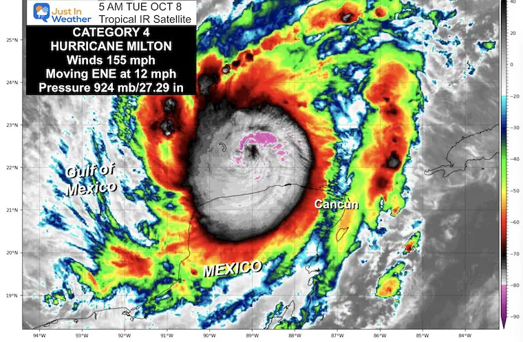
The latest on Milton (5 AM Advisory) had winds down to 155 mph. This makes it Category 4. It may regain some strength today, then weaken before landfall.
National Hurricane Center SUMMARY OF 5 AM EDT
- LOCATION…22.3N 88.9W
- ABOUT 85 MI…140 KM NE OF PROGRESO MEXICO
- ABOUT 560 MI…905 KM SW OF TAMPA FLORIDA
- MAXIMUM SUSTAINED WINDS…155 MPH…250 KM/H
- PRESENT MOVEMENT…ENE OR 75 DEGREES AT 12 MPH…19 KM/H
- MINIMUM CENTRAL PRESSURE…924 MB…27.29 INCHES
Click this image for the full morning report. I will write my next report before noon.
Local Weather Briefing:
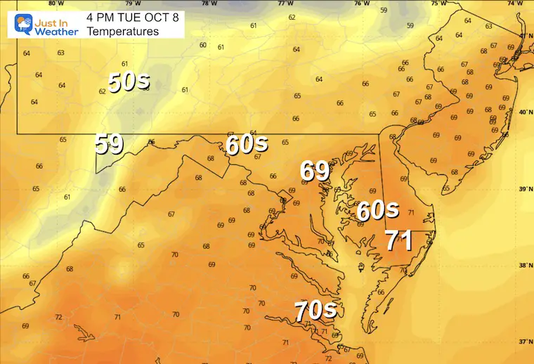
Afternoon Temperatures
CLIMATE DATA: Baltimore
TODAY October 8
Sunrise at 7:10 AM
Sunset at 6:37 PM
Normal Low in Baltimore: 50ºF
Record 31ºF in 2001
Normal High in Baltimore: 72ºF
Record 91ºF 2007
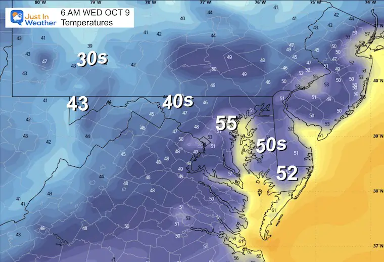
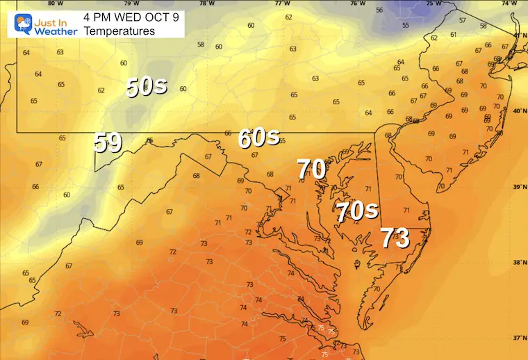
WEDNESDAY OCTOBER 9
Morning Low
Afternoon High
Looking Ahead:
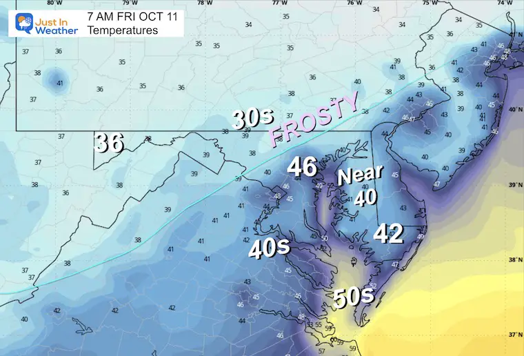
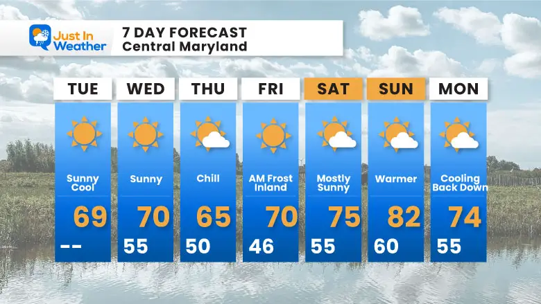
The next headline locally will be the possible first frost on Friday, then warming up over the weekend.
Friday Morning Low Temperatures
7 Day Forecast
A chilly week, bottoming out Friday morning. Then, warming back up again for the weekend.
Please share your thoughts and best weather pics/videos, or just keep in touch via social media.
-
Facebook: Justin Berk, Meteorologist
-
Twitter
-
Instagram
SCHEDULE A WEATHER BASED STEM ASSEMBLY
Severe Weather: Storm Smart October and next spring
Winter Weather FITF (Faith in the Flakes): November To March
Click to see more and send a request for your school.
ALSO SEE
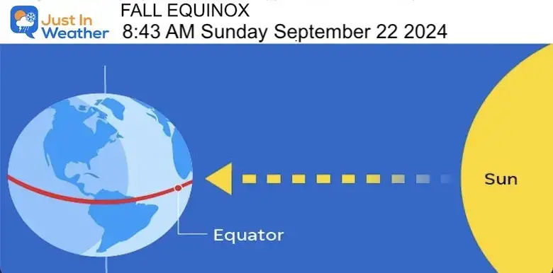
Equinox NOT Equal Daylight… Yet
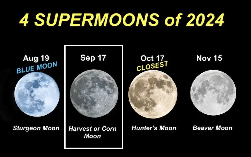
SECOND OF FOUR FULL SUPERMOONS
THANK YOU:
Baltimore Magazine Readers Choice Best Of Baltimore
Maryland Trek 11 Day 7 Completed Sat August 10
We raised OVER $104,000 for Just In Power Kids – AND Still Collecting More
The annual event: Hiking and biking 329 miles in 7 days between The Summit of Wisp to Ocean City.
Each day, we honor a kid and their family’s cancer journey.
Fundraising is for Just In Power Kids: Funding Free Holistic Programs. I never have and never will take a penny. It is all for our nonprofit to operate.
Click here or the image to donate:
RESTATING MY MESSAGE ABOUT DYSLEXIA
I am aware there are some spelling and grammar typos and occasional other glitches. I take responsibility for my mistakes and even the computer glitches I may miss. I have made a few public statements over the years, but if you are new here, you may have missed it: I have dyslexia and found out during my second year at Cornell University. It didn’t stop me from getting my meteorology degree and being the first to get the AMS CBM in the Baltimore/Washington region.
One of my professors told me that I had made it that far without knowing and to not let it be a crutch going forward. That was Mark Wysocki, and he was absolutely correct! I do miss my mistakes in my own proofreading. The autocorrect spell check on my computer sometimes does an injustice to make it worse. I also can make mistakes in forecasting. No one is perfect at predicting the future. All of the maps and information are accurate. The ‘wordy’ stuff can get sticky.
There has been no editor who can check my work while writing and to have it ready to send out in a newsworthy timeline. Barbara Werner is a member of the web team that helps me maintain this site. She has taken it upon herself to edit typos when she is available. That could be AFTER you read this. I accept this and perhaps proves what you read is really from me… It’s part of my charm. #FITF


