


January 2 Weather Still Cold This Weekend With A Warm Up Next Week
Friday, January 2, 2026 After the New Year's Day Morning Snow Squall, the cold air mass has been firmly in place. One more system passed through overnight with flurries and…
Sunday, September 29, 2024
Morning Report
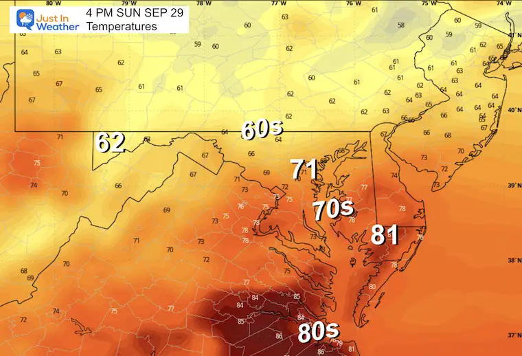
In contrast to the historic destruction from Helene, our region in the Mid-Atlantic received a gift of sunshine and temps in the 80s yesterday. That is over, as clouds have returned with mist, fog, and showers.
Temperatures will be cooler with the influence of the air mass over New England feeding in high Northeasterly winds.
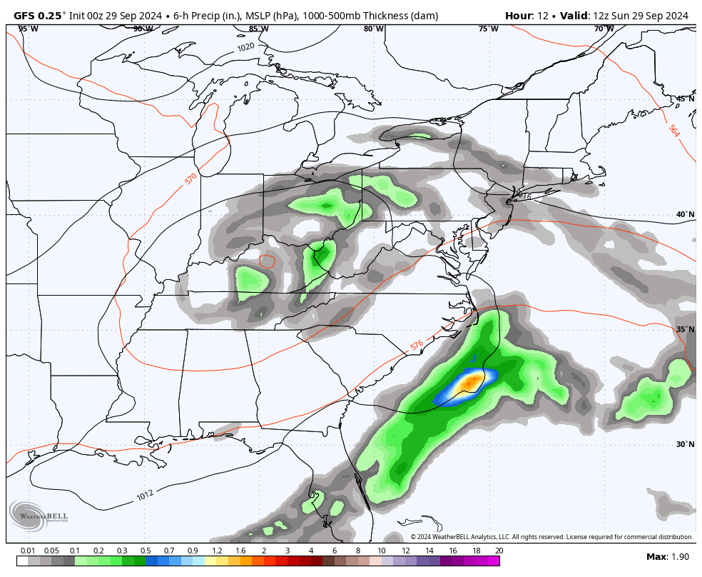
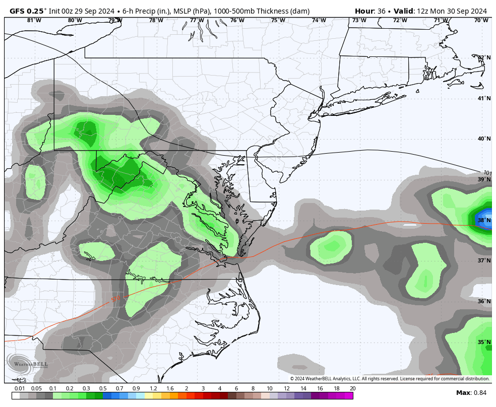
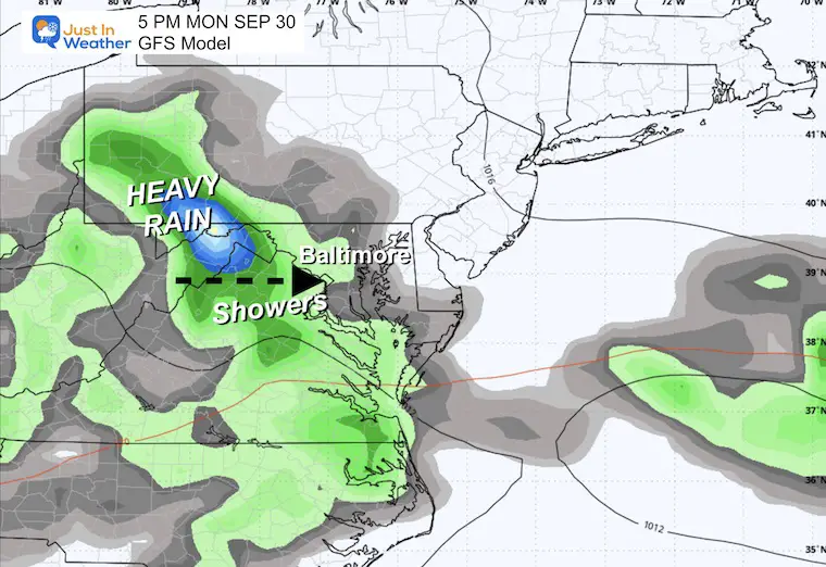
The remains of Helene continue to spin in the Ohio Valley with showers. The rain will become more prominent for us on Monday and Tuesday, then break to end the week.
There is a hint of another tropical system forming in a similar region to Helene and trying to reach the Gulf Coast next weekend. More on that below.
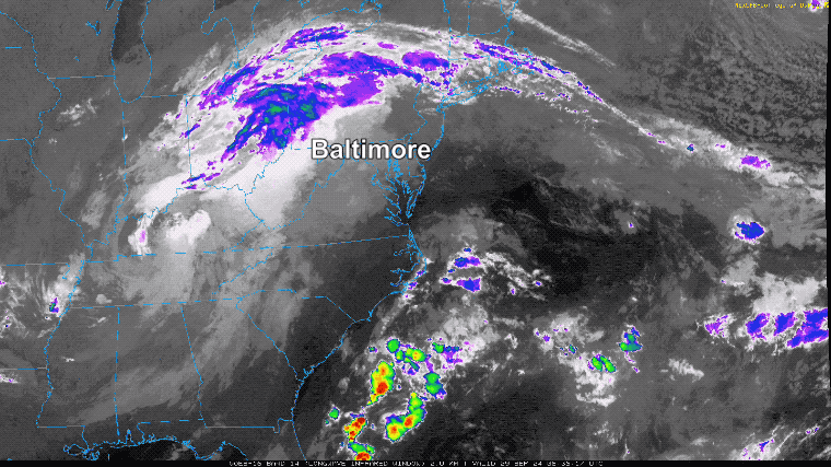
Sunday morning starts with mist and fog, along with spotty showers. They may not all show on radar, but we can see some of the rain.
The remains of Helene and the Upper-Level Low merging are seen across western Tennessee and Kentucky. Showers wrap around into Ohio and western Pennsylvania. Another plume of moisture is pulling up the coast of North Carolina.
To our North, the influence of High Pressure off the coast of Maine is sending cooler air into the moist environment, helping to expand the fog, mist, and drizzle.
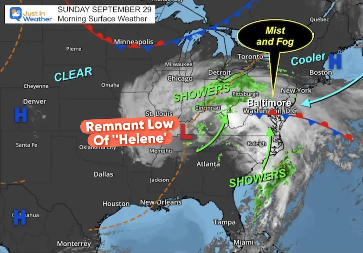
The large-scale circulation shows the spin of the Remnant Low from Helene (merging with the Upper-Level Low) over Kentucky. The influence of clouds across the Eastern US.
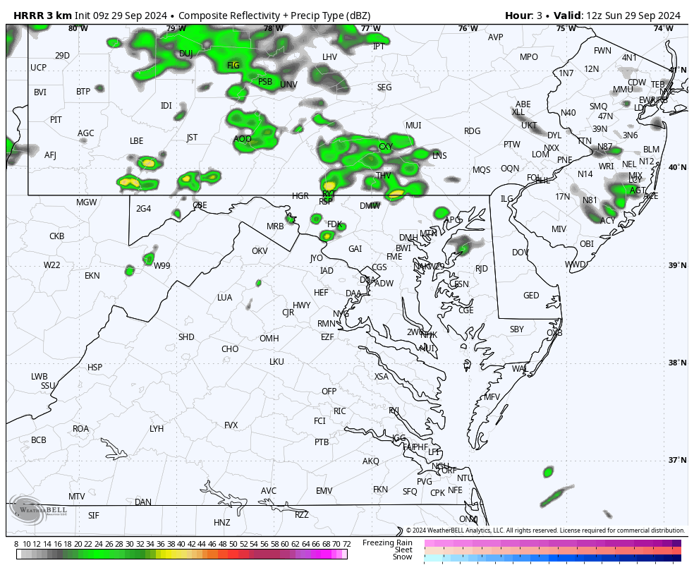
The drizzle, mist, and fog will not show here. However, we do see showers in southern PA expanding into Central Maryland this afternoon and evening. This does suggest wet weather for the Ravens home game in Baltimore tonight.
Sunrise at 7:01 AM
Sunset at 6:52 PM
Normal Low in Baltimore: 54ºF
Record 38ºF in 1951
The small range from morning to afternoon is a result of the added moisture in the air.
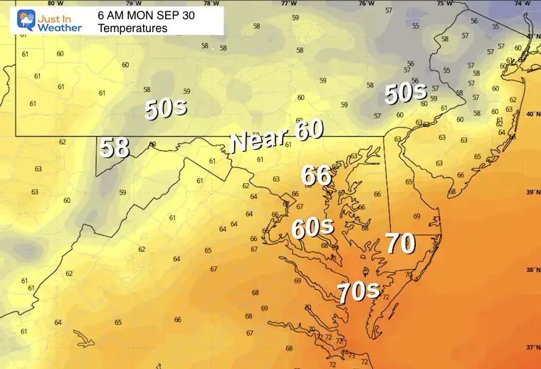
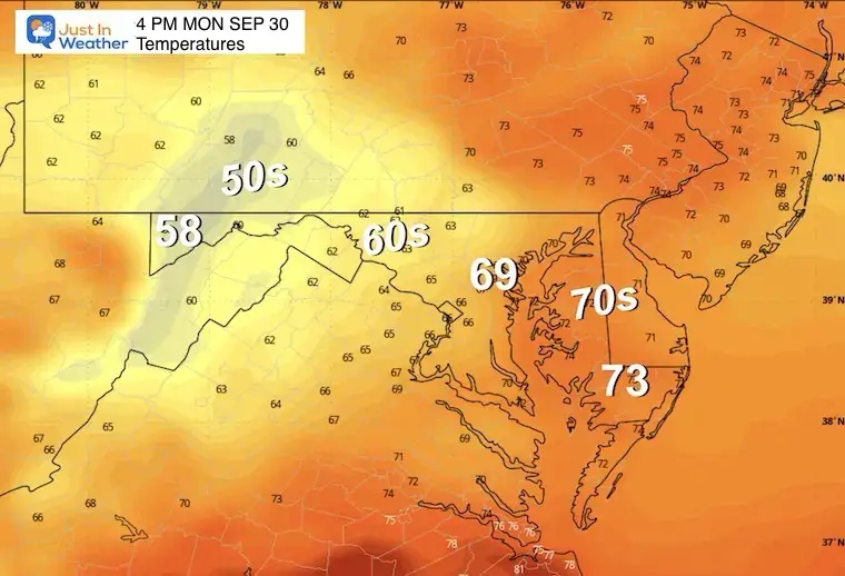
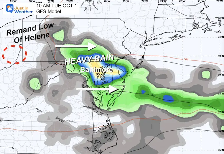
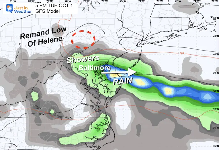
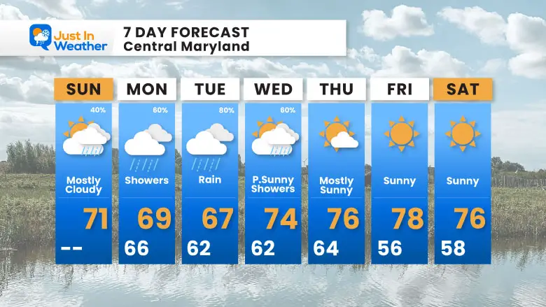
The remnant Low from Helene will pass through early in the work week. Rain will expand from the west and reach metro areas and Central Maryland, with the most wet weather on Tuesday.
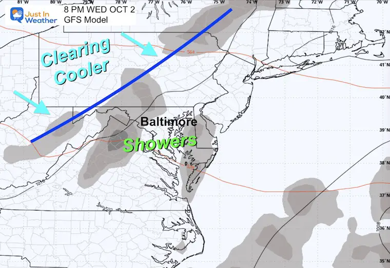
Then, a cold front will arrive with a fresh and dry air mass later on Wednesday.
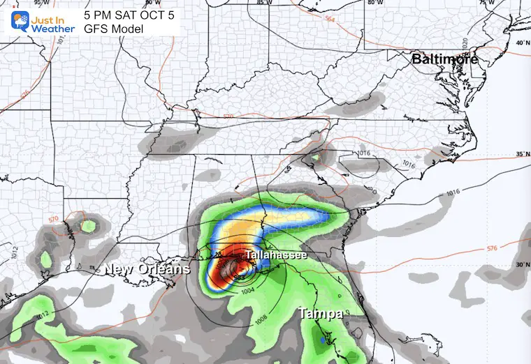
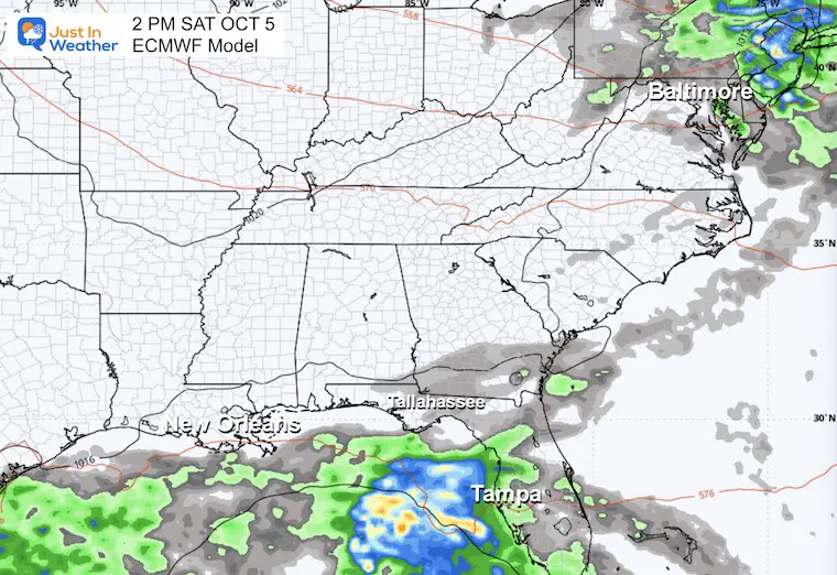
National Hurricane Center: 7-Day Outlook
A case for Atmospheric Memory shows a 50% chance of developing in the same general area where Helene formed.
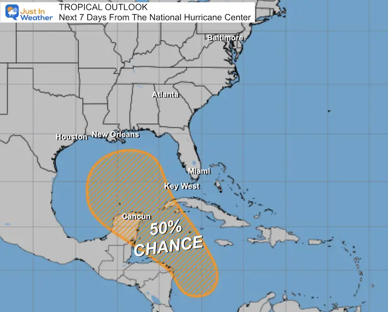
This helps to show why there is NO PROMISE OF A REPEAT! We CANNOT pin down a storm forecast or landfall before it even forms.
The GFS Model is trying to show a landfalling system, but the European ECMWF Model shows whatever develops may stay in the Gulf and get wind sheer to disrupt it and push over Florida.
The last system was initially tracked better by the ECMWF Model.
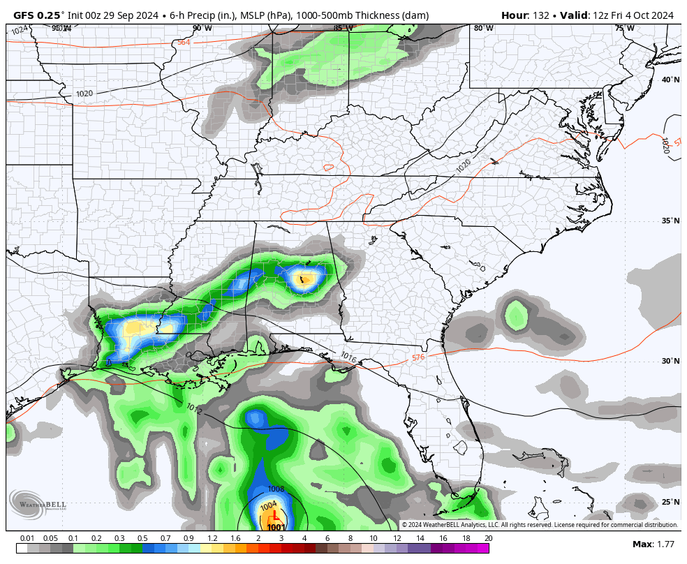
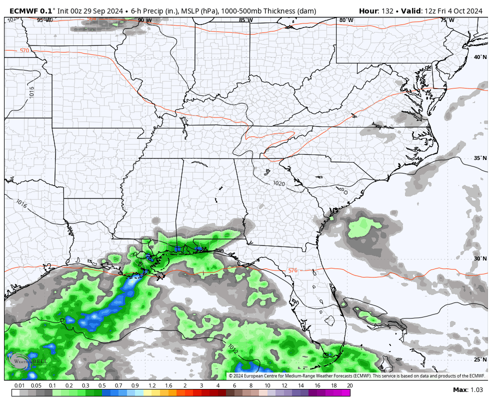
The rain from Helene is expected on Monday and Tuesday. More showers will linger as the upper levels energy stalls early next week.
Severe Weather: Storm Smart October and next spring
Winter Weather FITF (Faith in the Flakes): November To March
Click to see more and send a request for your school.

The annual event: Hiking and biking 329 miles in 7 days between The Summit of Wisp to Ocean City.
Each day, we honor a kid and their family’s cancer journey.
Fundraising is for Just In Power Kids: Funding Free Holistic Programs. I never have and never will take a penny. It is all for our nonprofit to operate.
Click here or the image to donate:

I am aware there are some spelling and grammar typos and occasional other glitches. I take responsibility for my mistakes and even the computer glitches I may miss. I have made a few public statements over the years, but if you are new here, you may have missed it: I have dyslexia and found out during my second year at Cornell University. It didn’t stop me from getting my meteorology degree and being the first to get the AMS CBM in the Baltimore/Washington region.
One of my professors told me that I had made it that far without knowing and to not let it be a crutch going forward. That was Mark Wysocki, and he was absolutely correct! I do miss my mistakes in my own proofreading. The autocorrect spell check on my computer sometimes does an injustice to make it worse. I also can make mistakes in forecasting. No one is perfect at predicting the future. All of the maps and information are accurate. The ‘wordy’ stuff can get sticky.
There has been no editor who can check my work while writing and to have it ready to send out in a newsworthy timeline. Barbara Werner is a member of the web team that helps me maintain this site. She has taken it upon herself to edit typos when she is available. That could be AFTER you read this. I accept this and perhaps proves what you read is really from me… It’s part of my charm. #FITF