


January 2 Weather Still Cold This Weekend With A Warm Up Next Week
Friday, January 2, 2026 After the New Year's Day Morning Snow Squall, the cold air mass has been firmly in place. One more system passed through overnight with flurries and…
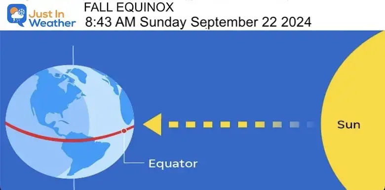
Friday September 27, 2024
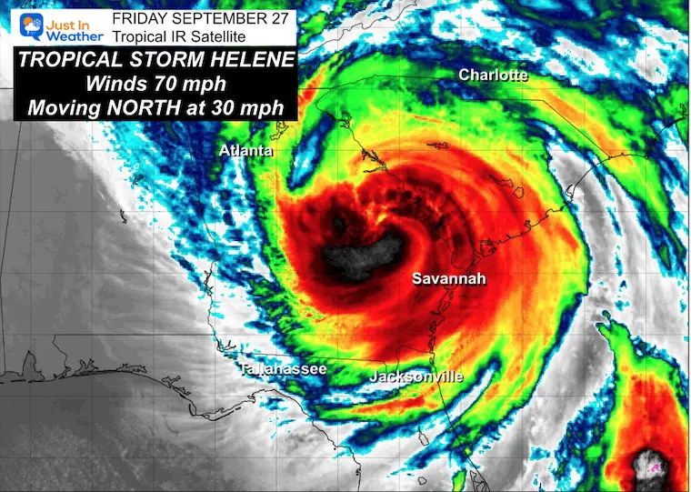
At 5 AM this morning, the National Hurricane Center finally downgraded Helene to a Tropical Storm with 70 mph. This was well inland, just 40 miles from Macon and 100 miles from Atlanta. This means it was inland for nearly 6 hours, and the devastation is extensive. Reports of tornadoes, transformer explosions, and sewage, in addition to the flooding and houses washed away, are included.
This report will focus on the weather as the storm races farther inland and gets absorbed into a stalled upper-level Low across the Ohio Valley.
I have included the weekend weather for our local Mid-Atlantic region as well below the report on Helene.
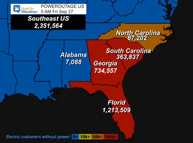
These are numbers from poweroutage.us as of 5 AM. They will climb higher throughout the day for sure.
Florida and Georgia have been hardest hit – so far.
I showed this yesterday, and this is one of many staging areas. There will be a lot of work for the linesmen and women, perhaps for weeks ahead.
2 AM to 5 AM Loop
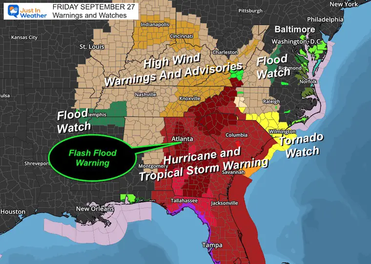
Hurricane and Tropical Storm Warnings will be adjusted to all Tropical Storm conditions due to the update.
High Wind and Flooding warnings and advisories extend all the way into Ohio and Indiana on the north side, and Tennessee and Mississippi on the west side.
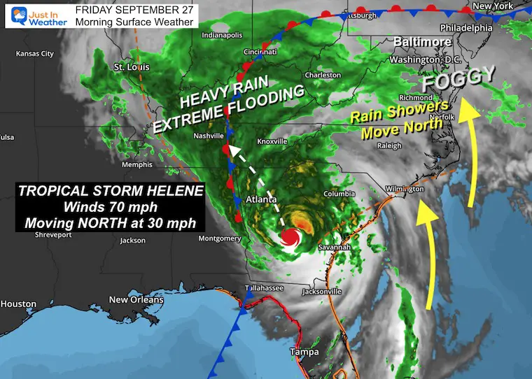
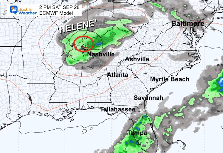
Helene was located in east-central Georgia with 70 mph winds. It was moving to the North at 30 mph and expected to turn Northwest across Atlanta this morning after sunrise.
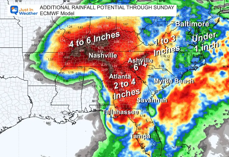
Heavy rain continues across the Blue Ridge Mountains into The Tennessee River Valley. Mudslides in the mountains and countless rivers and streams are overflowing. There may be some dams compromised as well.
Rain showers are pushing north up the coast into the Mid-Atlantic today.
The humid tropical weather has developed thick fog here.
We can see the Low Pressure racing into the Ohio/Tennessee River Valley, nearly stalling, and then spinning out.
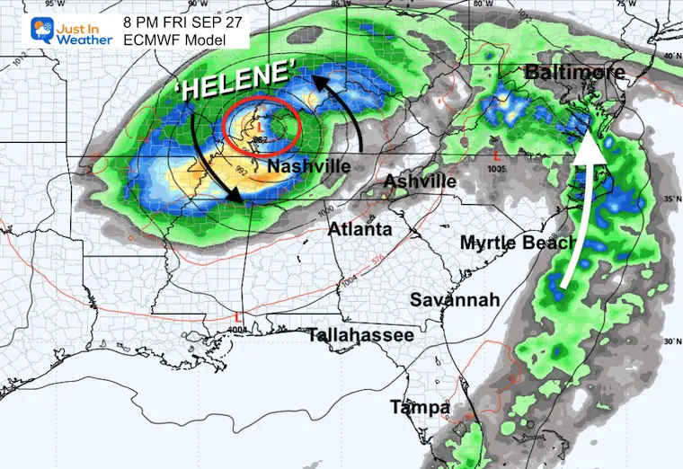
This is ADDITIONAL RAIN from overnight through Sunday.
Named Storms
Sunrise at 6:59 AM
Sunset at 6:55 PM
Normal Low in Baltimore: 55ºF
Record 39ºF in 1957
Normal High in Baltimore: 76ºF
Record 95ºF 1998
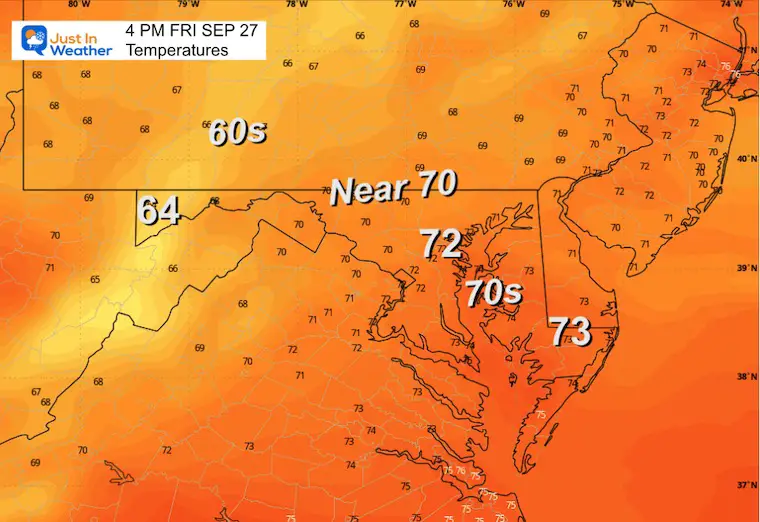
There is a warm and muggy feel to the air, pushing well ahead of the tropical system. There are areas of thick fog, and there will be rain, spotty showers, and thunderstorms today and into tonight.
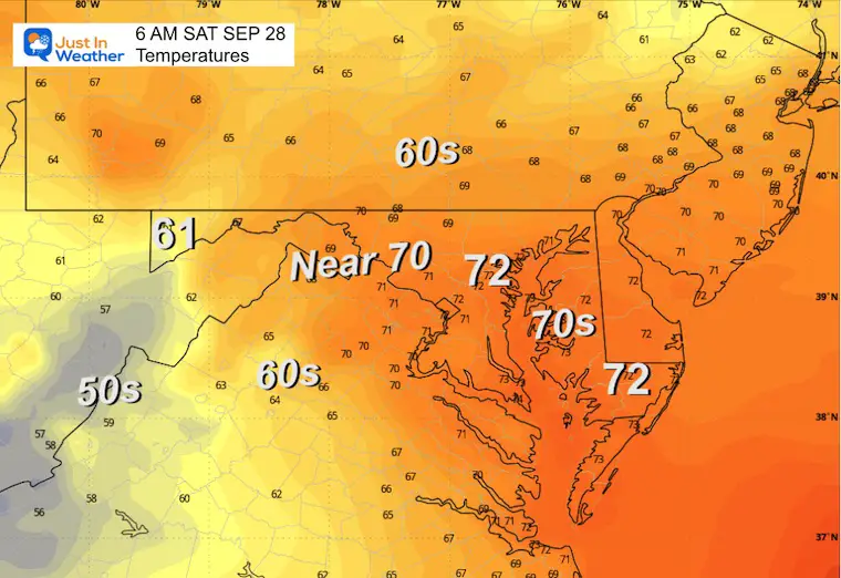
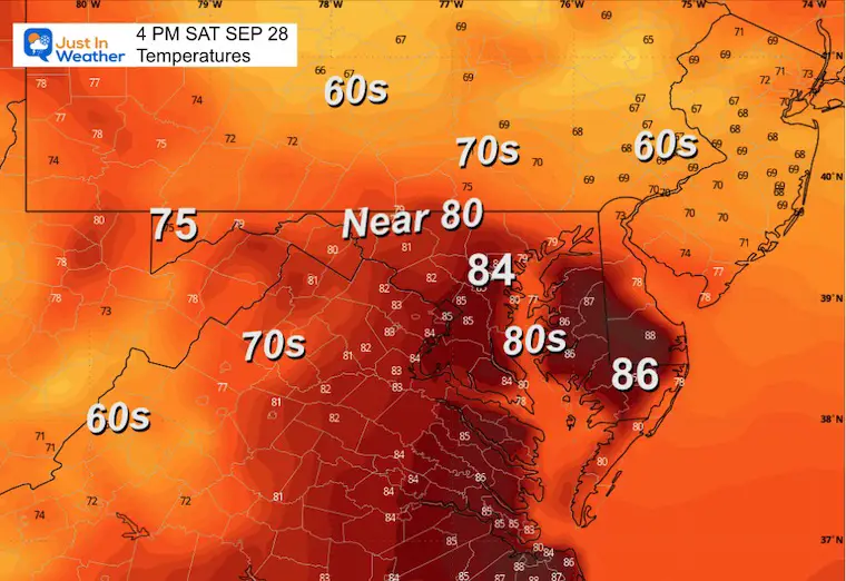
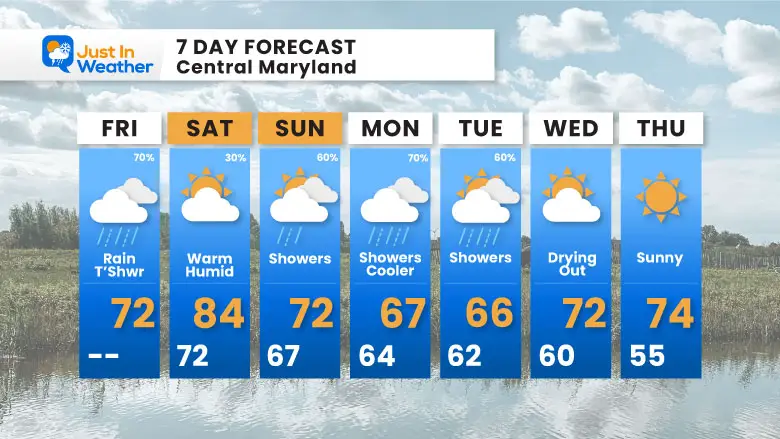
Saturday: May become sunny and warm, then a pop-up thundershower.
Sunday: More clouds and showers return. There may be showers at the Ravens game in Baltimore Sunday night.
Next Week: Extended period of clouds and showers Monday and Tuesday.
Bands of rain will move through this morning and break up into showers and thunderstorms this afternoon and evening.
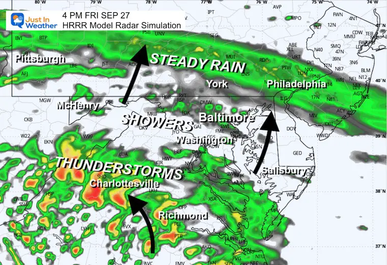
Not much change from the afternoon before… a signal of tropical humidity in place.
Severe Weather: Storm Smart October and next spring
Winter Weather FITF (Faith in the Flakes): November To March
Click to see more and send a request for your school.

The annual event: Hiking and biking 329 miles in 7 days between The Summit of Wisp to Ocean City.
Each day, we honor a kid and their family’s cancer journey.
Fundraising is for Just In Power Kids: Funding Free Holistic Programs. I never have and never will take a penny. It is all for our nonprofit to operate.
Click here or the image to donate:

I am aware there are some spelling and grammar typos and occasional other glitches. I take responsibility for my mistakes and even the computer glitches I may miss. I have made a few public statements over the years, but if you are new here, you may have missed it: I have dyslexia and found out during my second year at Cornell University. It didn’t stop me from getting my meteorology degree and being the first to get the AMS CBM in the Baltimore/Washington region.
One of my professors told me that I had made it that far without knowing and to not let it be a crutch going forward. That was Mark Wysocki, and he was absolutely correct! I do miss my mistakes in my own proofreading. The autocorrect spell check on my computer sometimes does an injustice to make it worse. I also can make mistakes in forecasting. No one is perfect at predicting the future. All of the maps and information are accurate. The ‘wordy’ stuff can get sticky.
There has been no editor who can check my work while writing and to have it ready to send out in a newsworthy timeline. Barbara Werner is a member of the web team that helps me maintain this site. She has taken it upon herself to edit typos when she is available. That could be AFTER you read this. I accept this and perhaps proves what you read is really from me… It’s part of my charm. #FITF