September 21 2024
With just a few hours left of summer, there is one last weather system that may try to work with the calendar. While it has been cloudy, it has also been a bit humid today. The next cold front has circulation spinning up this evening, which may enhance some of the rain and developing thunderstorms as it passes overnight. Below is a look at the short-range models, and I think this may be behaving a little faster than suggested.
The chance for severe limits is low, but some strong gusty winds over 58 mph may prompt a warming or two. Otherwise, this is about the downpours and lightning that could affect your plans or wake you up.
Following this system will be a cooler wind and a definite feel of fall on Sunday. Autumn officially begins tomorrow at 8:43 AM.
The chance for showers and thunderstorms will be this evening and a few rounds overnight. The final push will pass through Central Maryland before sunrise.
Here is a look at the setup and a comparison of the short-range models to see which one can handle this the best.
Live Radar Widget
See the set up and forecast below.
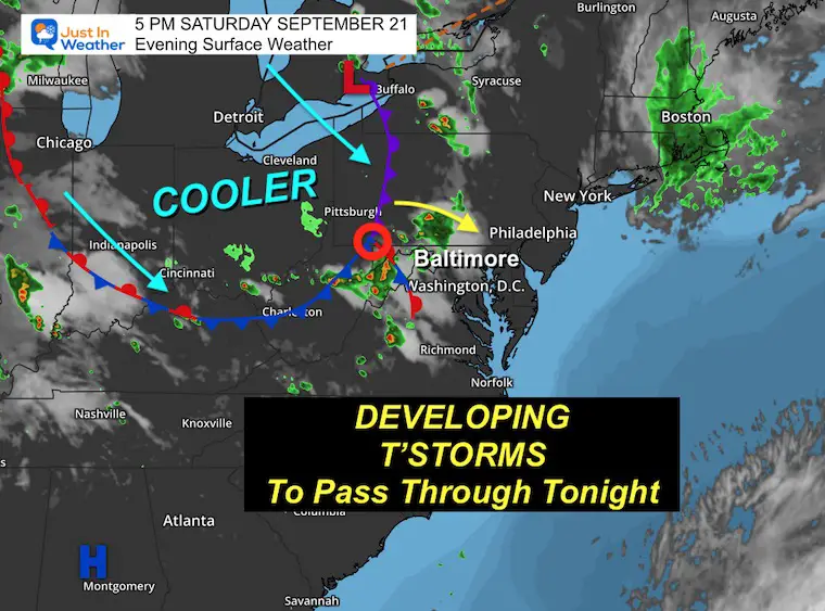
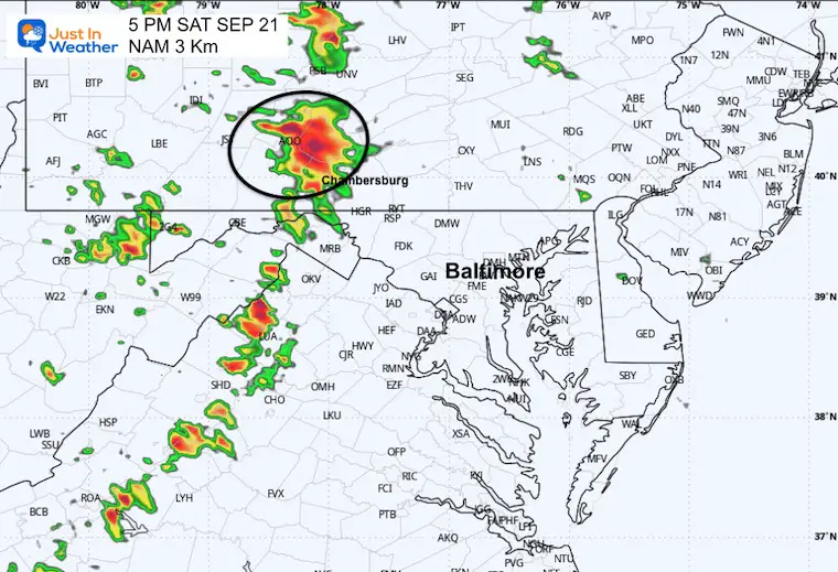
Saturday Evening Set Up
I’ve highlighted a ‘triple point’ with a red circle along the front. This is the circulation trying to spin up a new low pressure, which may enhance the developing thunderstorms overnight.
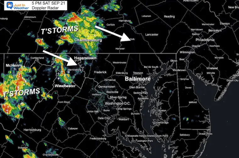
Let’s Back Up To 5 PM
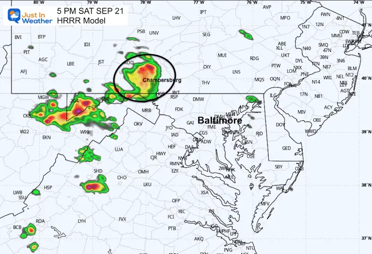
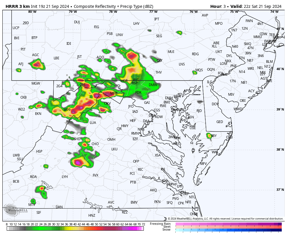
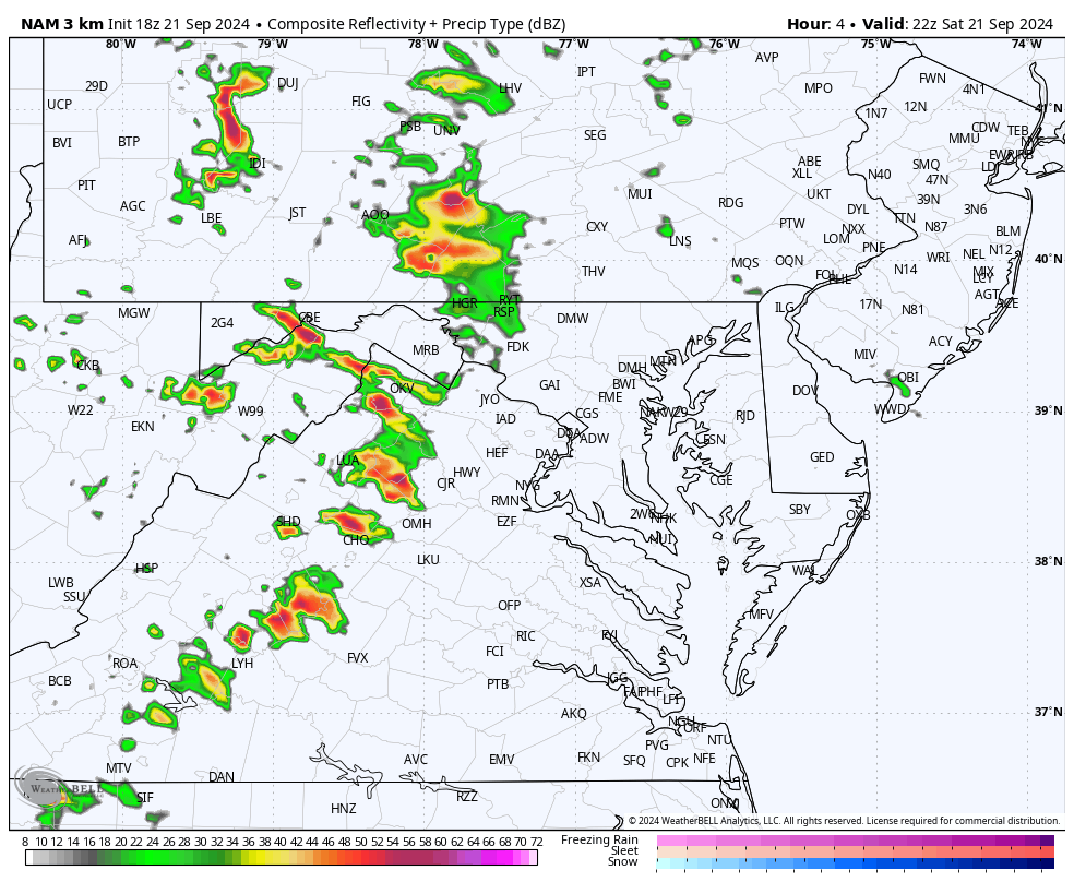
I want to compare the actual Doppler Radar to the short-range models HRRR (High Resolution Rapid Refresh) and the NAM 3 Km to see how they have handled this so far.
Doppler Radar
This cluster of thunderstorms reached Chambersburg, PA, just north and west of Hagerstown, and there was much more activity in the mountains south of McHenry.
HRRR Model (Forecast for 5 PM)
This forecast was pretty close to what is displayed above.
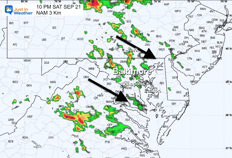
NAM 3Km (Forecast for 5 PM)
This plot was slower, but I believe it better covered the cluster near Chambersburg. This product may handle the storms better tonight, but it may be as much as an hour too slow.
Radar Simulations
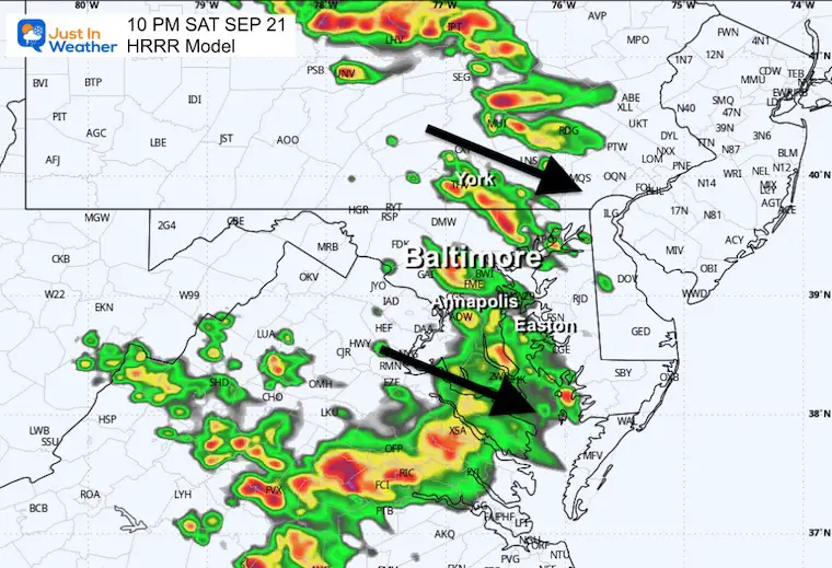
6 PM to 8 AM
These are SUGGESTIONS. There are subtle differences that I will highlight with snapshot time frames below.
HRRR Model Simulation
NAM 3 Km Model Simulation
This may be an hour too slow.
Snapshots
10 PM
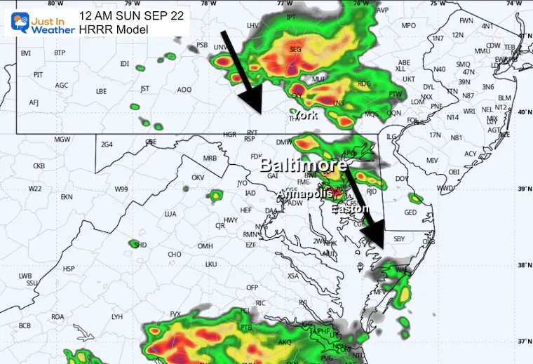
HRRR Model
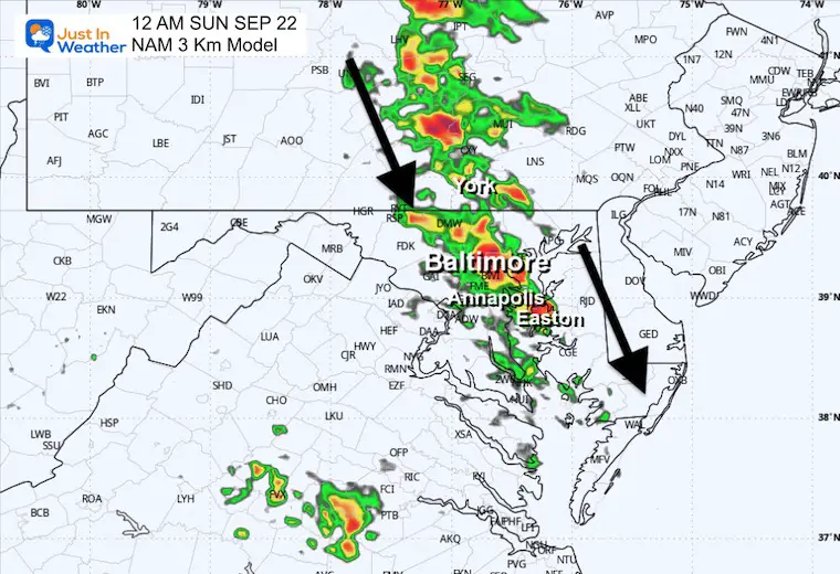
NAM 3 Km
This may resemble the 9 PM radar…
Midnight
The DIRECTION of the showers will gradually SHIFT FROM THE NORTH!
HRRR Model
NAM 3 Km
This may resemble the 11 PM radar…
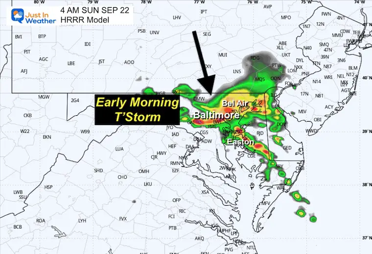
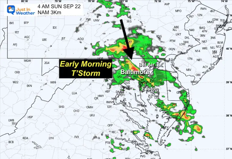
4 AM
HRRR Model
NAM 3 Km
This may resemble the 3 AM radar.
SUNDAY SEPTEMBER 22
NOTE:
Fall Begins At 8:43 AM Sunday
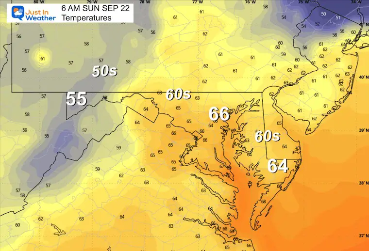
Morning Temperatures
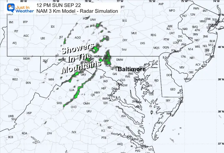
Noon Snapshot
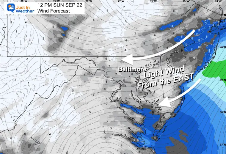
Wind Forecast
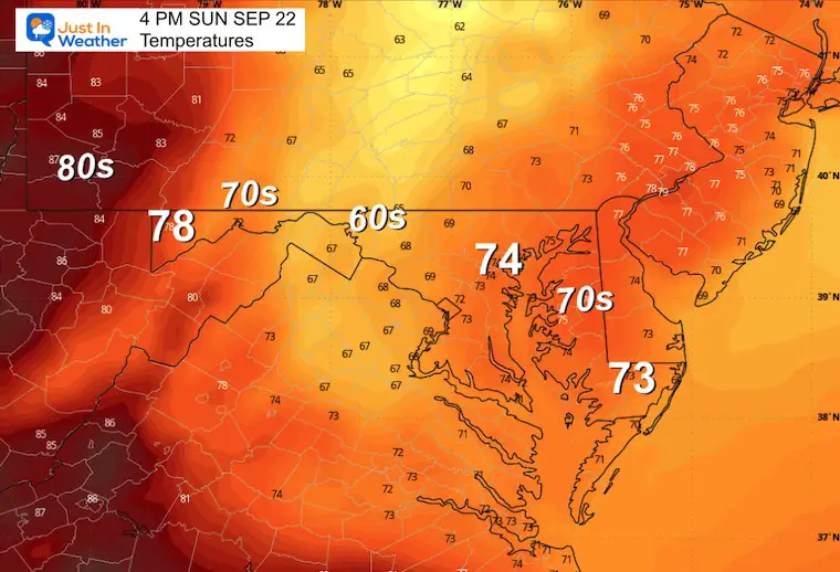
Light flow from the East will keep the damp and cool feel to the air.
Afternoon Temperatures
LOOKING AHEAD
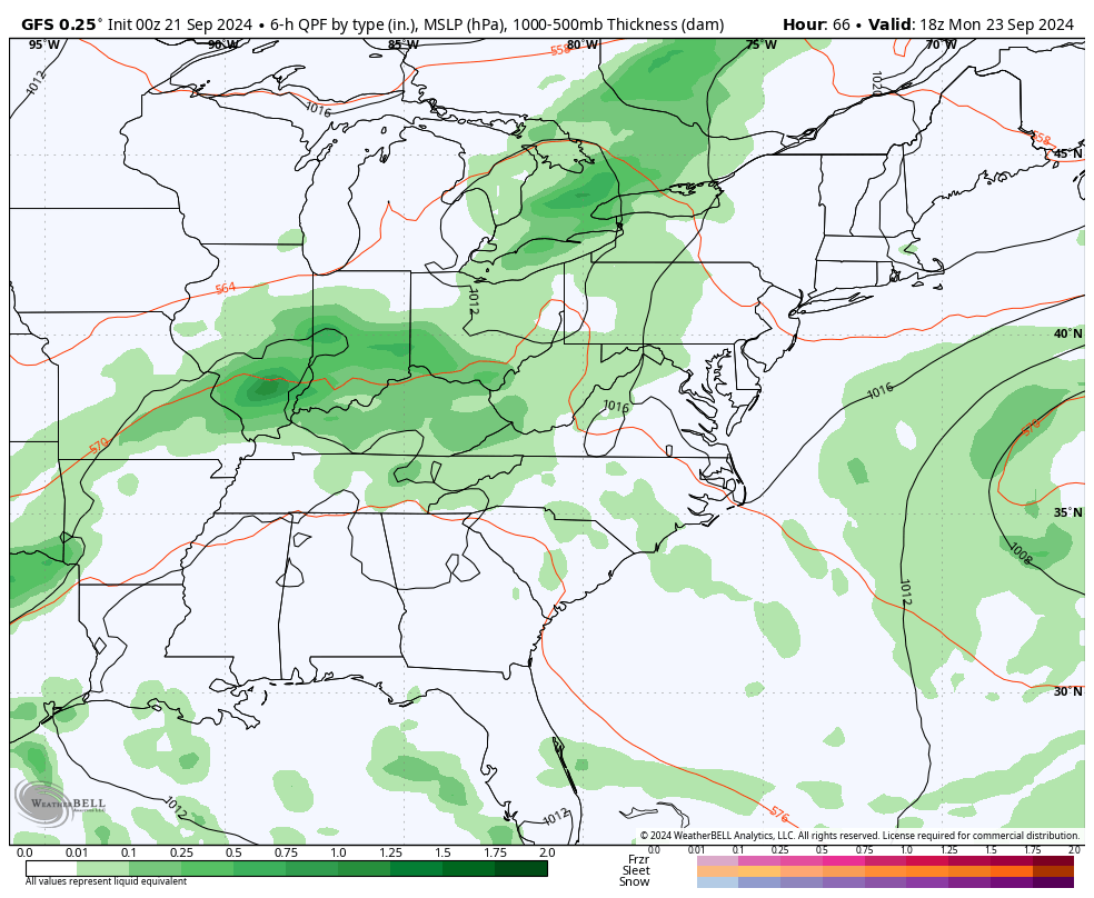
GFS Model Forecast Animation
Monday Through Friday
The weather pattern will be nearly stalled during the week. Steadier rain will fall across the Ohio Valley and the mountains, sending waves of showers our way each day. The chance will be lower farther east.
The big question is the potential tropical system trying to form in the Gulf of Mexico and move onshore into next weekend.
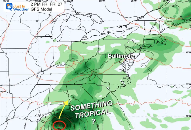
Friday
It is too early to state how strong the storm in the Gulf of Mexico will be, let alone if it will be named. It will more than likely be sending tropical moisture north along the front, feeding rain into our region.
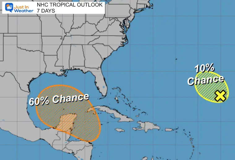
TROPICAL OUTLOOK
The National Hurricane Center 7-Day Outlook
40% chance for something to form in the Gulf of Mexico. This is a suggestion and not a promise. Remember the no-name storm we had off the South Carolina coast last week? It will more than likely still spread moderate to heavy rain our way during next weekend.
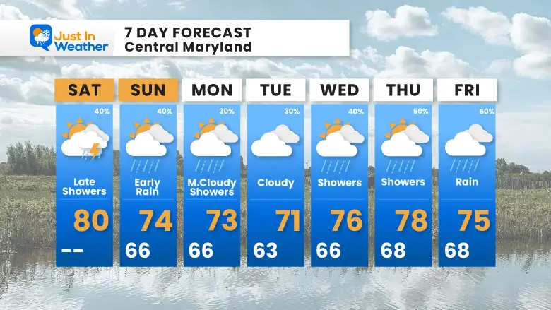
7 Day Forecast
A shift to cooler days in the 70s. Chance of showers almost every day. The better chance for rain will be in the mountains.
We will watch (not promise) something tropical trying to form in the Gulf of Mexico by the end of the week. If so, it may impact our weekend weather.
Please share your thoughts and best weather pics/videos, or just keep in touch via social media.
SCHEDULE A WEATHER BASED STEM ASSEMBLY
Severe Weather: Storm Smart October and next spring
Winter Weather FITF (Faith in the Flakes): November To March
Click to see more and send a request for your school.

THANK YOU:
Baltimore Magazine Readers Choice Best Of Baltimore
Maryland Trek 11 Day 7 Completed Sat August 10
We raised OVER $104,000 for Just In Power Kids – AND Still Collecting More
The annual event: Hiking and biking 329 miles in 7 days between The Summit of Wisp to Ocean City.
Each day, we honor a kid and their family’s cancer journey.
Fundraising is for Just In Power Kids: Funding Free Holistic Programs. I never have and never will take a penny. It is all for our nonprofit to operate.
Click here or the image to donate:

RESTATING MY MESSAGE ABOUT DYSLEXIA
I am aware there are some spelling and grammar typos and occasional other glitches. I take responsibility for my mistakes and even the computer glitches I may miss. I have made a few public statements over the years, but if you are new here, you may have missed it: I have dyslexia and found out during my second year at Cornell University. It didn’t stop me from getting my meteorology degree and being the first to get the AMS CBM in the Baltimore/Washington region.
One of my professors told me that I had made it that far without knowing and to not let it be a crutch going forward. That was Mark Wysocki, and he was absolutely correct! I do miss my mistakes in my own proofreading. The autocorrect spell check on my computer sometimes does an injustice to make it worse. I also can make mistakes in forecasting. No one is perfect at predicting the future. All of the maps and information are accurate. The ‘wordy’ stuff can get sticky.
There has been no editor who can check my work while writing and to have it ready to send out in a newsworthy timeline. Barbara Werner is a member of the web team that helps me maintain this site. She has taken it upon herself to edit typos when she is available. That could be AFTER you read this. I accept this and perhaps proves what you read is really from me… It’s part of my charm. #FITF
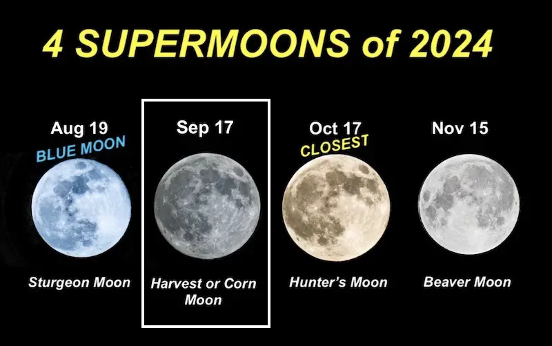
SECOND OF FOUR FULL SUPERMOONS
Click to see the full report: