September 13 Morning Fog Then Sun Into The Weekend And Rain Next Week
Friday September 13, 2024
Morning Report
Friday the Thirteenth can be a lucky day as we start with areas of fog and low clouds and end with increasing sun. The remains of Francine are nowhere near us, but they may help send in high clouds.
This weekend looks sunny and warm, but we are in need of more rain. This may arrive by Tuesday with a damp airflow from the Atlantic for a few days.
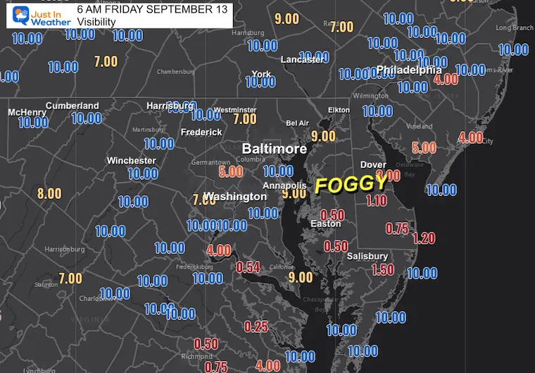
Morning Visibility
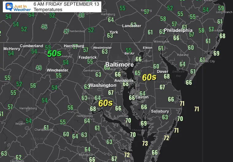
Morning Temperatures
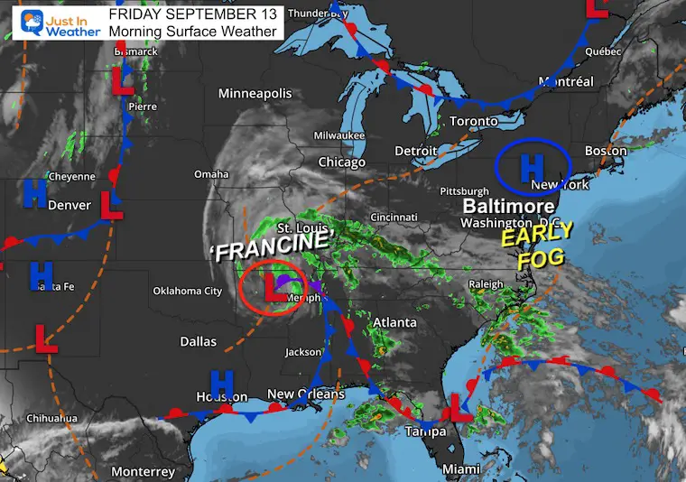
Morning Surface Weather
High Pressure is in control, and the added humidity has helped develop areas of fog. There were no advisories as of post time, but it could still affect your travel for a few hours.
The remains of Francine are in Arkansas, and the rain remains locked in place. Some of that moisture aloft will help feed the high clouds pushing our way.
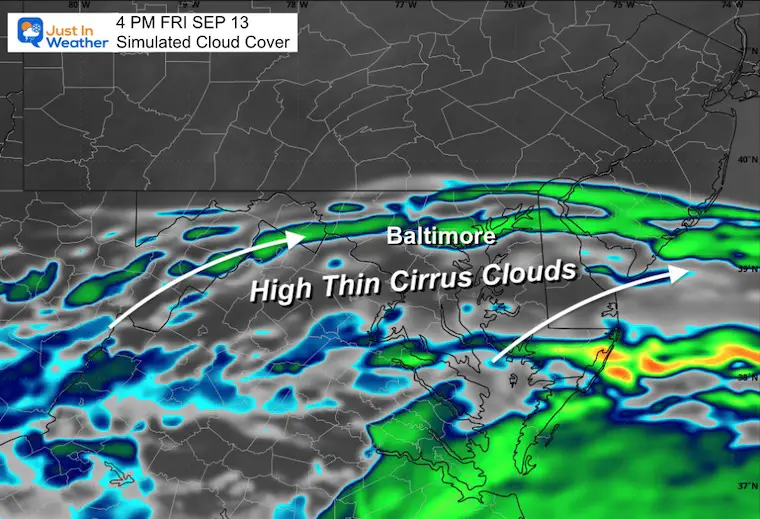
Cloud Forecast 8 AM to 8 PM
While fog and low clouds burn off, a band of high thin cirrus clouds will flow north. There should be more sun in the afternoon, which could be mixed with a milky white sky.
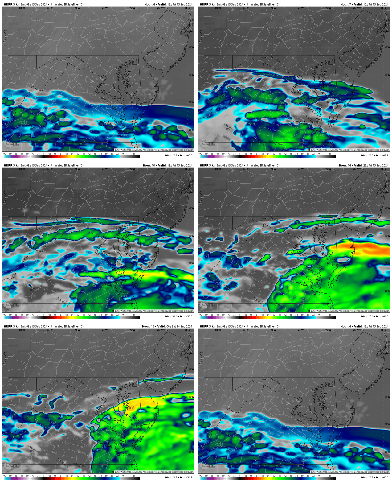
Snapshot at 4 PM
This may look worse than it will be…. High Thin Cirrus Clouds…. These can be transparent, but make the sky a milky white even with sunshine.
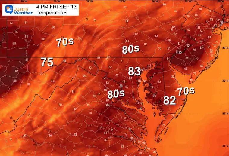
Afternoon Temperatures
CLIMATE DATA: Baltimore
TODAY September 13
Sunrise at 6:47 AM
Sunset at 7:17 PM
Normal Low in Baltimore: 60ºF
Record 42ºF in 1958
Normal High in Baltimore: 81ºF
Record 97ºF 1952
SATURDAY SEPTEMBER 14
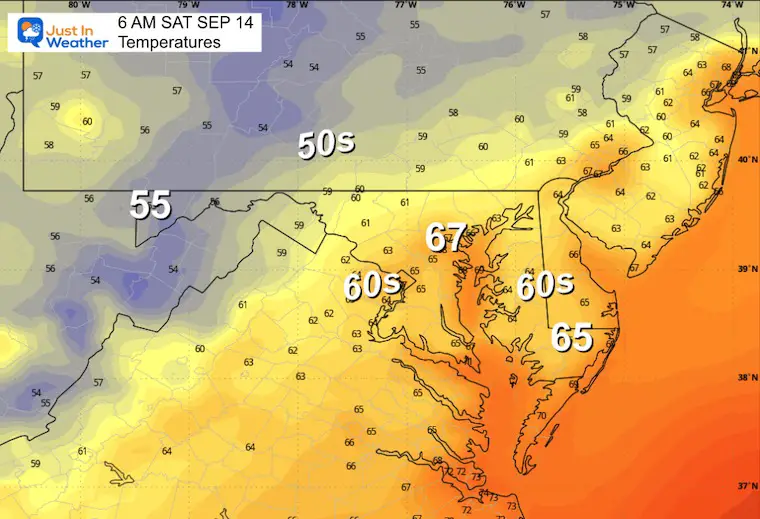
Morning Temperatures
Once again there may be areas of dense fog.
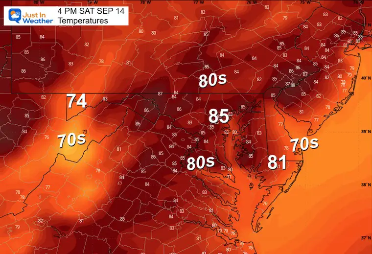
Afternoon Temperatures
With sunshine, temperatures will be slightly above average.
LOOKING AHEAD
After a quiet and warm weekend, we may watch Low Pressure develop off the East Coast and move inland. This could establish a longer trend of a Southeast flow to bring in a few days with showers or steady rain.
Monday
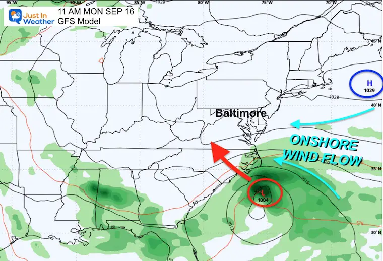
If Low Pressure does form with some tropical characteristics, it will move inland by Monday night. Our winds will shift FROM the East and bring in more moisture.
Forecast Monday to Friday
A coastal Low may form and move inland across North Carolina. The onshore flow will bring in moisture, rain, and cooler temperatures.
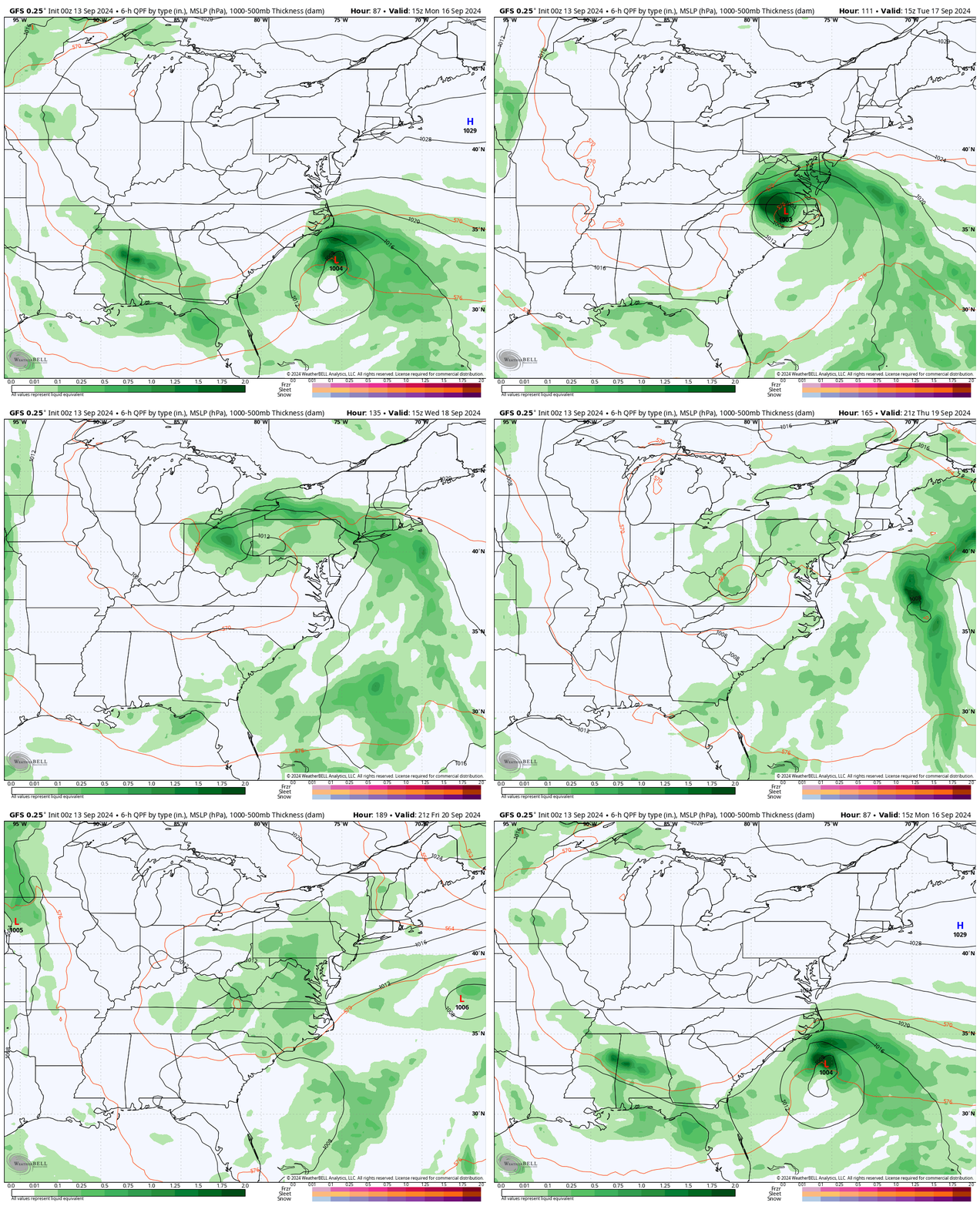
Closer Look
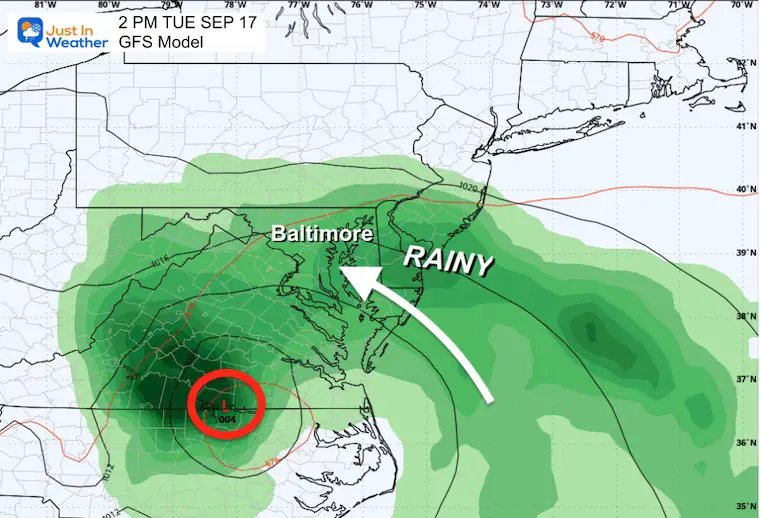
Tuesday
This may be our RAINY DAY.
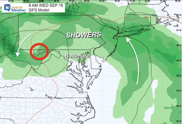
Wednesday
Lingering clouds and showers as Low Pressure moves North and spins out.
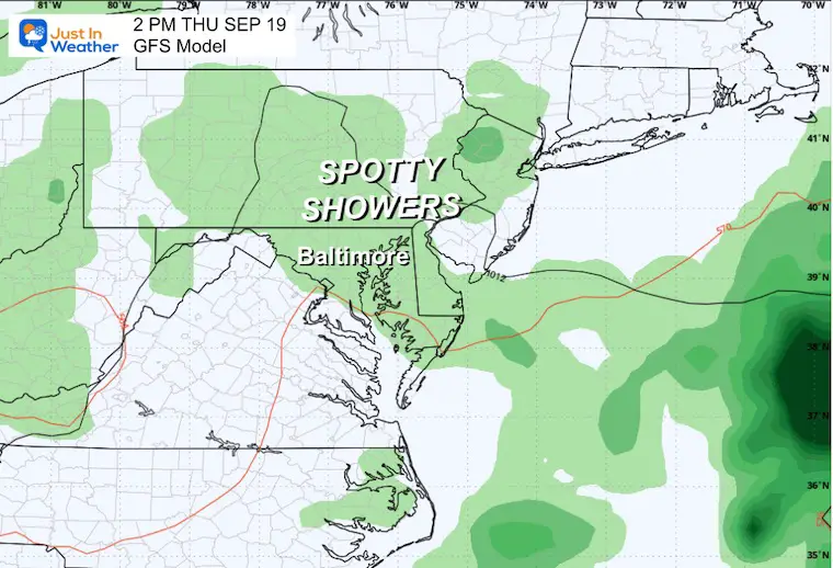
Thursday
Unsettled atmosphere with leftover clouds and showers, but NOT a washout.
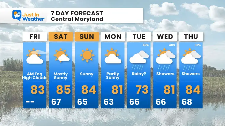
7 Day Forecast
A sunny weekend will be followed by the potential impact of a coastal storm and onshore flow.
Rain may arrive by Tuesday, then lingering showers on Wednesday and Thursday.
If You Missed It
Click here to see: NOAA Released Its Most Aggressive Hurricane Season Forecast
THANK YOU:
Baltimore Magazine Readers Choice Best Of Baltimore
Maryland Trek 11 Day 7 Completed Sat August 10
We raised OVER $104,000 for Just In Power Kids – AND Still Collecting More
The annual event: Hiking and biking 329 miles in 7 days between The Summit of Wisp to Ocean City.
Each day, we honor a kid and their family’s cancer journey.
Fundraising is for Just In Power Kids: Funding Free Holistic Programs. I never have and never will take a penny. It is all for our nonprofit to operate.
Click here or the image to donate:
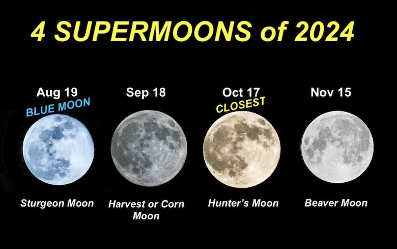
Four Supermoons In A Row
See more about the 4 Supermoons Through November here:
Please share your thoughts and best weather pics/videos, or just keep in touch via social media.
-
Facebook: Justin Berk, Meteorologist
-
Twitter
-
Instagram
RESTATING MY MESSAGE ABOUT DYSLEXIA
I am aware there are some spelling and grammar typos and occasional other glitches. I take responsibility for my mistakes and even the computer glitches I may miss. I have made a few public statements over the years, but if you are new here, you may have missed it: I have dyslexia and found out during my second year at Cornell University. It didn’t stop me from getting my meteorology degree and being the first to get the AMS CBM in the Baltimore/Washington region.
One of my professors told me that I had made it that far without knowing and to not let it be a crutch going forward. That was Mark Wysocki, and he was absolutely correct! I do miss my mistakes in my own proofreading. The autocorrect spell check on my computer sometimes does an injustice to make it worse. I also can make mistakes in forecasting. No one is perfect at predicting the future. All of the maps and information are accurate. The ‘wordy’ stuff can get sticky.
There has been no editor who can check my work while writing and to have it ready to send out in a newsworthy timeline. Barbara Werner is a member of the web team that helps me maintain this site. She has taken it upon herself to edit typos when she is available. That could be AFTER you read this. I accept this and perhaps proves what you read is really from me… It’s part of my charm. #FITF


