August 19 Storm Risk Then Cool Fall Preview And Ernesto A Hurricane Again Tracking Near Eastern Canada
Monday August 19, 2024
Morning Report
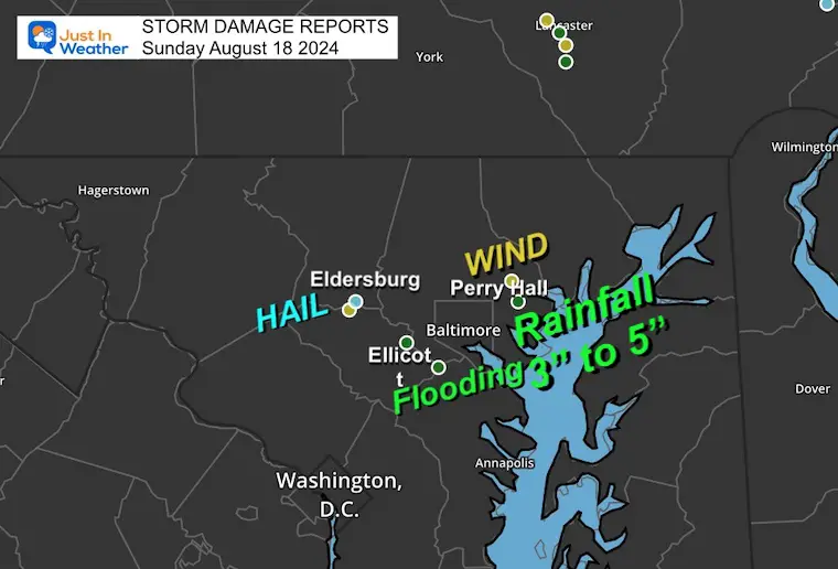
Some areas are cleaning up from storm damage that occurred later on Sunday. This storm exceeded expectations with potent flooding and wind damage. Some areas did receive 3 to 5 inches of rainfall.
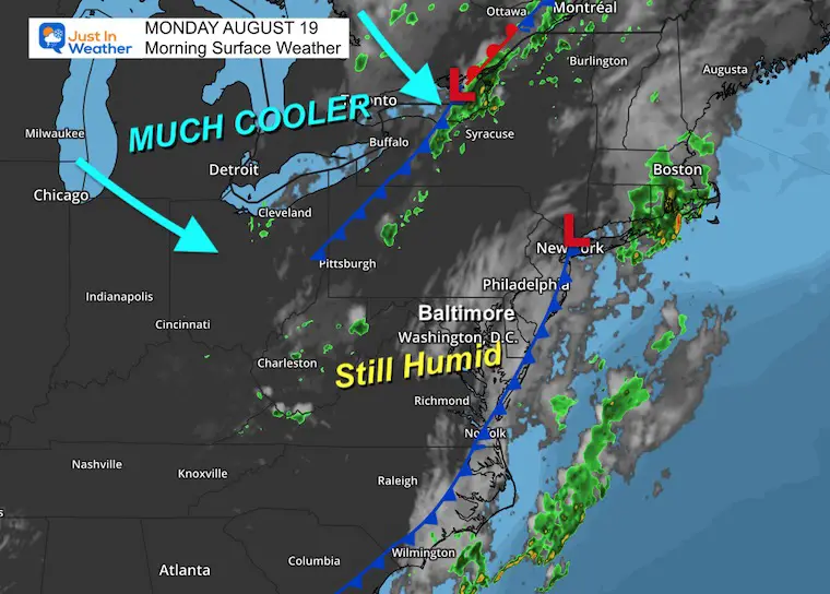
That system is moving away, but it is still humid as the new air mass is not here yet. It will arrive during the day to bring in cooler air and push the storm risk to Southern Maryland.
This week will bring cool enough air that will result in many inland areas down to the 40s Wednesday morning. It will be short-lived, then back to summer heat next week.
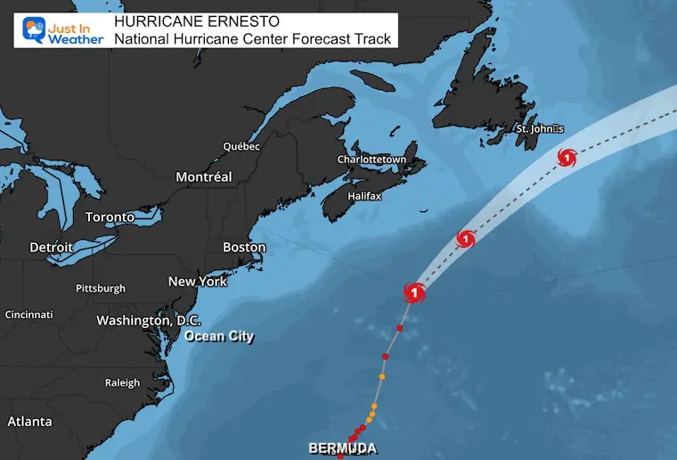
By the way, Ernesto is back to a hurricane and will skirt the Canadian coast near Nova Scotia and Newfoundland.
Storm Reports
- Hail near Eldersburg
- Flood Sirens sounded in Ellicott City with over 3 inches of rain
- Wind damage around Perry Hall
Morning Surface Weather
The weather system responsible for yesterday’s storm eruption is slowly moving through metro New York. To start the day, the air is still thick and humid.
A cold front in Pennsylvania will arrive midday, sparking more showers and ushering in a new air mass. This will be our Fall Preview.
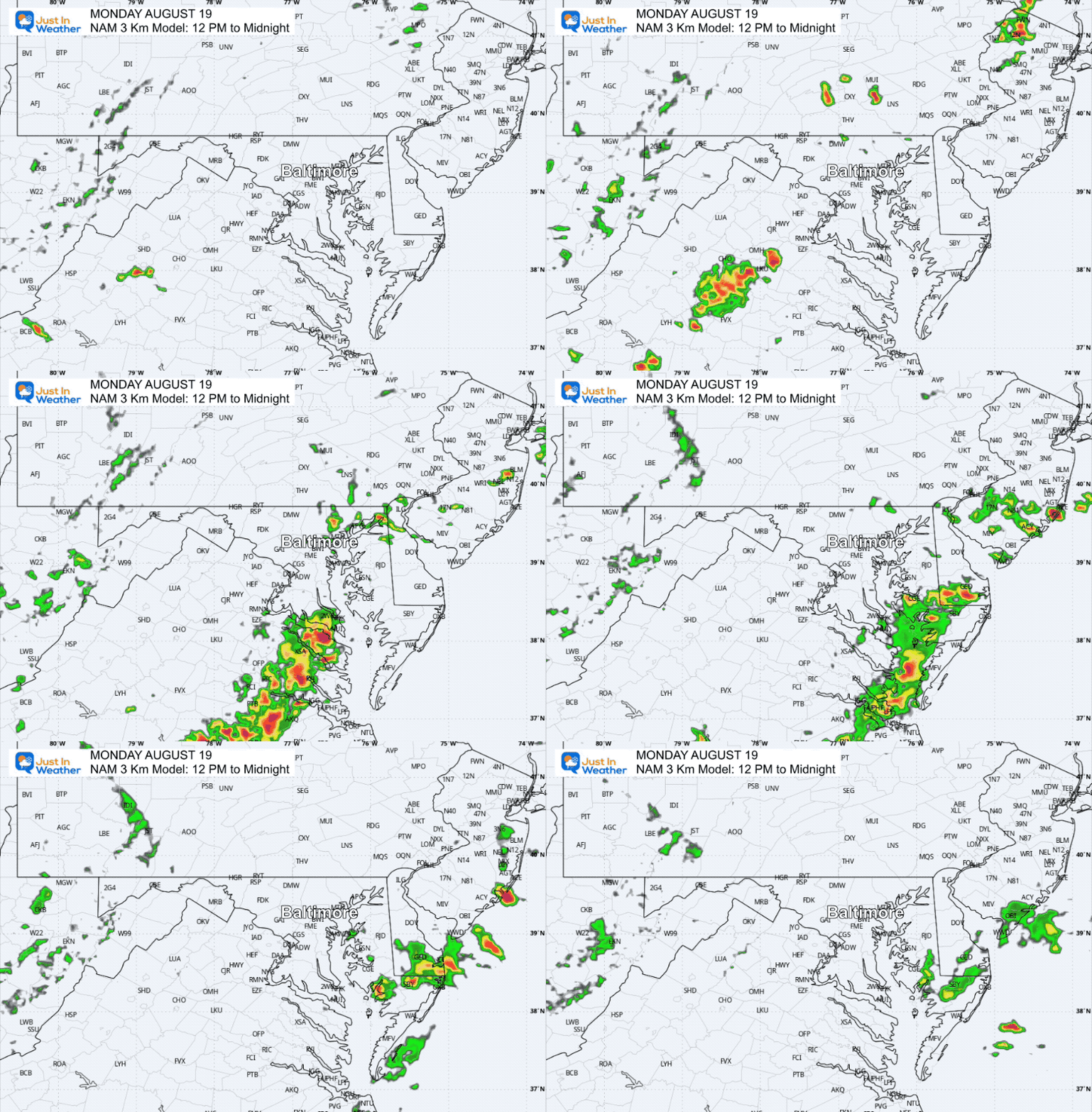
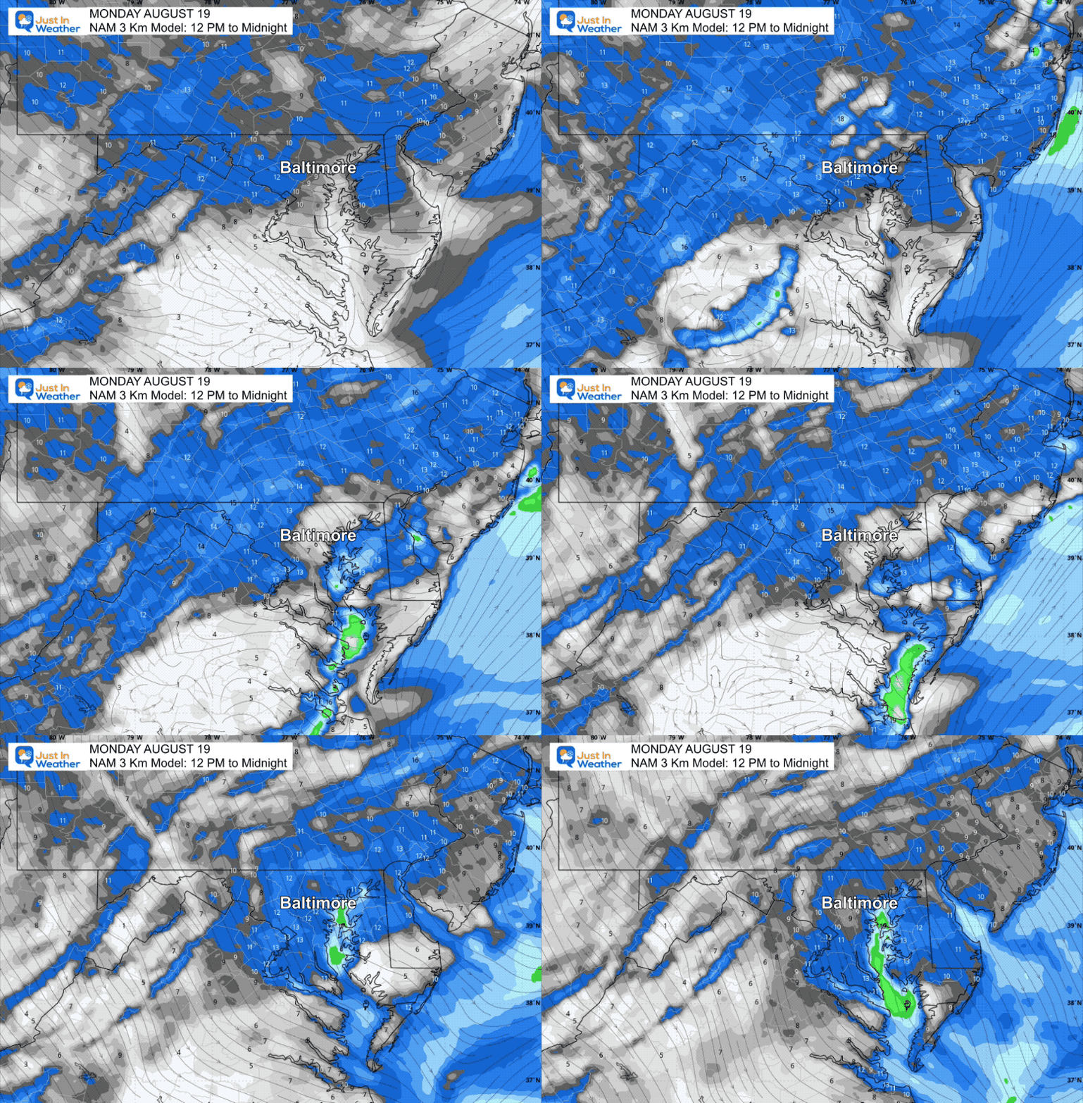
The better chance for strong thunderstorms will be in Southern Maryland between 5 PM and 10 PM.
FORECAST Radar Simulation: Noon to Midnight
Scattered showers and thunderstorms with a greater chance in Southern Maryland 5 PM to 10 PM.
Wind Forecast
Wind will increase from the Northwest, ushering in cooler air mass and making it feel a little more like Autumn.
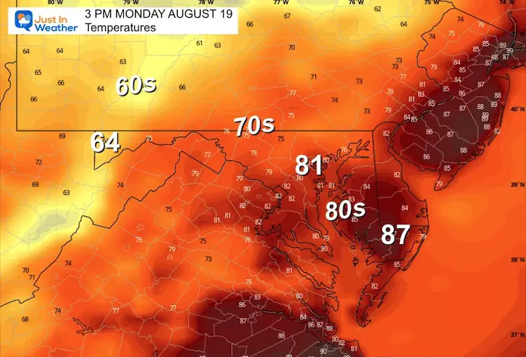
Afternoon Temperatures
These will be determined by any breaks of sun and the early development of showers.
ERNESTO A HURRICANE “AGAIN”
Satellite Loop
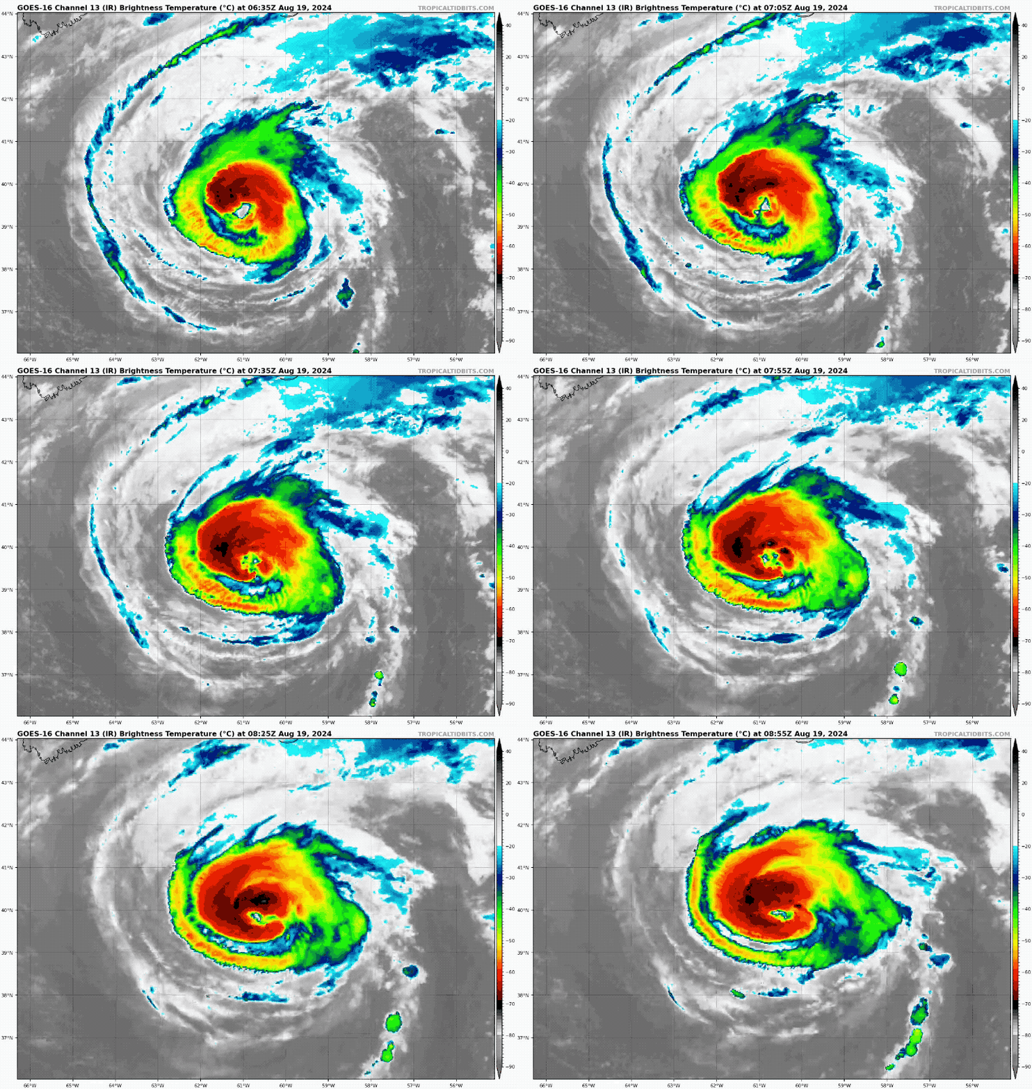
Morning Snapshot
This was down to a tropical storm after passing Bermuda, but then tapped into warmer water in the Gulf Stream last night and resurged back to a Category 1 Hurricane.
With 85 mph winds, high waves, and beach erosion remain across the coastal areas.
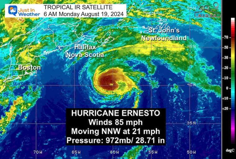
5 AM Stats From National Hurricane Center
———————————————-
- LOCATION…40.2N 60.5W
- ABOUT 340 MI…550 KM SSE OF HALIFAX, NOVA SCOTIA
- ABOUT 580 MI…935 KM SW OF CAPE RACE NEWFOUNDLAND
- MAXIMUM SUSTAINED WINDS…85 MPH…140 KM/H
- PRESENT MOVEMENT…NNE OR 30 DEGREES AT 21 MPH…33 KM/H
- MINIMUM CENTRAL PRESSURE…972 MB…28.71 INCHES
National Hurricane Center Forecast
The track takes it close to the Canadian coastline, then into the North Central Atlantic.
LOCAL EXTENDED FORECAST BELOW
CLIMATE DATA: Baltimore
TODAY August 19
Sunrise at 6:24 AM
Sunset at 7:56 PM
Normal Low in Baltimore: 66ºF
Record 52ºF in 1958
Normal High in Baltimore: 86ºF
Record 99ºF 2019
Summer Hot Day Totals At BWI
8 Days at or above 100ºF
39 Days total at or above 90ºF
THANK YOU:
Baltimore Magazine Readers Choice Best Of Baltimore
Maryland Trek 11 Day 7 Completed Sat August 10
We raised OVER $102,000 for Just In Power Kids – AND Still Collecting More
The annual event: Hiking and biking 329 miles in 7 days between The Summit of Wisp to Ocean City.
Each day, we honor a kid and their family’s cancer journey.
Fundraising is for Just In Power Kids: Funding Free Holistic Programs. I never have and never will take a penny. It is all for our nonprofit to operate.
Click here or the image to donate:
TUESDAY AUGUST 20
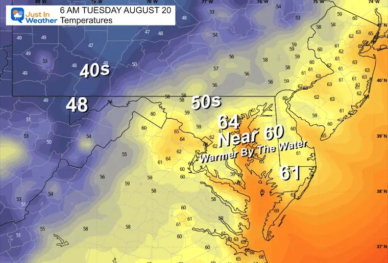
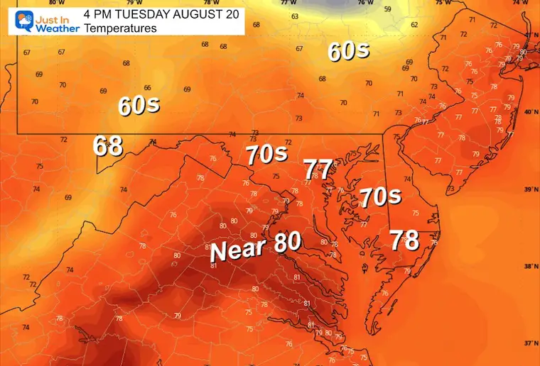
The new air mass from Canada will settle in and definitely feel like the edge of a new season.
Morning Temperatures
Afternoon Temperatures
Even metro Baltimore will hold in the 70s. A breeze from the Northwest may make it feel like early Autumn.
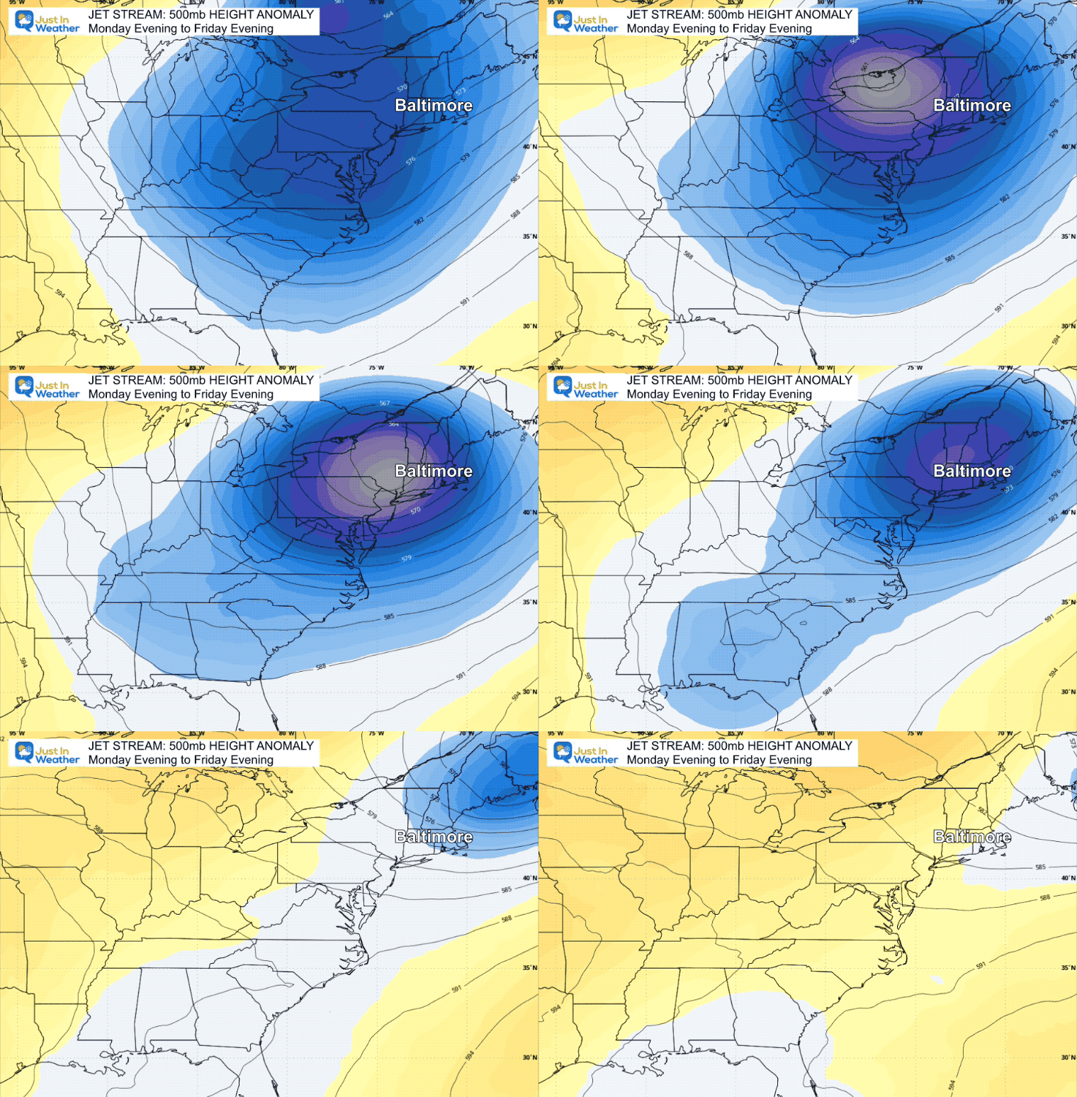
Jet Stream Monday to Friday
The animation shows the 500mb heights. This is around 18,000 ft and represents the warm and cool air in the atmosphere that responds to how high it is measured.
Here, we can see the influx and established Cool Pattern for much of the week.
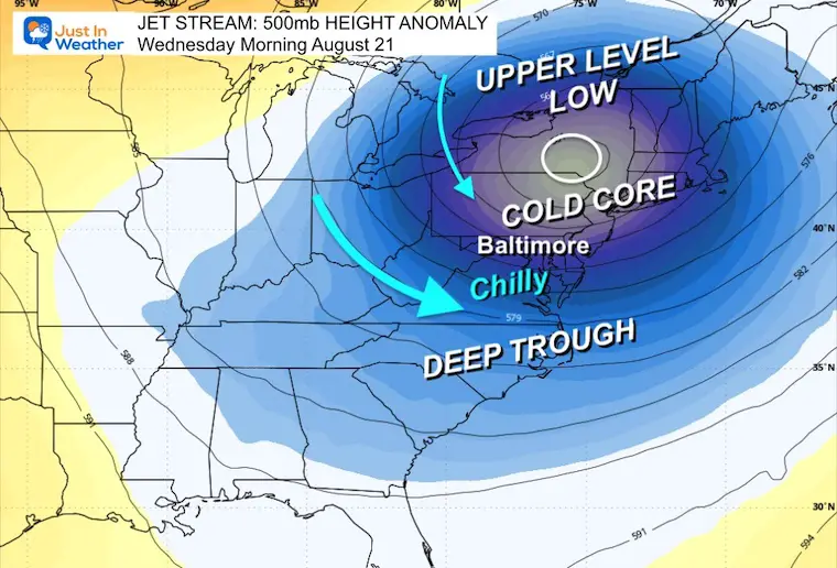
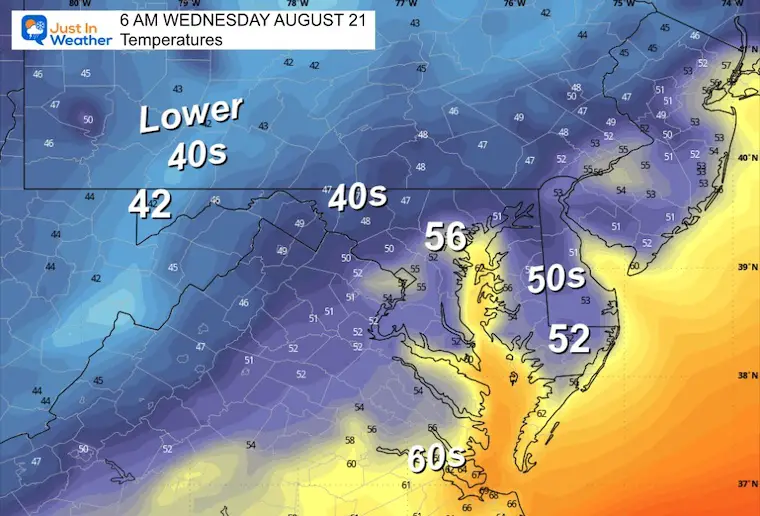
Wednesday Morning Snapshot
With a Deep Upper-Level Trough centered in New England and stretching down the East Coast, the morning will be chilly.
Some inland areas will drop into the 40s.
Wednesday Morning Temperatures
This should be the lowest of this cycle. Many areas inland will be in the 40s to start the day.
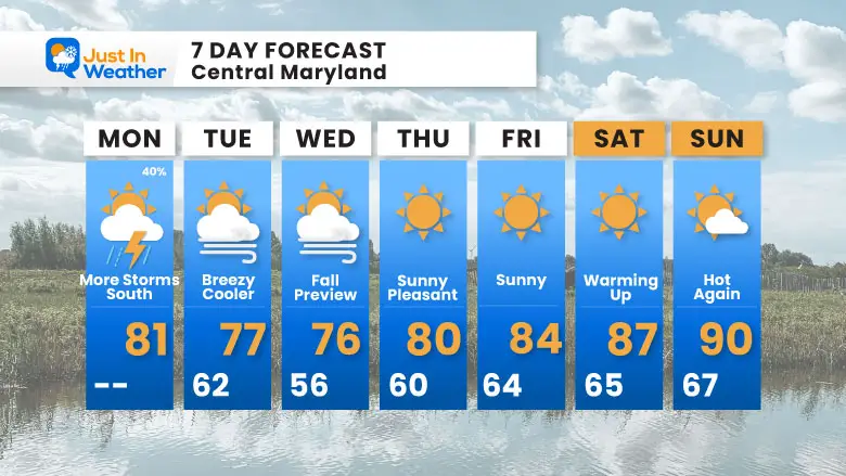
7 Day Forecast
I am showing the 50s for the Baltimore metro areas on Wednesday morning. Some inland areas will be in the 40s. Summer heat will return to near 90ºF next weekend.
Please share your thoughts and best weather pics/videos, or just keep in touch via social media.
-
Facebook: Justin Berk, Meteorologist
-
Twitter
-
Instagram
RESTATING MY MESSAGE ABOUT DYSLEXIA
I am aware there are some spelling and grammar typos and occasional other glitches. I take responsibility for my mistakes and even the computer glitches I may miss. I have made a few public statements over the years, but if you are new here, you may have missed it: I have dyslexia and found out during my second year at Cornell University. It didn’t stop me from getting my meteorology degree and being the first to get the AMS CBM in the Baltimore/Washington region.
One of my professors told me that I had made it that far without knowing and to not let it be a crutch going forward. That was Mark Wysocki, and he was absolutely correct! I do miss my mistakes in my own proofreading. The autocorrect spell check on my computer sometimes does an injustice to make it worse. I also can make mistakes in forecasting. No one is perfect at predicting the future. All of the maps and information are accurate. The ‘wordy’ stuff can get sticky.
There has been no editor who can check my work while writing and to have it ready to send out in a newsworthy timeline. Barbara Werner is a member of the web team that helps me maintain this site. She has taken it upon herself to edit typos when she is available. That could be AFTER you read this. I accept this and perhaps proves what you read is really from me… It’s part of my charm. #FITF


