Saturday, August 17, 2024
Morning Report
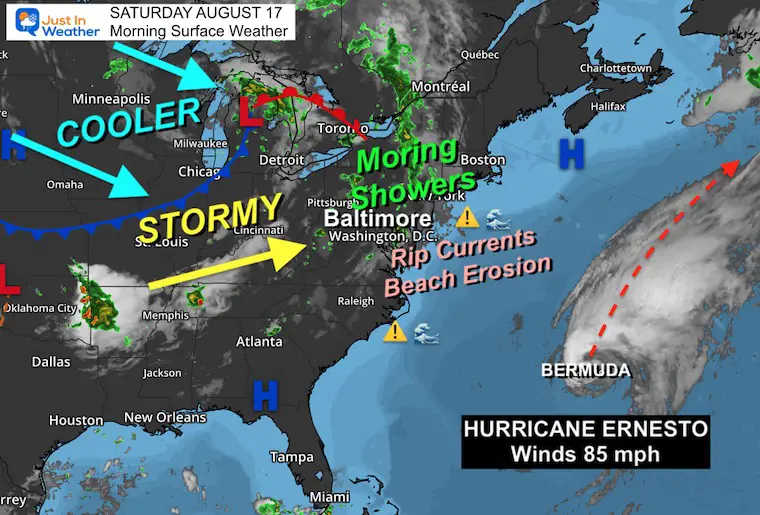
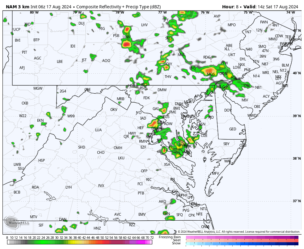
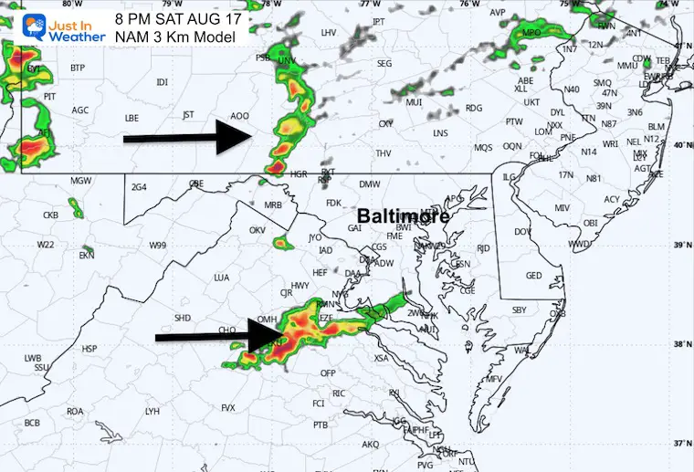
Rain showers have already moved into some areas this morning, and more are on the way. Our weekend will turn wet for all, but it is not an organized system. So, this is not a washout with steady rain. It will come in pulses of showers and thunderstorms, with some dry hours in between. This may lead to difficult calls for outdoor plans. Below are the latest ‘suggested but not promised’ radar simulation forecasts.
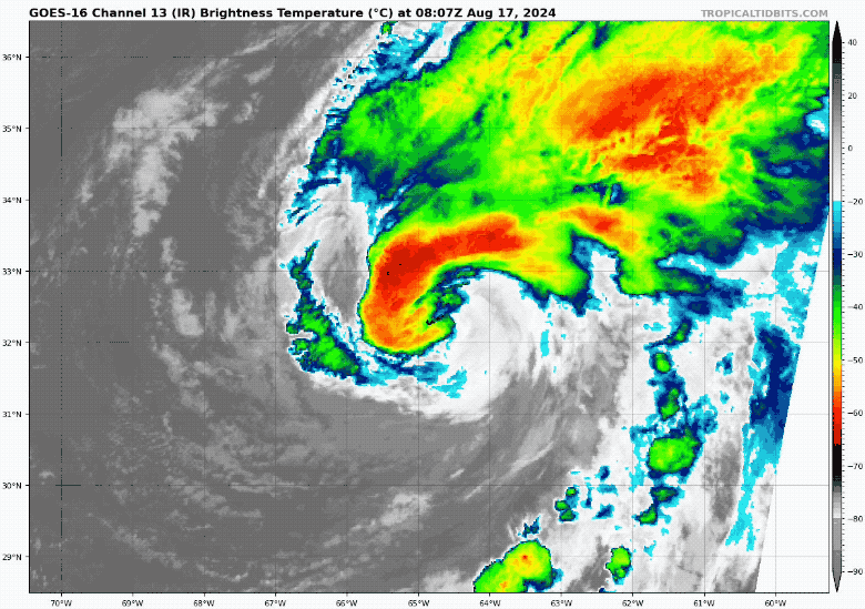
Hurricane Ernesto, which has 85 mph winds this morning, made landfall directly on Bermuda close to 5 AM EDT. This direct path through Bermuda is rare. It has had 19 direct hits since 1850, or once every 9 to 10 years.
While more than 500 miles east of our coast, it will send rip currents and high waves to our local beaches.
Morning Surface Weather
I am showing the wide view to highlight that Ernesto is NOT a weather factor for us but is affecting the beaches. Our rain and storm forecast is from a cold front and new air mass moving in from Canada. This will be a slow-moving system and keep the chance for showers around through Monday, then we will turn cooler.
HURRICANE ERNESTO
A Direct Hit On Bermuda at 5 AM this morning. This is a rare event for such a small island. Winds were 85 mph, ranking at Category 1. The storm will continue to move into the North Atlantic, however the impact on the East Coast will be high waves, rip currents, and beach erosion through the weekend.
Satellite Loop Close-Up
Snapshot
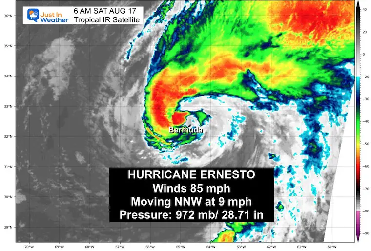
5 AM Stats From National Hurricane Center
———————————————-
- LOCATION…32.3N 64.8W
- ABOUT 0 MI…0 KM N OF BERMUDA
- MAXIMUM SUSTAINED WINDS…85 MPH…140 KM/H
- PRESENT MOVEMENT…NNE OR 20 DEGREES AT 9 MPH…15 KM/H
- MINIMUM CENTRAL PRESSURE…972 MB…28.71 INCHES
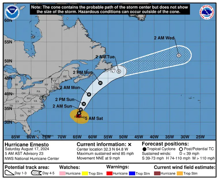
SUMMARY OF WATCHES AND WARNINGS IN EFFECT:
A Hurricane Warning is in effect for…
* Bermuda
National Hurricane Center Forecast Track
LOCAL WEATHER
Live Radar Widget
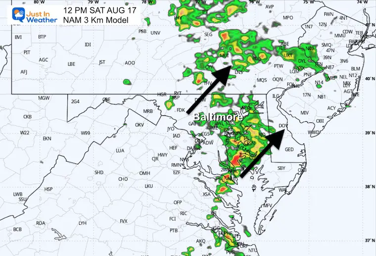
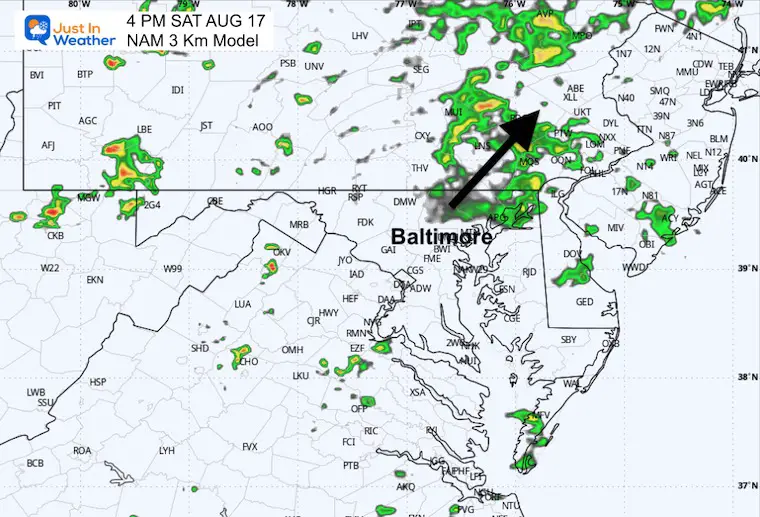
Radar Simulation: 10 AM to Midnight
Snapshots
Noon
4 PM
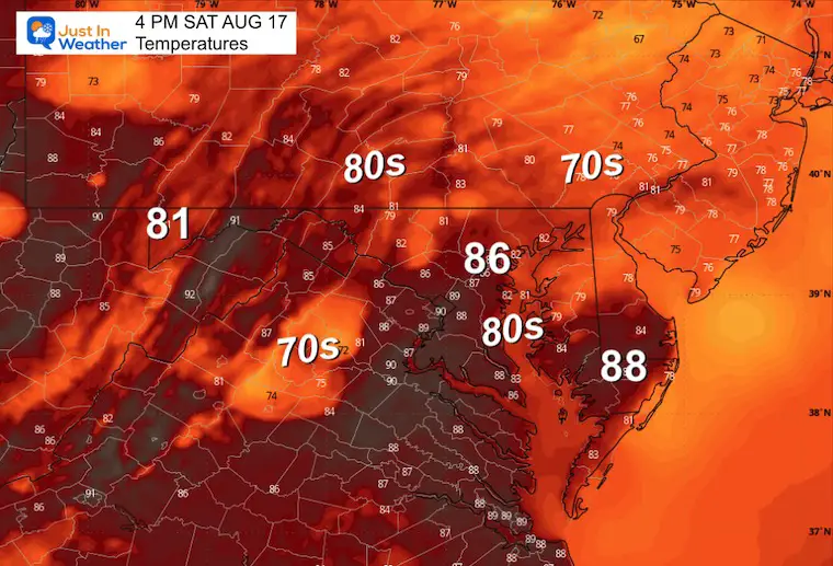
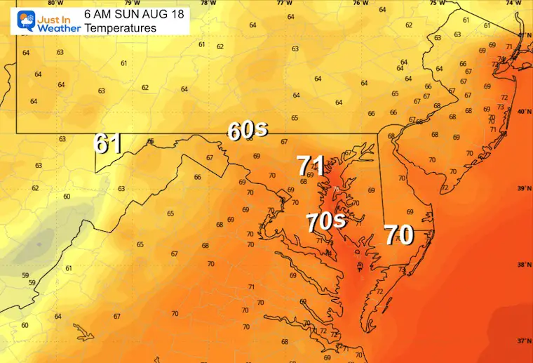
Afternoon Temperatures
Another pleasant day with low humidity and a little warmer.
8 PM
Maryland Trek 11 Day 7 Completed Sat August 10
We raised OVER $102,000 for Just In Power Kids – AND Still Collecting More
The annual event: Hiking and biking 329 miles in 7 days between The Summit of Wisp to Ocean City.
Each day, we honor a kid and their family’s cancer journey.
Fundraising is for Just In Power Kids: Funding Free Holistic Programs. I never have and never will take a penny. It is all for our nonprofit to operate.
Click here or the image to donate:

CLIMATE DATA: Baltimore
TODAY August 17
Sunrise at 6:22 AM
Sunset at 7:58 PM
Normal Low in Baltimore: 66ºF
Record 53ºF in 1979
Normal High in Baltimore: 87ºF
Record 100ºF 1988, 1997
Summer Hot Day Totals At BWI
8 Days at or above 100ºF
39 Days total at or above 90ºF
THANK YOU:
Baltimore Magazine Readers Choice Best Of Baltimore
SUNDAY AUGUST 18
Showers and Thunderstorms may start in the morning… then become scattered into the afternoon and evening.
Morning Temperatures
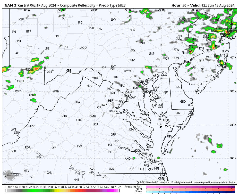
Radar Simulation 8 AM to Midnight
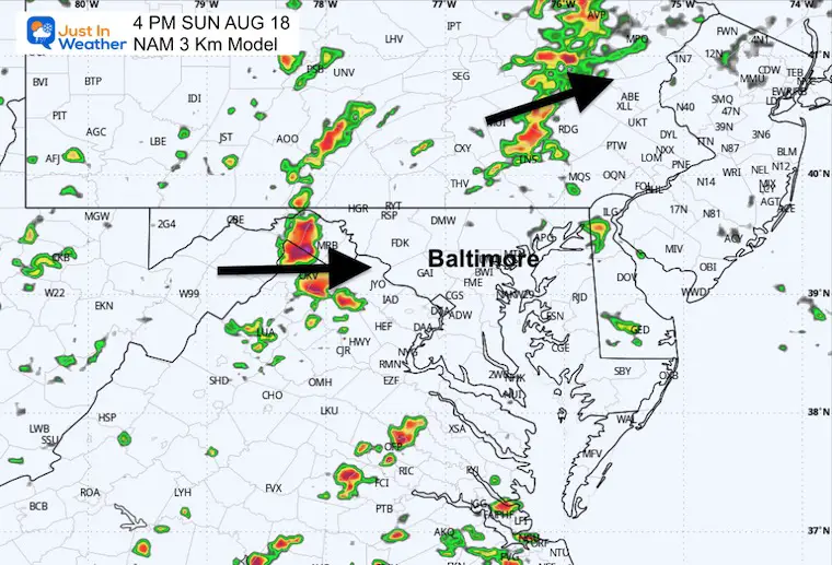
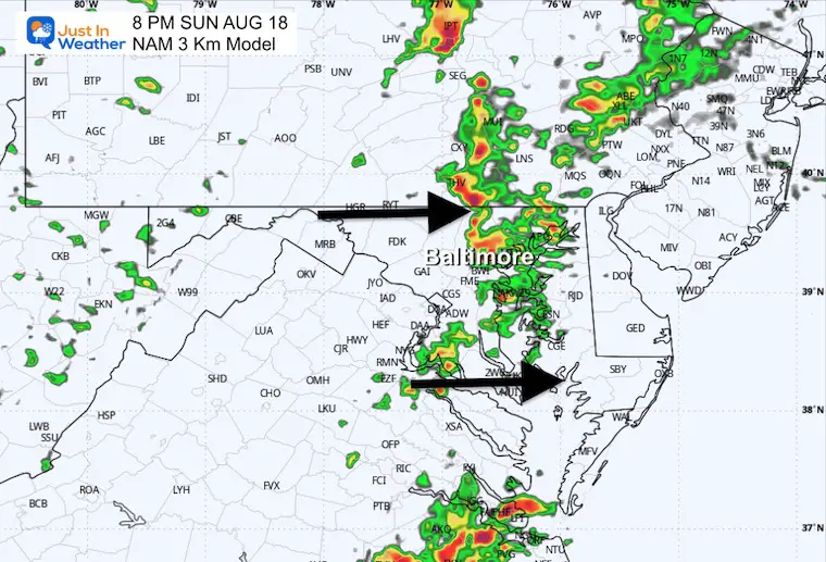
Pulsing of showers and thunderstorms. The main event may be a line of strong to severe storms passing through Central Maryland between 4 PM and 8 PM.
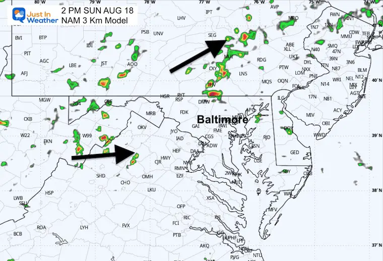
2 PM Radar Suggestion
4 PM Radar Suggestion
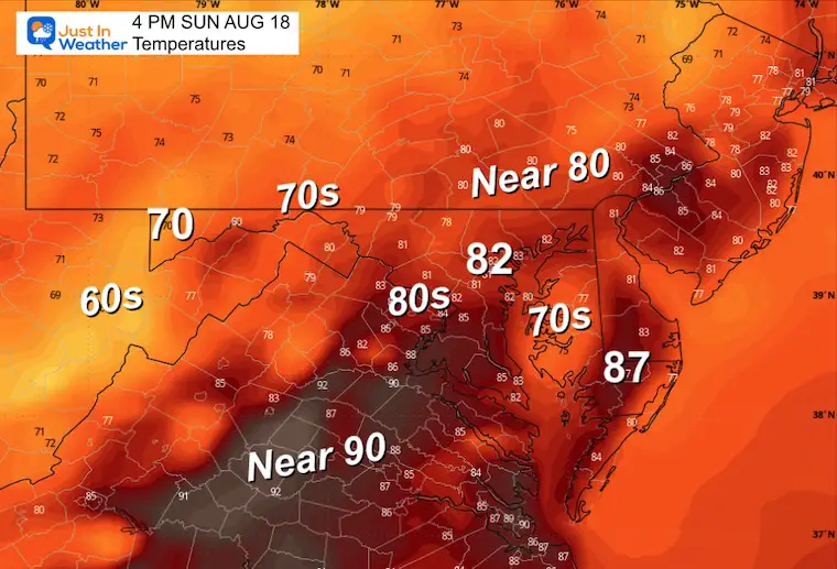
4 PM Temperatures
6 PM Radar Suggestion

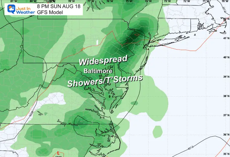
8 PM Radar Suggestion
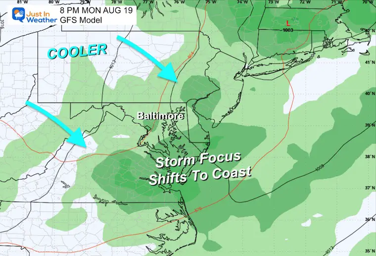
Weather Outlook Sunday to Tuesday
Sunday will have the most widespread storms. Then, on Monday, the storms will shift east and south as cooler air tries to shift in.
Snapshots
Sunday Evening
90% chance of thunderstorms.
Monday Evening
60% chance of thunderstorms.
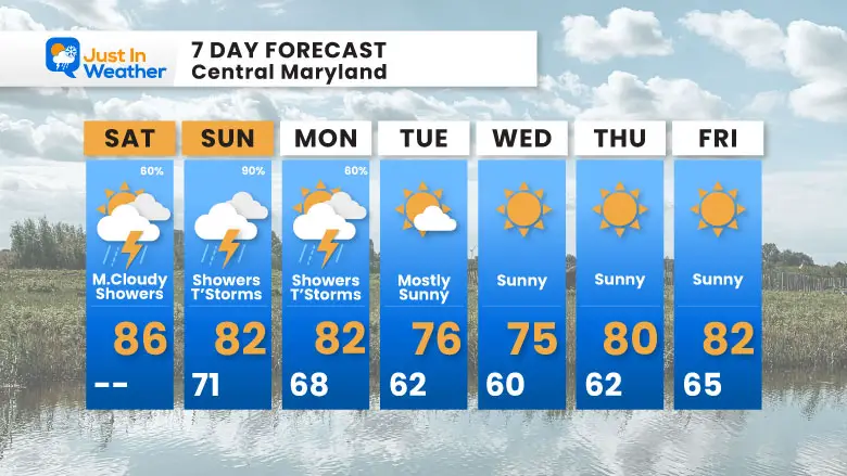
7 Day Forecast
Call it late summer or pre-fall… There will be a distinct cool down. Many inland areas may drop into the 50s for a few mornings, with 40s in the mountains.
Please share your thoughts and best weather pics/videos, or just keep in touch via social media.
RESTATING MY MESSAGE ABOUT DYSLEXIA
I am aware there are some spelling and grammar typos and occasional other glitches. I take responsibility for my mistakes and even the computer glitches I may miss. I have made a few public statements over the years, but if you are new here, you may have missed it: I have dyslexia and found out during my second year at Cornell University. It didn’t stop me from getting my meteorology degree and being the first to get the AMS CBM in the Baltimore/Washington region.
One of my professors told me that I had made it that far without knowing and to not let it be a crutch going forward. That was Mark Wysocki, and he was absolutely correct! I do miss my mistakes in my own proofreading. The autocorrect spell check on my computer sometimes does an injustice to make it worse. I also can make mistakes in forecasting. No one is perfect at predicting the future. All of the maps and information are accurate. The ‘wordy’ stuff can get sticky.
There has been no editor who can check my work while writing and to have it ready to send out in a newsworthy timeline. Barbara Werner is a member of the web team that helps me maintain this site. She has taken it upon herself to edit typos when she is available. That could be AFTER you read this. I accept this and perhaps proves what you read is really from me… It’s part of my charm. #FITF


