Friday, August 16 2024
Morning Report
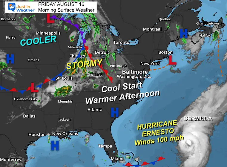
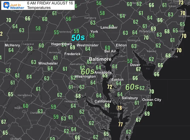
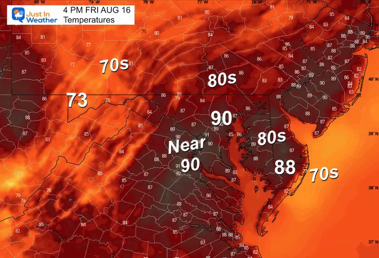
There is still a pleasant air mass in control of our region with a cool start this morning. The sunshine and slight shift in winds will allow the heat to build back close to 90ºF with a slight increase in humidity. Any storms today will be in the mountains, then we get widespread thunderstorms this weekend perhaps starting Saturday morning.
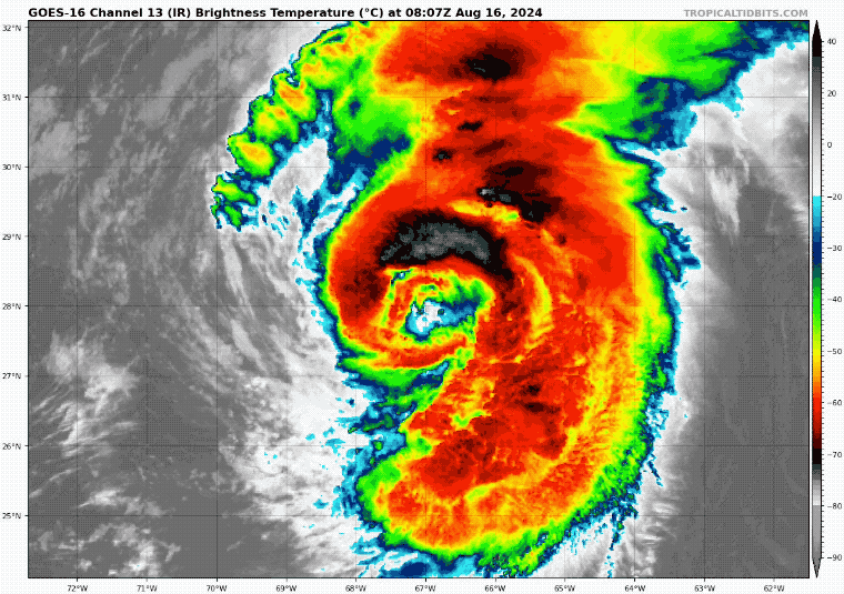
Hurricane Ernesto has 100 mph winds this morning. It continues its path toward a near-direct hit on Bermuda this weekend. While more than 500 miles east of our coast, it will send rip currents and high waves to our local beaches.
Morning Surface Weather
High Pressure is still in control with a cool start. The winds will allow some more heating today, with a slight increase in humidity. Stormy weather in the Midwest will reach us this weekend.
Hurricane Ernesto is a more pronounced element on the map in the lower right corner.
Morning Temperatures
Afternoon Temperatures
Another pleasant day with low humidity and a little warmer.
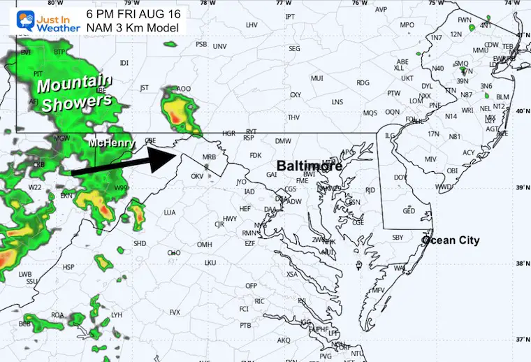
Evening Radar Suggestion
Showers and thunderstorms in the mountains. Remaining dry in metro areas and the beaches.
Maryland Trek 11 Day 7 Completed Sat August 10
We raised OVER $102,000 for Just In Power Kids – AND Still Collecting More
The annual event: Hiking and biking 329 miles in 7 days between The Summit of Wisp to Ocean City.
Each day, we honor a kid and their family’s cancer journey.
Fundraising is for Just In Power Kids: Funding Free Holistic Programs. I never have and never will take a penny. It is all for our nonprofit to operate.
Click here or the image to donate:

CLIMATE DATA: Baltimore
TODAY August 16
Sunrise at 6:21 AM
Sunset at 8:00 PM
Normal Low in Baltimore: 66ºF
Record 53ºF in 2013
Normal High in Baltimore: 87ºF
Record 101ºF 1997
Summer Hot Day Totals At BWI
8 Days at or above 100ºF
39 Days total at or above 90ºF
THANK YOU:
Baltimore Magazine Readers Choice Best Of Baltimore
HURRICANE ERNESTO
Hurricane Ernesto, now a Category 2 storm with 100 mph winds, is currently in the open ocean, primarily targeting Bermuda. Afterward, it could potentially impact Nova Scotia in Canada. The impact on the US will be in the form of rip currents and high waves on the east coast beaches this weekend.
Satellite Loop
Wider View
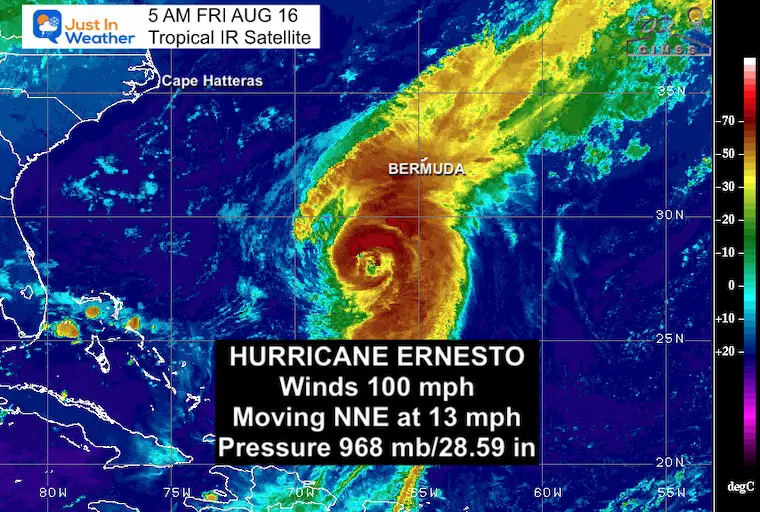
5 AM Stats From National Hurricane Center
———————————————-
- LOCATION…28.1N 67.0W
- ABOUT 320 MI…510 KM SSW OF BERMUDA
- MAXIMUM SUSTAINED WINDS…100 MPH…155 KM/H
- PRESENT MOVEMENT…NNE OR 30 DEGREES AT 13 MPH…20 KM/H
- MINIMUM CENTRAL PRESSURE…968 MB…28.59 INCHES
SUMMARY OF WATCHES AND WARNINGS IN EFFECT:
A Hurricane Warning is in effect for…
* Bermuda
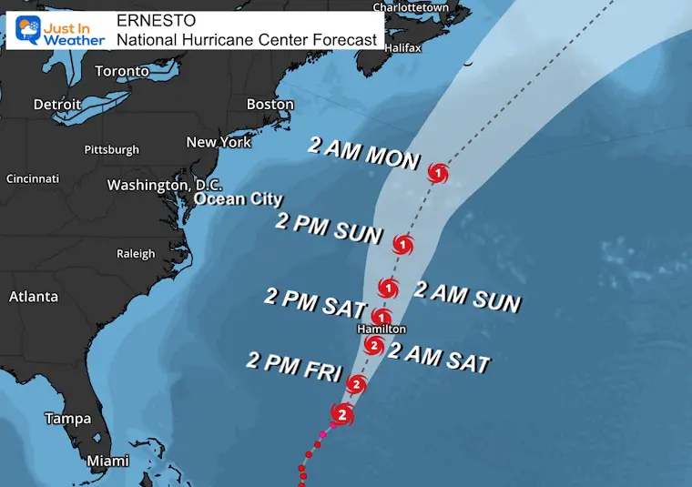
National Hurricane Center Forecast Track
This has a direct path through Bermuda. This small island has only had 18 direct hits since 1850. That is once every 9 to 10 years.
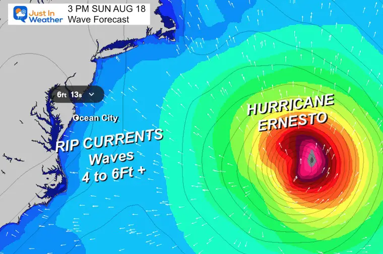
Wave Forecast: Sunday
Local beaches may get 4 to 6 Ft swells from the distant storm.
LOCAL WEATHER
SATURDAY AUGUST 17
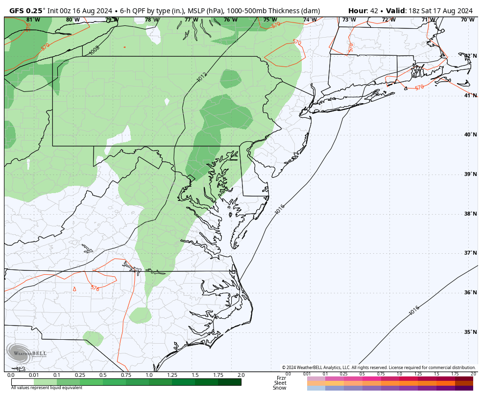
Showers and thunderstorms may start in the morning… then become scattered into the afternoon and evening.
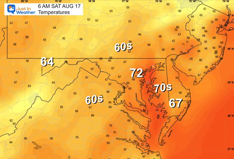
Morning Temperatures
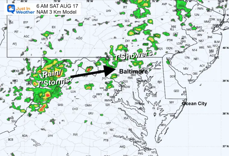
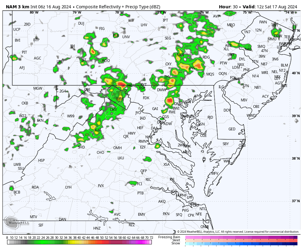
Morning Radar Suggestion
Radar Simulation 8 AM to 10 PM
Scattered showers and storms start with one wave in the morning, the pulse in the afternoon with daytime heating.
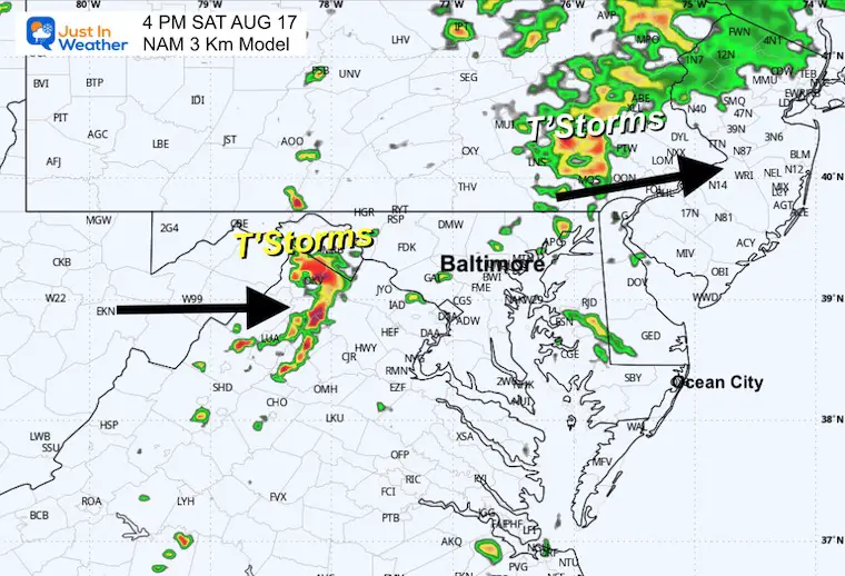
12 PM Radar Suggestion
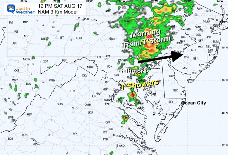
4 PM Radar Suggestion
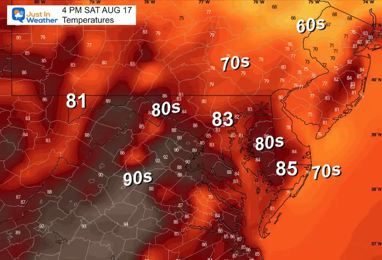
4 PM Temperatures
Weather Outlook Saturday to Tuesday
The chance for showers may be delayed and extended with slower progress. This is in part due to Hurricane Ernesto passing well off to our East.
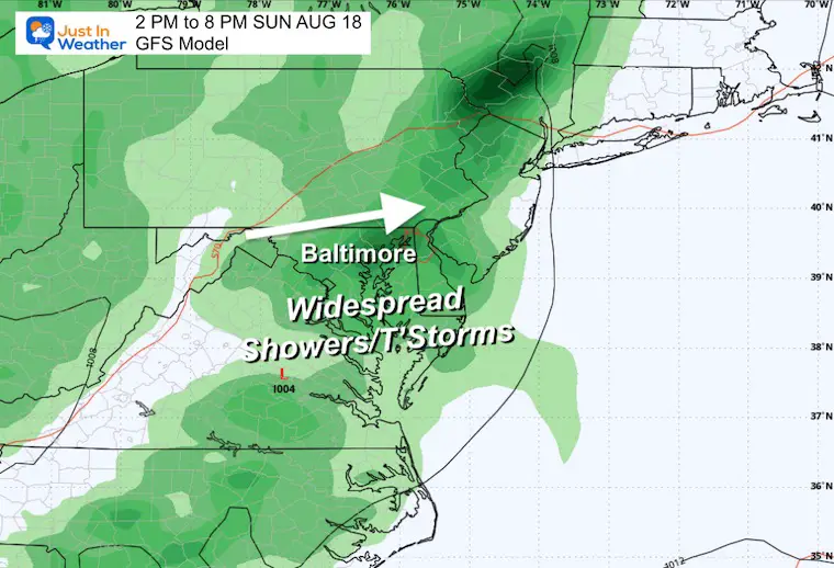
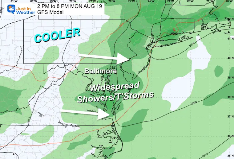
Sunday will have the most widespread storms. Then, on Monday, the storms will shift east and south as cooler air tries to shift in.
Snapshots
Sunday Evening
90% chance of thunderstorms.
Monday Evening
60% chance of thunderstorms.
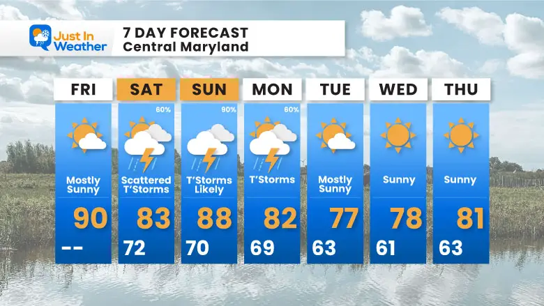
7 Day Forecast
The transition from summer heat to cooler pre-fall temps next week will bring a few days with thunderstorms. These will be most widespread on Sunday and are NOT from Ernesto.
Please share your thoughts and best weather pics/videos, or just keep in touch via social media.
RESTATING MY MESSAGE ABOUT DYSLEXIA
I am aware there are some spelling and grammar typos and occasional other glitches. I take responsibility for my mistakes and even the computer glitches I may miss. I have made a few public statements over the years, but if you are new here, you may have missed it: I have dyslexia and found out during my second year at Cornell University. It didn’t stop me from getting my meteorology degree and being the first to get the AMS CBM in the Baltimore/Washington region.
One of my professors told me that I had made it that far without knowing and to not let it be a crutch going forward. That was Mark Wysocki, and he was absolutely correct! I do miss my mistakes in my own proofreading. The autocorrect spell check on my computer sometimes does an injustice to make it worse. I also can make mistakes in forecasting. No one is perfect at predicting the future. All of the maps and information are accurate. The ‘wordy’ stuff can get sticky.
There has been no editor who can check my work while writing and to have it ready to send out in a newsworthy timeline. Barbara Werner is a member of the web team that helps me maintain this site. She has taken it upon herself to edit typos when she is available. That could be AFTER you read this. I accept this and perhaps proves what you read is really from me… It’s part of my charm. #FITF


