Thursday, August 1 2024
Morning Report
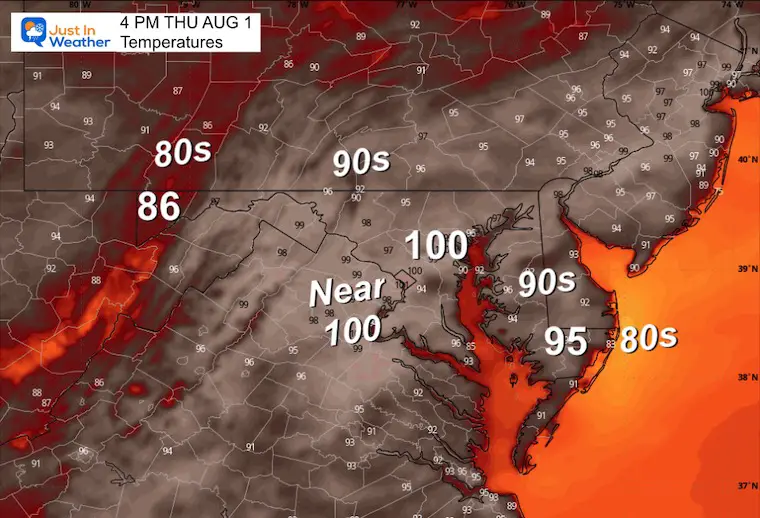
Here we go with that Heat Dome again! We will have a few more days in the high 90s to near 100ºF with high humidity. Not the best to be outside, but are we getting used to it?
If BWI hits 100ºF, it will tie the record set in 2006 and be the seventh time this summer that it has reached triple digits.
The chance of strong thunderstorms will increase during the weekend. Some improvement from the humidity and then from the heat is expected next week.
Summer Hot Day Totals At BWI
6 Days at or above 100ºF
35 Days total at or above 90ºF
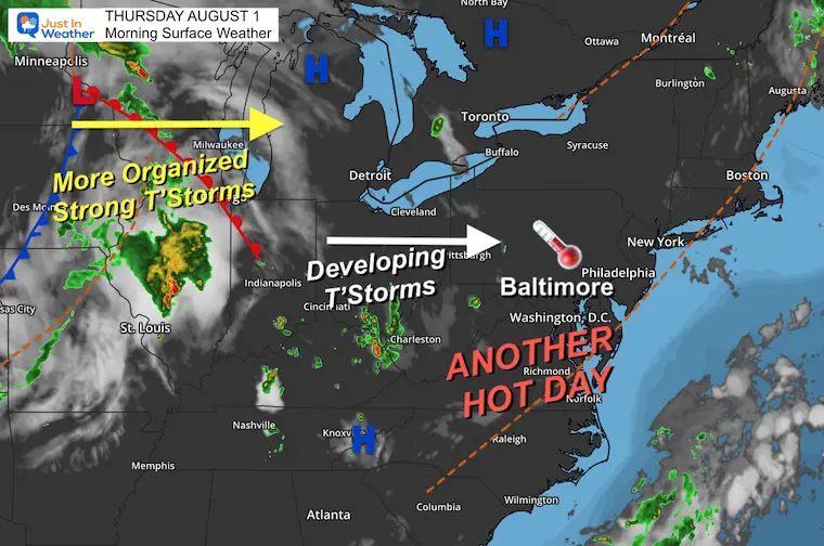
Morning Surface Weather
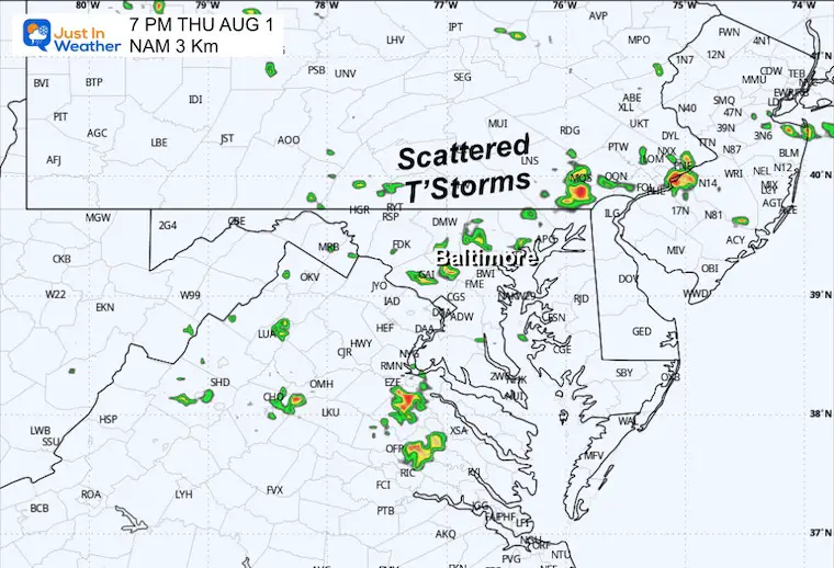
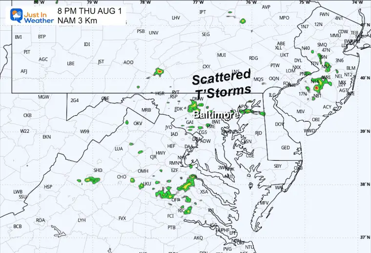
Warm and humid this morning. Get used to it! An old frontal boundary may help with isolated storms.
We are on the edge of the same old Heat Dome! We will get back to the upper 90s and near 100ºF for most of the next 7 days.
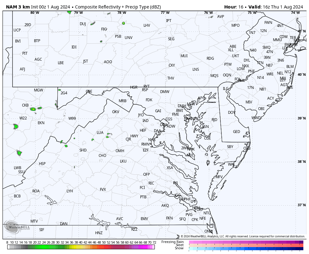
Live Radar Widget
This is expected to get more active after 3 PM.
Afternoon Temperatures
If BWI hits 100ºF, it will tie the record set in 2006 AND be the 7th time this summer in triple digits.
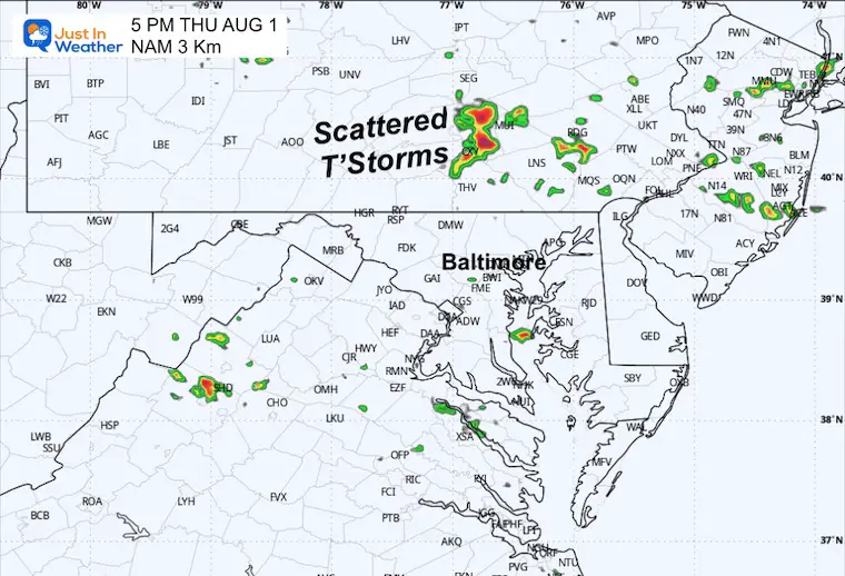
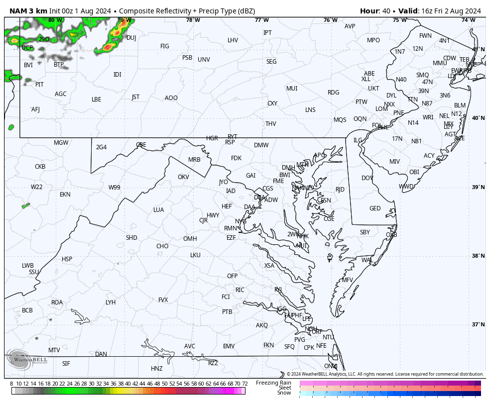
Radar Simulation Noon to 10 PM
Snapshot SUGGESTIONS
5 PM
7 PM
8 PM
Maryland Trek 11 Begins Sunday, Aug 4
The annual event involves hiking and biking 329 miles in 7 days from The Summit of Wisp to Ocean City.
Each day, we honor a kid and their family’s cancer journey.
Fundraising is for Just In Power Kids: Funding Free Holistic Programs. I never have and never will take a penny. It is all for our nonprofit to operate.

CLIMATE DATA: Baltimore
TODAY August 1
Sunrise at 6:08 AM
Sunset at 8:18 PM
Normal Low in Baltimore: 67ºF
Record 57ºF in 1895
Normal High in Baltimore: 88ºF
Record 100ºF 2006
Record Highs Recently Tied
Sunday July 14: 101ºF in 2024 tied 1895 AND 1954
Monday July 15: 102ºF in 2024 tied 1995
Tuesday July 16: 104ºF in 2024 tied 1988
Not a Record
Wednesday July 17: 100ºF
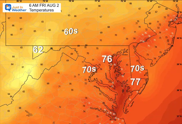
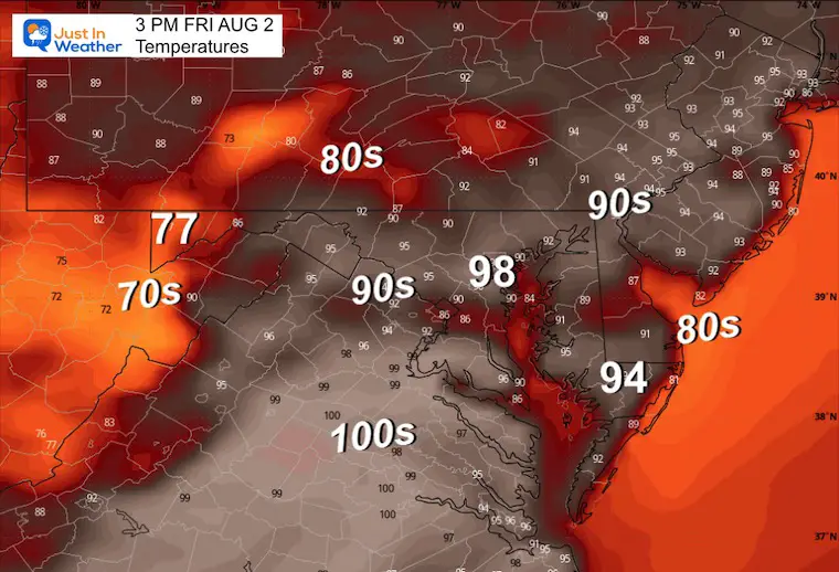
FRIDAY AUGUST 2
Morning Temperatures
Afternoon Temperatures
Hot and More Humid! Storm chance is about 60%.
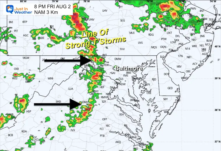
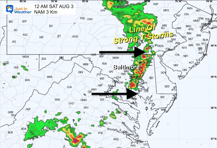
Radar Simulation Noon to Midnight
Snapshot SUGGESTIONS
4 PM
8 PM
Midnight
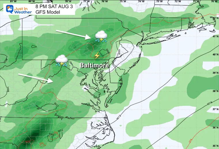
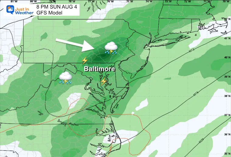
Forecast Saturday to Monday
Until Saturday, most days will feature showers and thunderstorms. By the end of the weekend, the storms may shift south, allowing slightly less humid air to move in. The Heat Wave will continue into next week.
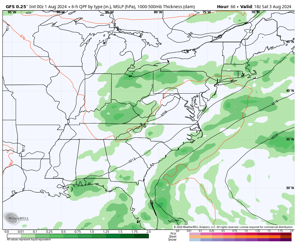
Saturday Evening
Strong Late Day Storms.
Sunday Evening
Widespread Strong Late Day Storms.
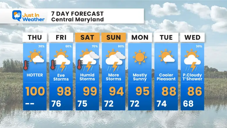
7 Day Forecast
High Heat into Next Week!
A slight cool down now showing up later next week.
Please share your thoughts and best weather pics/videos, or just keep in touch via social media.
RESTATING MY MESSAGE ABOUT DYSLEXIA
I am aware there are some spelling and grammar typos and occasional other glitches. I take responsibility for my mistakes and even the computer glitches I may miss. I have made a few public statements over the years, but if you are new here, you may have missed it: I have dyslexia and found out during my second year at Cornell University. It didn’t stop me from getting my meteorology degree and being the first to get the AMS CBM in the Baltimore/Washington region.
One of my professors told me that I had made it that far without knowing and to not let it be a crutch going forward. That was Mark Wysocki, and he was absolutely correct! I do miss my mistakes in my own proofreading. The autocorrect spell check on my computer sometimes does an injustice to make it worse. I also can make mistakes in forecasting. No one is perfect at predicting the future. All of the maps and information are accurate. The ‘wordy’ stuff can get sticky.
There has been no editor who can check my work while writing and to have it ready to send out in a newsworthy timeline. Barbara Werner is a member of the web team that helps me maintain this site. She has taken it upon herself to edit typos when she is available. That could be AFTER you read this. I accept this and perhaps proves what you read is really from me… It’s part of my charm. #FITF


