Wednesday, July 24 2024
Morning Report
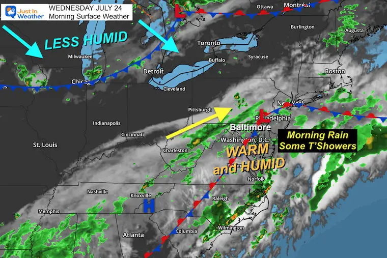
The ground may be wet with fresh rain falling when you step outside. This same old frontal boundary remains stuck over our region. This morning there has been some energy to produce a band of light rain with pockets of heavier showers, where a brief thunderstorm may track over Delmarva.
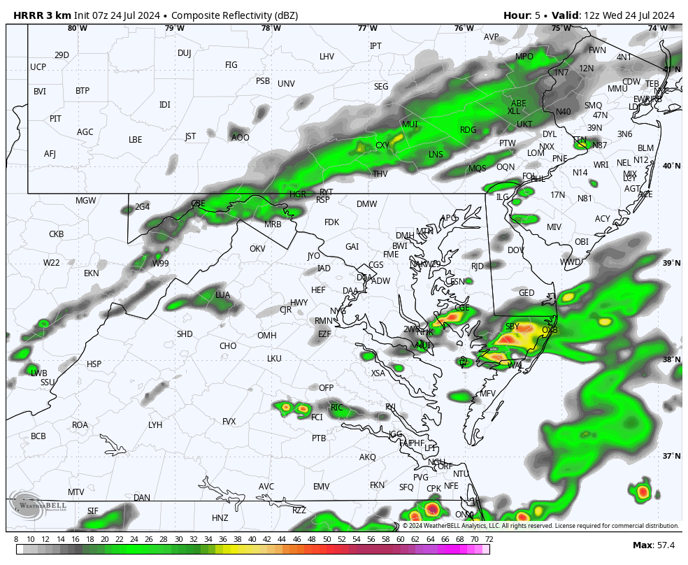
This afternoon and evening, the unsettled atmosphere will develop more thunderstorms… but they will be scattered. So this is not a plan buster but worth paying close attention to. The radar simulations below are suggestions and not promises. We will need to watch where the storms develop and then track that impulse, as this is not well organized.
TRIVIA
Sunrise in Baltimore is now AFTER 6 AM. This is 21 minutes LATER than Mid-June.
Summer Hot Day Totals At BWI
6 Days at or above 100ºF
31 Days total at or above 90ºF
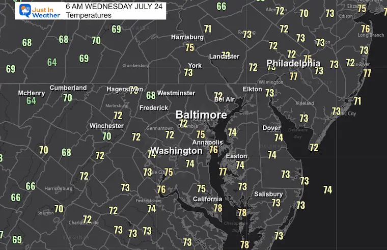
Morning Temperatures
Warm and Sticky
Live Radar Widget
Morning Surface Weather
Here is the same old stationary front with bands of rain.
The new air mass is over Michigan and will be moving our way by Friday with a very noticeable drop in humidity.
Radar Simulation Suggestion
HRRR Model 8 AM to 8 PM
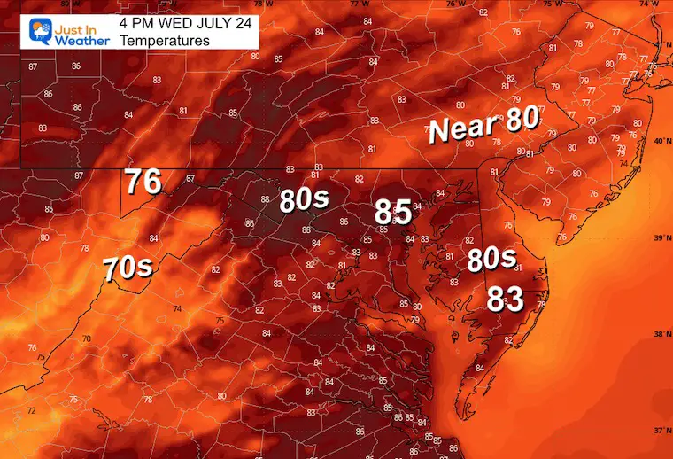
Afternoon Temperatures
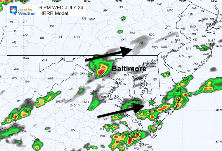
6 PM Snapshot HRRR Model
Pockets of showers and thunderstorms may develop along two lines: One across the Lower Eastern Shore to the Beaches, the other around Frederick, MD, to York, PA.
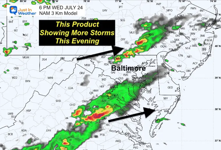
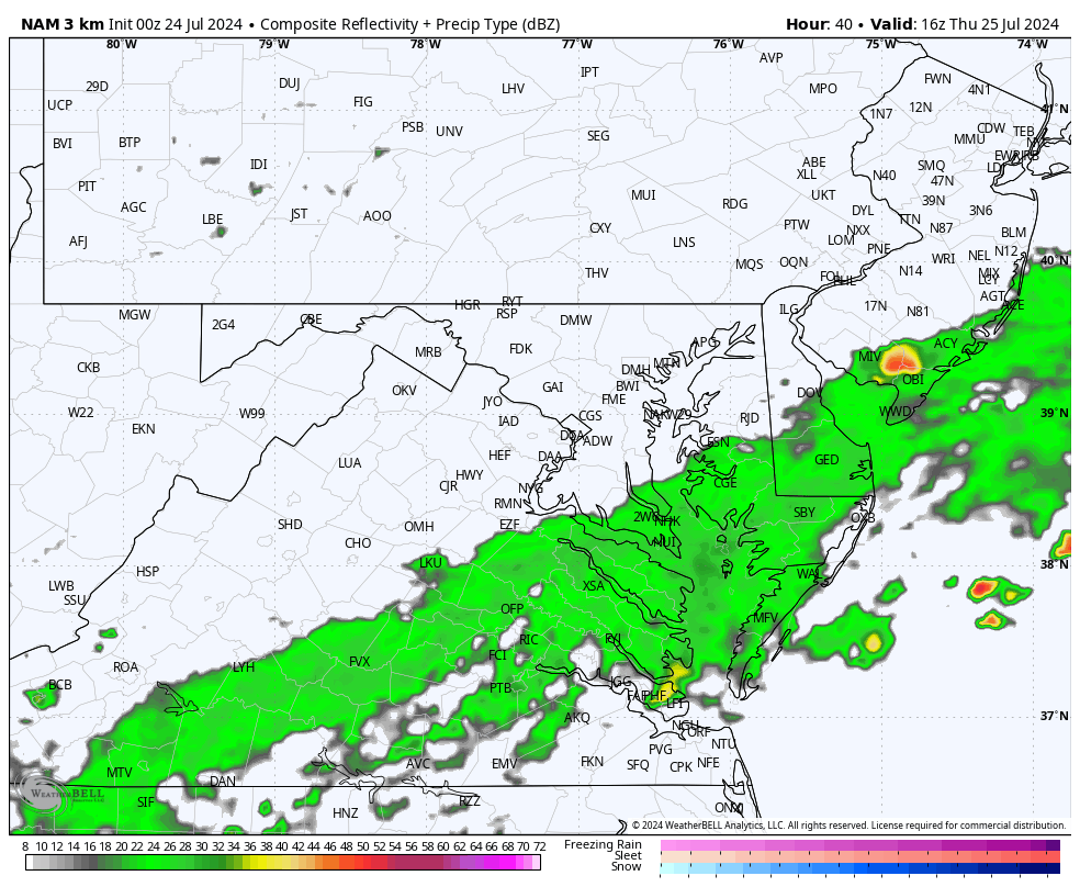
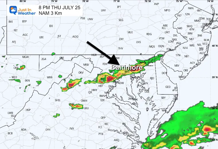
6 PM Snapshot NAM 3 Km Model
This model shows the northern line of storms more prominent between Westminster, MD, and Lancaster, PA.
CLIMATE DATA: Baltimore
TODAY July 24
Sunrise at 6:01 AM
Sunset at 8:25 PM
Normal Low in Baltimore: 68ºF
Record 55ºF in 1985
Normal High in Baltimore: 89ºF
Record 101ºF 2010
Record Highs Recently Tied
Sunday July 14: 101ºF in 2024 tied 1895 AND 1954
Monday July 15: 102ºF in 2024 tied 1995
Tuesday July 16: 104ºF in 2024 tied 1988
Not a Record
Wednesday July 17: 100ºF
THURSDAY JULY 25
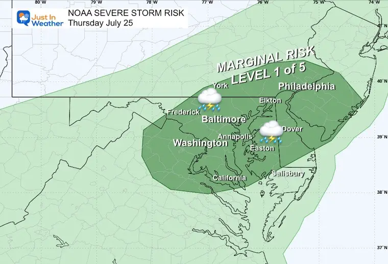
NOAA Severe Storm Risk
This shows only a MARGINAL chance for any storm to turn severe. There will be thunderstorms, but reaching severe levels will be limited.
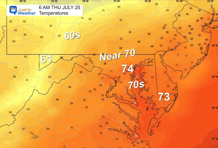
Morning Temperatures
Still warm and humid/muggy.
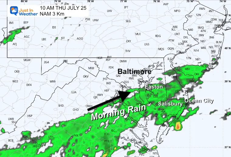
10 AM Radar Simulation
Radar Simulation Suggestion: Noon to Midnight
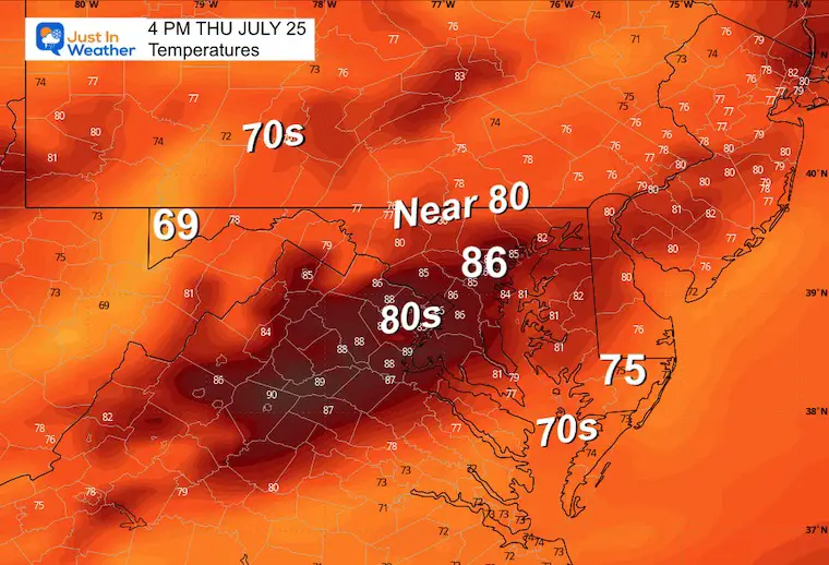
Afternoon Temperatures
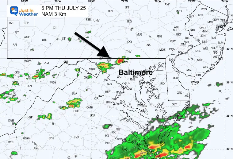
Snapshot Radar Simulation Suggestions:
5 PM
8 PM
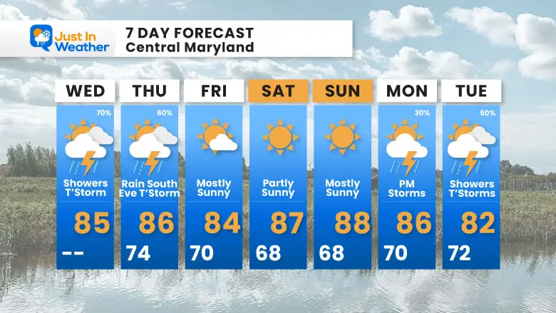
7 Day Forecast
Please share your thoughts and best weather pics/videos, or just keep in touch via social media.
RESTATING MY MESSAGE ABOUT DYSLEXIA
I am aware there are some spelling and grammar typos and occasional other glitches. I take responsibility for my mistakes and even the computer glitches I may miss. I have made a few public statements over the years, but if you are new here, you may have missed it: I have dyslexia and found out during my second year at Cornell University. It didn’t stop me from getting my meteorology degree and being the first to get the AMS CBM in the Baltimore/Washington region.
One of my professors told me that I had made it that far without knowing and to not let it be a crutch going forward. That was Mark Wysocki, and he was absolutely correct! I do miss my mistakes in my own proofreading. The autocorrect spell check on my computer sometimes does an injustice to make it worse. I also can make mistakes in forecasting. No one is perfect at predicting the future. All of the maps and information are accurate. The ‘wordy’ stuff can get sticky.
There has been no editor who can check my work while writing and to have it ready to send out in a newsworthy timeline. Barbara Werner is a member of the web team that helps me maintain this site. She has taken it upon herself to edit typos when she is available. That could be AFTER you read this. I accept this and perhaps proves what you read is really from me… It’s part of my charm. #FITF


