Sunday July 21 2024
Morning Report
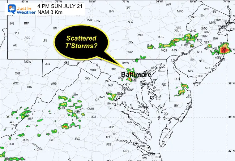
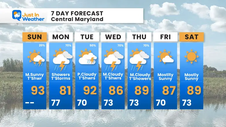
It feels like summer! That is an understatement. But after a second day in the 80s, we will get back to the 90s for a day. This may spark some isolated thunderstorms this afternoon, but I would not change any plans.
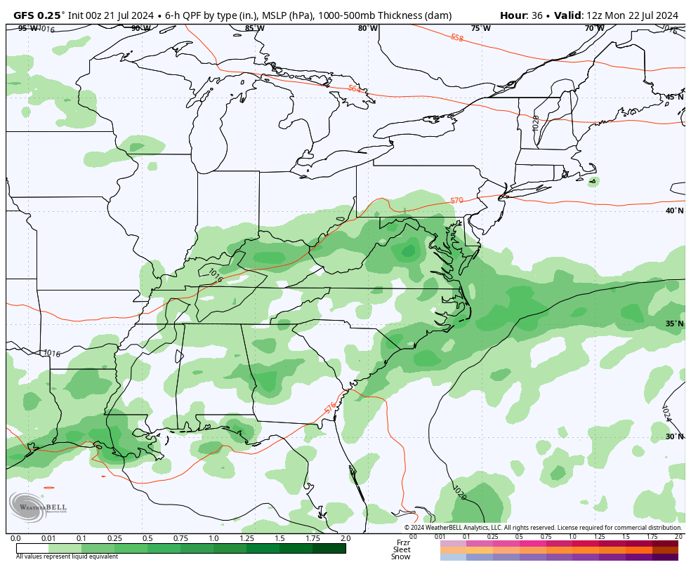
In the week ahead, however, an unsettled pattern will set up and stall. Each day may develop showers and thunderstorms. While Monday may have showers from morning to night, the other days are more likely to have late-day/evening/and night thundershowers.
TRIVIA: Baltimore Reports
1930 RECORD HEAT WAVE
- July 19 1930 = 103ºF
- July 20 1930 = 102ºF
- July 21 1930 = 104ºF
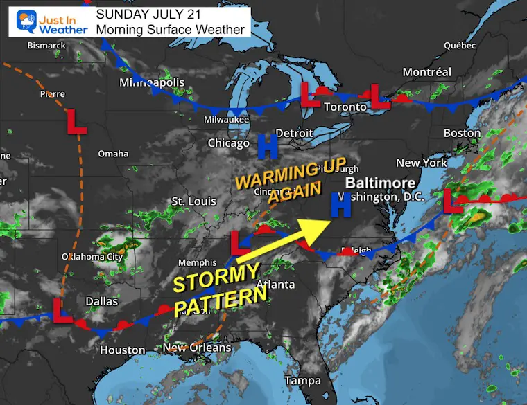
Morning Surface Weather
We have some dry air carved out in the Mid-Atlantic that will allow the heat to return with more sunshine.
The nearly stationary stormy pattern will be established with the boundary to our south that shifts over our region and hangs out for much of the week ahead.
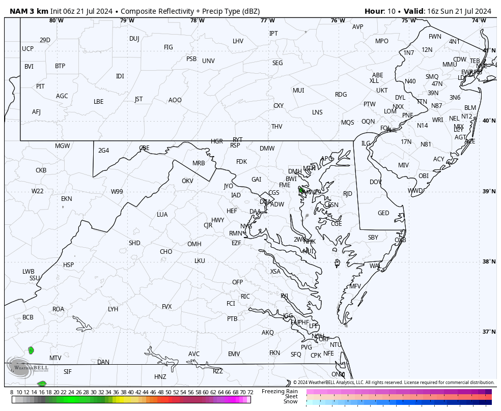
Live Radar Widget
Radar Simulation Suggestion: Noon to Midnight
4 PM Radar Snapshot Suggestion
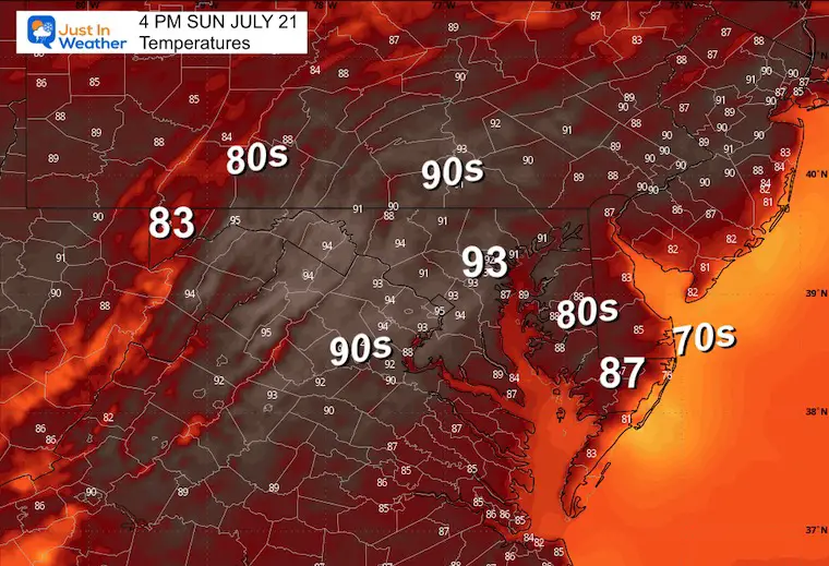
Afternoon Temperatures
CLIMATE DATA: Baltimore
TODAY July 21
Sunrise at 5:58 AM
Sunset at 8:28 PM
Normal Low in Baltimore: 68ºF
Record 53ºF in 1966
Normal High in Baltimore: 89ºF
Record 104ºF 1930
Record Highs Recently Tied
Sunday July 14: 101ºF in 2024 tied 1895 AND 1954
Monday July 15: 102ºF in 2024 tied 1995
Tuesday July 16: 104ºF in 2024 tied 1988
Not a Record
Wednesday July 17: 100ºF
MONDAY JULY 22
Radar Simulation Suggestion:
6 AM to Midnight
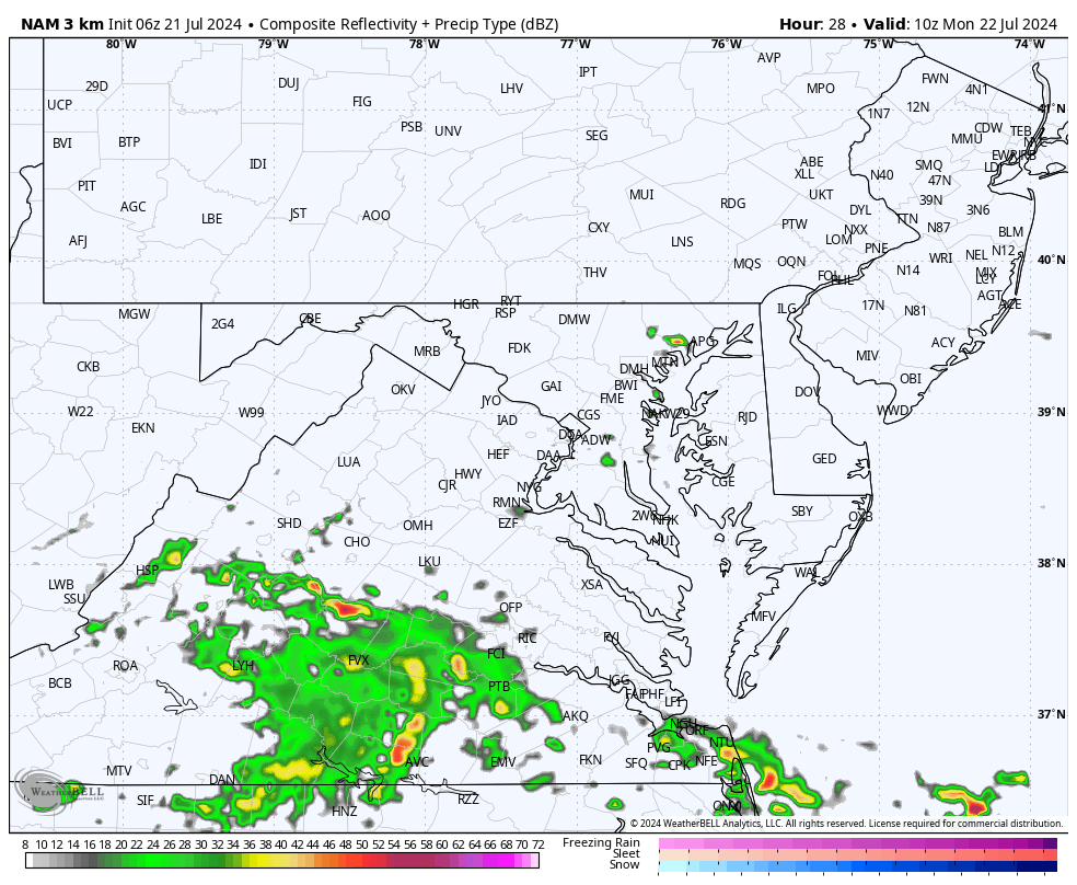
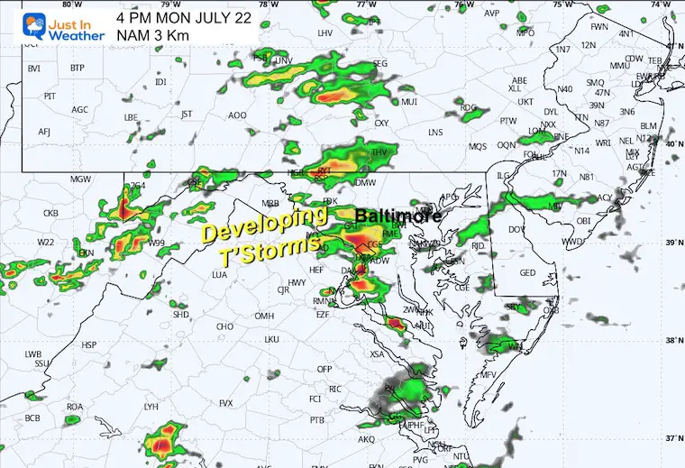
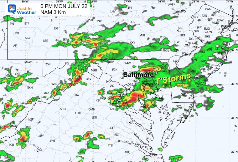
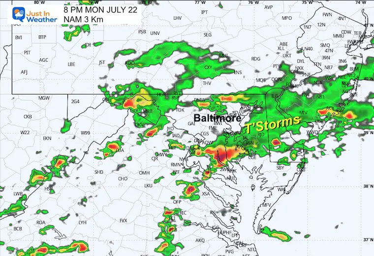
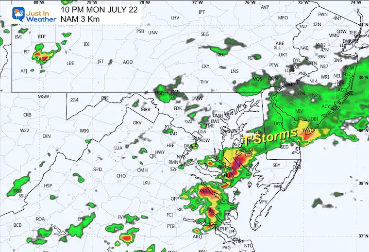
Morning showers are possible, followed by scattered storms through the afternoon and evening. Not much movement or direction, so some may sit and dump heavy rain on isolated areas.
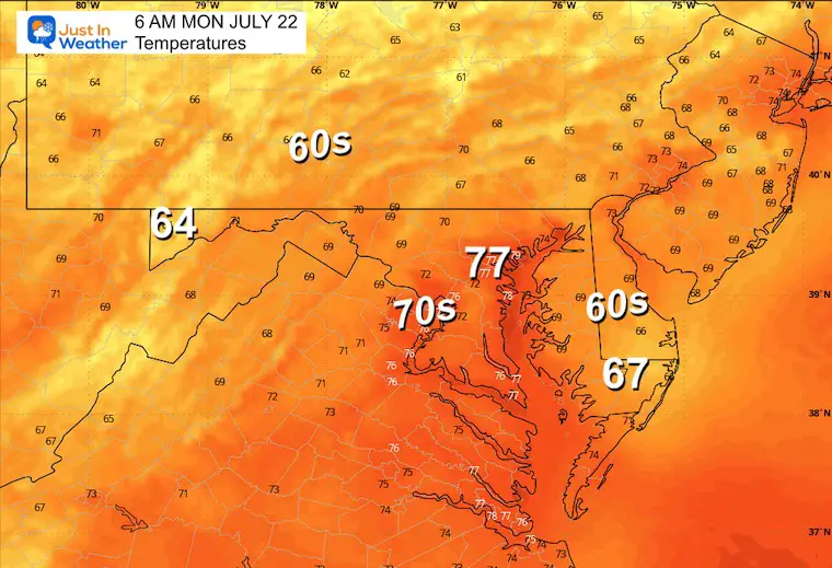
Morning Temperatures
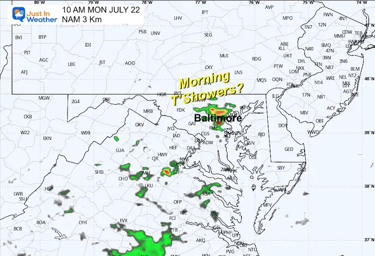
Morning Radar Suggestion
Potential early-day thundershowers.
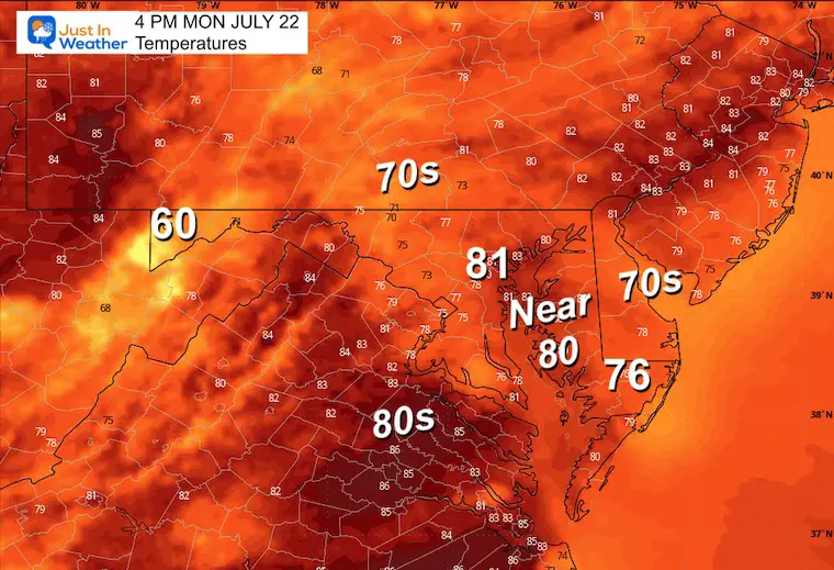
Afternoon Temperatures
Snapshot Suggestions:
4 PM Radar Simulation
6 PM Radar Simulation
8 PM Radar Simulation
10 PM Radar Simulation
LOOKING AHEAD
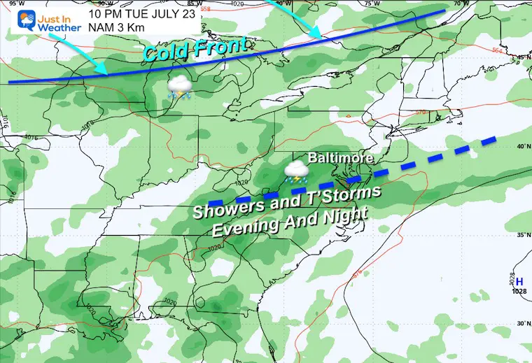
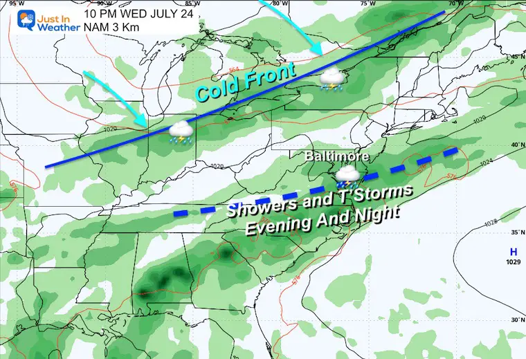
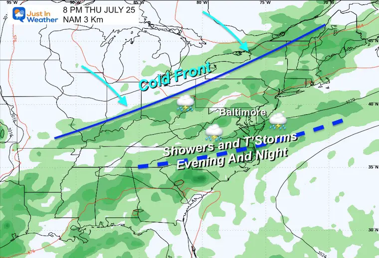
The upcoming work week will bring a pattern of daily showers and thunderstorms. Most of these will occur later in the afternoon, evening, and night. So, while we will be unsettled, not all days will be washouts.
Rain Forecast Monday to Friday
Tuesday Evening
Wednesday Evening
Thursday Evening
7 Day Forecast
Please share your thoughts and best weather pics/videos, or just keep in touch via social media.
RESTATING MY MESSAGE ABOUT DYSLEXIA
I am aware there are some spelling and grammar typos and occasional other glitches. I take responsibility for my mistakes and even the computer glitches I may miss. I have made a few public statements over the years, but if you are new here, you may have missed it: I have dyslexia and found out during my second year at Cornell University. It didn’t stop me from getting my meteorology degree and being the first to get the AMS CBM in the Baltimore/Washington region.
One of my professors told me that I had made it that far without knowing and to not let it be a crutch going forward. That was Mark Wysocki, and he was absolutely correct! I do miss my mistakes in my own proofreading. The autocorrect spell check on my computer sometimes does an injustice to make it worse. I also can make mistakes in forecasting. No one is perfect at predicting the future. All of the maps and information are accurate. The ‘wordy’ stuff can get sticky.
There has been no editor who can check my work while writing and to have it ready to send out in a newsworthy timeline. Barbara Werner is a member of the web team that helps me maintain this site. She has taken it upon herself to edit typos when she is available. That could be AFTER you read this. I accept this and perhaps proves what you read is really from me… It’s part of my charm. #FITF


