Tuesday, July 16 2024
Morning Report
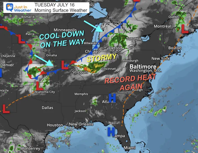
Baltimore at BWI hit 102ºF yesterday, tying the record set on the same date in 1995. The latest numbers for BWI show 4 days at or above 100ºF AND 27 days total at or above 90ºF. Today, we are expected to be above 100ºF as well. We will be adding the risk of severe storms to the mix. Some this afternoon and more likely tomorrow to finally break the heat wave.
Heat Wave Records To Consider
The excessive Heat Wave building in may only bring one or two challenges to record highs (in Baltimore). Here are some high marks to pay attention to. The best chance we will have will be on Wednesday to match the old record.
Recently Tied
Sunday, July 14: 101ºF in 2024 tied 1895 AND 1954
Monday, July 15: 102ºF in 2024 tied 1995
Next Records
Tuesday, July 16: 104ºF in 1988
Wednesday, July 17: 101ºF in 1988
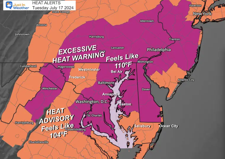
Heat Alerts: Including The Humidity To Calculate Heat Index/Feels Like Temps
- Excessive Heat Watch: Heat Index up to 110ºF
- Heat Advisory: Heat Index UP TO 104ºF
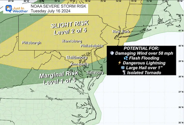
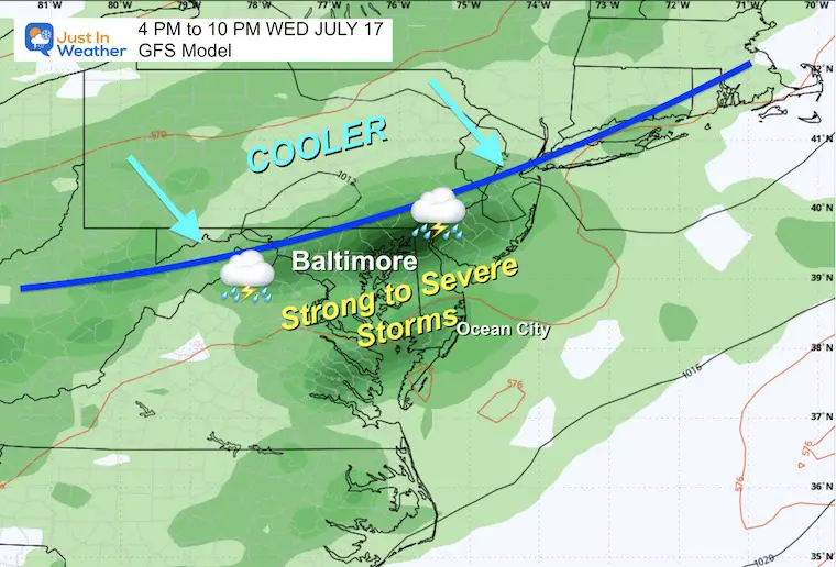
SEVERE STORM RISK
As we reach the peak of the heat and the cold front approaches, we will get one wave or storms that may turn severe this afternoon. The main risk will be damaging winds and flash flooding; However, hail and tornadoes still remain a threat.
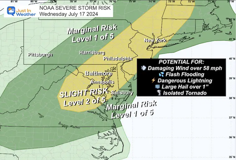
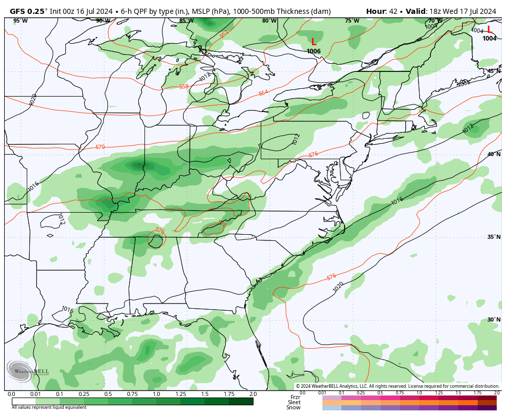
This will advance south on Wednesday with the cold front moving…
NOAA RISK TODAY
NOAA RISK TOMORROW
Morning Temperatures
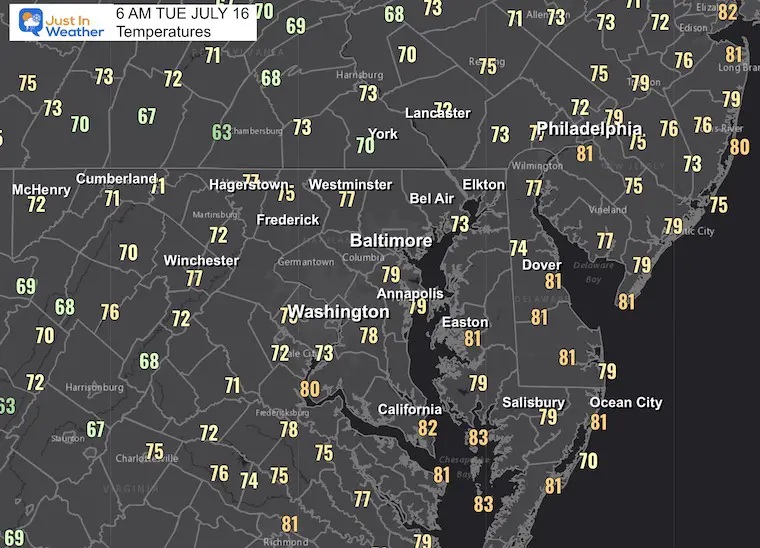
Tuesday Morning Set Up
LIVE RADAR WIDGET
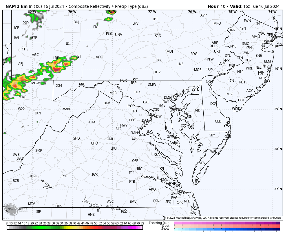
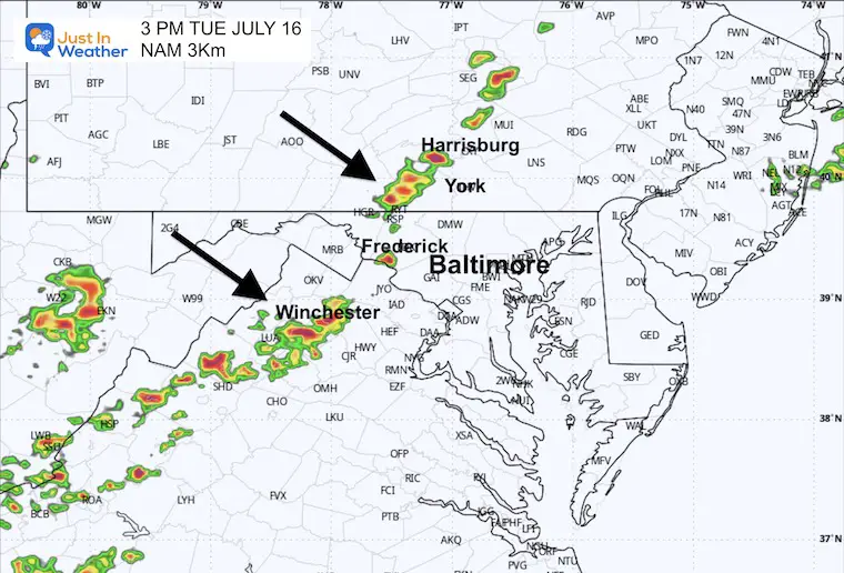
Looking for thunderstorms to develop after 1 PM. Compare to the Radar Simulation Forecast below.
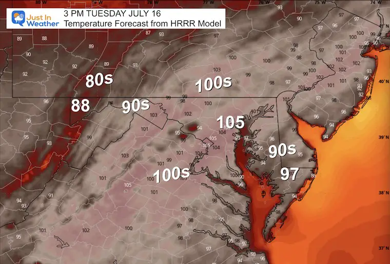
Afternoon Temperatures
This HRRR model continues to be the warmest solution and is usually spot on. If this verifies, we will tie the record in Baltimore.
Radar Simulation SUGGESTION From NAM 3 Km Model
Suggestion Noon to Midnight
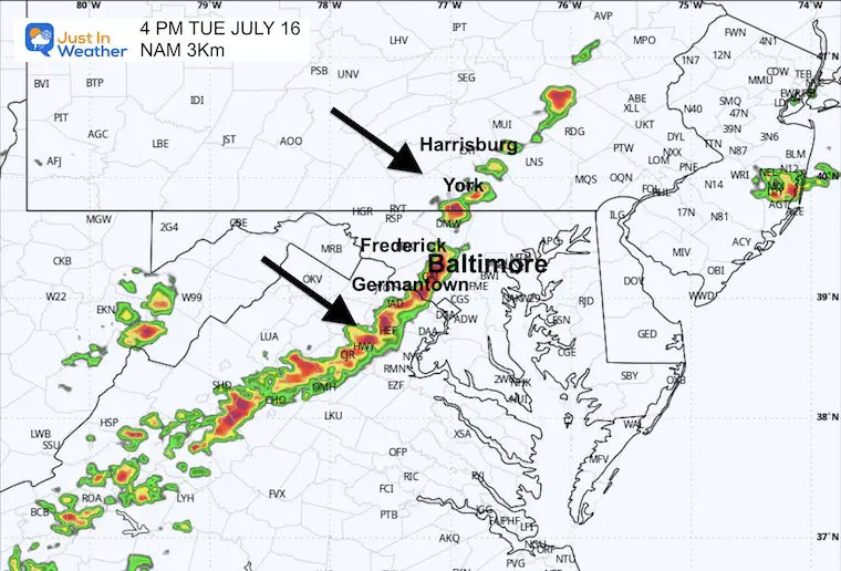
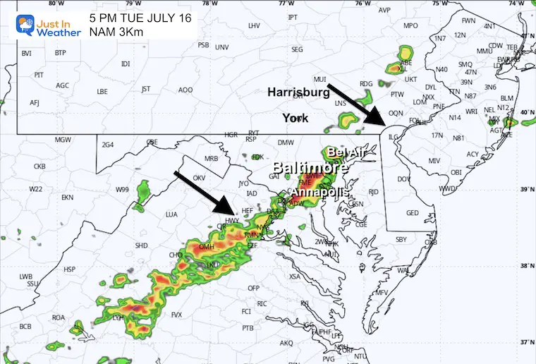
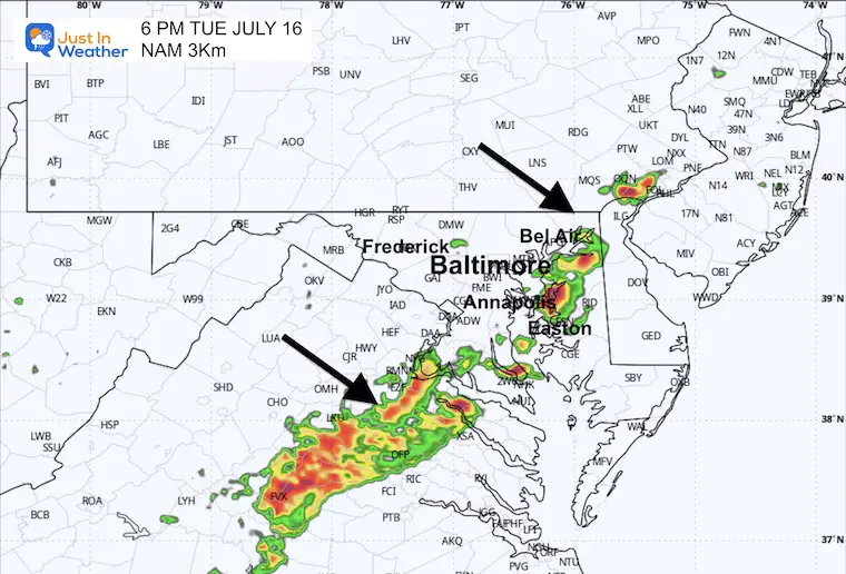
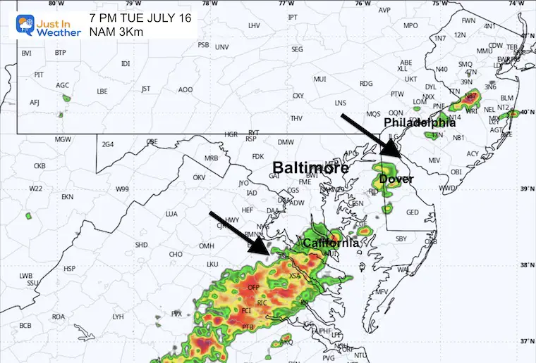
There may be a Severe Thunderstorm Watch issued IF this appears to be developing as shown below. That would mean a more valid POTENTIAL ahead of storms between 3 PM and 6 PM in metro areas.
3 PM Snapshot
4 PM Snapshot
5 PM Snapshot
6 PM Snapshot
7 PM Snapshot
CLIMATE DATA: Baltimore
TODAY July 16
Sunrise at 5:54 AM
Sunset at 8:31 PM
Normal Low in Baltimore: 68ºF
Record 57ºF in 1954
Normal High in Baltimore: 89ºF
Record 104ºF 1988
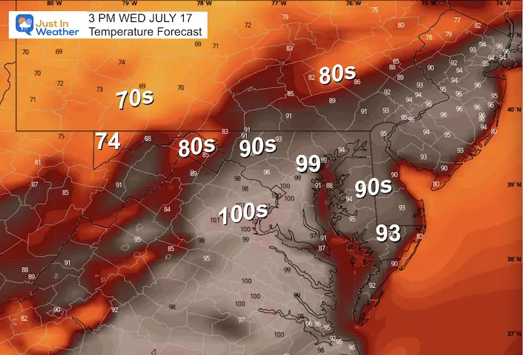
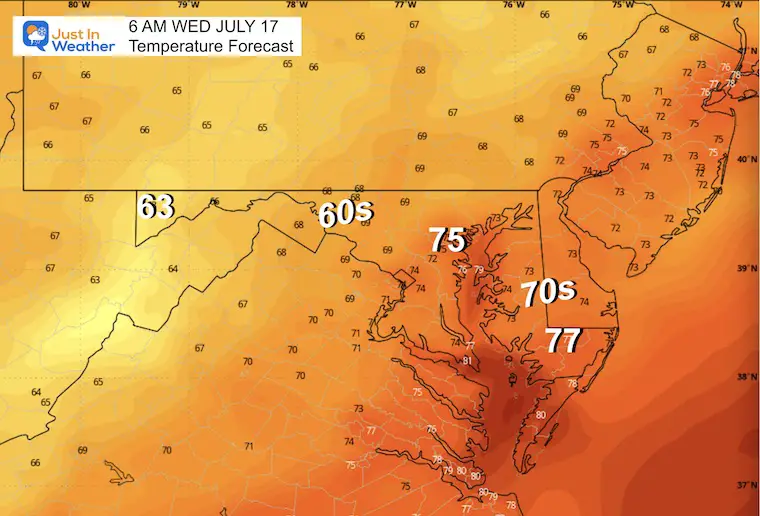
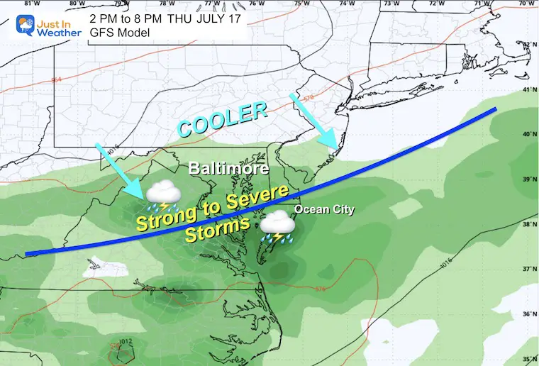
WEDNESDAY JULY 17
SEVERE STORM RISK AS HEAT WAVE BREAKS
Morning Temperatures
Afternoon Temperatures
Looking Ahead: Wednesday Afternoon to Friday
The culmination of this heat wave may be on Wednesday, with strong to severe storms as a cold front moves through. The new air mass should be in place for most of us on Thursday.
Wednesday
Thursday
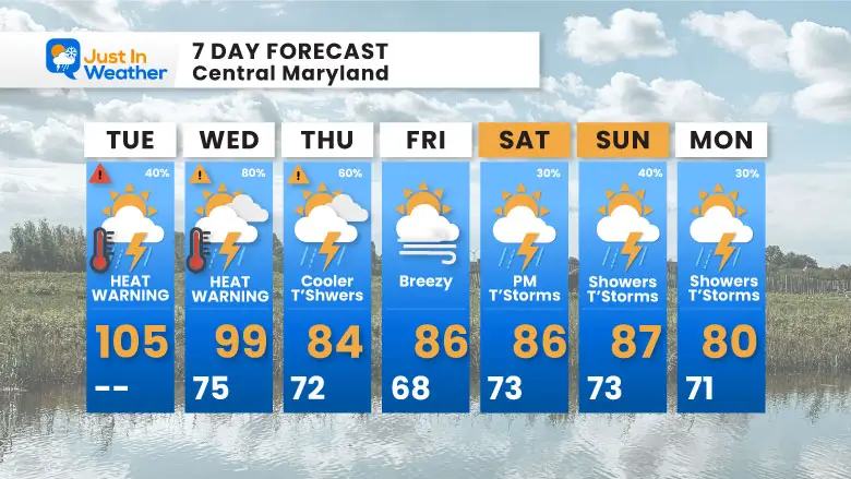
7 Day Forecast
The current excessive Heat Wave may only bring one or two more challenges to record highs in Baltimore.
Tuesday, July 16: 104ºF in 1988
Wednesday, July 17: 101ºF in 1988
Please share your thoughts and best weather pics/videos, or just keep in touch via social media.
RESTATING MY MESSAGE ABOUT DYSLEXIA
I am aware there are some spelling and grammar typos and occasional other glitches. I take responsibility for my mistakes and even the computer glitches I may miss. I have made a few public statements over the years, but if you are new here, you may have missed it: I have dyslexia and found out during my second year at Cornell University. It didn’t stop me from getting my meteorology degree and being the first to get the AMS CBM in the Baltimore/Washington region.
One of my professors told me that I had made it that far without knowing and to not let it be a crutch going forward. That was Mark Wysocki, and he was absolutely correct! I do miss my mistakes in my own proofreading. The autocorrect spell check on my computer sometimes does an injustice to make it worse. I also can make mistakes in forecasting. No one is perfect at predicting the future. All of the maps and information are accurate. The ‘wordy’ stuff can get sticky.
There has been no editor who can check my work while writing and to have it ready to send out in a newsworthy timeline. Barbara Werner is a member of the web team that helps me maintain this site. She has taken it upon herself to edit typos when she is available. That could be AFTER you read this. I accept this and perhaps proves what you read is really from me… It’s part of my charm. #FITF


