Monday July 15 2024
Morning Report
Baltimore hit 101ºF yesterday at BWI, tying the record set on the same date in 1895 and 1954. This was much warmer than expected, in part because of where the afternoon thunderstorms did and did not set up. The latest numbers for BWI show 3 days at or above 100ºF AND 26 days total at or above 90ºF. The next two days are expected to be above 100ºF as well.
Heat Wave Records To Consider
The excessive Heat Wave building in may only bring one or two challenges to record highs (in Baltimore). Here are some high marks to pay attention to. The best chance we will have will be on Wednesday to match the old record.
Sunday, July 14: 101ºF in 2024, tied 1895 AND 1954
- Monday July 15: 102ºF in 1995
- Tuesday July 16: 104ºF in 1988
- Wednesday July 17: 101ºF in 1988
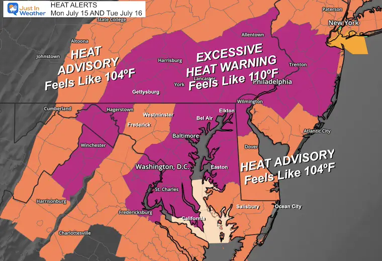
Heat Alerts: Including The Humidity To Calculate Heat Index/Feels Like Temps
Excessive Heat Watch: Heat Index up to 110ºF
Heat Advisory: Heat Index UP TO 104ºF
Yes, those extra degrees make a difference in threat and time, making it dangerous for most humans and pets.
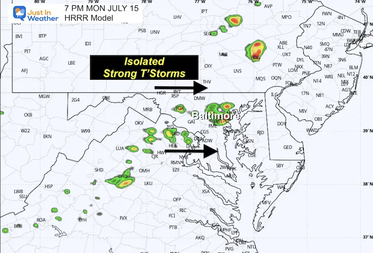
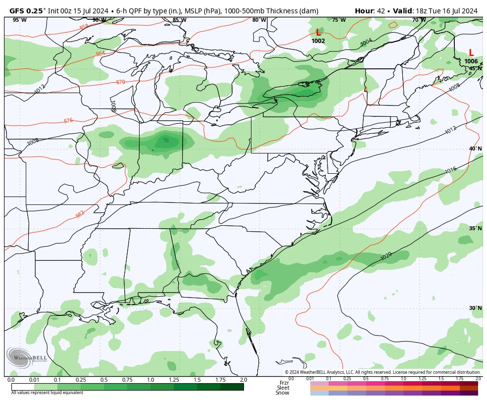
There may be some isolated thunderstorms forming again this afternoon. The forecast simulations below are purely suggestions and not promised, as pop-up showers depend on microclimate hot pockets for rising air. Our chance for rain will increase with a cold front on Wednesday that may turn severe but also end the Heat Wave with welcome relief.
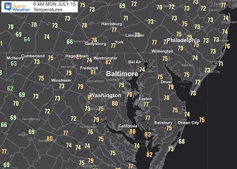
Morning Temperatures
LIVE RADAR WIDGET
Looking for Thunderstorms to develop after 3 PM. Compare to the Radar Simulation Forecast below.
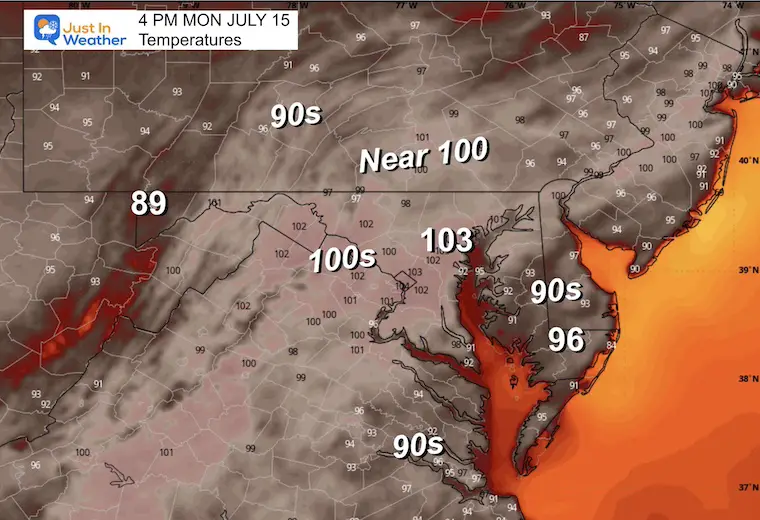
Afternoon Temperatures
I am sticking with this model as it has been the best with the high temperatures. It is suggesting a new record high today.
July 15: 102ºF in 1995
Radar Simulation:
Suggestion 2 PM to 10 PM
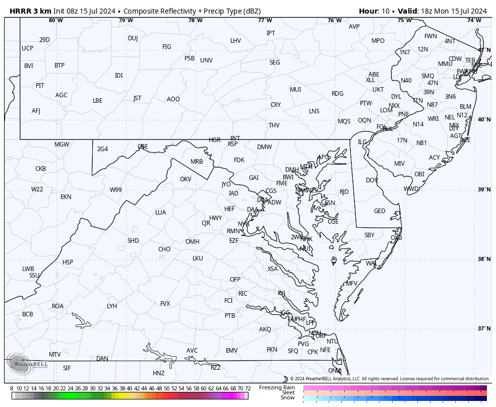
7 PM Snapshot
This potential thunderstorm may or may not be directly over Baltimore as shown, but we will have a few pockets of downpours for brief relief from the heat.
CLIMATE DATA: Baltimore
TODAY July 15
Sunrise at 5:53 AM
Sunset at 8:32 PM
Normal Low in Baltimore: 68ºF
Record 57ºF in 1895; 1999
Normal High in Baltimore: 89ºF
Record 102ºF 1995
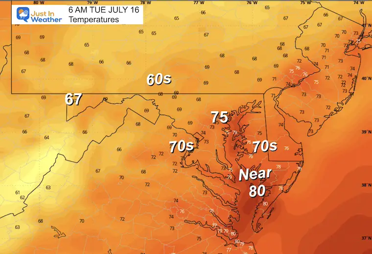
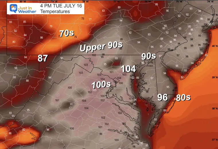
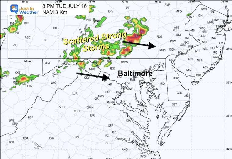
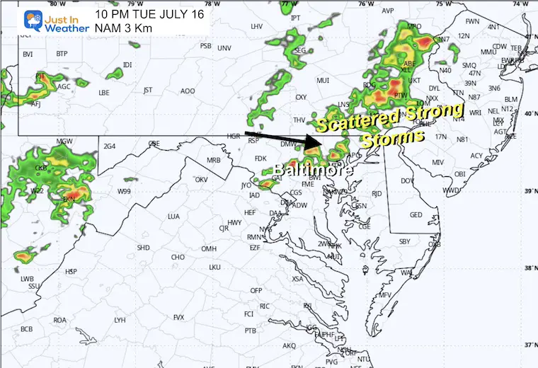
TUESDAY JULY 16
HEAT ALERTS CONTINUE
Morning Temperatures
Afternoon Temperatures
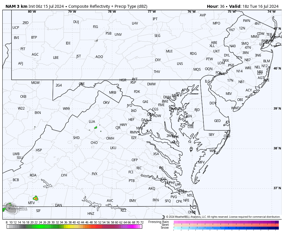
Radar Simulation:
Suggestion Noon to Midnight
Snapshots
8 PM
10 PM
Looking Ahead: Tuesday Afternoon to Friday
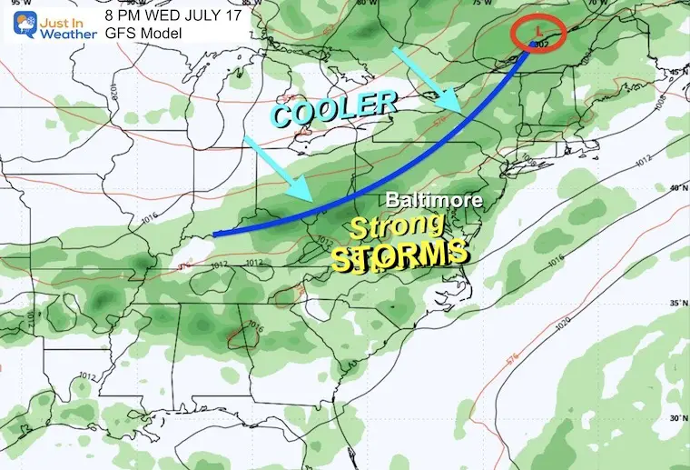
The culmination of this heat wave may be on Wednesday, with strong to severe storms as a cold front moves through. The new air mass should be in place for most of us by Thursday.
Wednesday
The main activity in the Mid-Atlantic will be with the cold front on Wednesday afternoon, evening, and night. Storms may turn severe as the heat wave finally breaks!
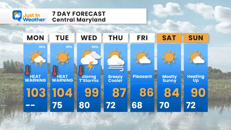
7 Day Forecast
The excessive Heat Wave may challenge or break more record highs (in Baltimore). We will get relief after a cold front arrives on Wednesday. This may include strong to severe storms.
- Monday July 15: 102ºF in 1995
- Tuesday July 16: 104ºF in 1988
- Wednesday July 17: 101ºF in 1988
Please share your thoughts and best weather pics/videos, or just keep in touch via social media.
RESTATING MY MESSAGE ABOUT DYSLEXIA
I am aware there are some spelling and grammar typos and occasional other glitches. I take responsibility for my mistakes and even the computer glitches I may miss. I have made a few public statements over the years, but if you are new here, you may have missed it: I have dyslexia and found out during my second year at Cornell University. It didn’t stop me from getting my meteorology degree and being the first to get the AMS CBM in the Baltimore/Washington region.
One of my professors told me that I had made it that far without knowing and to not let it be a crutch going forward. That was Mark Wysocki, and he was absolutely correct! I do miss my mistakes in my own proofreading. The autocorrect spell check on my computer sometimes does an injustice to make it worse. I also can make mistakes in forecasting. No one is perfect at predicting the future. All of the maps and information are accurate. The ‘wordy’ stuff can get sticky.
There has been no editor who can check my work while writing and to have it ready to send out in a newsworthy timeline. Barbara Werner is a member of the web team that helps me maintain this site. She has taken it upon herself to edit typos when she is available. That could be AFTER you read this. I accept this and perhaps proves what you read is really from me… It’s part of my charm. #FITF


