Wednesday, July 10 2024
Morning Report
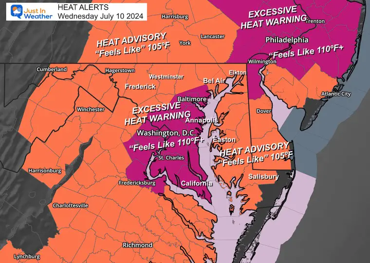
Baltimore hit 99ºF yesterday for the second time this summer. The latest numbers for BWI also show 22 days total at or above 90ºF. The peak heat index was 112ºF at 2:20 PM. This is why there was an upgrade to an Excessive Heat Warning AND that has been issued again for today!
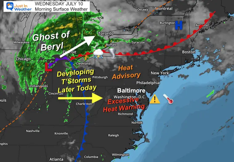
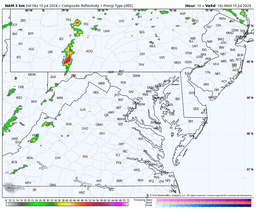
The ghost or remains of Beryl are heading towards Michigan. Heavy rain has pushed into the Great Lakes and Ontario, Canada. A trailing cold front from this Low-Pressure center will swing through our region this evening, bringing us strong storms with a chance that some in the region will reach severe limits.
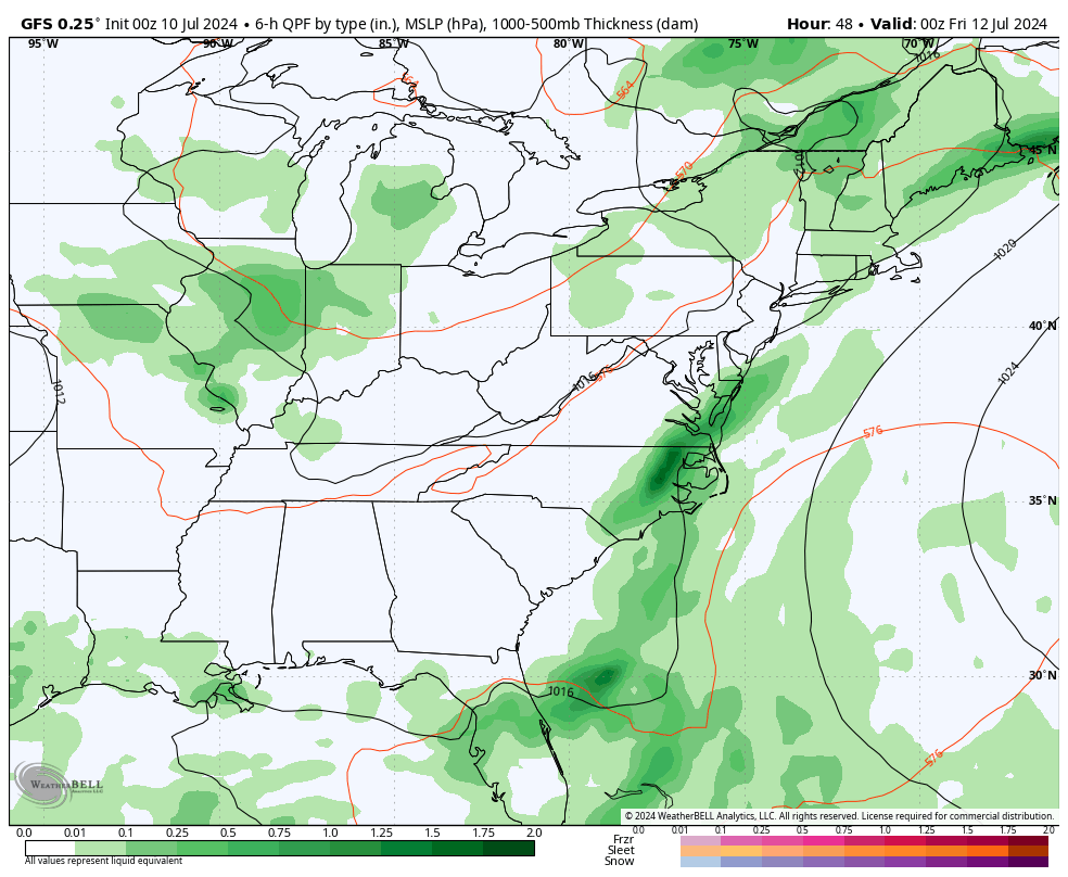
This boundary will remain nearly stalled for a few days with the next surge of region-wide rain on Friday.
Excessive Heat Warning and Advisory
Central to Southern Maryland has been put back in to join metro Philadelphia, with expectations for Heat Index values up to 110ºF or higher. Most of the rest of the region will be slightly lower, with Heat Index values of 105ºF.
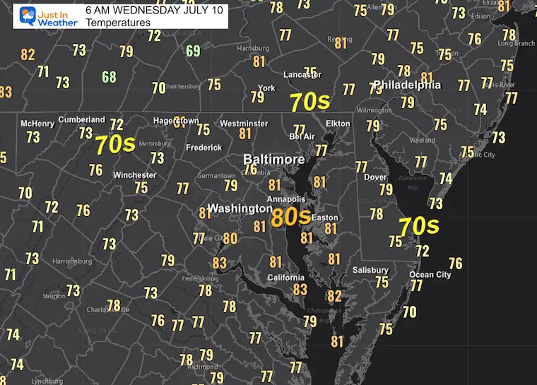
Morning Temperatures
Another Very Warm Start. Look at how many spots were reporting the 80s.
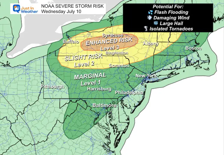
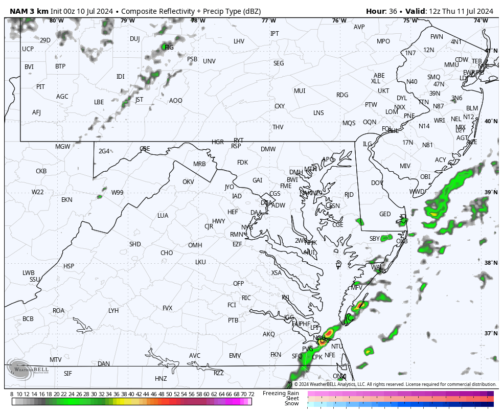
NOAA Severe Storm Risk
The ghost of Hurricane Beryl will be passing to our Northwest. The Enhanced Risk of severe storms will be in central New York. A trailing Cold Front from that Low Pressure is what will swing through The Mid-Atlantic by evening and bring us the risk of severe storms. Timing is key, so where it arrives before sunset will bring the best risk for storms to contain:
- Flash Flooding
- Damaging Winds (over 58 mph)
- Large Hail (Over 1 inch in diameter)
- Isolated Tornadoes
Today’s Weather
Hot, humid, and very uncomfortable! In fact dangerous for many to be outside for an extended period of time. As Beryl continues to move inland to the North, some of that moisture may influence our weather in the days ahead.
LIVE RADAR and LIGHTNING WIDGET
Morning Surface Weather
The trailing Cold Front is what will spark the line of strong to severe storms later today. The core Low Pressure that was once Hurricane Beryl will pass to our North… which is where the higher severe storm risk will be.
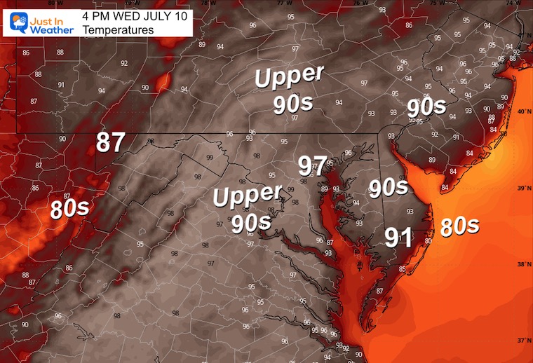
Afternoon Temperatures
Radar Simulation ‘Suggestion’
Noon to Midnight
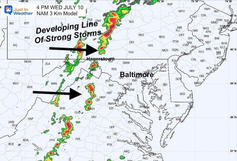
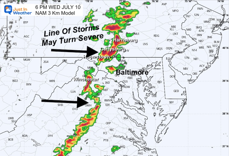
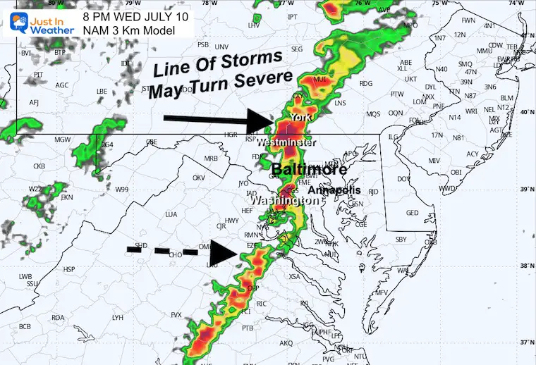
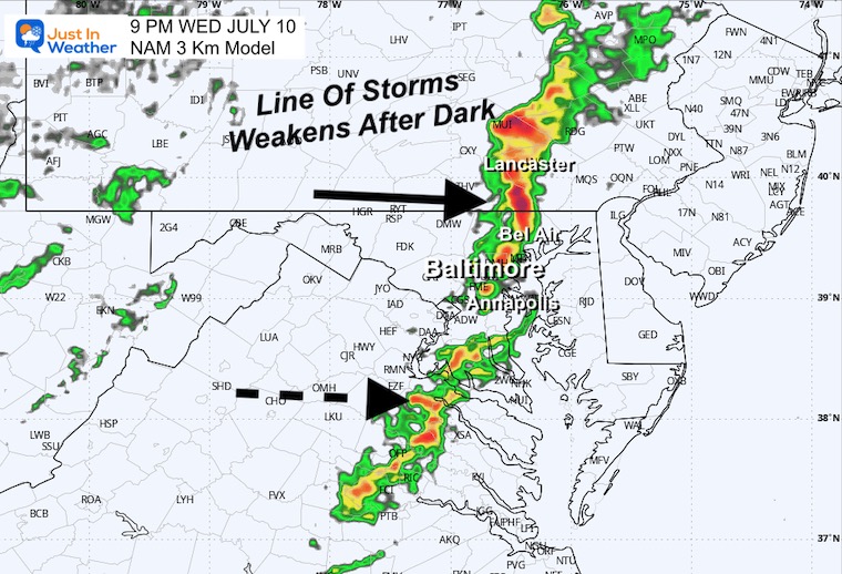
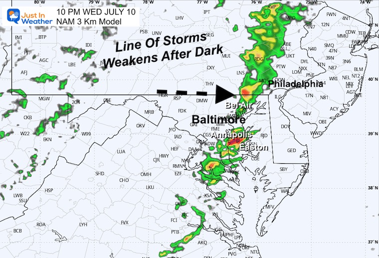
A line of strong to severe storms will approach our metro areas between 7 PM and 10 PM.
Snapshots
4 PM
6 PM
8 PM
9 PM
10 PM
CLIMATE DATA: Baltimore
TODAY July 10
Sunrise at 5:50 AM
Sunset at 8:34 PM
Normal Low in Baltimore: 68ºF
Record 55ºF in 1961
Normal High in Baltimore: 89ºF
Record 107ºF 1936 *Hottest Day in Baltimore History
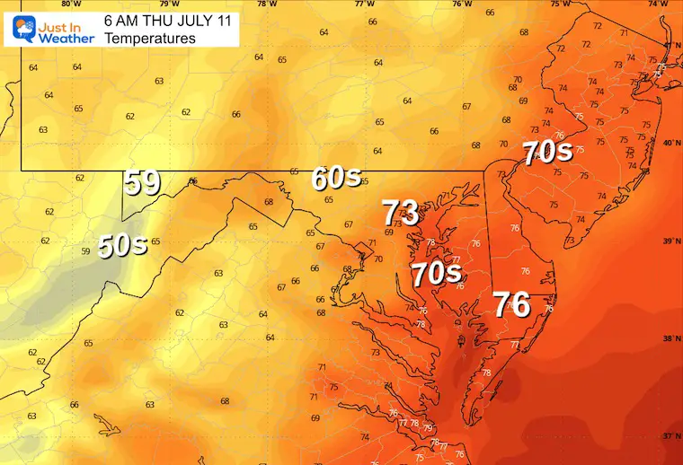
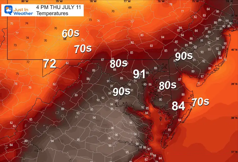
THURSDAY JULY 11
SLIGHT REDUCTION of heat and humidity. The line of storms will shift closer to the beaches in the afternoon and evening.
Morning Temperatures
Afternoon Temperatures
Radar Simulation ‘Suggestion’
8 AM to 8 PM
Local Impact: Thursday to Sunday Night
Beryl’s remains to our North and a trailing frontal boundary will keep the unstable air across the region…The widespread storm expectation will be Friday and again Sunday night.
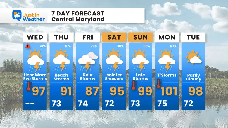
7 Day Forecast
The shift of strong storms to the beach on Thursday will build back across the region on Friday. High heat and unstable air will continue into early next week.
Please share your thoughts and best weather pics/videos, or just keep in touch via social media
RESTATING MY MESSAGE ABOUT DYSLEXIA
I am aware there are some spelling and grammar typos and occasional other glitches. I take responsibility for my mistakes and even the computer glitches I may miss. I have made a few public statements over the years, but if you are new here, you may have missed it: I have dyslexia and found out during my second year at Cornell University. It didn’t stop me from getting my meteorology degree and being the first to get the AMS CBM in the Baltimore/Washington region.
One of my professors told me that I had made it that far without knowing and to not let it be a crutch going forward. That was Mark Wysocki, and he was absolutely correct! I do miss my mistakes in my own proofreading. The autocorrect spell check on my computer sometimes does an injustice to make it worse. I also can make mistakes in forecasting. No one is perfect at predicting the future. All of the maps and information are accurate. The ‘wordy’ stuff can get sticky.
There has been no editor who can check my work while writing and to have it ready to send out in a newsworthy timeline. Barbara Werner is a member of the web team that helps me maintain this site. She has taken it upon herself to edit typos when she is available. That could be AFTER you read this. I accept this and perhaps proves what you read is really from me… It’s part of my charm. #FITF


