July 4th Storm Update Mid Afternoon Through Tonight
Thursday July 4 2024 at 3:30 PM
This afternoon we have a little complication to our weather and expectation for thunderstorms. The holiday has heightened awareness or any effect on your party or evening fireworks. The good news I that I think the bulk of activity will be through in time for most fireworks, but this is not cut and dry.
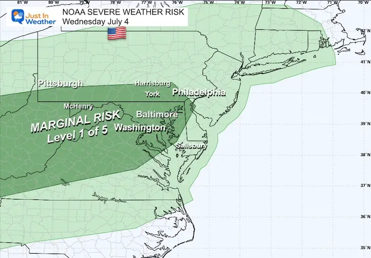
NOAA Severe Storm Risk
We have a marginal risk for severe weather, but it is worth paying attention to…
Live Radar and Lighting Widget
Compare to the set up and forecast maps below
Set Up
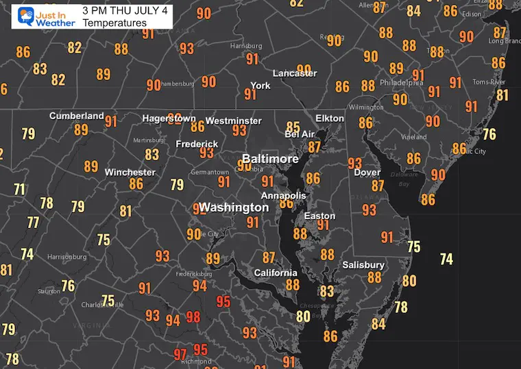
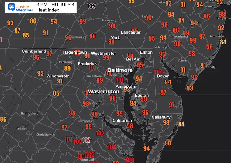
We have the heat and humidity. Most areas are in the 90s, with Heat Index values near 100ºF in Central Maryland and Southeast Virginia.
3 PM Weather Maps
Temperatures
Heat Index
Note 100ºF in Central Maryland and Southeast Virginia.
Analysis Notes:
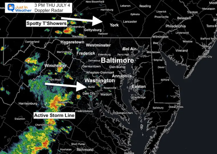
Doppler Radar has highlighted a line of storms in Virginia with spotty thundershowers across Southern Pennsylvania, all moving to the East at 15 to 20 mph. So, at first glance, it may appear that we will get more to flare up. What I will show below supports that some action may cross metro areas between 5 and 8 PM, but tonight is looking better across central Maryland. You may want to check across Southern Pennsylvania as storms may continue tonight.
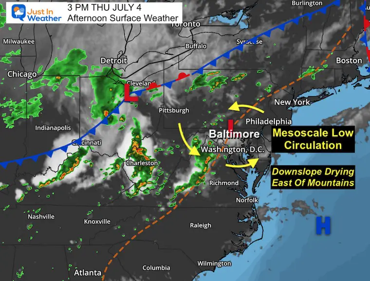
Surface Weather
However, the Surface Map suggests a Mesoscale Low has formed along a prefrontal trough. This is enhancing the storms, but the location is key for metro areas. This position may enhance downslope winds FROM the mountains near and South of the Low. That is a drying wind that may cause this line to weaken.
To the north, there is still upslope, which will sustain or enhance the thundershowers and larger storms in Pennsylvania.
3 PM Doppler Radar
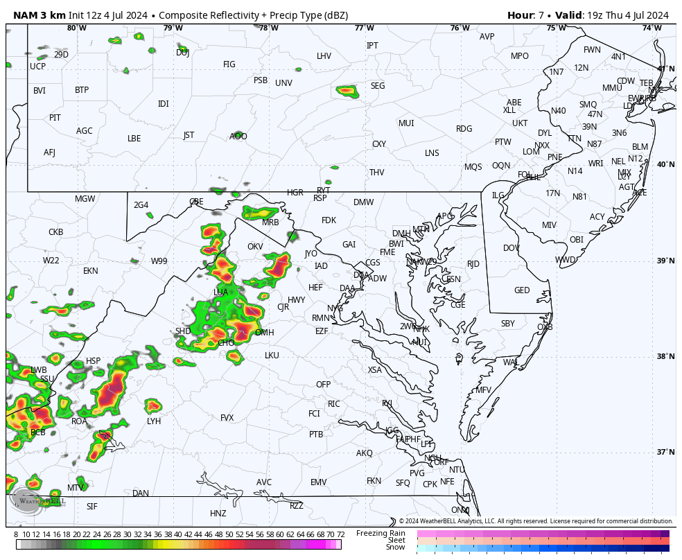
Compare to the Model Forecast From The NAM 3Km
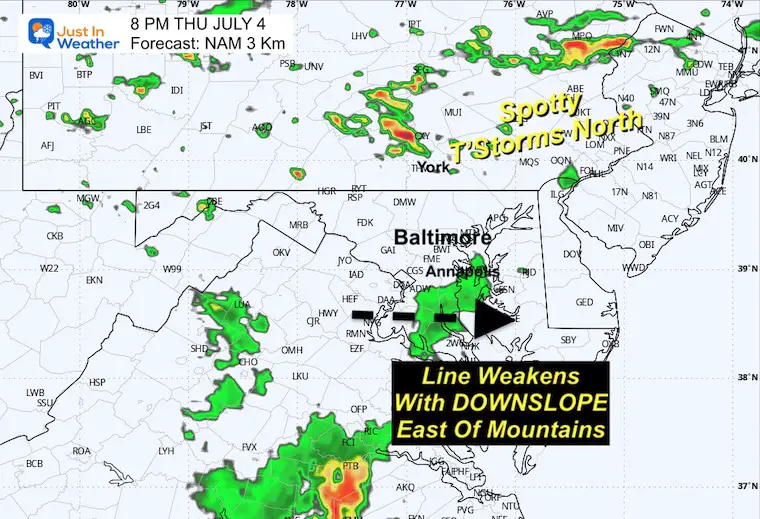
3 PM Forecast
This model was the best performing today, but it’s not perfect! So this is the short range to pay the most attention to… I will compare it to other plots below.
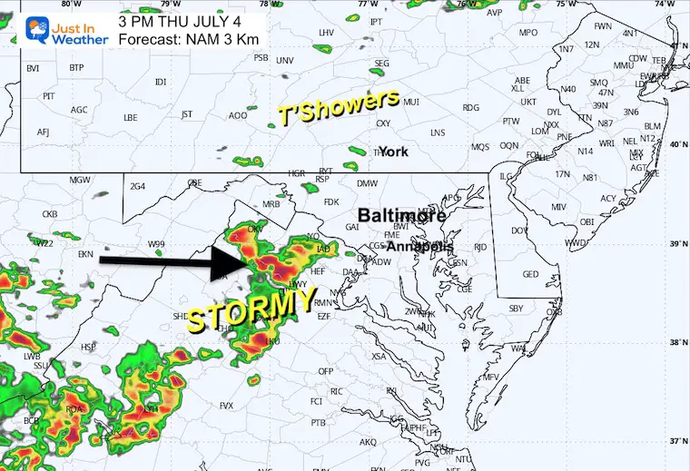
SNAPSHOT SUGGESTIONS
I believe we will see more action than shown here… This is only to show the trend of time and intensity….
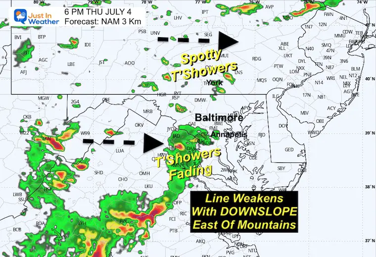
6 PM
Model Display: The line in Virginia may weaken as it approaches metro Washington and the Chesapeake Bay.
Storms in Pennsylvania will have a chance to keep growing and going.
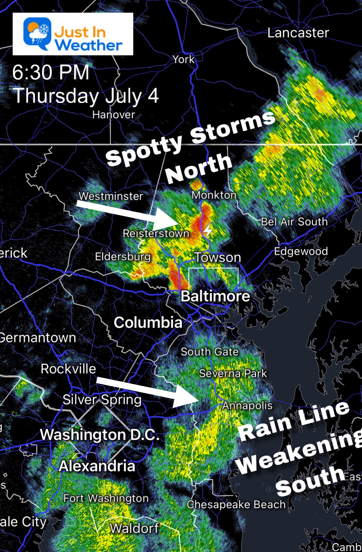
6:30 PM Verification
Here we see the actual radar showing a little more activity and a little father east/faster. The storm cluster was more impressive in the suburbs just NORTH of Baltimore.
The line of rain reached The Chesapeake Bay and is weakening, but still dropping beneficial rain.
8 PM
Model Display: At this point, the bulk of the action can be expected in Southern Pennsylvania. I cannot rule out thundershowers in Maryland… more than shown here. This product has underperformed recently. However, the action will be scattered and NOT widespread enough to make a solid call for your spot.
Radar Simulation: 4 PM to Midnight
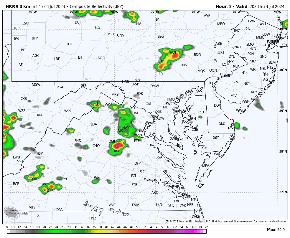
HRRR Model
This is not initialized well at 3 PM. It does still bring a line of showers or a leftover thunderstorm to Baltimore and Annapolis between 6 PM and 8 PM.
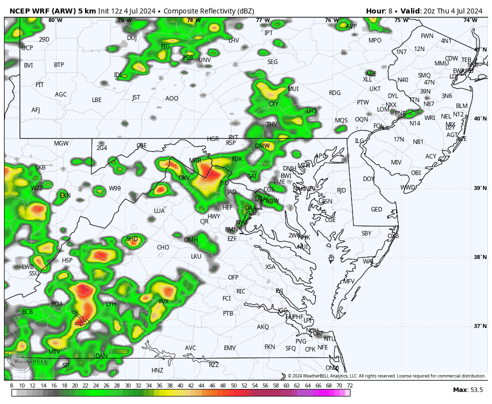
WRF Model
This was overdoing the afternoon showers… and it does maintain the line to cross Baltimore and Annapolis between 5 PM and 7 PM. Then, weaken and fall apart tonight.
FRIDAY JULY 5
Hot and More Humid! Showers and storms will develop in the afternoon. I do not trust how the models are handling this, and they will be scattered, so we will just have to watch anything develop and track from there.
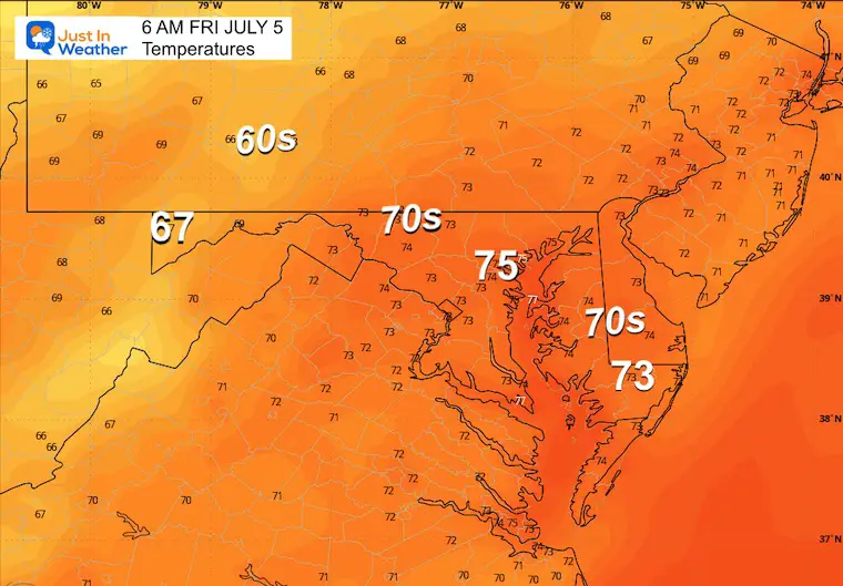
Morning Temperatures
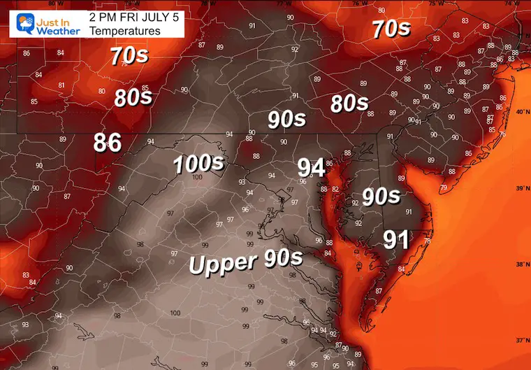
Afternoon Temperatures
Heat Index Values will approach 100ºF again.
Looking Ahead: Thursday Evening to Sunday Evening
Showers and thunderstorms will occur in the afternoon and evening almost every day. A break in the humidity will cut that pattern off on Sunday.
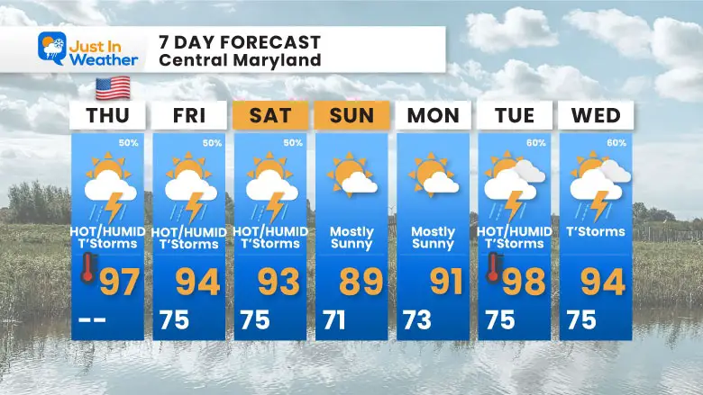
7 Day Forecast
We will remain with hot and humid weather for the next week. There may be a break in humidity on Sunday and Monday. Otherwise, each day will have a chance for afternoon storms.
Please share your thoughts and best weather pics/videos, or just keep in touch via social media
RESTATING MY MESSAGE ABOUT DYSLEXIA
I am aware there are some spelling and grammar typos and occasional other glitches. I take responsibility for my mistakes and even the computer glitches I may miss. I have made a few public statements over the years, but if you are new here, you may have missed it: I have dyslexia and found out during my second year at Cornell University. It didn’t stop me from getting my meteorology degree and being the first to get the AMS CBM in the Baltimore/Washington region.
One of my professors told me that I had made it that far without knowing and to not let it be a crutch going forward. That was Mark Wysocki, and he was absolutely correct! I do miss my mistakes in my own proofreading. The autocorrect spell check on my computer sometimes does an injustice to make it worse. I also can make mistakes in forecasting. No one is perfect at predicting the future. All of the maps and information are accurate. The ‘wordy’ stuff can get sticky.
There has been no editor who can check my work while writing and to have it ready to send out in a newsworthy timeline. Barbara Werner is a member of the web team that helps me maintain this site. She has taken it upon herself to edit typos when she is available. That could be AFTER you read this. I accept this and perhaps proves what you read is really from me… It’s part of my charm. #FITF


