


January 2 Weather Still Cold This Weekend With A Warm Up Next Week
Friday, January 2, 2026 After the New Year's Day Morning Snow Squall, the cold air mass has been firmly in place. One more system passed through overnight with flurries and…
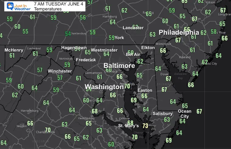
Tuesday, June 4
Morning Report
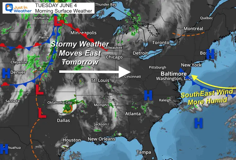
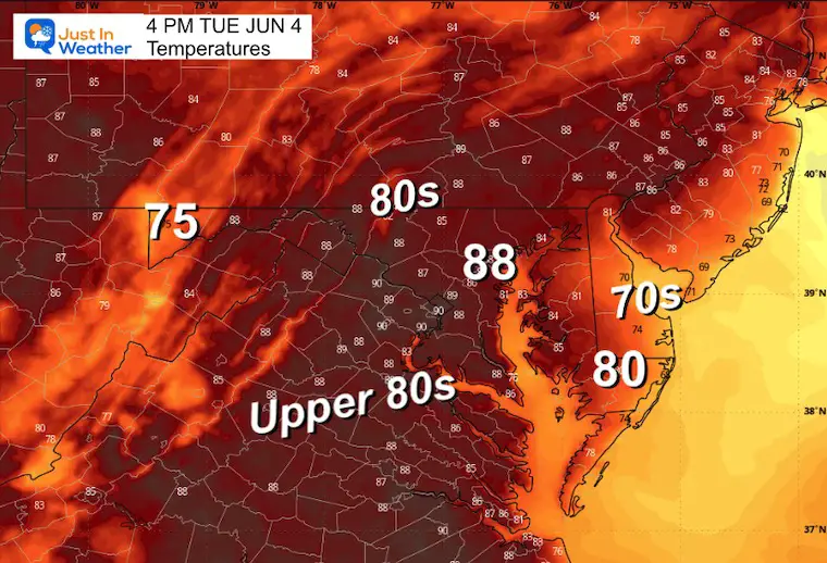
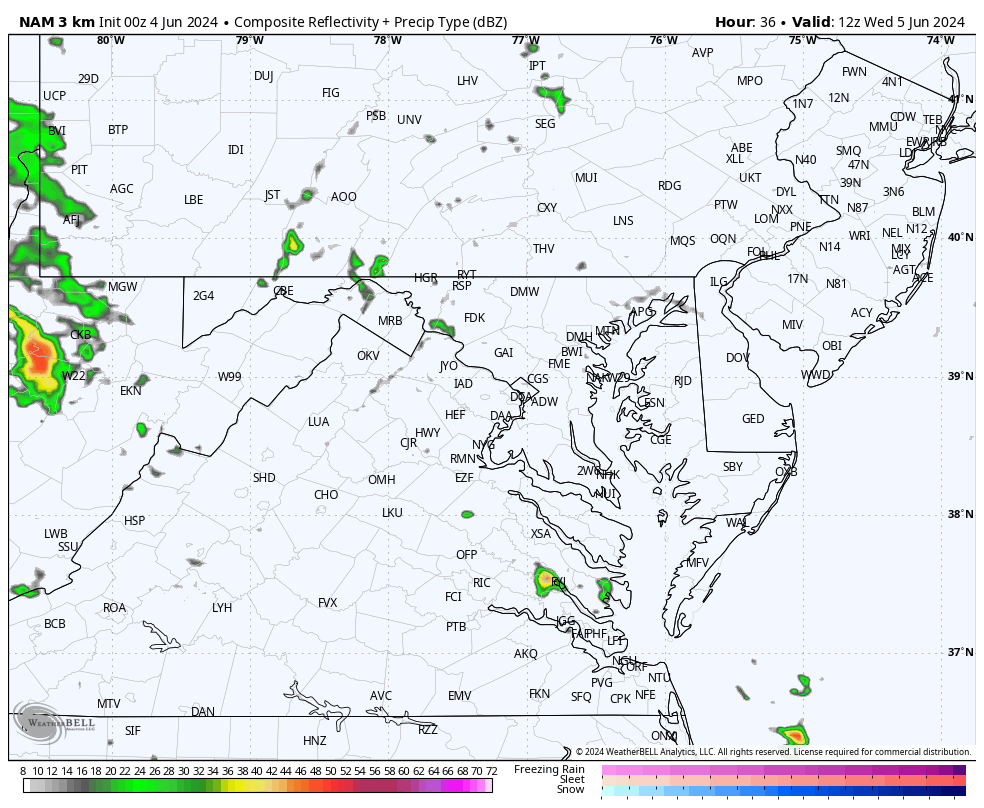
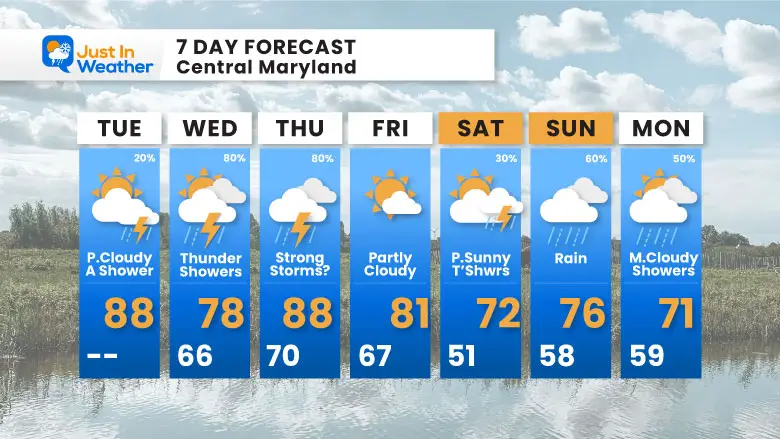
We are in an early summer mode of weather for sure. Higher humidity will be more noticeable today and it may be a little incentive to develop some spotty thundershowers. This will be all about wind flow.
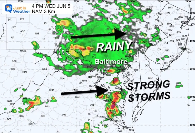
More storms on Wednesday afternoon could affect temperatures and afternoon outdoor plans.
Looking ahead, the weekend may bring more rain and cooler temperatures, with the focus (at this time) on Sunday.
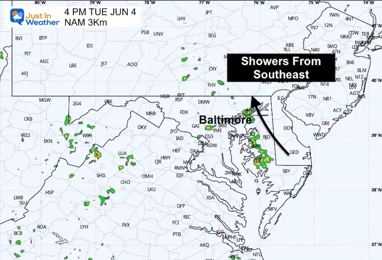
A weakness in the atmosphere is expected to increase wind from the Southeast. With the high humidity in place, this will increase the risk of thunderstorms.
This will become more active mid afternoon…
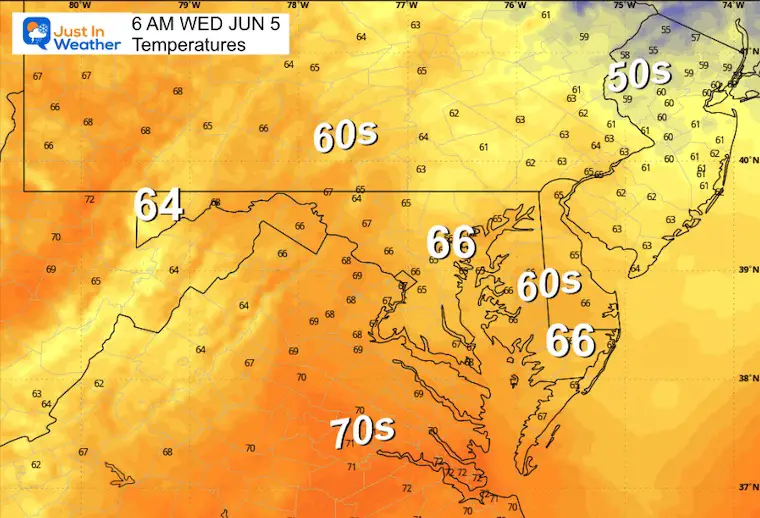
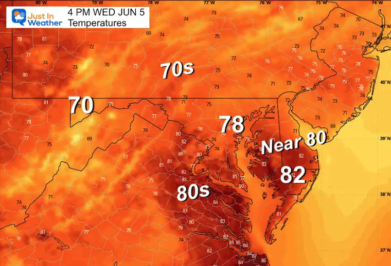
Warm and humid!
The Southeast wind works on the added moisture from the Ocean and Bay PLUS increases upslope flow to enhance any storm development.
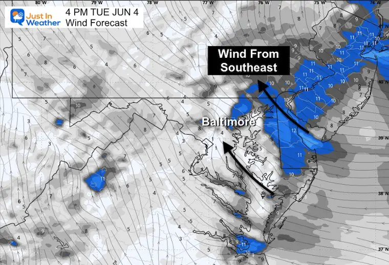
A band of showers and storms may be developing along the wind flow… and they will be slow-moving, from the South To the North.

Sunrise at 5:41 AM
Sunset at 8:29 PM
Normal Low in Baltimore: 59ºF
Record 46ºF in 1964; 2019
Normal High in Baltimore: 81ºF
Record 96ºF 1925; 1939
The next weather system is expected to become more active this afternoon.
The cool down may be in response to more rain.
A band of steady rain across Central Maryland and north, and strong to severe storms may pass through Southern Maryland.
The next storm system worth watching may bring steady rain on Sunday.
This is a SUGGESTION and subject to change in timing and intensity.
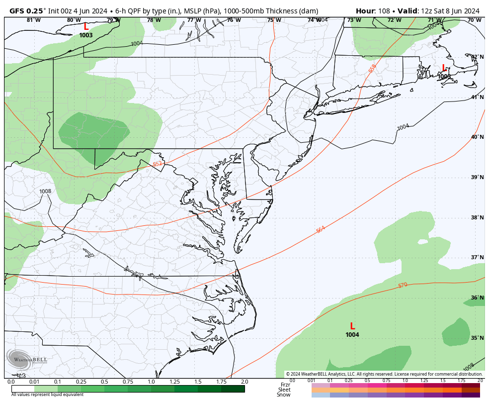
An increase in storm risk over the next few days will eventually take some of the steam out of the air. This weekend may bring an increase in rain and a drop in temperatures again.
I am aware there are some spelling and grammar typos and occasional other glitches. I take responsibility for my mistakes and even the computer glitches I may miss. I have made a few public statements over the years, but if you are new here, you may have missed it: I have dyslexia and found out during my second year at Cornell University. It didn’t stop me from getting my meteorology degree and being the first to get the AMS CBM in the Baltimore/Washington region.
One of my professors told me that I had made it that far without knowing and to not let it be a crutch going forward. That was Mark Wysocki, and he was absolutely correct! I do miss my mistakes in my own proofreading. The autocorrect spell check on my computer sometimes does an injustice to make it worse. I also can make mistakes in forecasting. No one is perfect at predicting the future. All of the maps and information are accurate. The ‘wordy’ stuff can get sticky.
There has been no editor who can check my work while writing and to have it ready to send out in a newsworthy timeline. Barbara Werner is a member of the web team that helps me maintain this site. She has taken it upon herself to edit typos when she is available. That could be AFTER you read this. I accept this and perhaps proves what you read is really from me… It’s part of my charm. #FITF