May 30 Cool Few Days The Weekend Warm Up And Sunday May Turn Soggy
Thursday, May 30
Morning Report
The storms some of us experienced yesterday afternoon also led to a glorious display of rainbows. That system is in New England now, and the last bit of energy will pivot our way this afternoon. That energy will develop more clouds and might produce a small chance of showers.
Rainbow Display Wednesday Evening
See more shared in the comments. They were so vivid and bright!
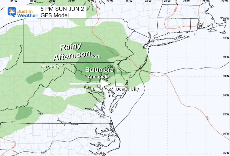
This weekend will start with dry weather and a warm-up. However, the next system appears to be faster, so it will arrive sooner on Sunday. The mountains can still expect rain in the morning. Now, we can add in the increased risk of rain and a soggy Sunday afternoon in central/Metro areas as well.
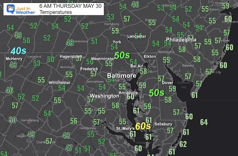
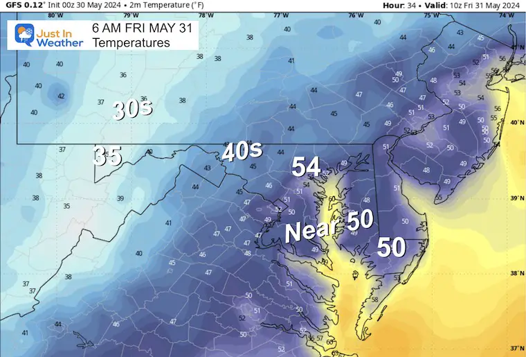
Temperatures at 6 AM
Morning Surface Weather
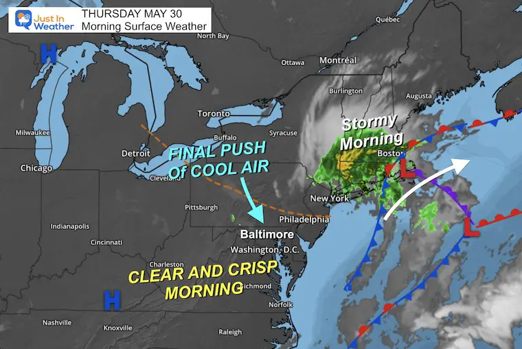
The little storm system is dumping heavy rain on Southern New England this morning.
As High Pressure builds in, one last disturbance will pivot some energy to develop afternoon clouds and an isolated shower.
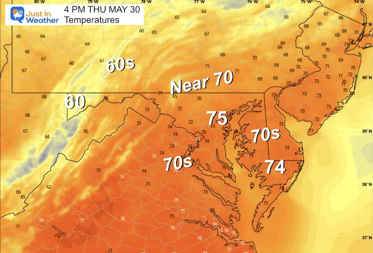
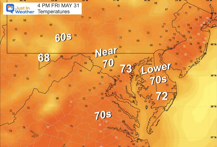
Afternoon Temperatures
A little below average, making it feel refreshingly cool and crisp.
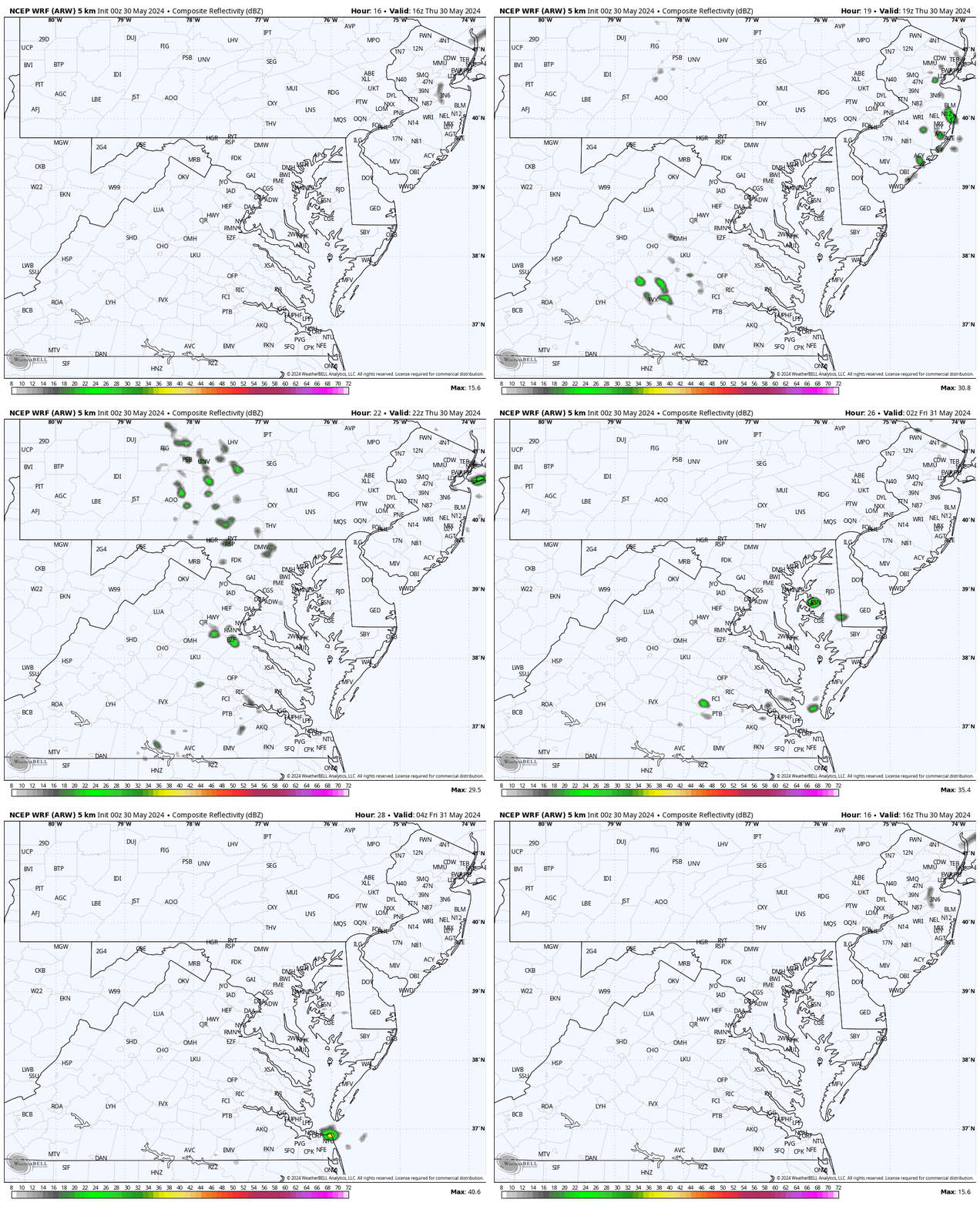
Radar Simulation: Noon to Midnight
With the cool, unsettled air, clouds will develop midday. A few isolated showers may pop up mid-afternoon. The odds are near 20%, so most will stay dry.
CLIMATE DATA: Baltimore
TODAY May 30
Sunrise at 5:43 AM
Sunset at 8:26 PM
Normal Low in Baltimore: 58ºF
Record 38ºF in 1996
Normal High in Baltimore: 79ºF
Record 98ºF 1991
Friday
Sunny and crisp with the coolest air of this pattern.
Temperatures
Morning
Afternoon
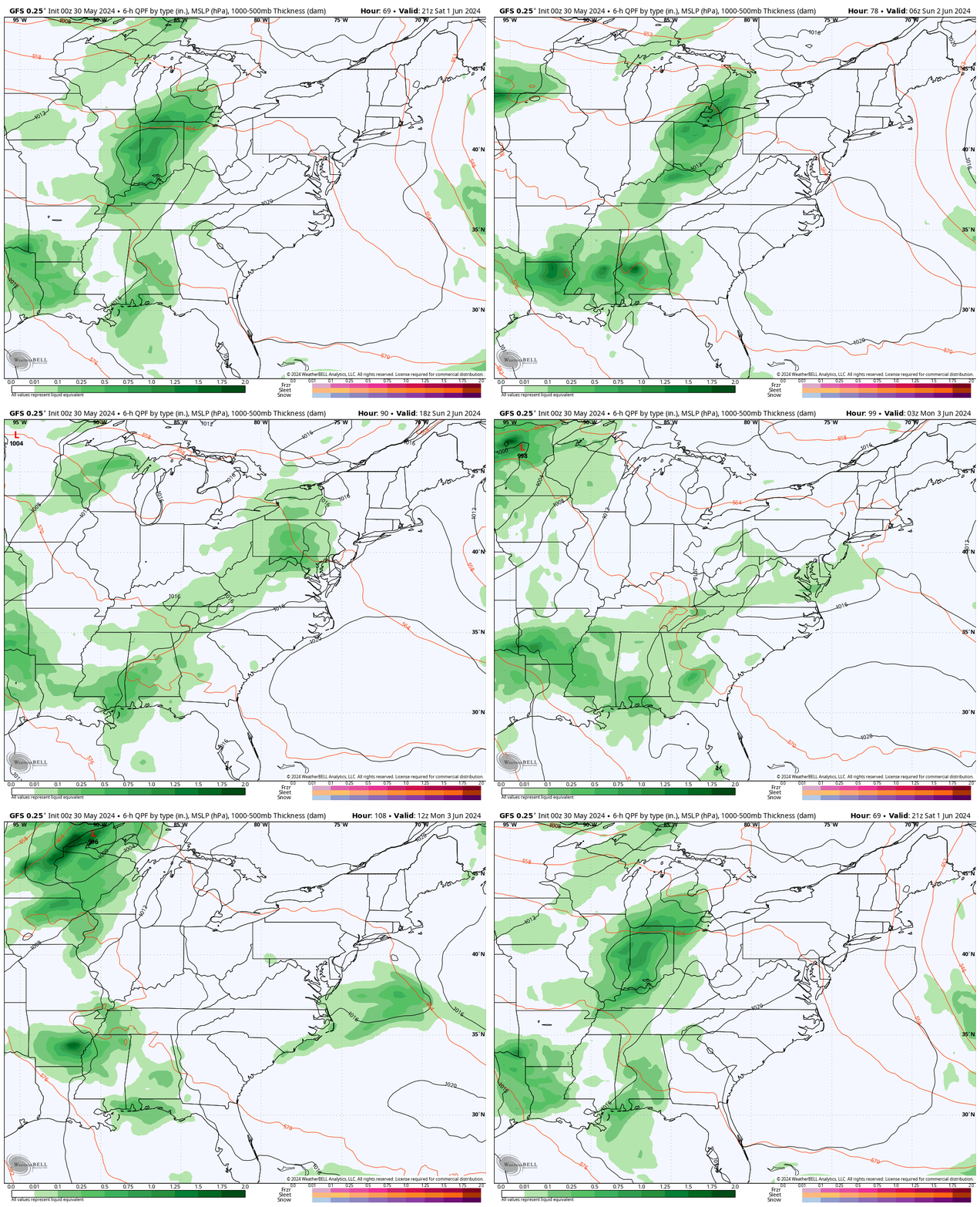
Weekend Weather: Saturday Afternoon To Monday Morning
The next system will arrive with rain on Sunday. Since it is moving faster, it will arrive sooner than suggested yesterday.
At this point, I would plan for the potential for Sunday to turn soggy.
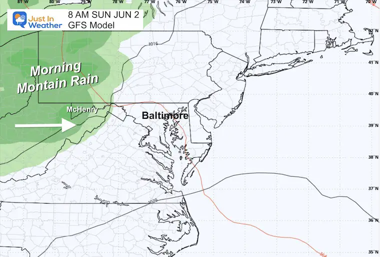
Snapshot Morning
The rain is still expected to reach the mountains at the start of the day.
Snapshot Afternoon
The cluster of rain appears to cross over much of our region to make for a wet end to the weekend.
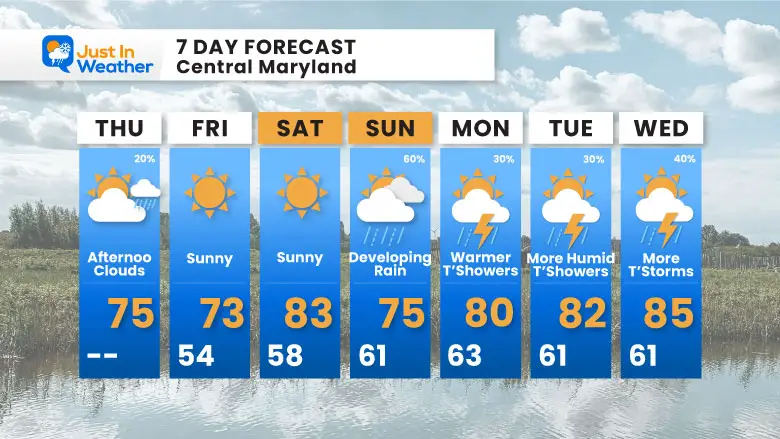
7 Day Forecast
Temps warm up over the weekend, but Sunday looks more wet.
Next week will be back into the 80s with more humidity and afternoon thunderstorms.
STEM Assemblies/In School Fields Trips Are Back
Click to see more and ‘Book’ a visit to your school
Please share your thoughts and best weather pics/videos, or just keep in touch via social media
-
Facebook: Justin Berk, Meteorologist
-
Twitter
-
Instagram
RESTATING MY MESSAGE ABOUT DYSLEXIA
I am aware there are some spelling and grammar typos and occasional other glitches. I take responsibility for my mistakes and even the computer glitches I may miss. I have made a few public statements over the years, but if you are new here, you may have missed it: I have dyslexia and found out during my second year at Cornell University. It didn’t stop me from getting my meteorology degree and being the first to get the AMS CBM in the Baltimore/Washington region.
One of my professors told me that I had made it that far without knowing and to not let it be a crutch going forward. That was Mark Wysocki, and he was absolutely correct! I do miss my mistakes in my own proofreading. The autocorrect spell check on my computer sometimes does an injustice to make it worse. I also can make mistakes in forecasting. No one is perfect at predicting the future. All of the maps and information are accurate. The ‘wordy’ stuff can get sticky.
There has been no editor who can check my work while writing and to have it ready to send out in a newsworthy timeline. Barbara Werner is a member of the web team that helps me maintain this site. She has taken it upon herself to edit typos when she is available. That could be AFTER you read this. I accept this and perhaps proves what you read is really from me… It’s part of my charm. #FITF


