Monday, May 27
Morning Report
If you were with family and friends celebrating the holiday, I hope you made your memories outdoors already. The downturn in our weather will reflect the somberness of Memorial Day.
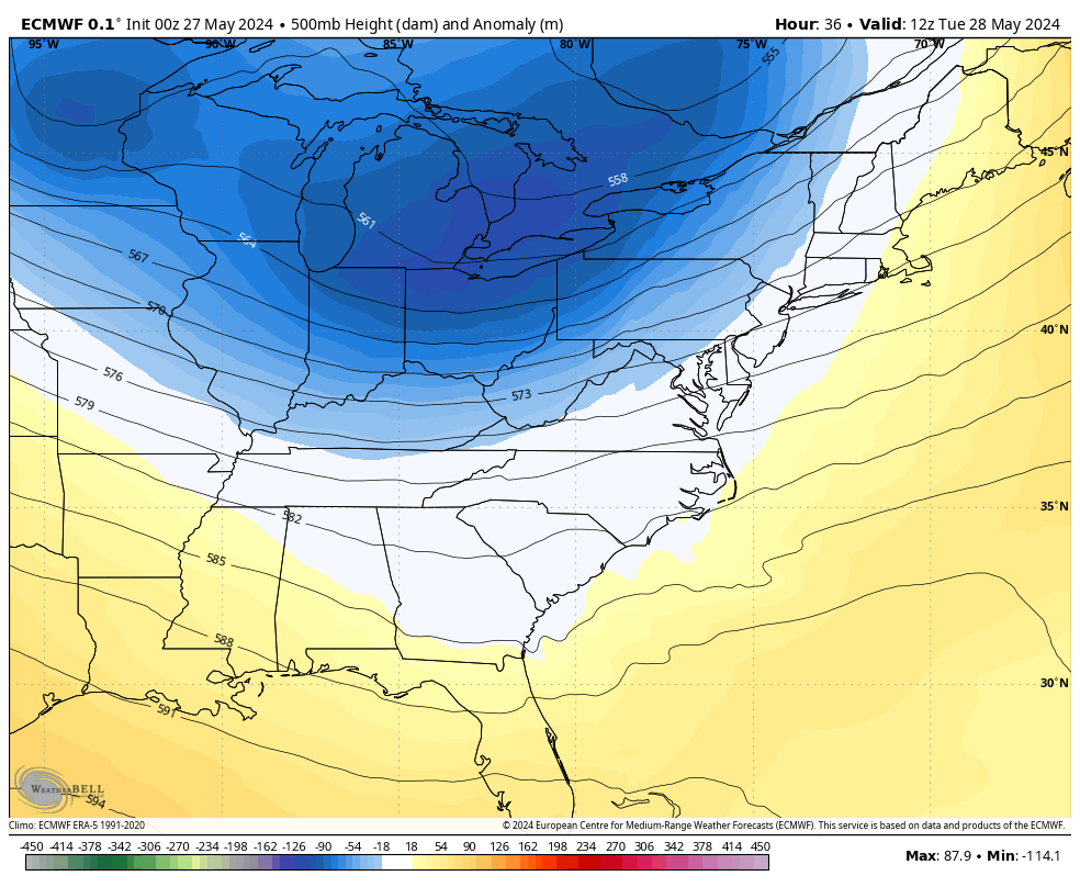
After days and weeks without severe storm outbreaks, the energy impulse will pass through our region this afternoon and evening.
In the week ahead, the pendulum will swing in the atmosphere and bring us a distinct cool down.
Flooding In Busch Stadium, St. Louis
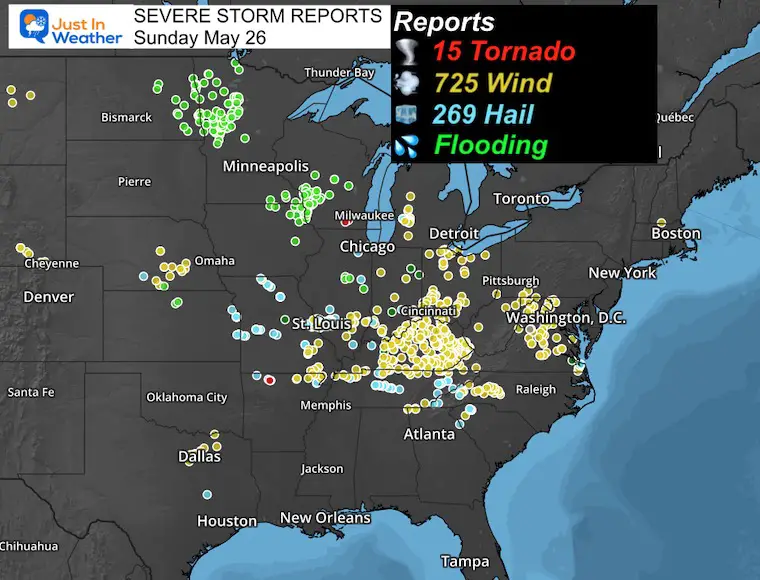
NOAA Storm Reports Sunday
Over 1,000 storm reports, including fatal storms and a disruption of sporting events. This included the Coca-Cola 500 shortened in Charlotte and also in St. Louis, where the Cardinals were hosting The Cubs.
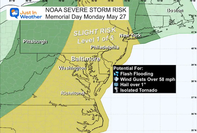
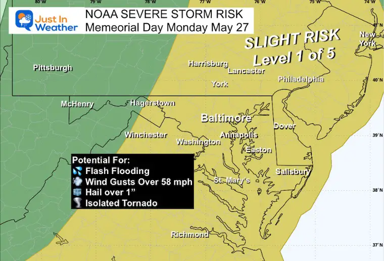
NOAA Severe Storm Risk Today
This shift to the east covers most of our region. The energy is not as intense, so the Slight Risk is Level 2 of 5 for the potential to get severe limits reached.
Storms have the potential but not promised to produce:
- Flash Flooding
- Winds over 58 mph
- Hail over 1” diameter
- An Isolated Tornado
Keep In Mind For Alerts Issued
- Watch: These storms are POSSIBLE, NOT PROMISED! THERE IS POTENTIAL they may form…
- Warning: Severe storms are identified and tracked through specific towns with more specific timelines.
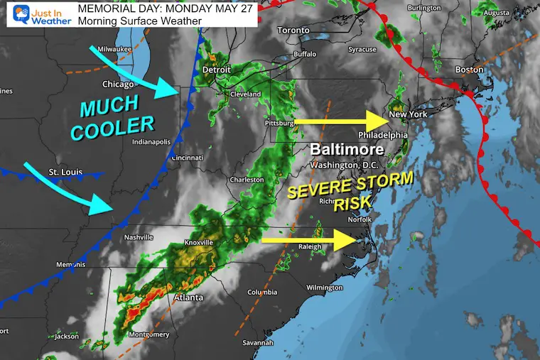
Morning Surface Weather
A line of showers with embedded storms is stretched ahead of the cold front. This run ahead and disconnection remove some of the intense dynamics, so the Storm Risk will be lower than last week. It will get reenergized with the heating of the day when it crosses our region.
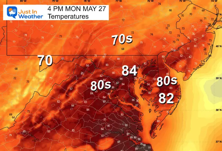
Afternoon Temperatures
These will depend on where the storms set up. Many reach the lower 80s, but will cool into the lower 70s when storms pass through.
Severe Storm Risk: Closer
Live Radar and Lightning Widget
Compare this to the Forecast Maps below
Radar Simulations
I can not emphasize this enough: Computer Model Guidance is just a guide and suggestion, it is NOT PERFECT!
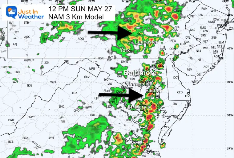
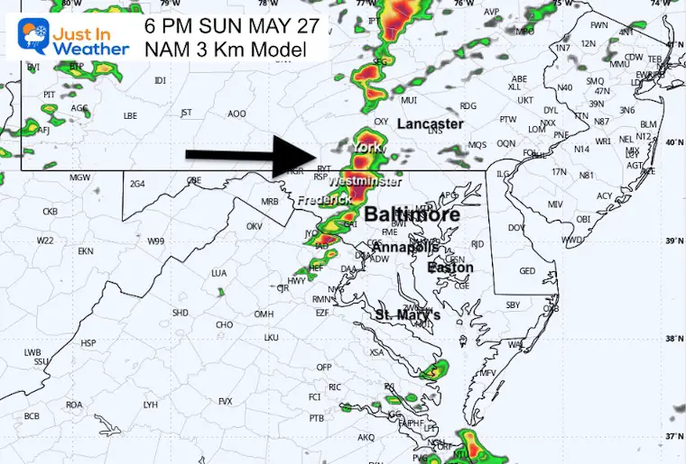
Here is a look at the NAM 3 Km and HRRR Models. They are short-range and high-resolution solutions. They differ in the placement and timing of storms. Compare here:
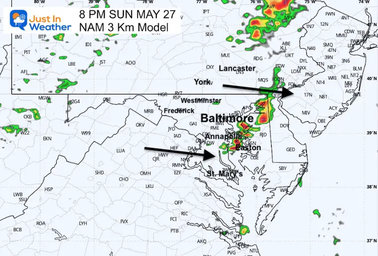
NAM 3 Km Model 10 AM to 10 PM
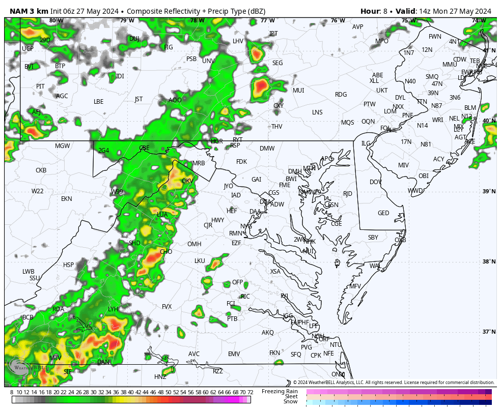
Snapshot at Noon
This model shows the remnant of the initial line of rain crossing the region and igniting some new boomers.
Snapshot at 6 PM
This model shows the main line of strong to severe storms entering the western suburbs in the evening.
Snapshot at 8 PM
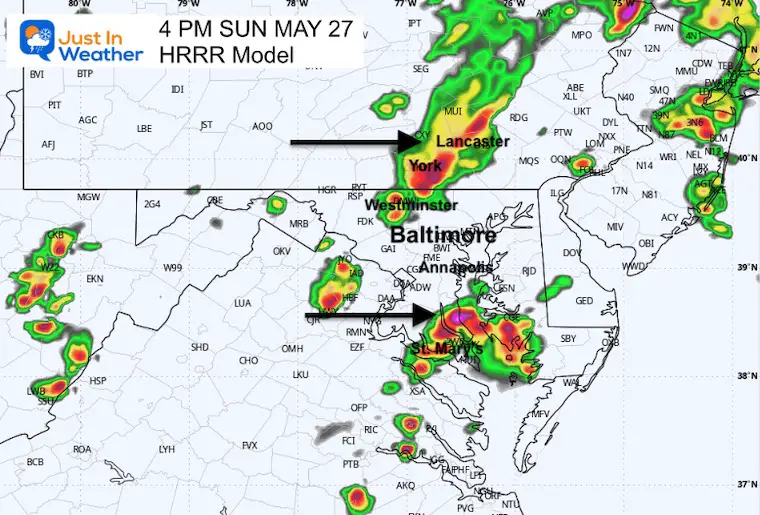
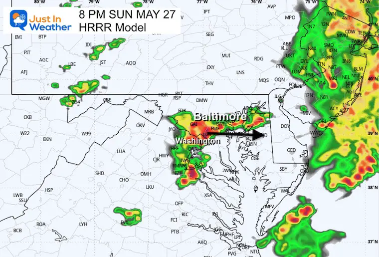
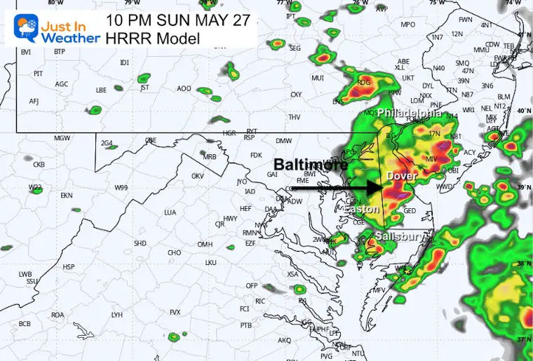
HRRR Model Noon to 10 PM
This has a different solution. It skips the late morning line of rain, but brings in more robust storms this afternoon and evening.
Snapshot at 4 PM
By skipping the morning rain, the atmosphere (on this model) remains less stable and erupts with strong and severe storms a few hours earlier.
Snapshot at 8 PM
Given the location of the cold front, there may be a few hours with a few rounds of storms in Central Maryland.
Snapshot at 10 PM
CLIMATE DATA: Baltimore
TODAY May 27
Sunrise at 5:44 AM
Sunset at 8:24 PM
Normal Low in Baltimore: 57ºF
Record 43ºF in 1915; 1961
Normal High in Baltimore: 78ºF
Record 95ºF 1941
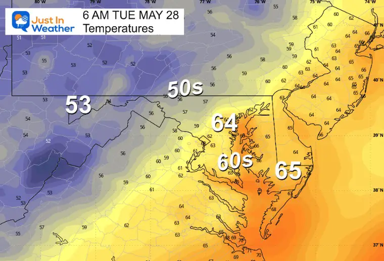
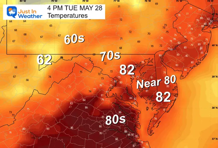
Tuesday
Slightly less humid air but cooler aloft. This may spark some afternoon showers.
Temperatures
Morning
Afternoon
Looking Ahead
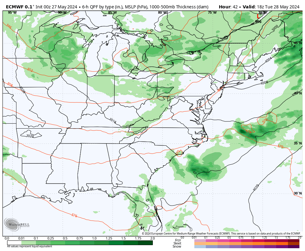
Tuesday to Friday
Afternoon showers will still be possible as the cooler air arrives mid week.
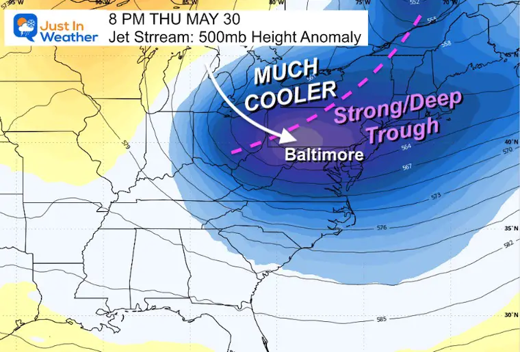
Jet Stream: Tuesday to Friday
Watch as the trough of much cooler air swings through later this week.
Snapshot Thursday
This final impulse of the cold core with the trough may still ignite showers.
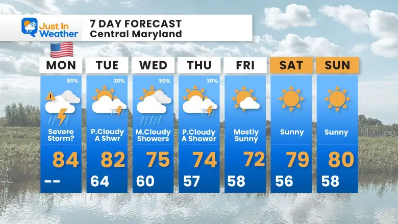
7 Day Forecast
With the cooler air arriving, there will still be some unstable air and daily showers on Wednesday and Thursday.
At this time, next weekend looks pleasant.
STEM Assemblies/In School Fields Trips Are Back
Click to see more and ‘Book’ a visit to your school

Please share your thoughts and best weather pics/videos, or just keep in touch via social media
RESTATING MY MESSAGE ABOUT DYSLEXIA
I am aware there are some spelling and grammar typos and occasional other glitches. I take responsibility for my mistakes and even the computer glitches I may miss. I have made a few public statements over the years, but if you are new here, you may have missed it: I have dyslexia and found out during my second year at Cornell University. It didn’t stop me from getting my meteorology degree and being the first to get the AMS CBM in the Baltimore/Washington region.
One of my professors told me that I had made it that far without knowing and to not let it be a crutch going forward. That was Mark Wysocki, and he was absolutely correct! I do miss my mistakes in my own proofreading. The autocorrect spell check on my computer sometimes does an injustice to make it worse. I also can make mistakes in forecasting. No one is perfect at predicting the future. All of the maps and information are accurate. The ‘wordy’ stuff can get sticky.
There has been no editor who can check my work while writing and to have it ready to send out in a newsworthy timeline. Barbara Werner is a member of the web team that helps me maintain this site. She has taken it upon herself to edit typos when she is available. That could be AFTER you read this. I accept this and perhaps proves what you read is really from me… It’s part of my charm. #FITF


