Sunday May 12
Mother’s Day Morning Report
Today, we focus on the all-important Mother’s Day weather and the ongoing impact of the latest Solar Storm. We have been stuck in a pattern with persistent showers and even some heavier thunderstorms. Today will bring more. But because of this pattern, the clearing at night for the epic Aurora viewing has been in the mountains from the Shenandoah to western Maryland and PA.
Before we get to the weather today, I want to address the Northern Lights.
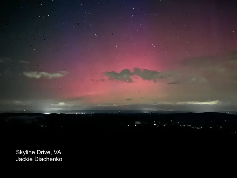
Aurora Saturday Night
My friend Jackie Diachenko made an impromptu trip to Skyline Drive with her sister. After 2.5 hours of waiting through a wicked storm, they got 5 minutes of this view—one that eluded some other photography friends. I did suggest to one friend that it was OK to leave early and focus on the next chance tonight.
I was hesitant about the potential viewing with the Kp index dropping to 5. It was then bumped up to 7 which was marginal, and good enough for The Shenandoah in Virginia. The good news is that we can expect a stronger show tonight.
Another Amazing Photo
I just wanted to share one of the more incredible photos that may sell a lot of prints for this photographer, Mike Mezeul II. He drove 9 hours to Nebraska for the photo of a lifetime.
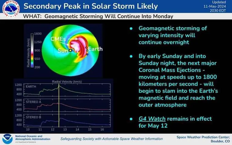
Aurora Tracking and Forecast
Second Peak
NOAA Space Weather Prediction Center has projected that tonight, we may see an impulse matching or surpassing what happened on Friday night.
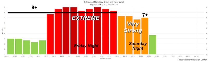
Planetary Kp Index
The Extreme Event on Friday was Kp=9.
It dropped to a Kp=5 Saturday evening, then back up to Kp=7 Saturday night.
While it is down this morning, it is forecast to jump tonight.
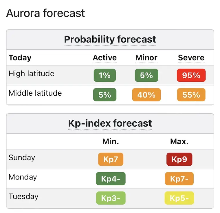
NOAA Forecast
The forecast is back up to Kp=9. This is an Extreme Event and may promote a G5 Storm Watch/Warning like we had Friday.
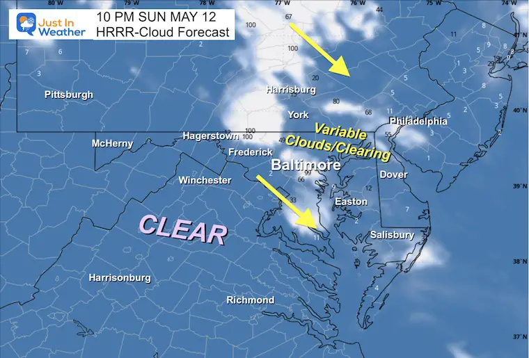
Cloud Forecast Tonight
After a day of showers and thunderstorms in metro Baltimore and Delmarva, we can expect the clouds to break. Once again, the clear sky is expected across the inland mountains. It should spread to a larger area.
Suggestion: If you drive inland, get away from lights AND turn your vehicle lights off as well out of courtesy to other viewers. This was one issue many photographers had over the weekend.
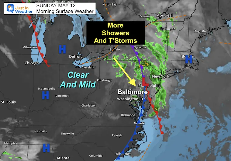
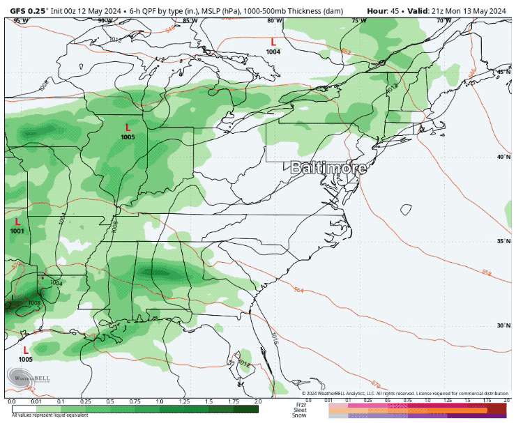
Morning Surface Weather
This last disturbance and an upper-level trough will build up more showers and Thunderstorms this afternoon. There is a dry air mass to our west, and it will build east on Monday.
Live Radar Widget
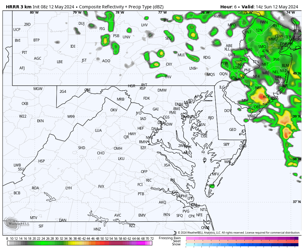
There have been some showers this morning. Another round is expected to develop mid-day into this afternoon.
Radar Simulation 10 AM to 10 PM
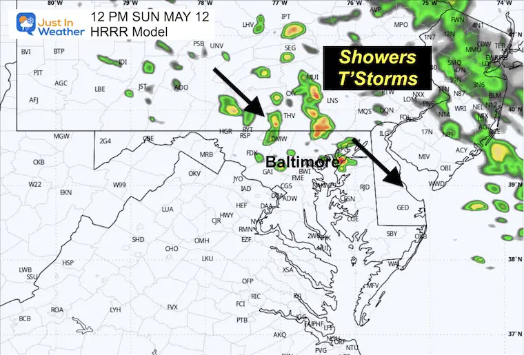
A flare-up of showers and storms mid-day into the afternoon. Some stray showers may linger into the evening, but the activity will diminish.
Snapshot at Noon
New showers and thunderstorms will develop across central Pennsylvania into central Maryland, moving Southeast.
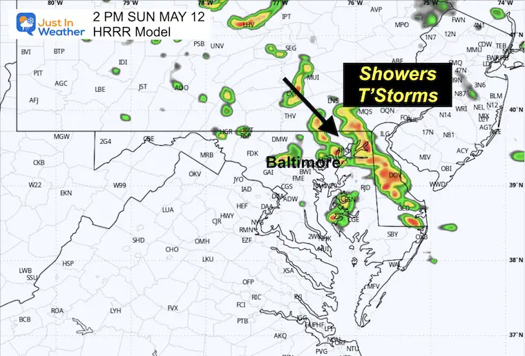
Snapshot at 2 PM
A line of storms is expected to develop and stretch across parts of central Maryland to Delmarva.
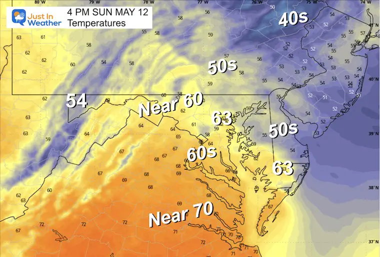
Afternoon Temperatures
Remaining below average in the 60s.
CLIMATE DATA: Baltimore
TODAY May 12
Sunrise at 5:56 AM
Sunset at 8:11 PM
Normal Low in Baltimore: 52ºF
Record 35ºF in 1963
Normal High in Baltimore: 75ºF
Record 94ºF 1881
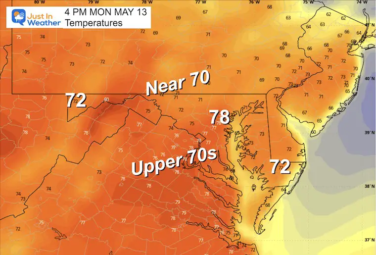
Monday Weather
More sunshine and a return to the mild 70s.
Temperatures
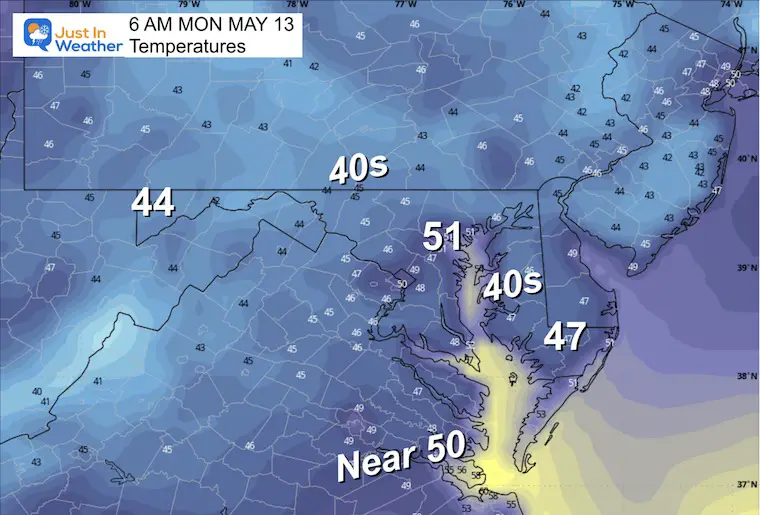
Morning
Afternoon
Looking Ahead
Storm Simulation: Monday Afternoon to Thursday
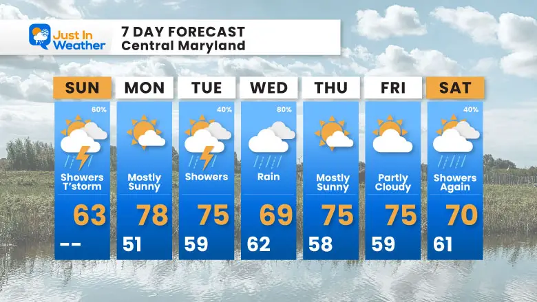
After a dry Monday, showers return later on Tuesday, leading to a wet Wednesday. Then, we hopefully get back to another sunny day on Thursday.
7 Day Forecast
Note:
Next week will warm up back to the 70s.
The best chance for rain will be Tuesday and Wednesday.
STEM Assemblies/In School Fields Trips Are Back
Click to see more and ‘Book’ a visit to your school

Please share your thoughts and best weather pics/videos, or just keep in touch via social media
RESTATING MY MESSAGE ABOUT DYSLEXIA
I am aware there are some spelling and grammar typos and occasional other glitches. I take responsibility for my mistakes and even the computer glitches I may miss. I have made a few public statements over the years, but if you are new here, you may have missed it: I have dyslexia and found out during my second year at Cornell University. It didn’t stop me from getting my meteorology degree and being the first to get the AMS CBM in the Baltimore/Washington region.
One of my professors told me that I had made it that far without knowing and to not let it be a crutch going forward. That was Mark Wysocki, and he was absolutely correct! I do miss my mistakes in my own proofreading. The autocorrect spell check on my computer sometimes does an injustice to make it worse. I also can make mistakes in forecasting. No one is perfect at predicting the future. All of the maps and information are accurate. The ‘wordy’ stuff can get sticky.
There has been no editor who can check my work while writing and to have it ready to send out in a newsworthy timeline. Barbara Werner is a member of the web team that helps me maintain this site. She has taken it upon herself to edit typos when she is available. That could be AFTER you read this. I accept this and perhaps proves what you read is really from me… It’s part of my charm. #FITF


