April 24 Weather: Some Showers Then Another Push Of Cold Air Followed By Summer Heat Sunday
Wednesday, April 24
Morning Report
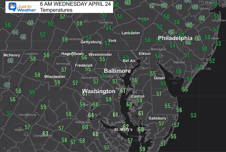
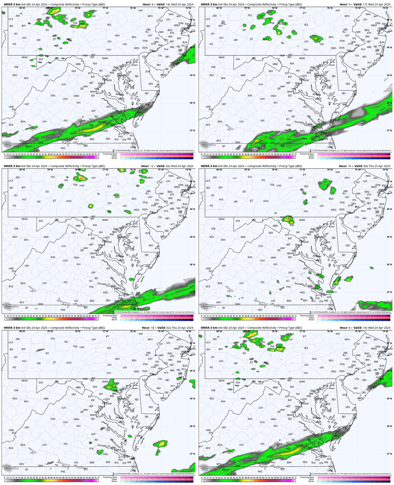
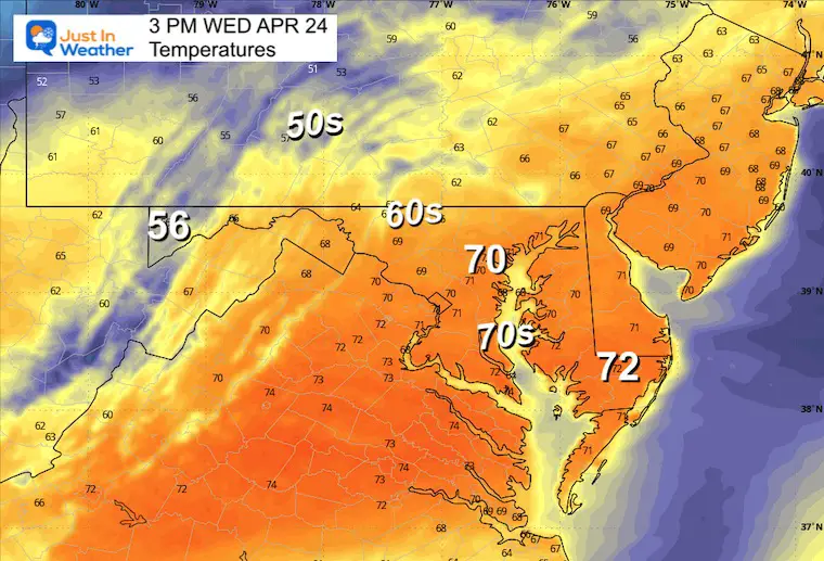
A milder start today with most areas in the 50s to near 60ºF along parts of the Bay. There is a push of colder air on the way. The boundary has ignited some showers, and a few more may develop inland this afternoon. The main weather feature today will be the wind and the last warm day for a while.
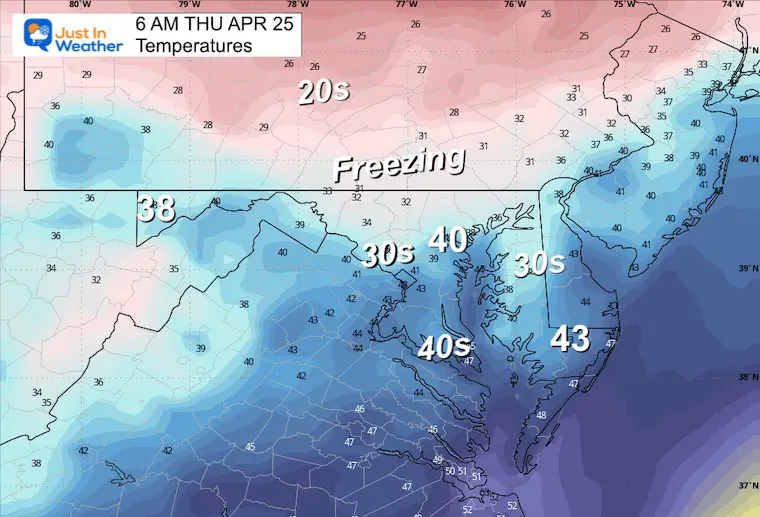
Colder air by Thursday morning may drop inland areas back to near FREEZING. This chilly air mass will last into Saturday, and then the flip to summer heat arrives on Sunday.
Flood Alerts
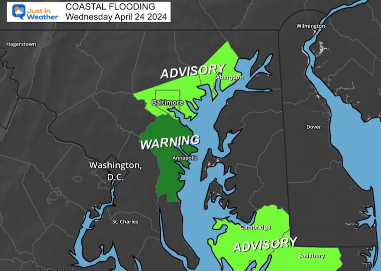
This morning, Annapolis is already flooding. The wind is helping to push already high water in place. The other reason has become more known recently: the ground is actually sinking.
Flooding is also possible along the Bay Shore in Baltimore, Harford County, and The Lower Eastern Shore.
Morning Temperatures
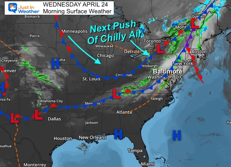
Morning Surface Weather
A double-barrel cold front is moving through today. The first has brought early showers. The next may ignite afternoon showers. Following this will be much noticeable colder air.
The wind shift will help lessen the flooding across the Bay areas.
Radar Simulation: 10 AM to 10 PM
Afternoon Temperatures
IN CASE YOU MISSED IT
Full Moon Photos Tuesday Evening
CLIMATE DATA: Baltimore
TODAY April 24
Sunrise at 6:18 AM
Sunset at 7:53 PM
Normal Low in Baltimore: 47ºF
Record 32ºF in 2003
Normal High in Baltimore: 70ºF
Record 93ºF 1960
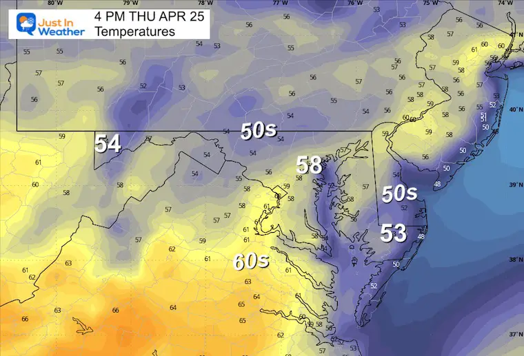
Thursday Weather: Cooler
Morning Temperatures
We may have Frost and Freeze Alerts posted inland… and again Friday morning.
Afternoon Temperatures
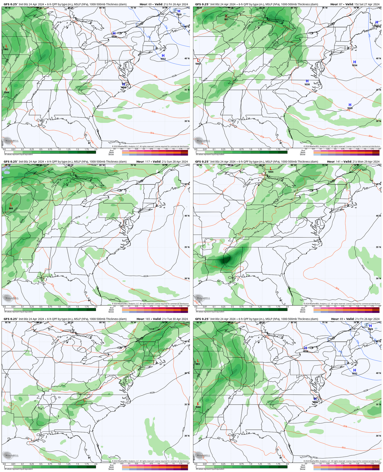
Looking Ahead: Weather Animation Friday to Tuesday
I do not see much organized, but we need to keep the chance for rain showers on Saturday.
Then summer heat builds in on Sunday, with the next system to produce some afternoon thundershowers on Tuesday.
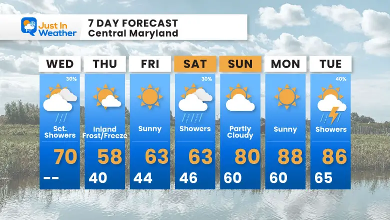
7 Day Forecast
This next push of chilly air will be with us through Saturday. The summer heat will arrive Sunday.. which may lead to eventual thundershowers by Tuesday.
STEM Assemblies/In School Fields Trips Are Back
Click to see more and ‘Book’ a visit to your school
Please share your thoughts and best weather pics/videos, or just keep in touch via social media
-
Facebook: Justin Berk, Meteorologist
-
Twitter
-
Instagram
RESTATING MY MESSAGE ABOUT DYSLEXIA
I am aware there are some spelling and grammar typos and occasional other glitches. I take responsibility for my mistakes and even the computer glitches I may miss. I have made a few public statements over the years, but if you are new here, you may have missed it: I have dyslexia and found out during my second year at Cornell University. It didn’t stop me from getting my meteorology degree and being the first to get the AMS CBM in the Baltimore/Washington region.
One of my professors told me that I had made it that far without knowing and to not let it be a crutch going forward. That was Mark Wysocki, and he was absolutely correct! I do miss my mistakes in my own proofreading. The autocorrect spell check on my computer sometimes does an injustice to make it worse. I also can make mistakes in forecasting. No one is perfect at predicting the future. All of the maps and information are accurate. The ‘wordy’ stuff can get sticky.
There has been no editor who can check my work while writing and to have it ready to send out in a newsworthy timeline. Barbara Werner is a member of the web team that helps me maintain this site. She has taken it upon herself to edit typos when she is available. That could be AFTER you read this. I accept this and perhaps proves what you read is really from me… It’s part of my charm. #FITF


