Monday June 10 Weather Brings Multiple Showers And Some Strong Thunderstorms
Monday June 10 2019
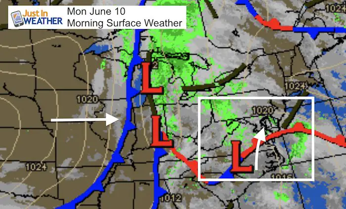
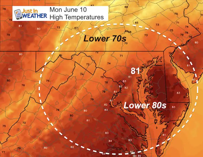
One thing you should notice this morning is a wet ground. We have had showers roll through already and the moisture has kept things damp. There will be multiple rounds of showers today, arriving from the south. This is a signal that temperatures will be warmer and feel a little sticky, however a big difference between central Maryland and southern PA temperatures.
[adrotate group=”4″]
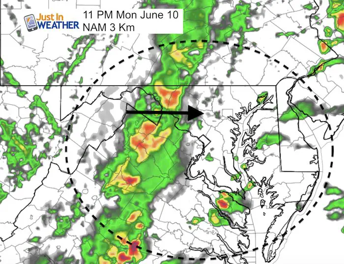
In the warmer air to the south, there will be more thunderstorms, which includes around the Bay and Eastern Shore during the afternoon. But tonight there will be a later line of storms we all should get in on with the cold front. That is what will bring in a cooler air mass for two days, before the next round of rain on Thursday.
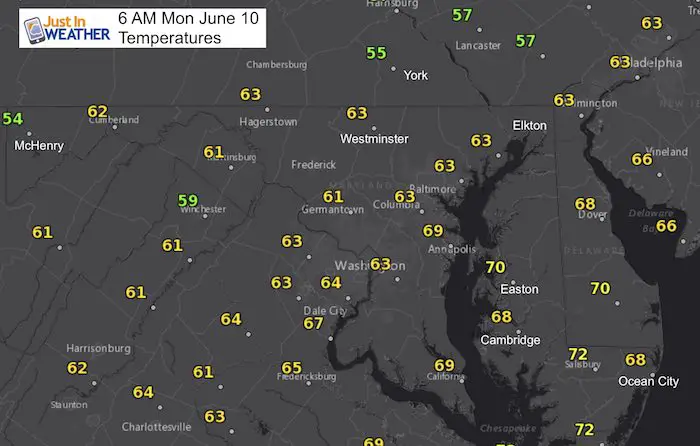
Morning Temperatures:
A pleasant start, but as clouds increase the movement will only reach the lower to middle 70s.
Kids Trek Too!
Bring Your Kids To Join My Team This Summer
Click the logo for more information
Local Weather Stats: Monday June 10, 2019 in Baltimore
Average High: 82ºF
Record High: 97ºF in 1964
Average Low: 60ºF
Record Low: 49ºF in 1960
Sunrise: 5:39 AM
Sunset 8:32 PM
*Daylight = 0:40 longer than yesterday
*Bay Water Temperature = 71ºF at Thomas Pt. Light House
Keep In Touch Every Day
Just in case you don’t get all posts on your social media feed, stay up to date with the latest info…
Click here to sign up for email alerts…. Be the first to hear any new weather.
Rain Today:
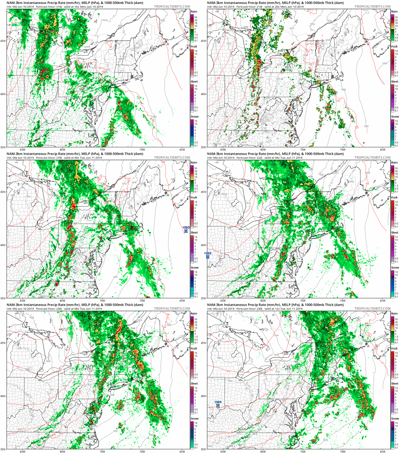
Here are a few snapshots of key time frame today. See the simulation animation below.
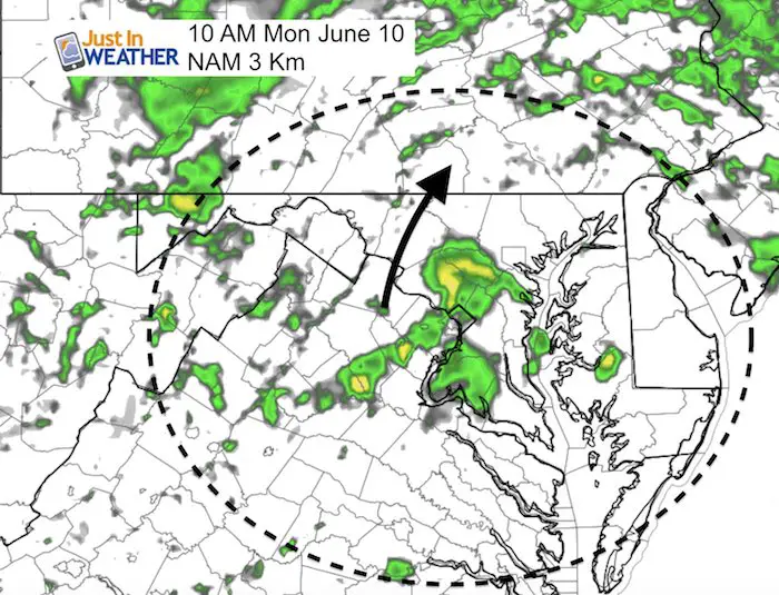
Morning Rain
This flow will be from the south. This model may beef by an hour, but the idea will be this cluster mid to late morning pushing through central Maryland towards southern PA
[adrotate group=”4″]
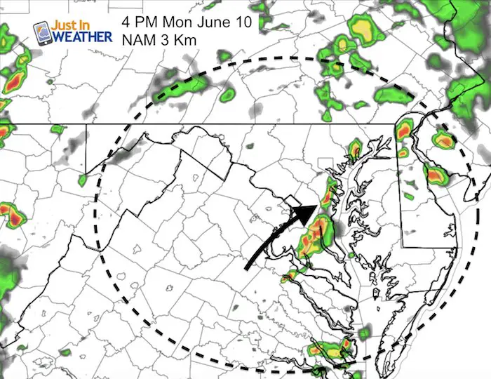
Mid Afternoon
Thunderstorms will try to develop near and east of I-95 an cross the Bay
High Temperatures
Storms Tonight
This will be the cold front bringing a wider band of rain overnight
Rain Animation Today
[adrotate group=”4″]
The Week Ahead
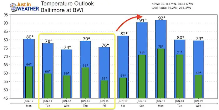
Tuesday and Wednesday will be dry and cooler.
Thursday and Friday: Warmer with showers and some storms
Temperature Outlook
Join My Team: Maryland Trek 6
Our look got an upgrade, but we have the same purpose. Please click the logo take a look at our new page.
- Consider joining our team for the week, a single day, or even as a sponsor.
Support Our Nonprofit:
Proceeds go to our programs Providing FREE holistic care for kids in cancer treatment and up to 5 years post treatment and caregivers.

Shine On
Proceeds from all sales go to Just In Power Kids. Click the image to shop and show your support.
Love Maryland Shirts and Hoodies
This shirt was designed by my ‘bonus’ daughter Jaiden. The hoodie has been the biggest hit, so our promotion has been extended until the end of this week.
|
||
|
Show your love for Maryland and make this 14 year old artist and her mom extra proud
|
Please share your thoughts, best weather pics/video, or just keep in touch via social media
-
Facebook: Justin Berk, Meteorologist
-
Twitter: @JustinWeather
-
Instagram: justinweather
Related Links:


