Saturday Evening Snow Or No Snow Update

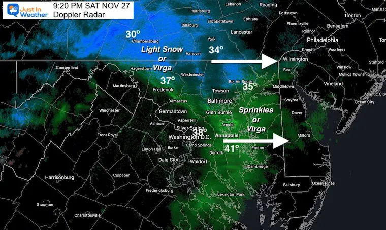
A quick look at the Doppler Radar at 9:20 PM appears to show the little system moving in early.
Is this part or all of this early season experiment? It does follow the theme I mentioned early in the week: Weather systems continue to arrive earlier than initial model forecasts.
UPDATE: Many reports from Facebook and Twitter confirmed this was reaching the ground.
FITF my friends!!!
One of the problems we run into during the cold season: Snow and rain can show up on radar falling from the clouds. But, if the surface air is dry, it will sublimate or evaporate before reaching the ground. That is virga, which was my first impression the case tonight.
However, some flakes have made it with this round. But I am doubting that coating for most of us, still happy we had the snow make it and before bedtime!
The European Model does suggest another round of showers between 2 and 4 AM. But given the lack of support, I would not hold out much for that.
I am sorry I have not had other updates today. The holiday plans had me occupied. If there is anything noteworthy, I will post a full report before midnight. If not, I will still get up to see if anything falls.


