


April 24 Weather: Some Showers Then Another Push Of Cold Air Followed By Summer Heat Sunday
Wednesday, April 24 Morning Report A milder start today with most areas in the 50s to near 60ºF along parts of the Bay. There is a push of colder air…
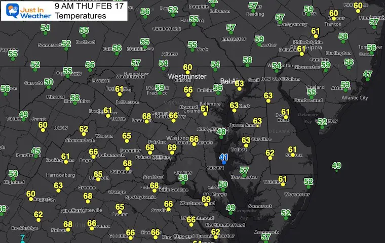
Thursday February 17 2022
Night Report
There is Weather Folklore that farmers have followed for centuries that states: If in winter there is thunder, snow may fall in one week or under.
Well, we might have a rumble of thunder early Friday morning along with wind gusts between 50 and 60 mph. Cold air will follow, but it is the long range possibility that shows winter will try to throw us another hit.
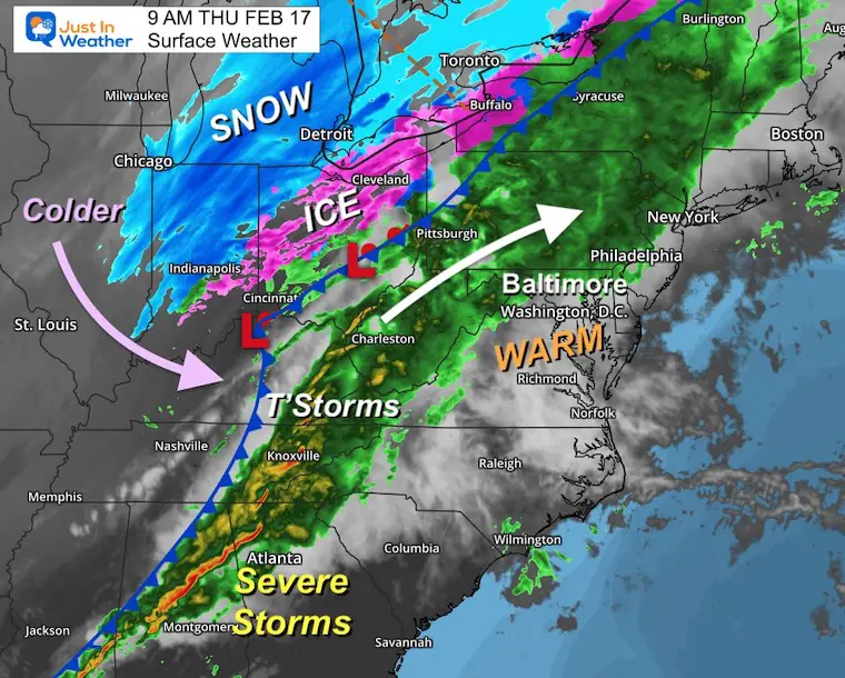
This evening we see quite the impressive storm crossing the Appalachians tonight. Severe storms to the south, heavy rain along the front, then ice and heavy snow to the north in the Great Lakes.
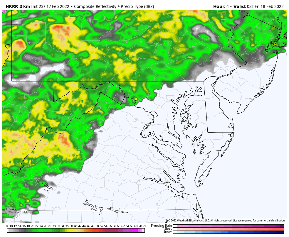
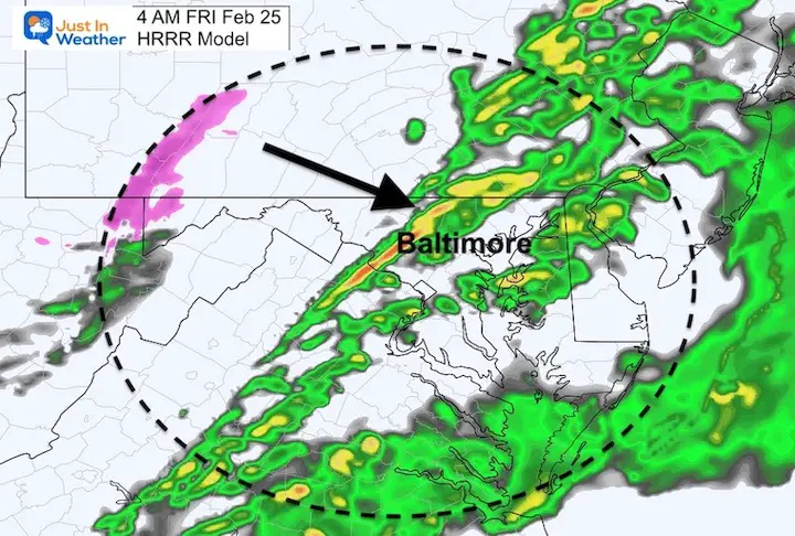
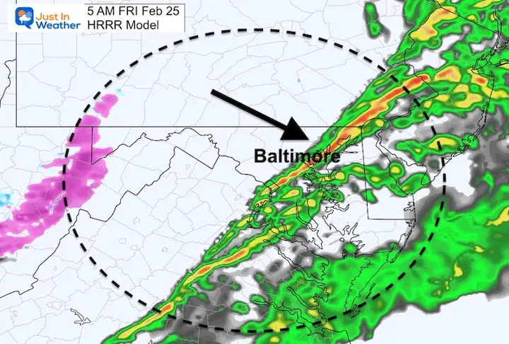
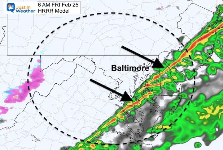
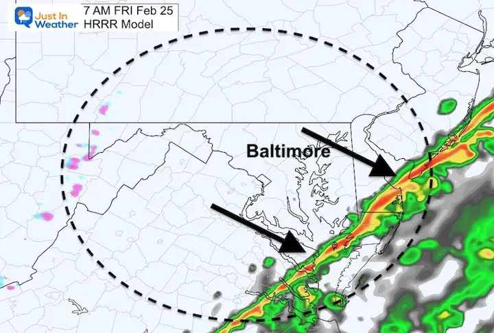
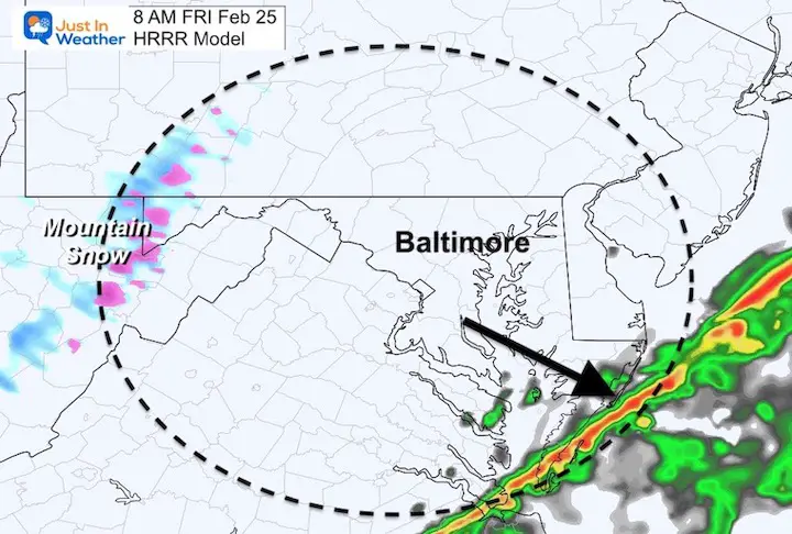
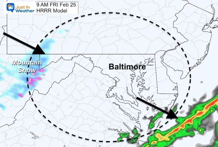
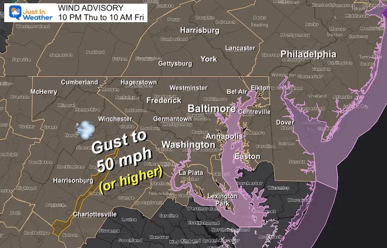
In this post: A new radar simulation and hourly timeline to plot the cold front crossing our region by sunrise Friday. While The Wind Advisory kicks in between 10 PM to 10 AM, the peak winds should be with the storm line, but remain gusty all day.
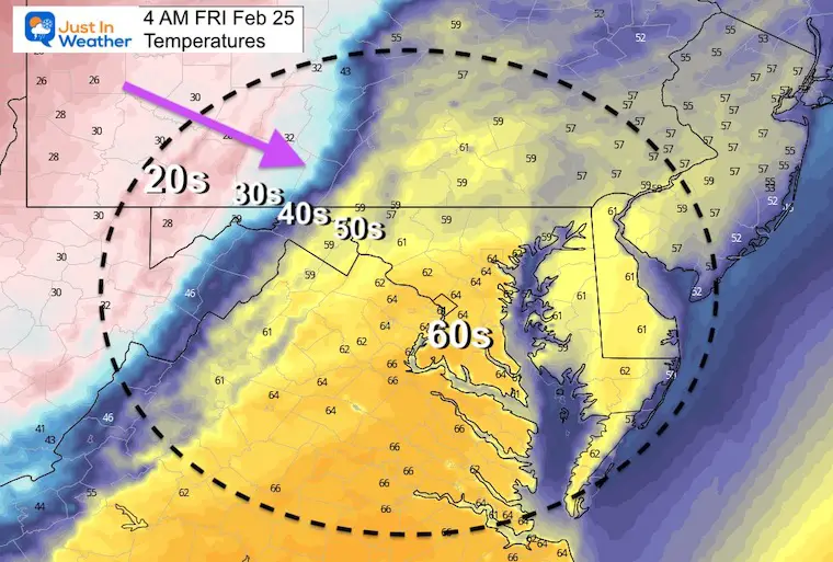
Temperatures will be in the 60s overnight locking our high temps in early. By sunrise, much of our region will drop into the 30s and 40s.
Looking ahead, only for the sake of our Winter Folklore, the three main models are all trying to bring in wintry weather next week.
9 PM- Look at all the 60s!!!!
The edge of the steady rain is just north and west of Baltimore. Of you have not seen much, it will move in soon.
The ice and snow are just west of Pittsburgh. That will reach western Maryland by morning. In between, a very volatile cold front that may still produce thunder overnight as it passes by.
Much colder air will follow… and reach central Maryland before sunrise. See the Temperatures timeline below.
10 PM Thu to 10 AM Fri

3 AM to 9 AM
*There may be a one hour buffer (before or after what is shown). So, Baltimore may get this line between 4 AM and 6 AM. If you hear rumbling outside, don’t be too surprised.
Wind Advisory
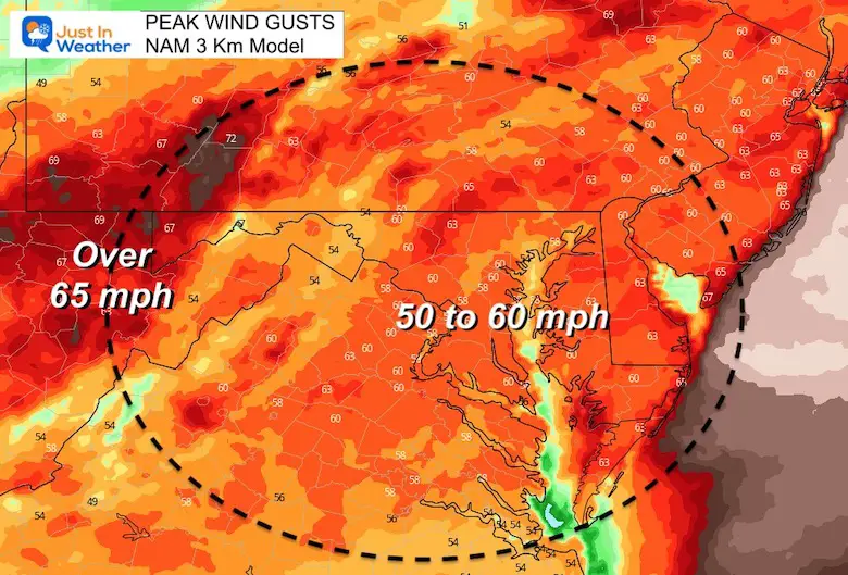
Model Guidance supports the potential for gusts with the front 50 to 60 mph.
Note: Strong wind will remain during the day as it ushers in colder air.
Midnight to 4 PM
4 AM
Remaining warm overnight, but dropping below freezing in the Western Maryland Mountains.
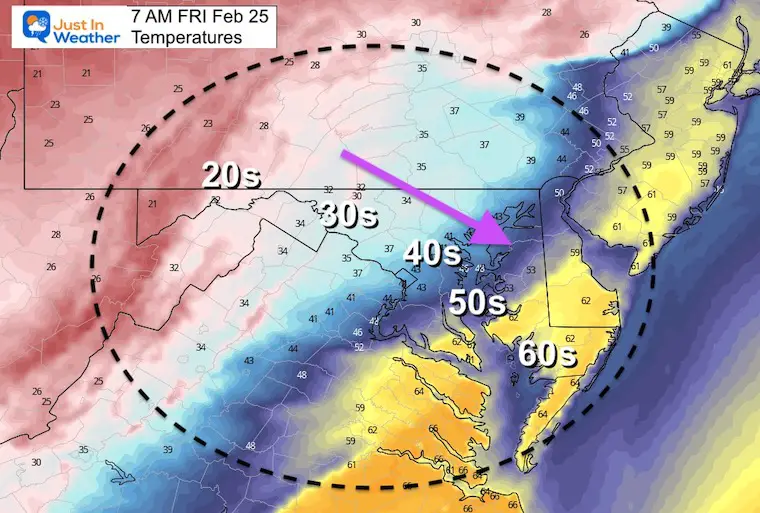
7 AM
By sunrise, the cold front will be in Southern Maryland. So metro areas will crash from the 60s to the 30s and lower 40s. It will be windy, so it will definitely FEEL like winter has returned.
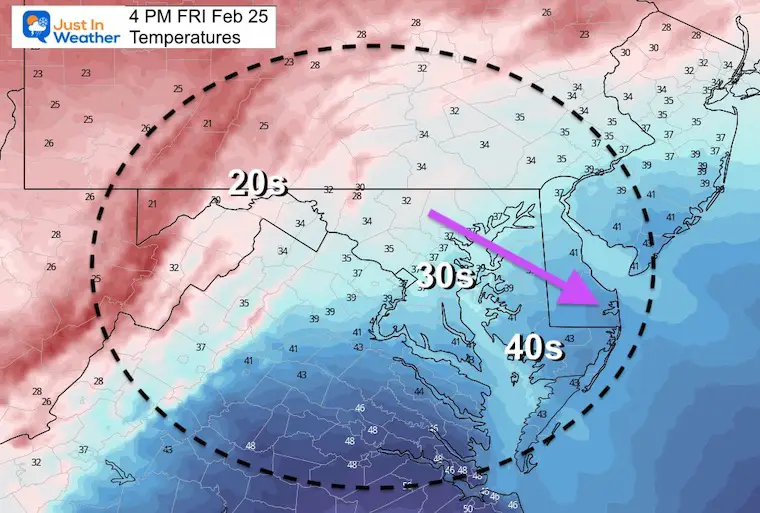
4 PM
Temps may remain steady during the day then fall again in the afternoon. Notice the 30s around Baltimore and Washington. I am aware of the prior few Fridays when temps did NOT drop as low was expected. This time we do not have to worry about the freezing line, so if it ends up remaining in the lower 40s it will simply just feel cold!
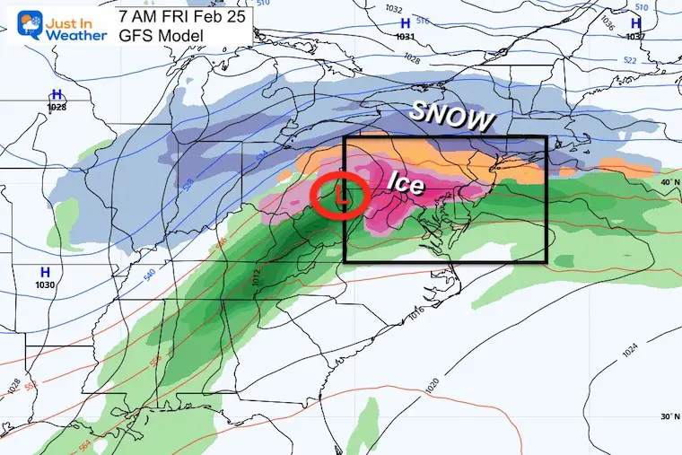
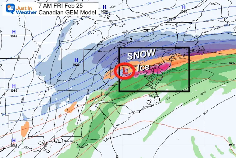
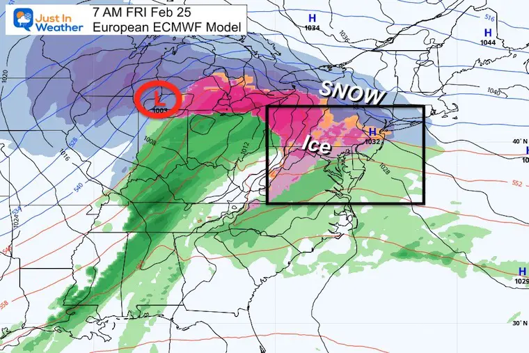
I have a policy of NOT showing computer models for a winter event one week away. Often they do not validate.
I am making the exception now for the purpose of the Winter Weather Folklore.
If we have have some thunder early morning, here we see the main model package showing a winter weather/icing potential next Friday. That would fit “one week or under”.
At this point it looks like a freezing rain event. I would not put stock in specifics, but it is worth watching to see if there is any trend a we get closer.
GFS Model
Canadian GEM Model
European ECWMF Model


Last Winter Recap: My Old Outlook And Your Grades Of My Storm Forecasts


*Disclaimer due to frequent questions:
I am aware there are some spelling and grammar typos. I have made a few public statements over the years, but if you are new here you may have missed it:
I have dyslexia, and found out at my second year at Cornell. I didn’t stop me from getting my meteorology degree, and being first to get the AMS CBM in the Baltimore/Washington region.
I do miss my mistakes in my own proofreading. The autocorrect spell check on my computer sometimes does an injustice to make it worse.
All of the maps and information are accurate. The ‘wordy’ stuff can get sticky.
There is no editor that can check my work when I need it and have it ready to send out in a newsworthy timeline.
I accept this and perhaps proves what you read is really from me…
It’s part of my charm.
#FITF