April 3, 2023
Monday Morning
At first glance this may seem like a typical spring forecast. We have a chilly morning with widespread frost, then warming in the afternoon. A warm up will build in this week as we watch another eruption of severe storms in the middle of the nation. Often the worst weather hits the Great Plains states, then we get the final gasp in a diminished form.
Considering what we saw last week and locally into the weekend, plus the possible atmospheric memory on display, this is worth watching closely. Especially for the hardest hit areas from the last tornado outbreak.
The other factor is that The Baltimore Orioles home opener is on Thursday and it may be affected by rain.
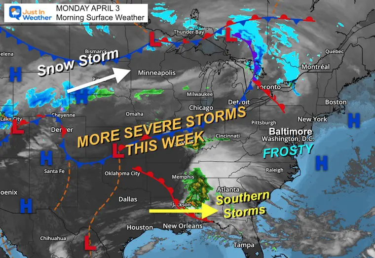
Morning Surface Weather
The next big storm will be pulling out of the Colorado Rockies moving to the Great Lakes. Snow will rage across the Northern Plains, with a few days of severe storms in the same areas hit last week.
Note that the southern US storm has widespread high thin clouds that may dim the sun in the Mid Atlantic at times today.
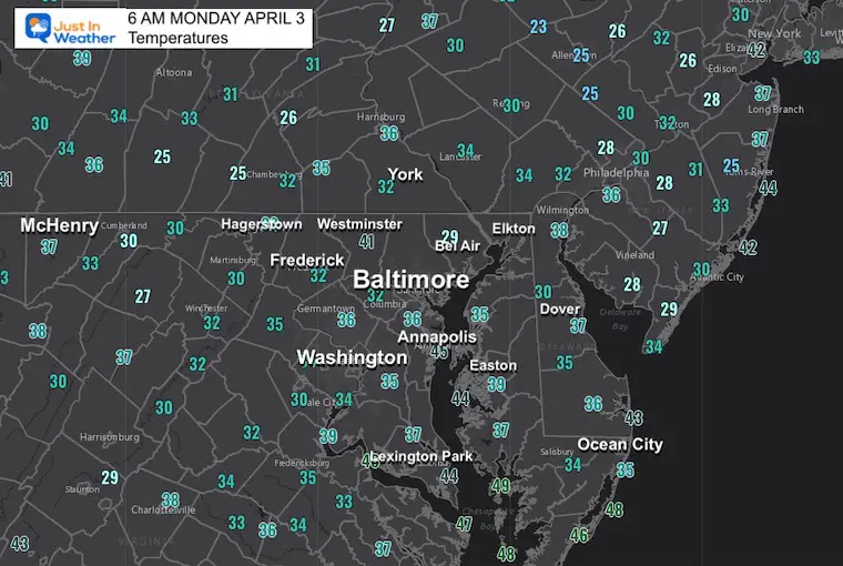
Morning Temperatures
Widespread 30s and frost.
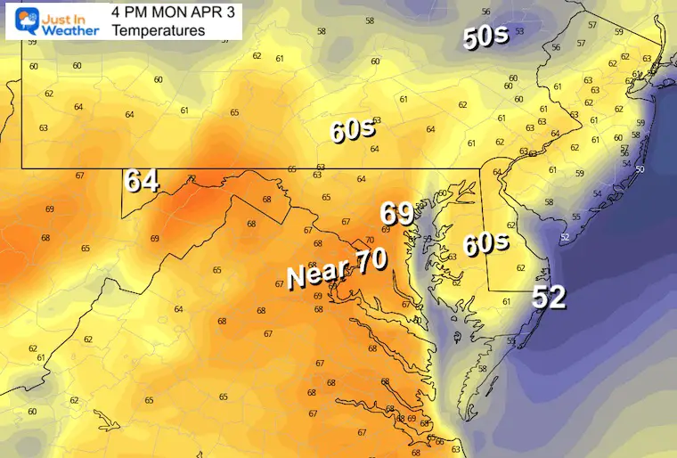
Afternoon Temperatures
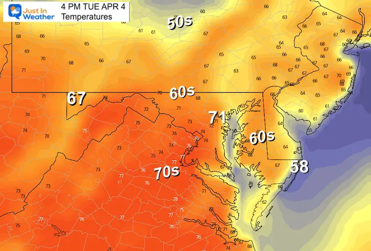
A push of 70s will be spreading in from the west today.
Subscribe for eMail Alerts
CLIMATE DATA
TODAY April 3
Normal Low in Baltimore: 39ºF
Record 27ºF in 2013
SNOW: 4.5” in 1915
Normal High in Baltimore: 62ºF
Record 88ºF in 1963
REPORTS:
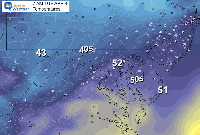
Tuesday Morning Temperatures
Tuesday Afternoon Temperatures
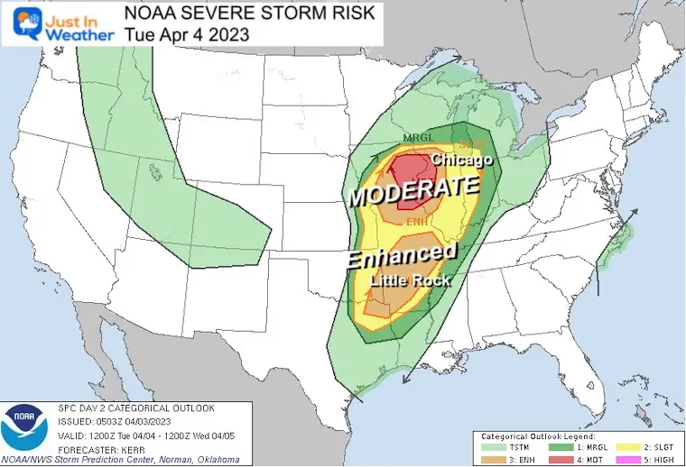
Severe Storm Outbreak
Tuesday
The most active eruption of storms is expected tomorrow. This may include a tornado outbreak been Des Moines, Iowa, and Chicago, with another cluster around Little Rock, Arkansas.
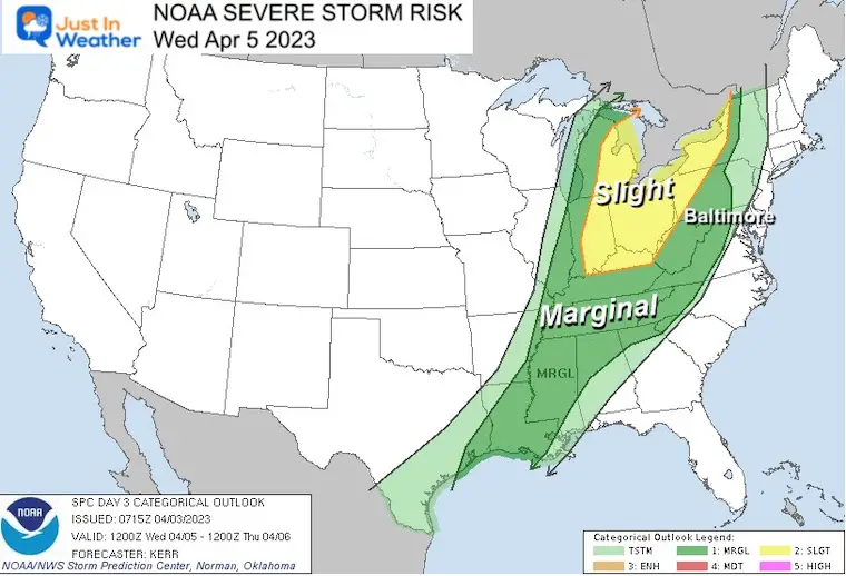
Wednesday
The energy of the storm complicit will push into the Eastern Great Lakes. The lower level ‘Slight Risk’ includes Indianapolis, Cincinnati, Detroit, Cleveland, and Buffalo.
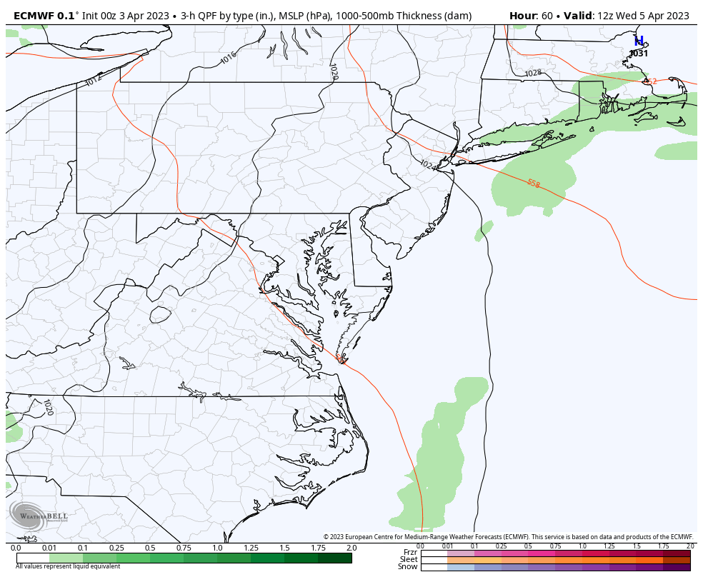
Locally in the Mid Atlantic: The remains of a storm line may arrive at night in a diminished form.
Storm Animation
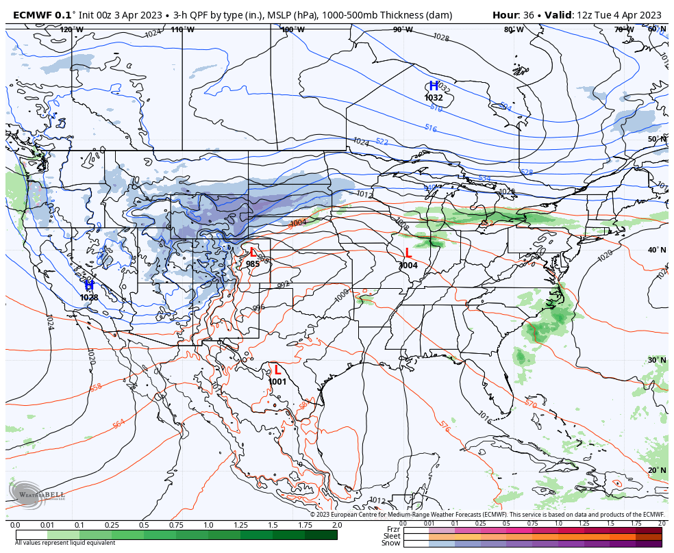
This National View from Tuesday morning to Thursday afternoon shows the larger storm. Heavy snow will move through the northern plains in the cold sector, while the severe storms will be most active in the warm sector mainly with daytime heat.
Closer View
Wednesday Morning to Thursday Afternoon
We might see some isolated showers or a Thunderstorm in western areas Wednesday night, then a broader area of rain Thursday. This is the focus that could affect the Orioles home opening in Baltimore.
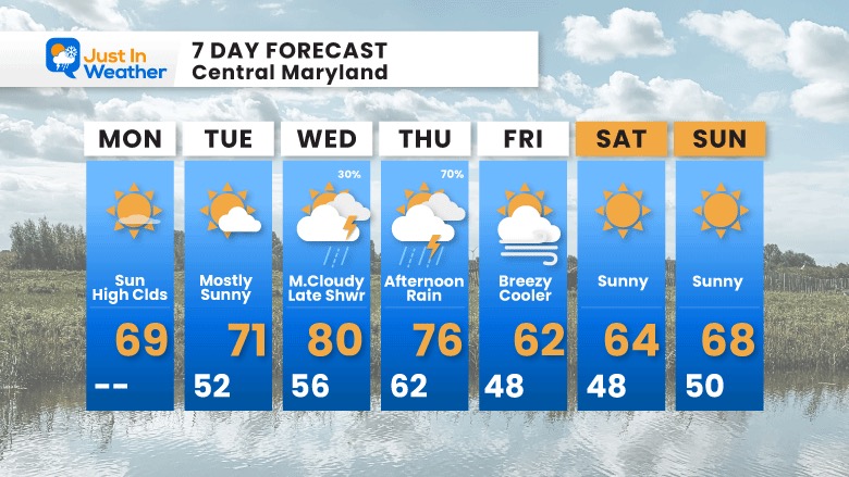
7 Day Forecast
While we will warm up this week, we will watch the severe storm outbreak in the middle of the nation head our way. We might get some late night storms Wednesday, then the main system could bring rain Thursday afternoon. This is worth paying attention to for Orioles Opening Day.
STEM Assemblies/In School Fields Trips Are Back
Click to see more and ‘Book’ a visit to your school

Please share your thoughts, best weather pics/videos, or just keep in touch via social media
RESTATING MY MESSAGE ABOUT DYSLEXIA
I am aware there are some spelling and grammar typos, and occasional other glitches. I take responsibility for my mistakes, and even the computer glitches I may miss.
I have made a few public statements over the years, but if you are new here you may have missed it:
I have dyslexia, and found out during my second year at Cornell University. It didn’t stop me from getting my meteorology degree, and being first to get the AMS CBM in the Baltimore/Washington region. One of my professors told me that I had made it that far without knowing, and to not let it be a crutch going forward. That was Mark Wysocki and he was absolutely correct!
I do miss my mistakes in my own proofreading. The autocorrect spell check on my computer sometimes does an injustice to make it worse. I also can make mistakes in forecasting. No one is perfect predicting the future.
All of the maps and information are accurate. The ‘wordy’ stuff can get sticky.
There has been no editor that can check my work when I needed it and have it ready to send out in a newsworthy timeline. Barbara Werner is a member of the web team that helps me maintain this site. She has taken it upon herself to edit typos, when she is able. That could be AFTER you read this.
I accept this and perhaps proves what you read is really from me…
It’s part of my charm.
#FITF


