


April 19 Showers Later Today Then Strong Winds Usher In Colder Air Tomorrow
Friday April 19 Morning Report The pattern is about to change. The sunny and mild days we have had will be replaced with a colder-than-average outlook into next week. This…
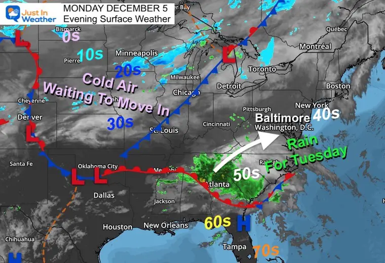
December 5, 2022
Monday Night Update
A few things I want to share this evening as we have an active weather pattern on the way. If you questioned my atmospheric memory theory, the past couple of weeks has shown the timing part of it. Once again we have another 3rd day rain day. This one will also arrive in the morning, but does appear to be with us through the afternoon.
If you see this report early in the morning, I have the live radar to compare to the timeline simulation below.
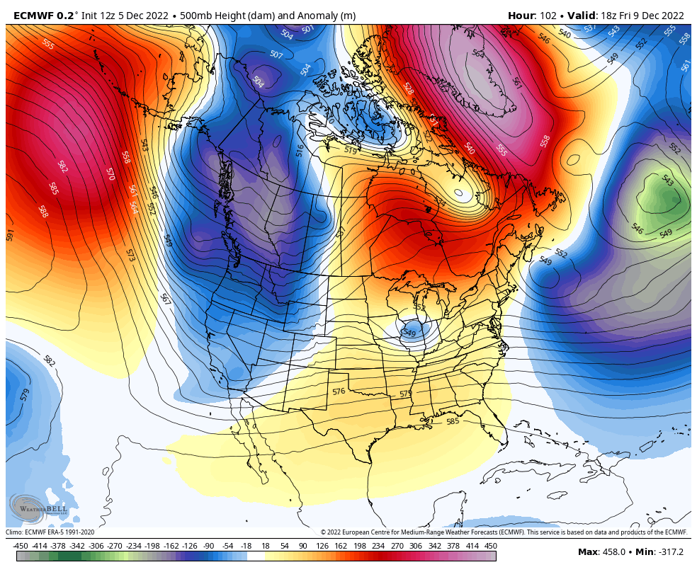
The other purpose of this report is to update you on the snow chance this weekend and pattern change trying to evolve. It is December 5th, and my prior report was about this date starting off our snow season for nearly a decade. It is also what helped kick off the history of Faith in the Flakes with my son.
December 5th Snow In Baltimore And The Start Of Faith In The Flakes FITF
A very frustrating element here is that the long range modeling is flawed and without direction. Yes, something dramatic is going to happen in the jet stream. The Polar Vortex may get dislodged next week. But the main models do not handle it the same way.
At this point I feel like we are back in familiar territory: Do we stick with the reliable European ECWMF Model (colder), or the new expensive upgrade to the American GFS Model (milder). I am adding in the Canadian GEM for good measure as I have found history with its performance in colder patterns. Let’s take a look:
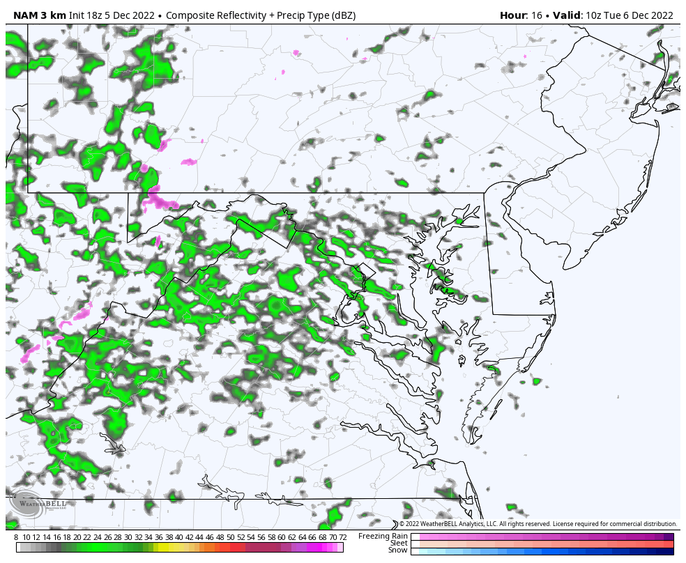
A wave of Low Pressure is going to bring rain from Georgia and South Carolina up the coast into our region by morning. The cold front to the west will help funnel the moisture our way. There is plenty of cold air in the Northern Plains. It’s just a matter of getting the mechanism to shift it our way…
Tuesday 5 AM to Midnight NAM 3 Km Model
Rain will be with us at daybreak and likely last east of the mountains all day and evening.
You can control the image to pan and zoom in.
I will have a new update in my Tuesday morning report.
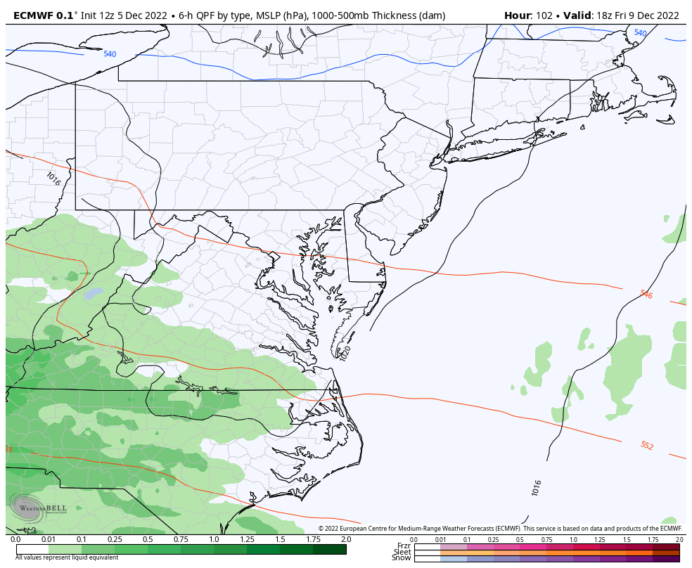
That will give us yet ANOTHER 3 day cycle until we get the next event in here. Here is a look at the European ECMWF Model. This has slowed down to delay the onset until later Friday night.
What you will see is that it remains consistent bringing snow in to include central Maryland and southern Pennsylvania through Saturday morning.
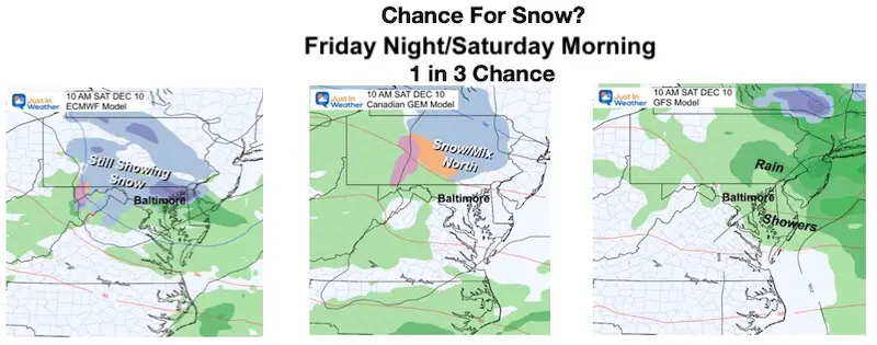
If we run the contrast between the 3 main models, there is an unsettling discrepancy. The European is colder with snow. The Canadian is in the middle shifting the snow north, with the GFS Model remaining the warmest with just rain.
The GFS is the American Model that had yet another expensive update. The last one was not necessarily a blockbuster improvement and this one is yet to be seen.
So I am keeping the chance for snow at least 30% for now. Beyond my wish for snow, the European model has consistency and longevity on its side. We will see if it holds up.
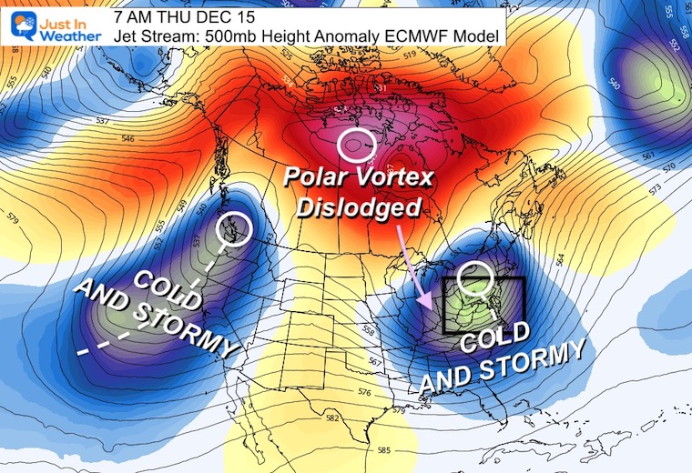
If we look at the week ahead into the middle of the month, the European Model here continues to show the coldest solution.
The European Model is showing a deep trough for the Eastern US and another deep trough for the Western US with a strong storm moving in from the Pacific.
The GFS Model is less robust with a hint of cold air in the Great Lakes, but much less impressive than we have seen.
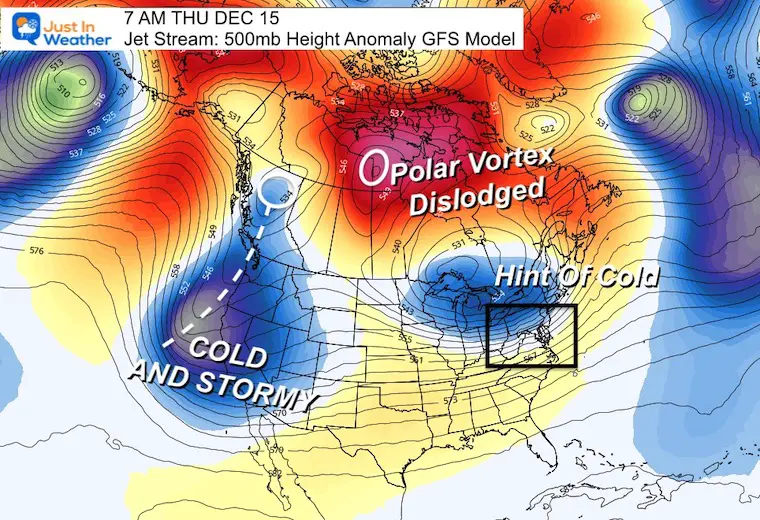
The Polar Vortex will get a nudge mid month, and we will start to see arctic air expanding. The question for us is, will it get here?
The reason I show this to you is that we see all the signals for a pattern change. I’ve talked about that for a while (and I know you may have seen others on the same topic). This early season discussion is to see which model is handling the pattern better, then we may have a lead on each storm that follows.
Comparing The Snow In Decembers With Similar Patterns
Comparing December Cold Pattern Forecast To Snow In Similar Analog Years
December Outlook Trending Colder For Start Of Meteorological Winter
I see many factors to support colder influence with multiple systems. Early and later in winter. Check it out.
Winter Outlook 2023 For Snow Not Typical La Niña Plus Polar Vortex Disruption
Atmospheric Memory Suggests Active Winter Storm Pattern Outlook
Winter Outlook 2023 From NOAA Very Different Than Farmers Almanacs
Winter Outlook 2023 Early Look At Snow From Two Farmers Almanacs
If you want a snowy winter, this is what you might want to look for in the rest of the tropical season. (You might be seeing a lot of commercial snow removal people out this Winter).
Record August For No Named Tropical Storms: Closer Look At Snow Following
Winter Weather Folklore Top 20 And More Outlook Signals From Nature For Cold And Snow


Click to see more and ‘Book’ a visit to your school
