


April 24 Weather: Some Showers Then Another Push Of Cold Air Followed By Summer Heat Sunday
Wednesday, April 24 Morning Report A milder start today with most areas in the 50s to near 60ºF along parts of the Bay. There is a push of colder air…
November 16 2022
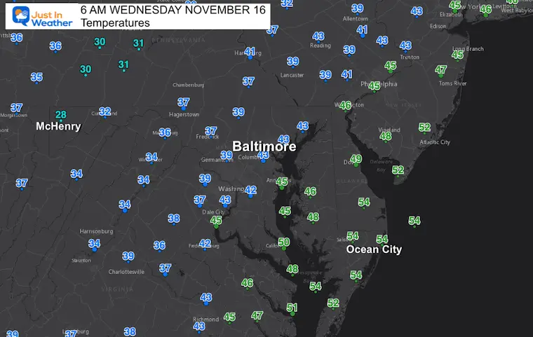
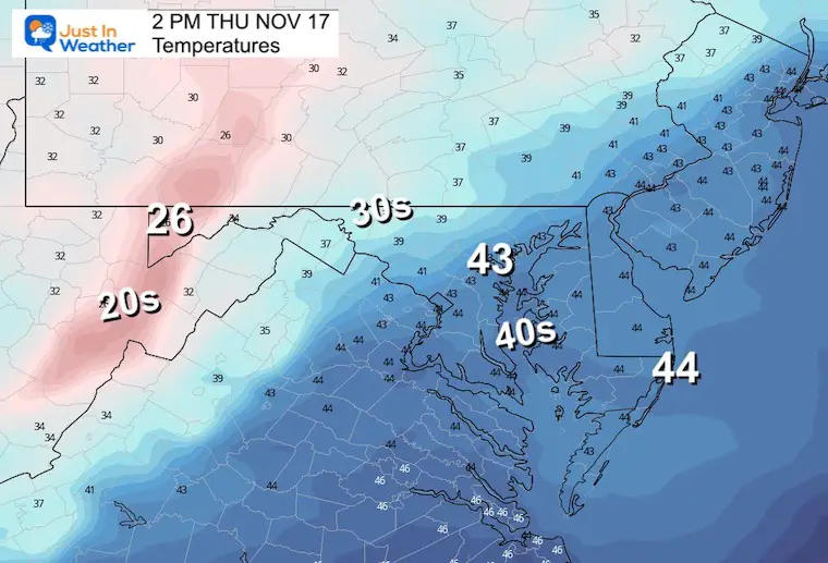
Wednesday Morning Update
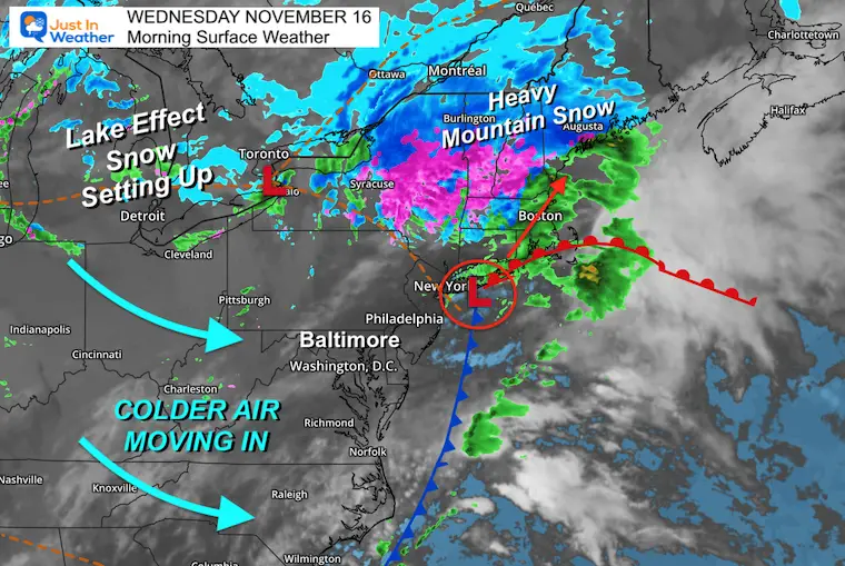
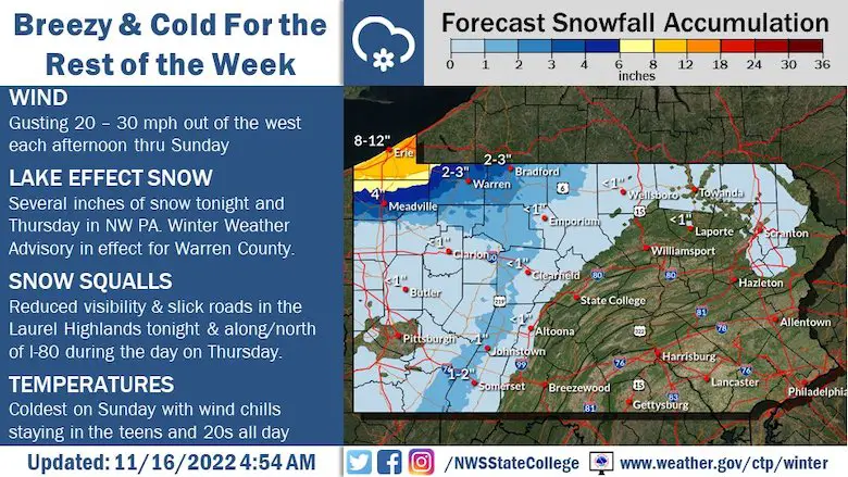
We have areas of fog this morning and wet roads, but safely above freezing (for now). A cold winter pattern will be settling in for the rest of the week. For most of us that just means windy and cold, but dry. There will be an impressive Lake Effect Snow event setting up, which includes Western Maryland, and big snow numbers are about to be reported from Erie to Buffalo.
545 pm in Altoona….around 3 inches has fallen. There have been a few accidents too…..nice looking if you don’t have to be out in it. @WTAJnews @JoeMurgo @MoffettKaitlyn @WxShield @JustinWeather @TonyPannWBAL @ChrisClimate @TenaciousTopper @capitalweather pic.twitter.com/YSw4A6EW6B
— Howard Bernstein (@hbwx) November 15, 2022
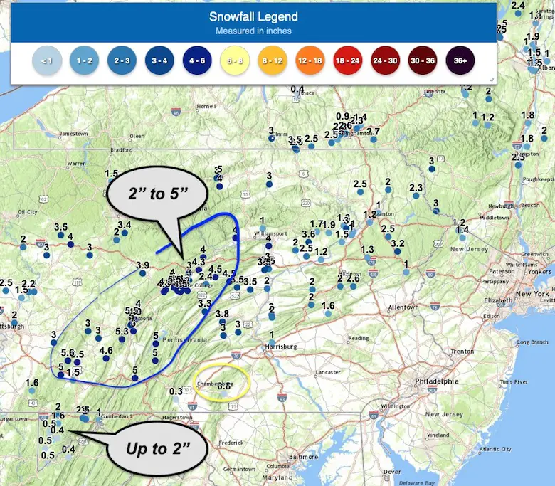
These numbers are from NWS Spotters. While Western Maryland shows up around 1/2 inch, I have received personal reports closer to 2”.
Nearby Chambersburg PA to Harrisburg had a coating to 1” of snow.
Central Pennsylvania were the big winners where Altoona to State College got close to 5 inches.
If you slept in, NASA finally got Artemis 1 off the ground and safely into space just before 2 AM. Here is the video coverage of the liftoff.
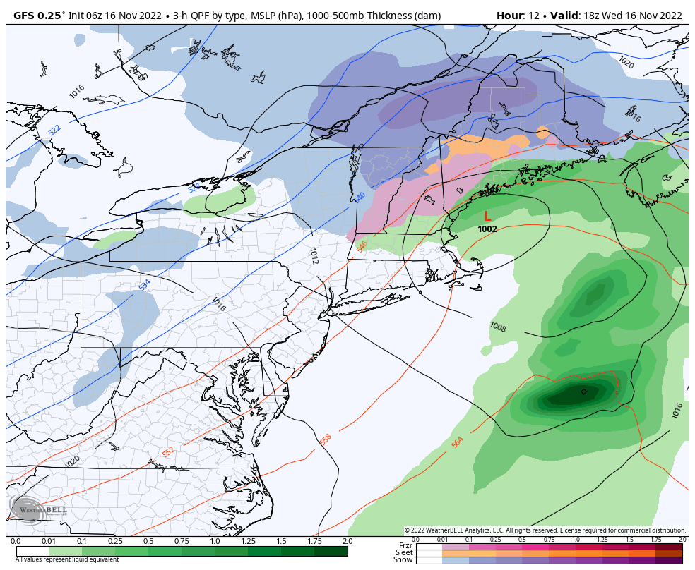
Our Nor’easter is located near New York City and heading into New England. Heavy interior snow for the mountains, then a new Lake Effect Snow event will set up to our west.
This may bring a few inches to Garrett County, and perhaps closer to a foot or two for some locations near Buffalo.
(GFS Model)
As the Nor’easter departs, cold wind will set up into the weekend. The Lake Effect Snow will crank for many days as well, but local metro areas should remain dry. Perhaps a passing flurry in the northern suburbs.
Here is the NWS Forecast for the Pennsylvania Lake Effect Snow:
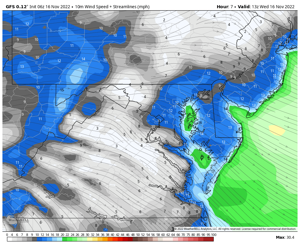
It will remain windy through tomorrow (and longer).
Normal Low in Baltimore: 36ºF
Record 19ºF in 1996
SNOW: Trace 2018
Normal High in Baltimore: 57ºF
Record 76ºF 2005
Click to see more and ‘Book’ a visit to your school

Winter Outlook 2023 From NOAA Very Different Than Farmers Almanacs
Winter Outlook 2023 Early Look At Snow From Two Farmers Almanacs
If you want a snowy winter, this is what you might want to look for in the rest of the tropical season. (You might be seeing a lot of commercial snow removal people out this Winter).
Record August For No Named Tropical Storms: Closer Look At Snow Following
Winter Weather Folklore Top 20 And More Outlook Signals From Nature For Cold And Snow


