


April 24 Weather: Some Showers Then Another Push Of Cold Air Followed By Summer Heat Sunday
Wednesday, April 24 Morning Report A milder start today with most areas in the 50s to near 60ºF along parts of the Bay. There is a push of colder air…
Wednesday, October 19, 2022
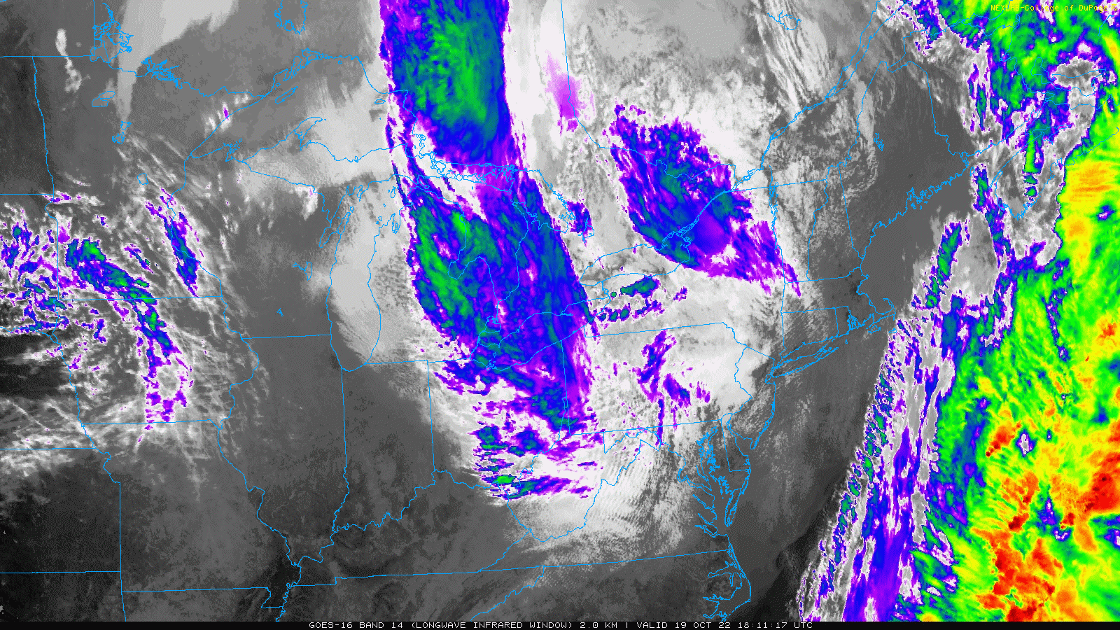
Let’s try this again. Cold air is wrapping around this Upper Level Low in the Great Lakes. While it has helped produce clouds today, they will diminish overnight and allow for maximum cooling. New Cold Temperature Alerts have been issued.
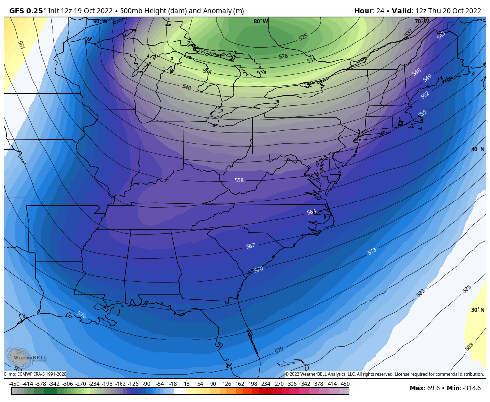
Before we dive into that, I also want to address how this early season cold pattern will ease and flip on the warm switch this weekend. It may leave a circulation behind to form off the Carolina Coast, forming a new Low to bring us rain on Sunday. Let’s check it out.
2 PM to 4 PM
The snow may be done, but some of the trees are at peak color, so I wanted to share with you again.
This webcam is positioned at The Greene Turtle Deep Creek Lake and shows Wisp Resort, including a zoomed-in view of Squirrel Cage, The Face, the terrain park, Boulder, the mountain coaster, the tubing park and a shot of McHenry Cove at Deep Creek Lake!
First flakes!
📍 Garrett County, MD
📷 Kristin Skeweris#FITF is Faith in the Flakes#Maryland #snow pic.twitter.com/y4BSZ9HV8y— Justin Berk (@JustinWeather) October 19, 2022
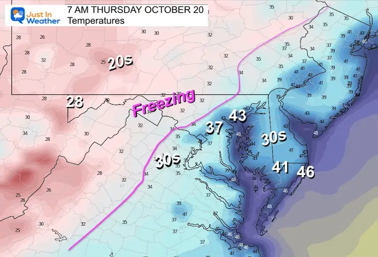
A new Freeze Warning has been issued for Thursday morning and it covers most of the counties north and west of I-95 from Baltimore and Washington.
A new Frost Advisory has been issued for most counties around the rest of the Chesapeake Bay in Maryland across to Delaware. Ironically Talbot County has been excluded, but I would still consider the frost away from the water.
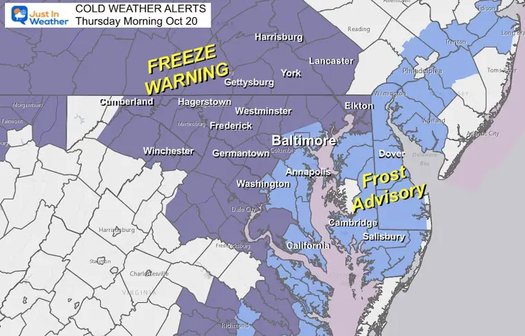
If you are in the Freeze Warning, it is advised to disconnect your garden hoses to prevent them from bursting.
Also cover to protect or bring sensitive plants in the house.
Watch the trough lift and fade, allowing for a warm up (yellow). You can see the spin left behind off the coast this weekend, that will pull back into Maryland on Sunday.
The GFS model has caught up to what I showed you this morning on the European Model… bringing rain in for us on Sunday.
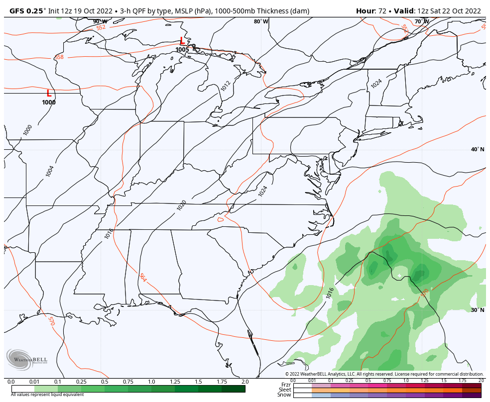
This is the same forecast I showed this morning. It still holds: The start of the weekend looks good, but plan for rain on Sunday.
Click to see more and ‘Book’ a visit to your school


Winter Outlook 2023 Early Look At Snow From Two Farmers Almanacs
If you want a snowy winter, this is what you might want to look for in the rest of the tropical season.
Record August For No Named Tropical Storms: Closer Look At Snow Following

