Friday Evening September 30
At 5 PM, Ian was reclassified as a Post Tropical Cyclone. It is inland with 70 mph winds and has lost its tropical signature, and is now being stretched out up the East Coast of the US. That includes us, in and around Maryland.
This post has a quick update on the storm, and a focus on the rain (and some wind) we can expect in our area.
IT WILL FEEL LIKE A NOR’EASTER FOR US
While this is still a dangerous system with storm surge and flooding rainfall in the path, the impact for our region will be less potent, while still very noticeable.
IR Satellite Loop
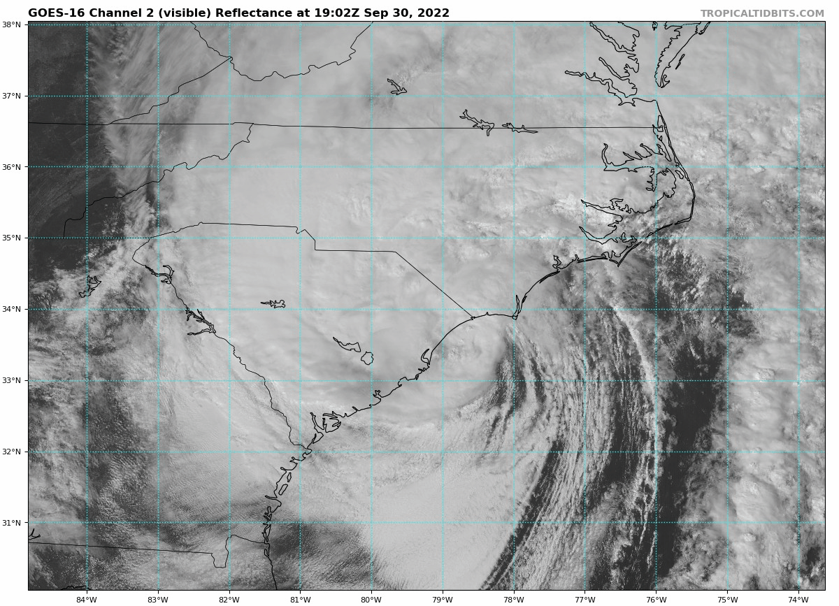
Post Tropical Cyclone Ian
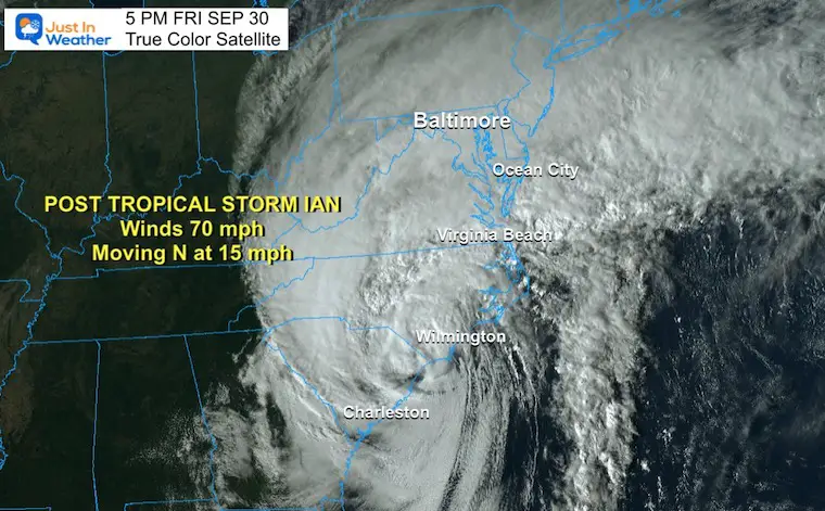
Quick Stats at 5 PM
- Winds are 70mph
- Moving to the North 15 mph
- Located 20 miles NW form Myrtle Beach, SC
- Tropical Storm force winds extend 205 miles from the center.
5 PM True Color Satellite
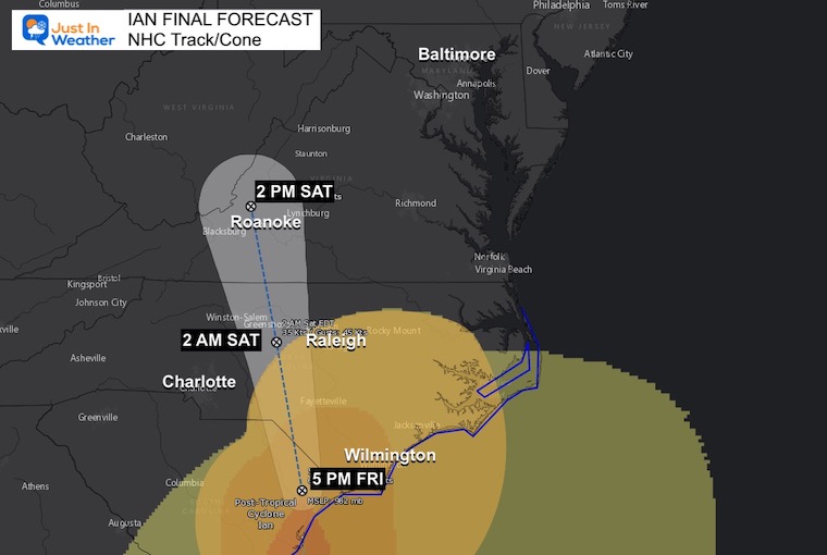
Forecast Track Into Virginia
This is the National Hurricane Track/Cone.
The remnants of Ian will break down and be declassified by Saturday afternoon near Roanoke, VA. It will bring flash flooding along its path into the mountains.
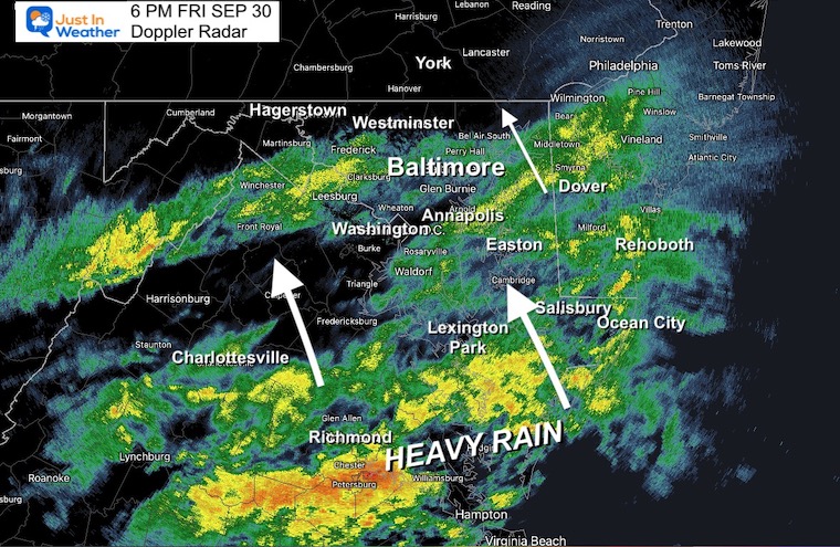
LIVE RADAR WIDGET
The brighter green, yellow, and orange are where the rain is reaching the ground.
Mid Atlantic Focus
Let’s look at the rain first, then the wind…
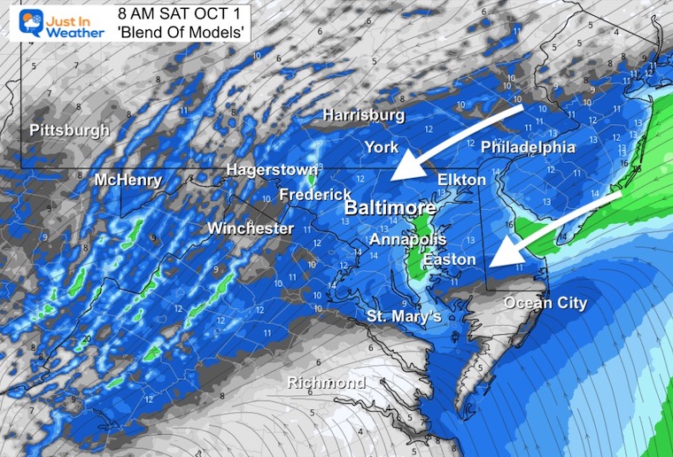
Rainfall This Evening
Doppler Radar Snapshot at 6 PM
Rain has reached I-70 between Baltimore to Frederick. It will continue to spread north this evening.
The heavy rain is already near Richmond and will also spread north tonight.
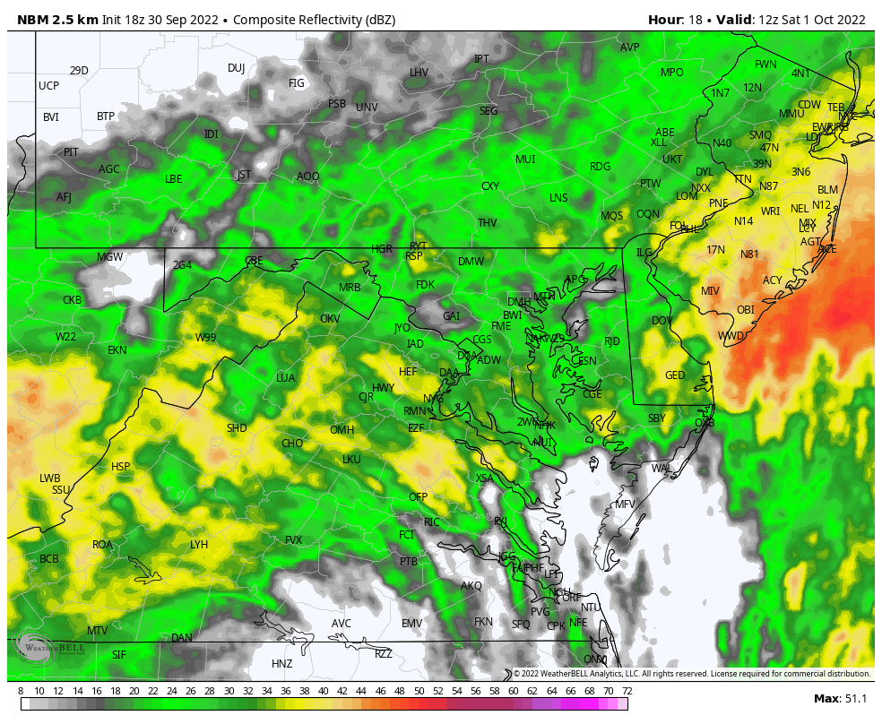
Model Guidance
For many months I have mentioned the errors in one model or another. Here is a look at the National Blend of Models NBM, taking the average of the solutions for something that may be more acceptable.
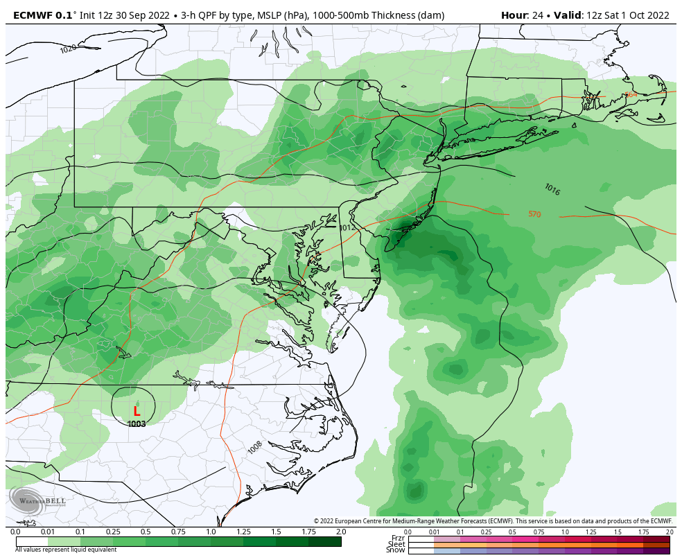
It still looks like the rain has moved in a little faster. The heaviest rain will fall overnight into Saturday morning.
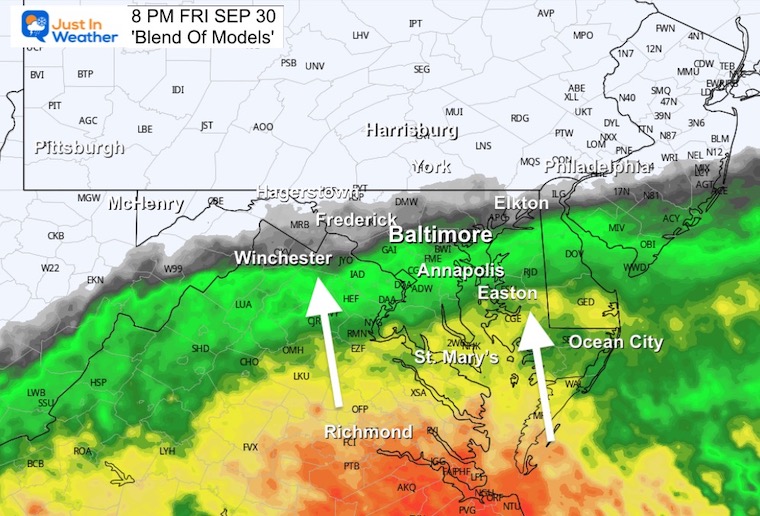
8 PM
Rain moving through and north of metro Baltimore
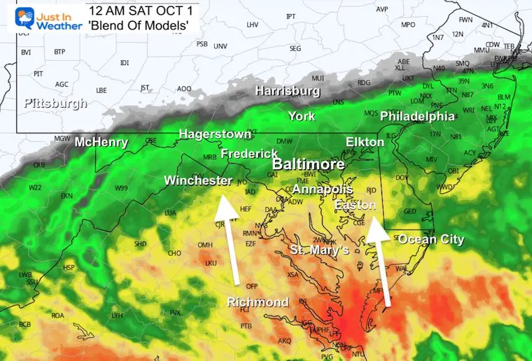
Midnight
Rain will overspread into Southern PA.
Heavy Rain will be moving up through southern Maryland.
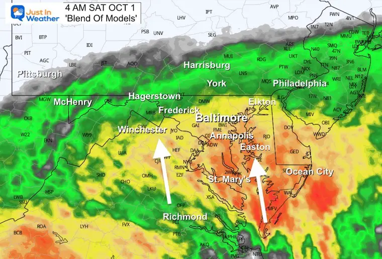
4 AM
Heavy Rain will continue in southern Maryland and spread into metro Baltimore.
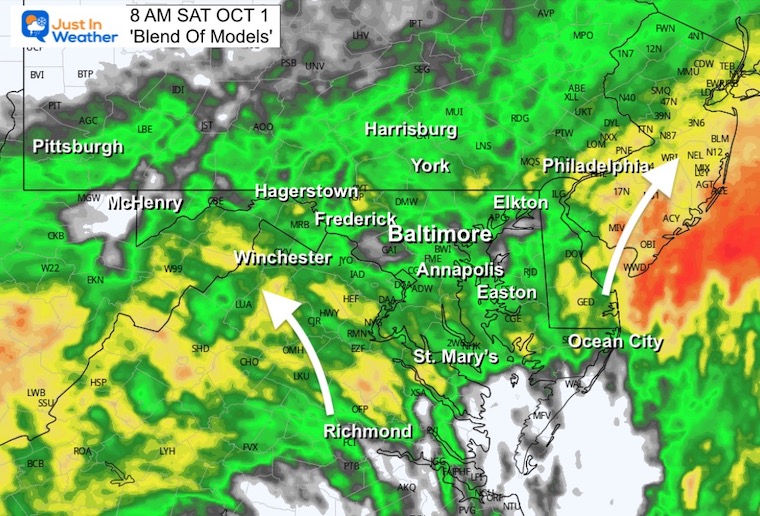
8 AM
The heaviest rain will split off to the east, while the core Low of Ian will pivot to the west. Heavy rain will continue in the mountains.
Radar Simulation: Saturday 8 AM to Midnight
The Western Rain Band with the remnants of Ian will continue to spin and slowly pivot to the east. We will remain under showers off and on all day.
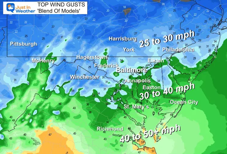
WIND:
Yes, we have had wind restrictions and they may continue through the morning. This will be like a Nor’easter for us, then ease during Saturday afternoon.
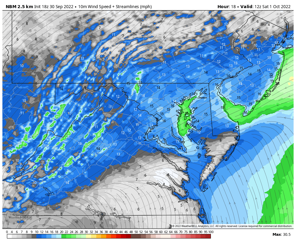
Morning Wind Snapshot
The Northeast Wind will feel like a Nor’easter and keep us chilly.
Peak Wind Gusts:
Overnight through Saturday morning.
Wind Forecast Animation
8 AM Sat To Midnight
As we can see, the winds might ease during the afternoon on Saturday.
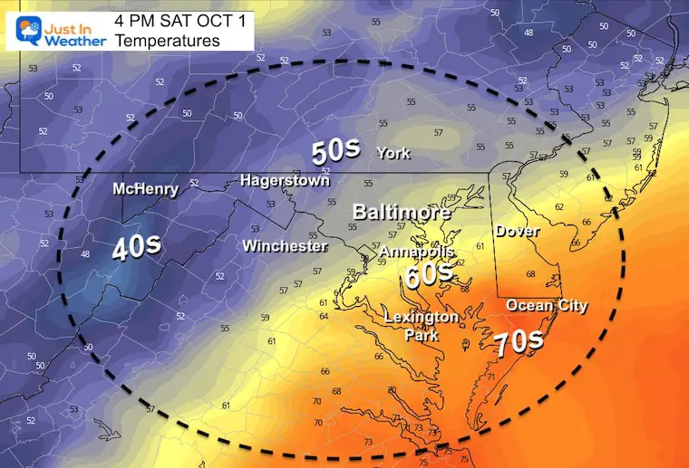
Temperatures Saturday Afternoon:
Most of the region will be chilly, stuck in the 50s. However, with the wind from the Atlantic and crossing the Chesapeake Bay: South of the Bay Bridge to The Beaches will be mid 60s to near 70ºF.
Longer Impact
ECWF Model Forecast Saturday Morning to Tuesday Afternoon
Plotting the rain and circulation inland, we can see the rain split later on Saturday, then redevelop on Sunday.
The new Low Pressure trying to organize may pass through Maryland and off the coast keeping the risk of rain showers around through Tuesday.
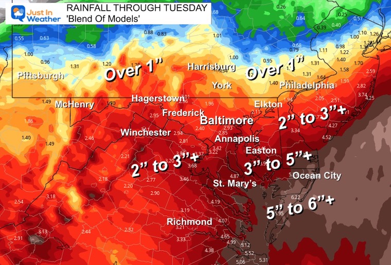
Rainfall Forecast Total Through Tuesday
PATTERN CHANGER?
Hurricane Ian May Help Cooler Pattern Change: Monitor For Atmospheric Memory This Winter
CONNECTION TO WINTER?
If you want a snowy winter, this is what you might want to look for in the rest of the tropical season.
Record August For No Named Tropical Storms: Closer Look At Snow Following
Hurricane Season Forecast: June 1 Through November 30
NOAA 2022 Hurricane Forecast- Above Normal Again

Related Posts
NOAA Study: Reducing Air Pollution INCREASED Tropical Storms

Atlantic Tropical History: Maps of Origin Regions Every 10 Days


Please share your thoughts, best weather pics/videos, or just keep in touch via social media
STEM Assemblies/In School Fields Trips Are Back
Click to see more and ‘Book’ a visit to your school


