


April 24 Weather: Some Showers Then Another Push Of Cold Air Followed By Summer Heat Sunday
Wednesday, April 24 Morning Report A milder start today with most areas in the 50s to near 60ºF along parts of the Bay. There is a push of colder air…
Wednesday September 21, 2022
Morning Update
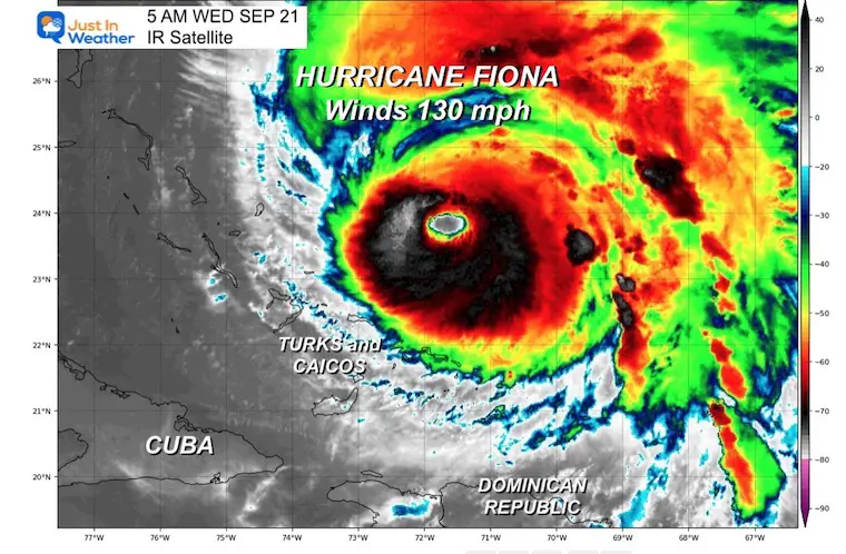
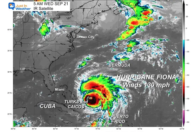
Hurricane Fiona is a Category 4 storm this morning with winds of 130 mph. It is the strongest hurricane in an otherwise quiet season. This strength was forecast and it is going to continue to be a player across the east coast.
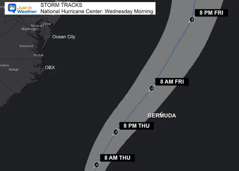
The track is moving north of North Caicos Island this morning and tracking to the west of Bermuda by Friday. It will miss the eastern US, but send rip currents and beach erosion up and down the coast.
Snapshot
Before sunrise, the center of the storm was located more than 100 miles north of North Caicos Island. This is a rough estimate as the National Hurricane Center did not post their update at 5 AM.
See the sequence of images tracking the storm today.
Category 4 #HurricaneFiona has winds of 130 mph this morning. Here we see a very distinct eye as it tracks north towards Bermuda now pic.twitter.com/COBBngnQ8D
— Justin Berk (@JustinWeather) September 21, 2022
The eye of Major #HurricaneFiona seen on this wide view satellite Wednesday morning. At Category 4, winds are 130 mph and it is moving North at 8 mph, expected to pass West of Bermuda early Friday morning. pic.twitter.com/uZYdbSzhsS
— Justin Berk (@JustinWeather) September 21, 2022
SUMMARY 200 AM EDT…0600 UTC…INFORMATION
———————————————-
LOCATION…23.4N 71.8W
ABOUT 105 MI…170 KM N OF NORTH CAICOS ISLAND
ABOUT 755 MI…1215 KM SW OF BERMUDA
MAXIMUM SUSTAINED WINDS…130 MPH…210 KM/H
PRESENT MOVEMENT…N OR 350 DEGREES AT 8 MPH…13 KM/H
MINIMUM CENTRAL PRESSURE…942 MB…27.82 INCHES
A TROPICAL STORM WATCH IS IN EFFECT FOR…
* BERMUDA
A TROPICAL STORM WATCH MEANS THAT TROPICAL STORM CONDITIONS ARE POSSIBLE WITHIN THE WATCH AREA…GENERALLY WITHIN 48 HOURS.
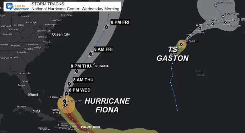
Most ensembles show this curving through the Bahamas then east of the US coast. I say most, because there are some outliers and we must consider that so far this has not been handled well with computer models… and verifying to the LEFT of the expectations.
NOAA 2022 Hurricane Forecast- Above Normal Again


NOAA Study: Reducing Air Pollution INCREASED Tropical Storms

Atlantic Tropical History: Maps of Origin Regions Every 10 Days


Climate Data/Weather Stats For The Month
September Starts Meteorological Autumn: Weather Climate Stats For Maryland at Baltimore
Click to see more and ‘Book’ a visit to your school

Winter Outlook 2023 Early Look At Snow From Two Farmers Almanacs
If you want a snowy winter, this is what you might want to look for in the rest of the tropical season.
Record August For No Named Tropical Storms: Closer Look At Snow Following
Rainbow Ice Cave In Mt. Rainier A Very Rare Find: Photos And Video