


April 19 Showers Later Today Then Strong Winds Usher In Colder Air Tomorrow
Friday April 19 Morning Report The pattern is about to change. The sunny and mild days we have had will be replaced with a colder-than-average outlook into next week. This…
July 6 2022
Wednesday Morning Update
There is a lot to discuss but I unfortunately have to keep this very brief due to prescheduled plans with my son. So I apologized for the abbreviated recap of the storms yesterday and forecast for more today.
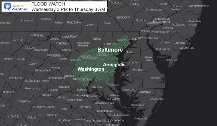
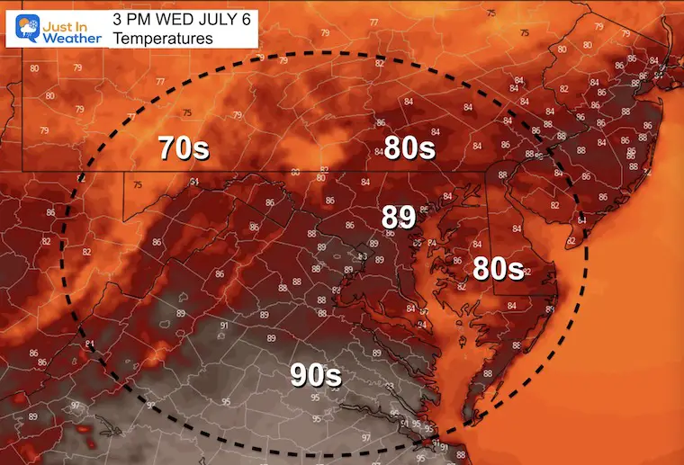
We do have a Flood Watch in central Maryland including metro Baltimore and Washington. The good news is that the severe storm risk will be pushed to our south today, but we may see some heavy rain producers anyway.
Before we get to that, yesterday a tornado touched down in Bowie, MD.
Bowie has the confirmed tornado (likely EF-0 or EF-1) with additional tree damage in southern Anne Arundel County.
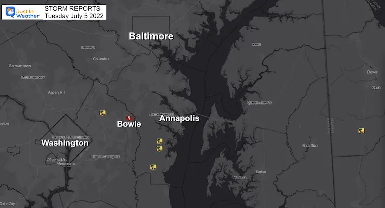
Time: 5:33 PM
Location: 1 Mile north of Bowie in Prince Georges County
Preliminary Report: STRUCTURES DAMAGED ALONG WITH TREES UPROOTED AND
SNAPPED, AND POWER-POLES SNAPPED. AT THIS TIME, THERE
HAVE BEEN NO CONFIRMED REPORTS OF INJURIES. ESTIMATED
MAXIMUM WIND SPEEDS OF 90 MPH.
It was an active weather day for those east of DC, especially between 515-630 PM. A supercell (rotating thunderstorm) spread severe weather across parts of Prince Georges & Anne Arundel counties. Tornado Warnings are in red & Severe T’Storm Warnings are in yellow. #MDwx pic.twitter.com/xTHRfxiU4P
— NWS Baltimore-Washington (@NWS_BaltWash) July 6, 2022
These was the best I could piece together on short notice. Thank you to al that shared. This included the possible tornado near Salisbury as well.
When the final storm survey is issued, I will share it online.
Thank you Jeff Reetz and The Bowie Volunteer Fire Department
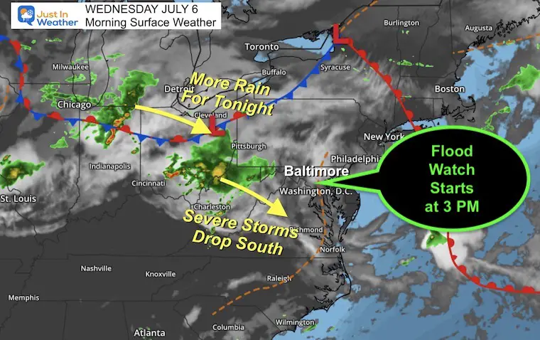
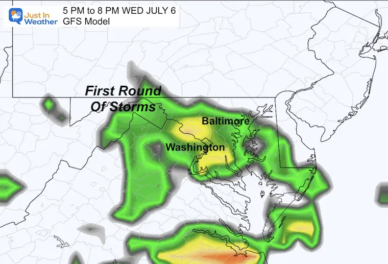
The main energy will shift south today. However, in the marginal areas there will be the potential for locally heavy rain producing storms.
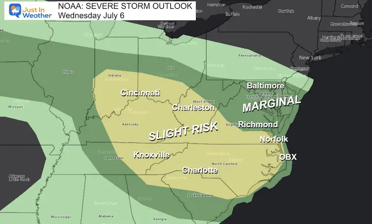
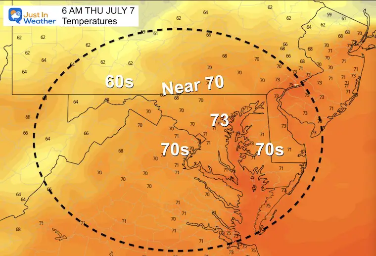
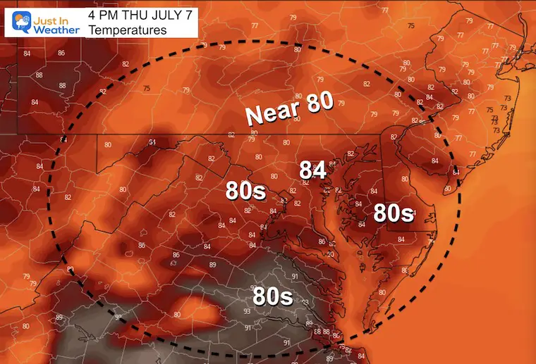
More active storms are moving out of the Great Lakes and Ohio Valley. These will be shifting to the south, but we are expecting to get in on some locally heavy rain producing storms this afternoon and tonight.
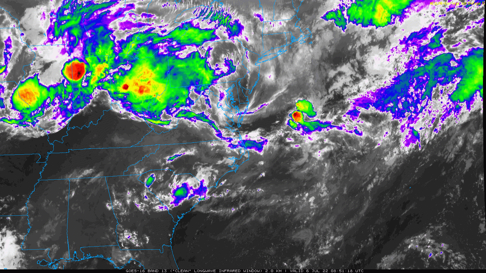
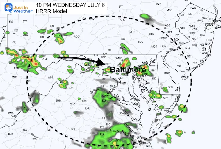
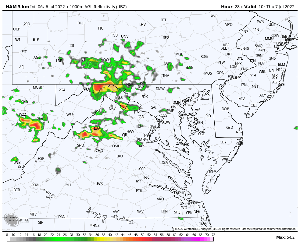
I have little confidence with the short range model guidance. While it has been helpful with general storm product, they have been lacking with specifics. Today’s guidance package is wide ranging and sparse… So I resorted to showing these two products as we may see one late afternoon storm cluster, then more likely storms after dark.
More storms like to form overnight.
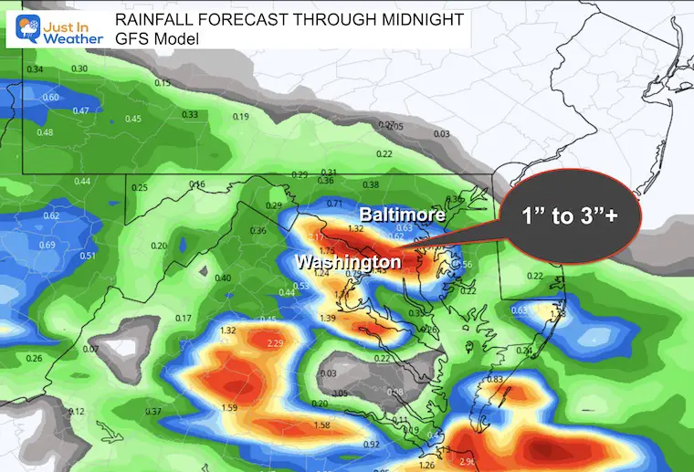
Where the storms set up, they may produce up to 3 inches of rain rain, leading to local flooding.
This may begin with storms in the morning and then may become another active day with severe storm risk.
I am sorry I do not have an extended outlook prepared today.

NOAA 2022 Hurricane Forecast- Above Normal Again


NOAA Study: Reducing Air Pollution INCREASED Tropical Storms

Atlantic Tropical History: Maps of Origin Regions Every 10 Days


May 16 Large Hail Videos And Storm Tracking Map


*Disclaimer due to frequent questions:
I am aware there are some spelling and grammar typos. I have made a few public statements over the years, but if you are new here you may have missed it:
I have dyslexia, and found out at my second year at Cornell. I didn’t stop me from getting my meteorology degree, and being first to get the AMS CBM in the Baltimore/Washington region.
I do miss my mistakes in my own proofreading. The autocorrect spell check on my computer sometimes does an injustice to make it worse.
All of the maps and information are accurate. The ‘wordy’ stuff can get sticky.
There is no editor that can check my work when I need it and have it ready to send out in a newsworthy timeline.
I accept this and perhaps proves what you read is really from me…
It’s part of my charm.