Monday Afternoon May 16 2022
Finally we have evidence to support the severe thunderstorm development. There has been quite the debate and it has been dizzying and possibly confusing to the public. In short, the morning rain stabilized the air a little, but the return of the sun and timing of the front has been just enough to act on a few developing lines of rain.
Let’s take a quick look
I accepted in my last report that I was wrong for expecting this Watch to be extended into Maryland. Then The National Weather Service proved me wrong for bring wrong. Ha!
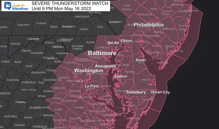
Severe Thunderstorm Watch
This expires at 9 PM, but will be cancelled earlier from west to east as it moves through….
Potential for cells to produce
- Damaging Winds Over 58 mph
- Large Hail over 1” Diameter
- An Isolated Tornado
Know Watch Vs Warning
Should an Alert be issued for Severe Storms, Tornadoes, or Flooding, please remember this:
A WATCH means it ‘might’ happen. This is often issued first for a large area.
A WARNING means it is ‘HAPPENING NOW’! This is shirt term with a county and towns listed in the path.
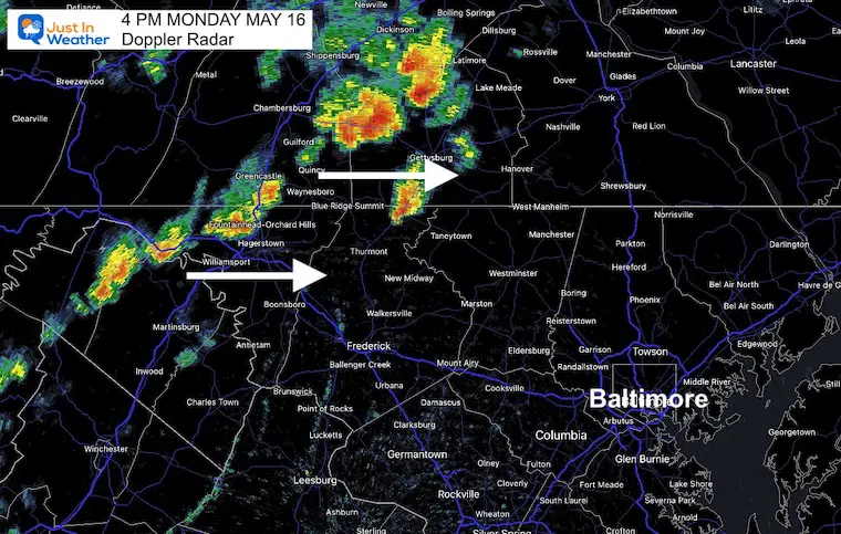
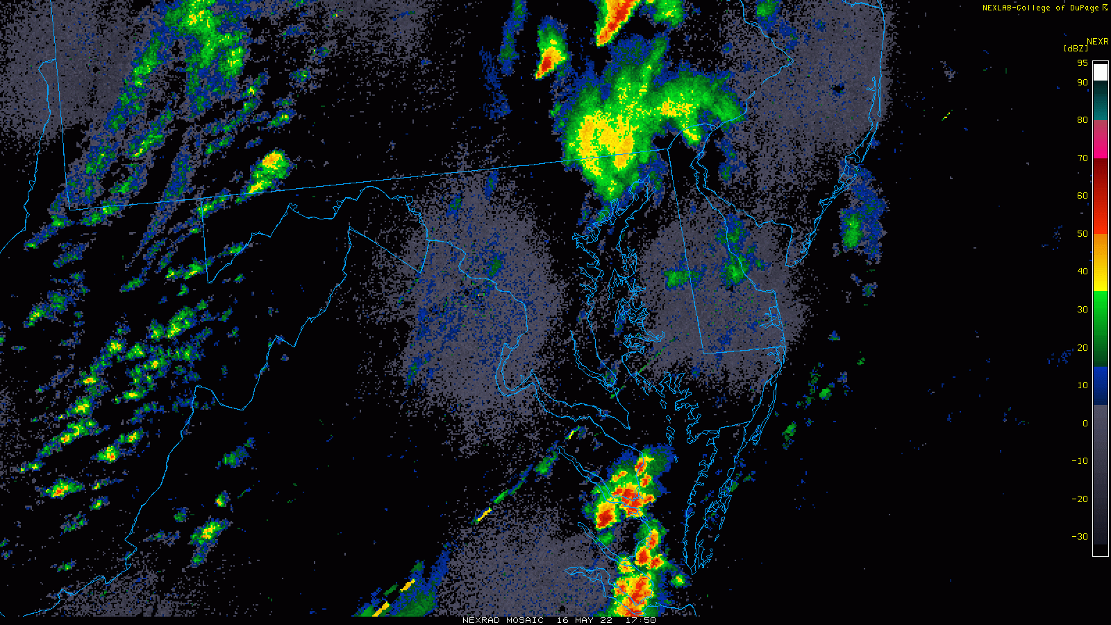
Snapshot at 4 PM
The broken line of storms trying to solidify between Hagerstown and north of Gettysburg.
Expect this cluster along the MD/PA line with Thurmont, Westminster, and York in line before 5 PM.
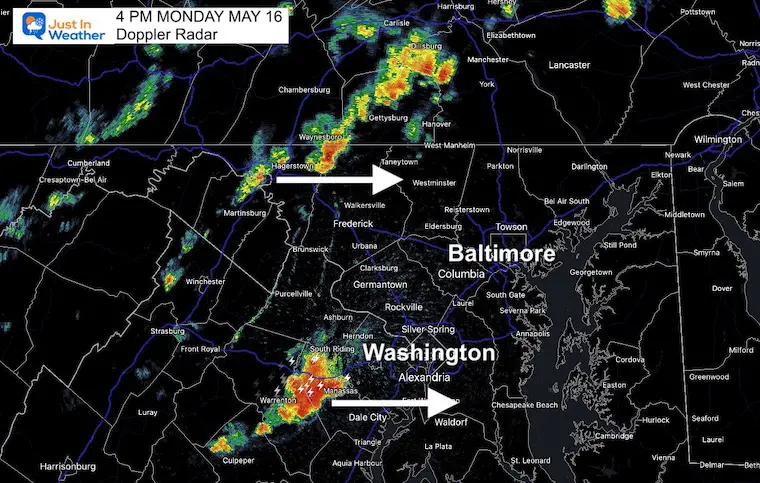
Wider View
A larger cluster around Manassas, VA will track to Waldorf, MD by 5 PM. This cell does have large hail and damming wind potential, including Alexandria in the path.
Doppler Radar Loop
Watching the quick development and movement of these cells…
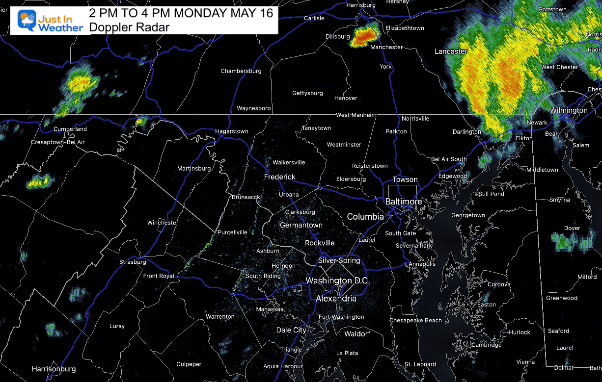
Regional Radar Loop: 2 PM to 4 PM
Notice the multiple lines pinwheeling through… One cluster of sever storms passed up the coast from Chicoteague to Ocean City.
The most potent cell is west of Washgington, DC, While a broken line is trying to solidify between Hagerstown and Harrisburg PA.
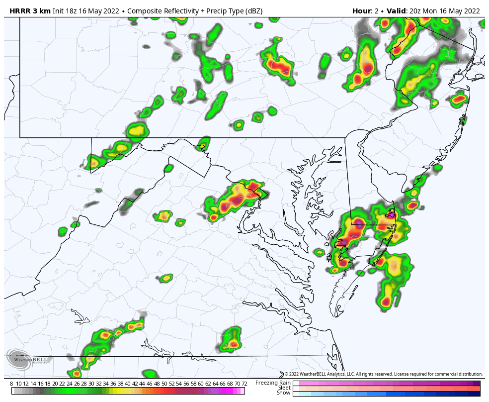
HRRR Model: 4 PM to Midnight
This model seems to be missing some of the activity (like the north line into PA), so I am only providing this loop. Not the slider…
Note the progress from 5 PM with a cluster around metro Baltimore and a second by Ocean City.
The main line crossing Delmarva and southern Maryland by 8 PM
One more possible push off showers from the mountains reaches Hagerstown to Washington between 10 PM and Midnight.
Severe Storm Risk- From This Morning
The Enhanced Risk is Level 3 of 5, a rare status for us, so lease take this seriously.
Storms may contain damaging winds, large hail, and isolated tornados.
This is a Risk POTENTIAL, NOT A PROMISE…
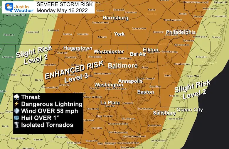
Severe Storm Risk: Potential For
Damaging Winds Over 58 mph
Hail OVER 1 inch diameter
Isolated Tornadoes are very possible, but not for everyone. These are hit and mostly miss, but all it takes is one!
Tropical Season Begins June 1
Atlantic Hurricane Forecast

Related Posts
NOAA Study: Reducing Air Pollution INCREASED Tropical Storms

Atlantic Tropical History: Maps of Origin Regions Every 10 Days


Please share your thoughts, best weather pics/video, or just keep in touch via social media
*Disclaimer due to frequent questions:
I am aware there are some spelling and grammar typos. I have made a few public statements over the years, but if you are new here you may have missed it:
I have dyslexia, and found out at my second year at Cornell. I didn’t stop me from getting my meteorology degree, and being first to get the AMS CBM in the Baltimore/Washington region.
I do miss my mistakes in my own proofreading. The autocorrect spell check on my computer sometimes does an injustice to make it worse.
All of the maps and information are accurate. The ‘wordy’ stuff can get sticky.
There is no editor that can check my work when I need it and have it ready to send out in a newsworthy timeline.
I accept this and perhaps proves what you read is really from me…
It’s part of my charm.


