April 24 Weather: Some Showers Then Another Push Of Cold Air Followed By Summer Heat Sunday
Wednesday, April 24 Morning Report A milder start today with most areas in the 50s to near 60ºF along parts of the Bay. There is a push of colder air…
May 15 2022
SundayMorning Report
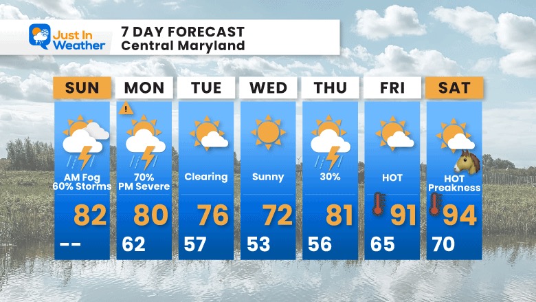
There is a lot to unpack this morning for today and the week ahead. In the short expectation for your outdoor events, keep them going but bay attention for timing of potential storms eruption. Timeline suggestions below.
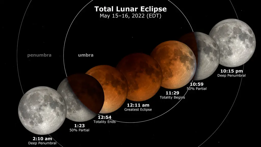
The weather still may clear for viewing of the Total Lunar Eclipse Tonight. Lots of info for the event.
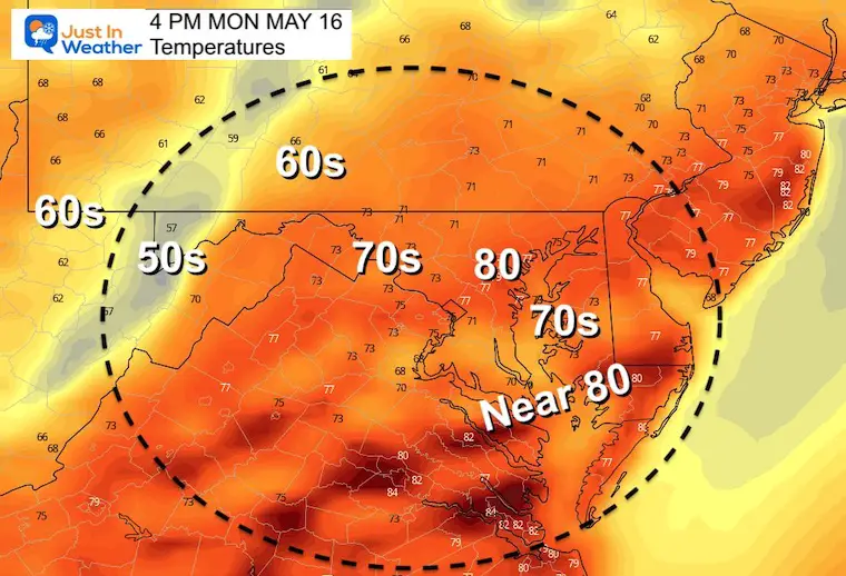
Severe Storm Risk is ENHANCED for Monday!
Heat back to the 90s expected for Preakness Weekend.
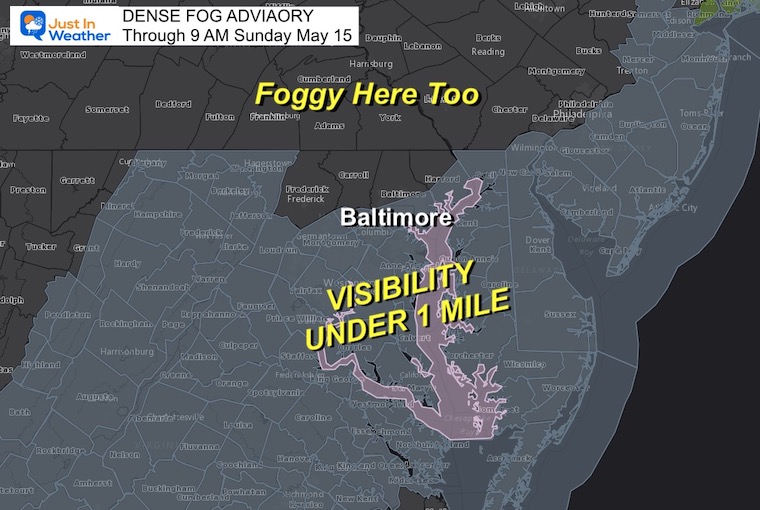
The added moisture from rain on Saturday has led to dense fog this morning.
Visibility down under 1 mile for many, with the worst by the Bay, Delmarva, and where it rained list night.
There has been fog in PA even where the Advisory is not in place.
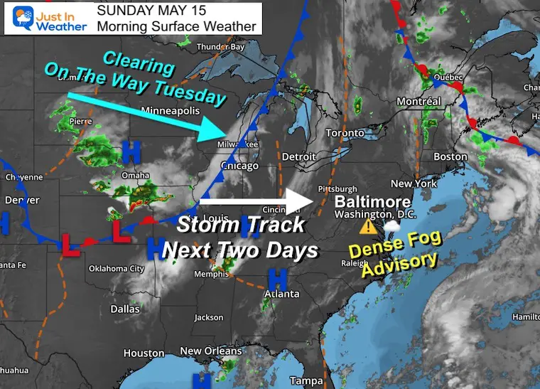
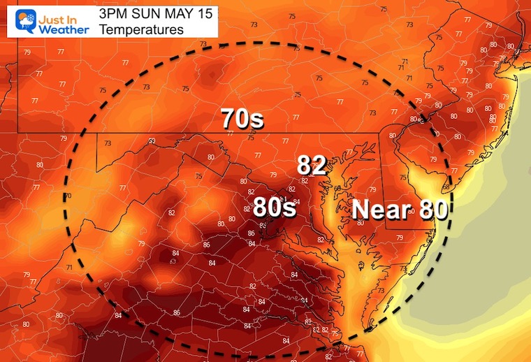
When this fog dissipates, there will be a humid feel left to the air, and any sun will work with that moisture to build storms later…
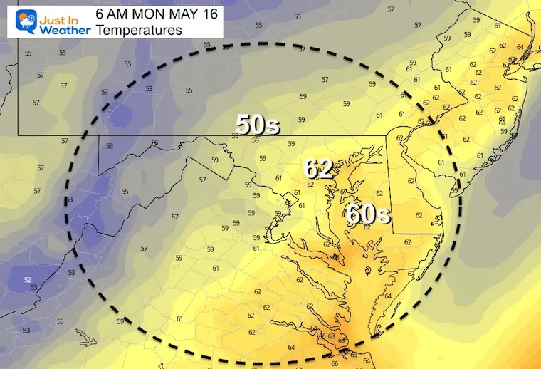
Clearing is on the way by Tuesday.
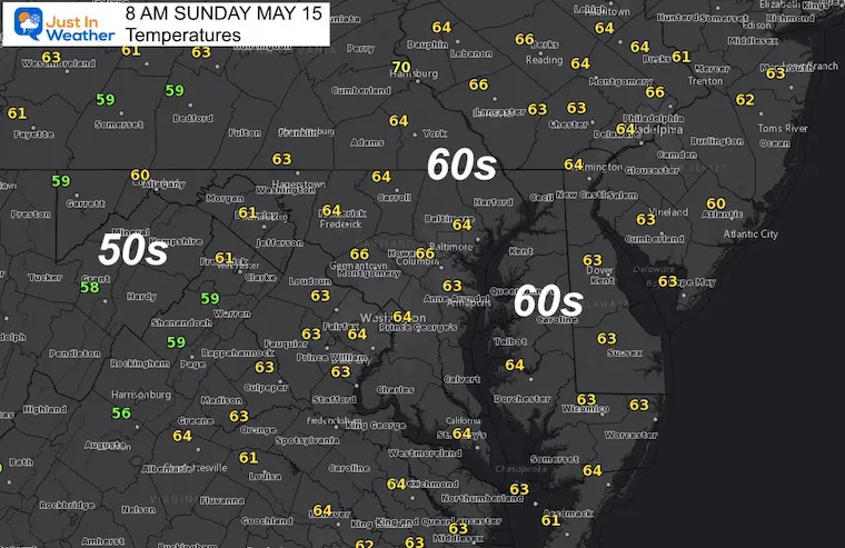
Already mild this morning…
It will be warmer! Any sunny breaks feel humid, and will help fuel storm cells.
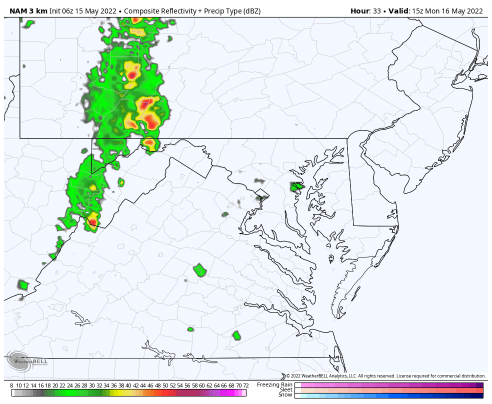
REMINDER: This are NOT PERFECT! The NAM 3 Km gets the nod today with better handling, but the tinning and coverage still may have a buffer of an hour or two…
Metro areas expect this between 4 PM and 7 PM


This will be a prime viewing event, IF the sky can clear, and there is a chance for it..
Click Here for all the info needed including NASA Animations AND Live Stream Link to track online.
Normal Low in Baltimore: 52ºF
Record 41ºF in 1984
Normal High in Baltimore: 74ºF
Record 96ºF 1962
There is a higher chance for:
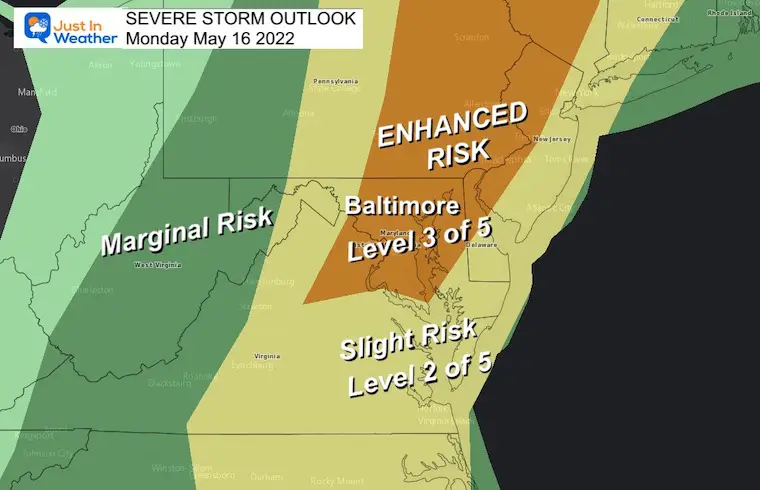
This set up with with a strong cold front. The result will be a line of severe storms that has the potential to turn severe.
Main event will be between 2 PM and 7 PM
SUMMER HEAT BY NEXT WEEKND
The pattern will relax and let the heat build later this week, with 90s next weekend.