


April 19 Showers Later Today Then Strong Winds Usher In Colder Air Tomorrow
Friday April 19 Morning Report The pattern is about to change. The sunny and mild days we have had will be replaced with a colder-than-average outlook into next week. This…
Thursday February 17
Morning Report
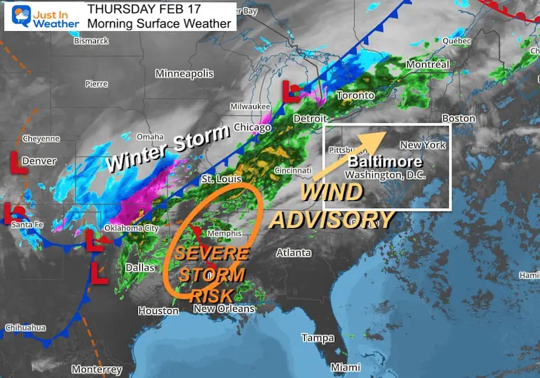
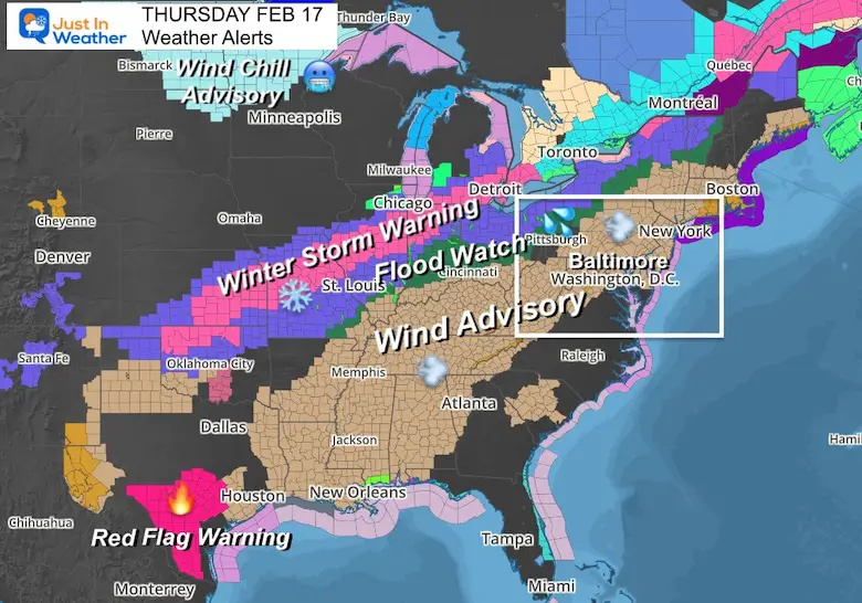
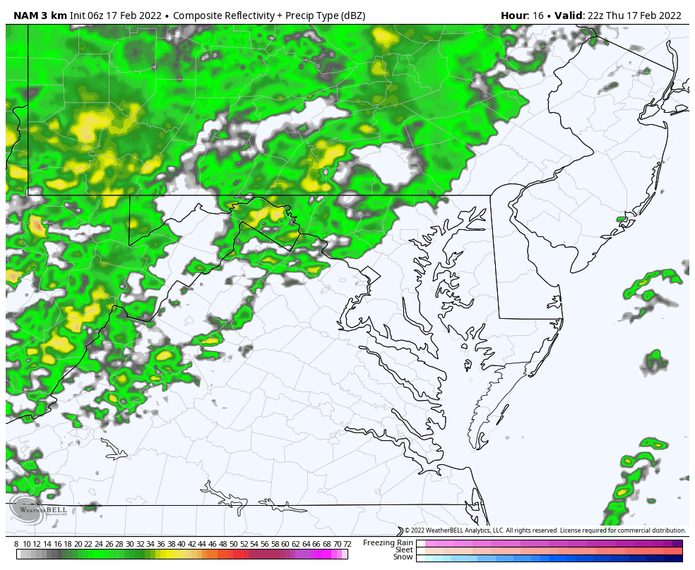
A large winter storm dominated the middle of the nation today. Snow is exiting Denver and will be expanding through Chicago. Flights will be impacted with a large area of severe weather alerts. This includes a long, but narrow band of Winter Storm Warnings, but a larger region of Wind Advisories.
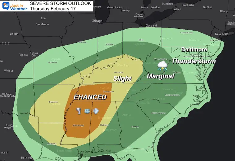
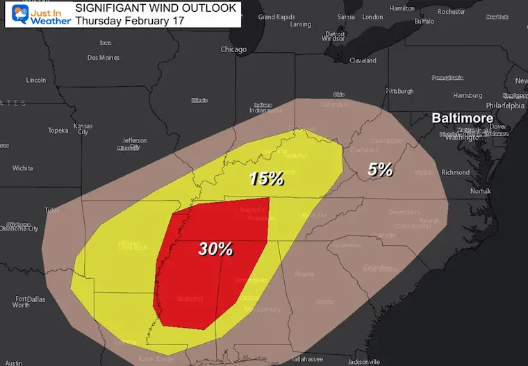
The big concern will be the Severe Storm Outlook in the Deep South with the risk of tornados, large hail, and damaging wind.
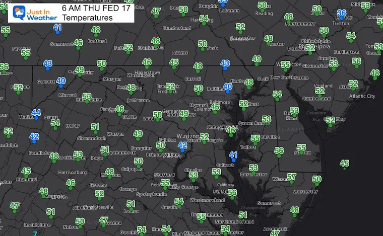
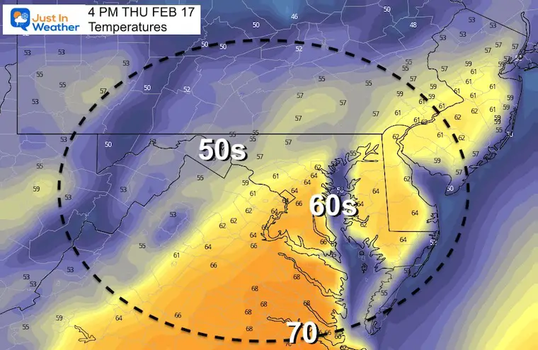
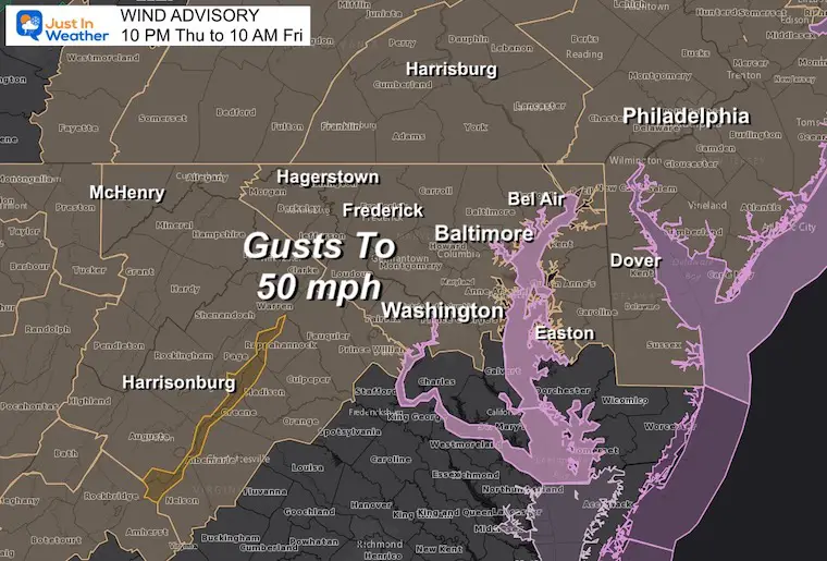
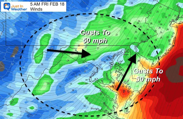
Here in the Mid Atlantic, we will have a breezy and warm day. Tonight a Wind Advisory kicks in with gusts to 50 mph and possible thunder before dawn Friday.
Extended Outlook: Another Arctic blast is possible by the end of the month.
Headlines
Morning Set Up
This storm expands from New Mexico to the Canadian boarder. Snow will expand to the Great Lakes in the cold air, which severe storms will erupt in the South.
Mid Atlantic: Wind Advisory begins tonight.
Enhanced Risk: Most of Mississippi, Northern Alabama, and Western Tennessee. This has the highest chance for tornadoes, large hail, and damming winds.
Slight Risk: Shaded in Yellow, this area may still get in on the severe storms, but the risk is lower.
Marginal Risk: This area shaded is green has the lowest risk in the severe zone due to timing of the event too late in the day, or closer to the cooler temps on the north side that don’t fully support the storms.
Thunderstorms: Baltimore and all of Maryland into Southern PA and Delaware are included with the chance for rumbles of thunder. This would be the remnants of the storms that fade overnight. A cold front will arrive before sunrise.
These are the odds and any particular storm will produce a funnel cloud that touches the ground. This will be highest in the Enhanced Outlook Region.
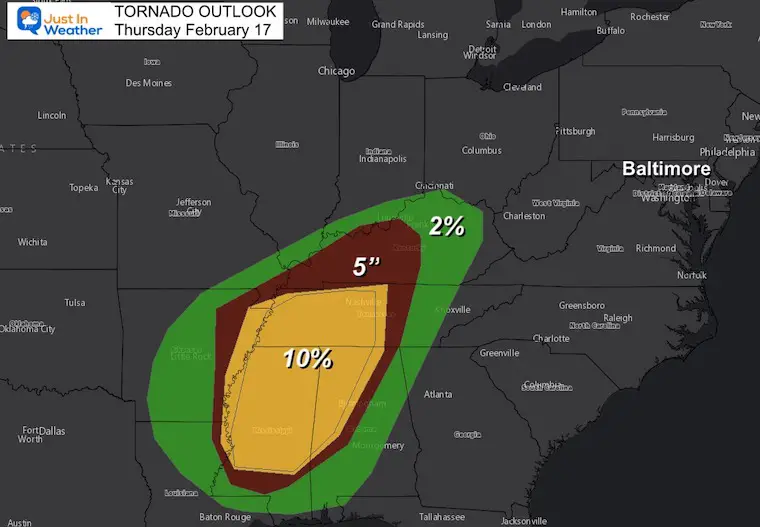
This is for the chances of damaging winds over 60 mph.
Local Storm Maps Below
TODAY February 17
Seasonal Snow: 14”;
+0.5” ABOVE AVERAGE
Normal Low in Baltimore: 27ºF
Record +3ºF in 1958
Normal High in Baltimore: 45ºF
Record 76ºF 1976
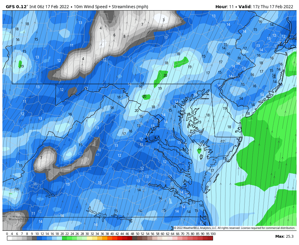
12 PM Thu to 12 PM Fri
This may help explain the volatile weather.
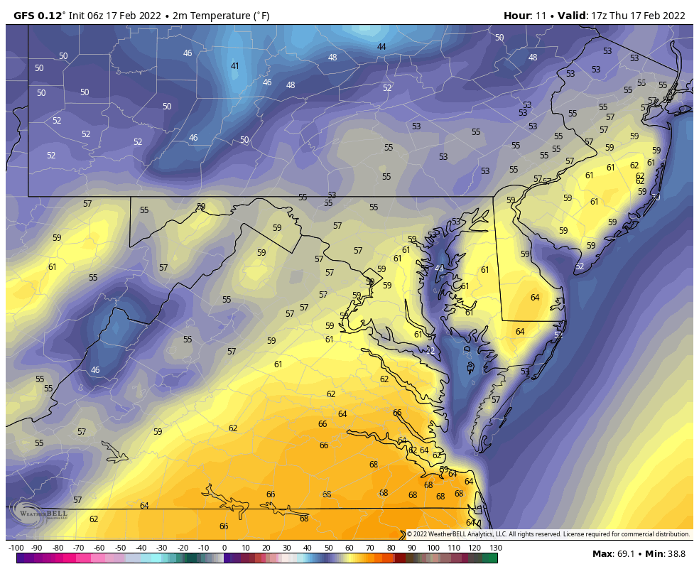
One more surge of warm air ahead of the cold front early morning.
This begins at 10 PM Tonight….
Gusts will reach 50 mph: Secure trash cans and outdoor furniture. Branches may break and some power outages possible.
12 PM Thu to 12 PM Fri
This is the main line that may produce rumbles of thunder.
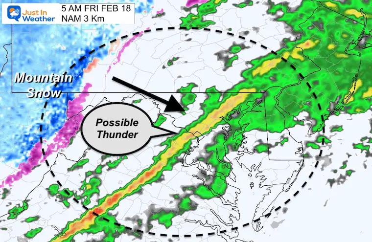
5 PM Thu to 10 AM Fri
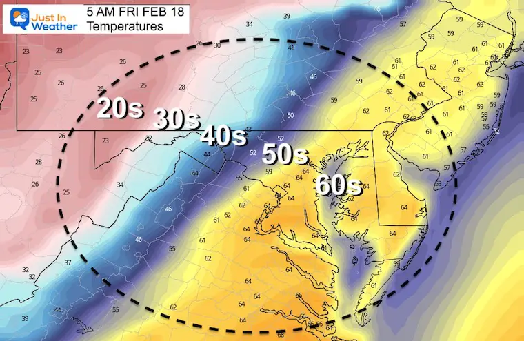
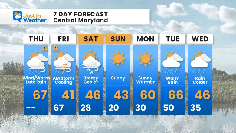
It will be chilly this weekend, then warm again next week.
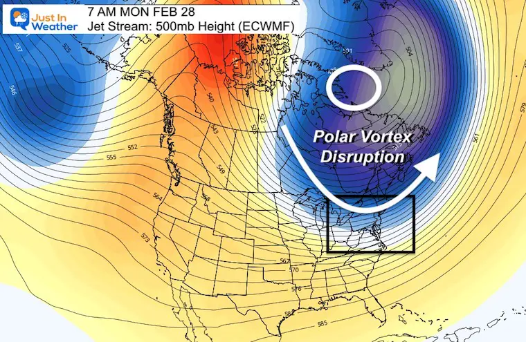
Winter is NOT DONE yet! Usually when there is an early warming, it will be balanced by a deep trough fighting back.
The long range outlook on a global scale shows a Polar Vortex Disruption at the end of the month. There is potential but not a promise for more winter weather. #FITF
The high temps Friday will be before sunrise, then falling to the 40s by noon.
The weekend will be chilly, then warming next week.
We are NOT DONE WITH WINTER YET!


Last Winter Recap: My Old Outlook And Your Grades Of My Storm Forecasts


*Disclaimer due to frequent questions:
I am aware there are some spelling and grammar typos. I have made a few public statements over the years, but if you are new here you may have missed it:
I have dyslexia, and found out at my second year at Cornell. I didn’t stop me from getting my meteorology degree, and being first to get the AMS CBM in the Baltimore/Washington region.
I do miss my mistakes in my own proofreading. The autocorrect spell check on my computer sometimes does an injustice to make it worse.
All of the maps and information are accurate. The ‘wordy’ stuff can get sticky.
There is no editor that can check my work when I need it and have it ready to send out in a newsworthy timeline.
I accept this and perhaps proves what you read is really from me…
It’s part of my charm.
#FITF