


April 24 Weather: Some Showers Then Another Push Of Cold Air Followed By Summer Heat Sunday
Wednesday, April 24 Morning Report A milder start today with most areas in the 50s to near 60ºF along parts of the Bay. There is a push of colder air…
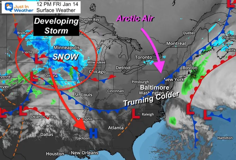
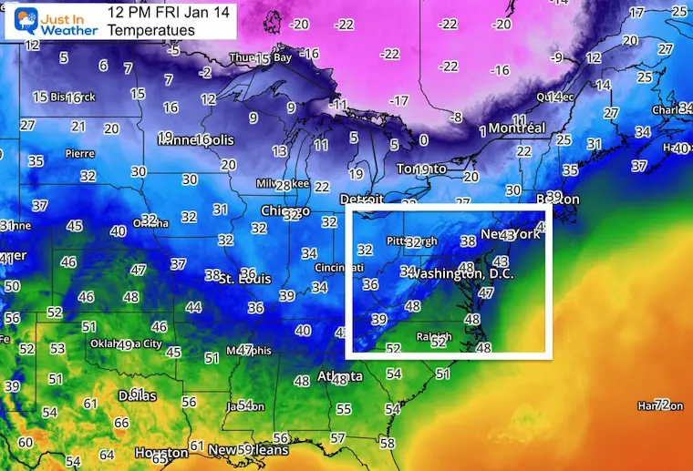
Friday January 14 2022
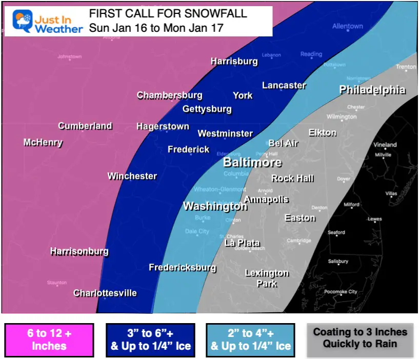
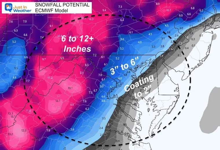
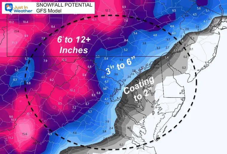
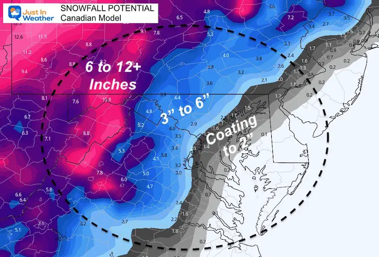
As the storm takes form in the Northern Plains States, and we are within 2 days of the storm for our region, I am ready to present my First Call For Snowfall. There is a lot of confidence that the arrival will be snow, and it will come down heavy in a hurry.
If you have plans Sunday afternoon and evening, this is time to think again. We will have a large impact event.
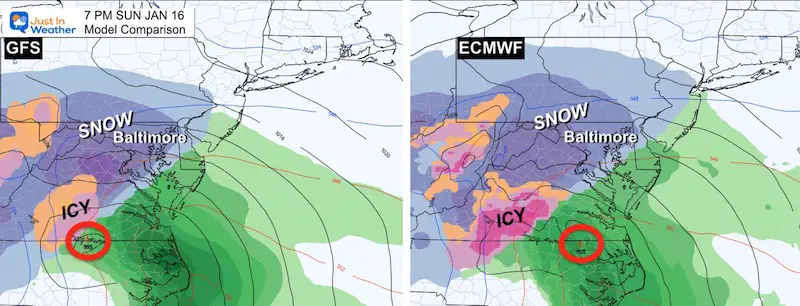
There will be a transition to sleet and freezing rain in most urban areas and around the Chesapeake Bay. Farther west, this will remain snow in the mountains, where double digit totals will be seen.
I still expect some wiggle room for tracking the transition time and locations. But the overall impact will include the wintry start, ice on snow for many, and strong winds gusting to 50 mph on Monday.
More on the details coming up. This report is about the onset time and snow.
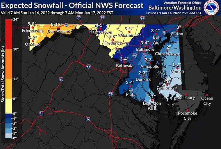
Winter Storm Warning is up for the areas that expect mostly or all snow.
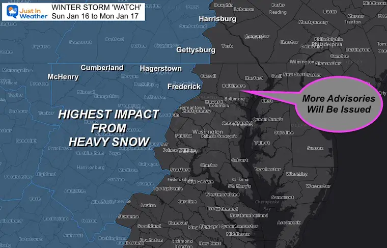
More Advisories will be issued for the rest of the region soon.
NAM 3Km Noon to 7 PM Sunday


There will be a tight gradient of snow totals based on when the warm air comes in with the easterly winds.
The transition will be from the south and east…
Given the arctic air in place ahead of the storm, there may be extensive icing in the areas in blue, especially in dark blue. Up to 1/4″ of ice on top of the snow is possible. Ice can linger longer than model suggest, so the timing will be refined as we get closer.
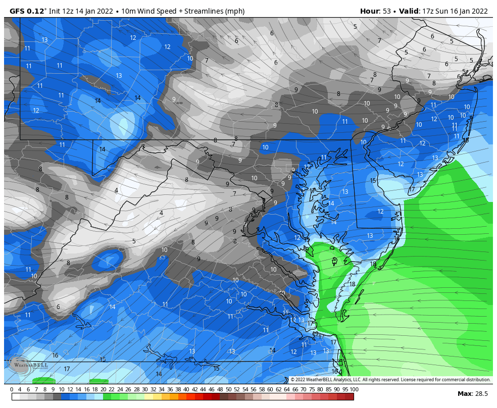
The strong storm will have a lot of wind pulling in warmer air off of the Atlantic to mix over snow to ice and rain east of the mountains. Then the winds will switch to the west behind the storm on Monday.
Peak gusts will be higher than the steady wind forecast shown here.
Click here to view all offices with maps of the range of expectations.
More advisories will be issued shortly
Highest Impact Zones With Most Snow
These are areas most likely to get OVER 6 inches of snow. The places that stay all snow in the mountains will get over 12 inches of snow.
This will be upgraded to a WARNING when within 24 hours of the start.
Many more areas will still get advisories issued for lower snow, and even wind impacts as we get closer.
Faith in the Flakes.
Also See:
Click for The Full Morning Report


Last Winter Recap: My Old Outlook And Your Grades Of My Storm Forecasts


