


April 19 Showers Later Today Then Strong Winds Usher In Colder Air Tomorrow
Friday April 19 Morning Report The pattern is about to change. The sunny and mild days we have had will be replaced with a colder-than-average outlook into next week. This…
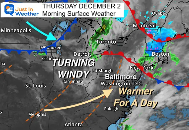
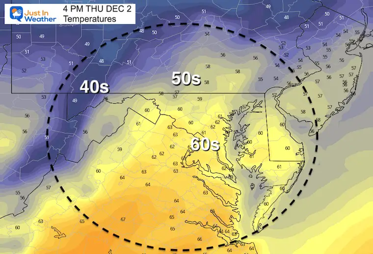
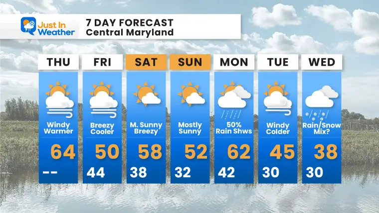
Thursday December 2
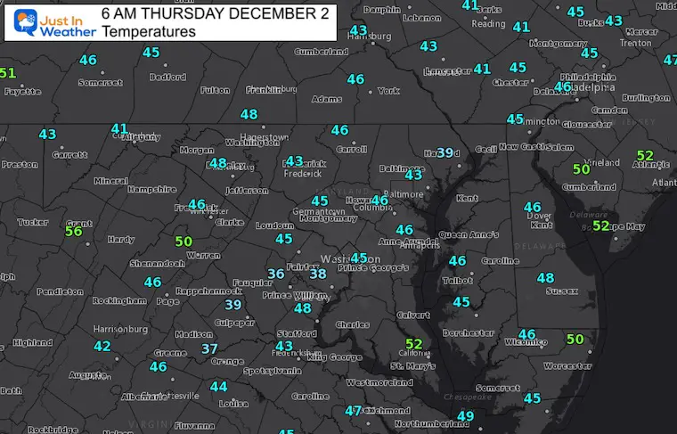
The fast moving weather cycle is bringing those winds to the surface. After a cold pattern for the past two weeks, we get a warm up today, but it will come with strong winds.
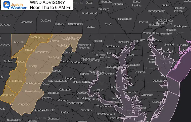
Gusts in the mountains will push the threshold for some damage, and a advisory has been issued.
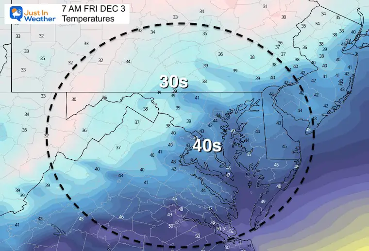
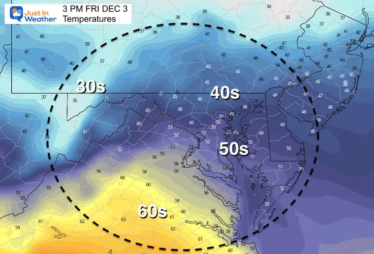
We settle back this weekend with temps remaining a little warmer than average. Then more bumps in the road next week including another warm day and a possible wintry mix.
Strong winds will help to warm us up today as they roll over the mountains.
The strongest winds will be on the west facing slopes west of Frederick.
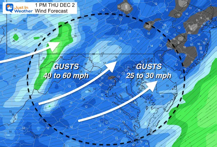
Includes Hagerstown, Cumberland, and McHenry
Normal Low in Baltimore: 32ºF
Record 9ºF in 1967
Normal High in Baltimore: 50ºF
Record 72ºF 1970
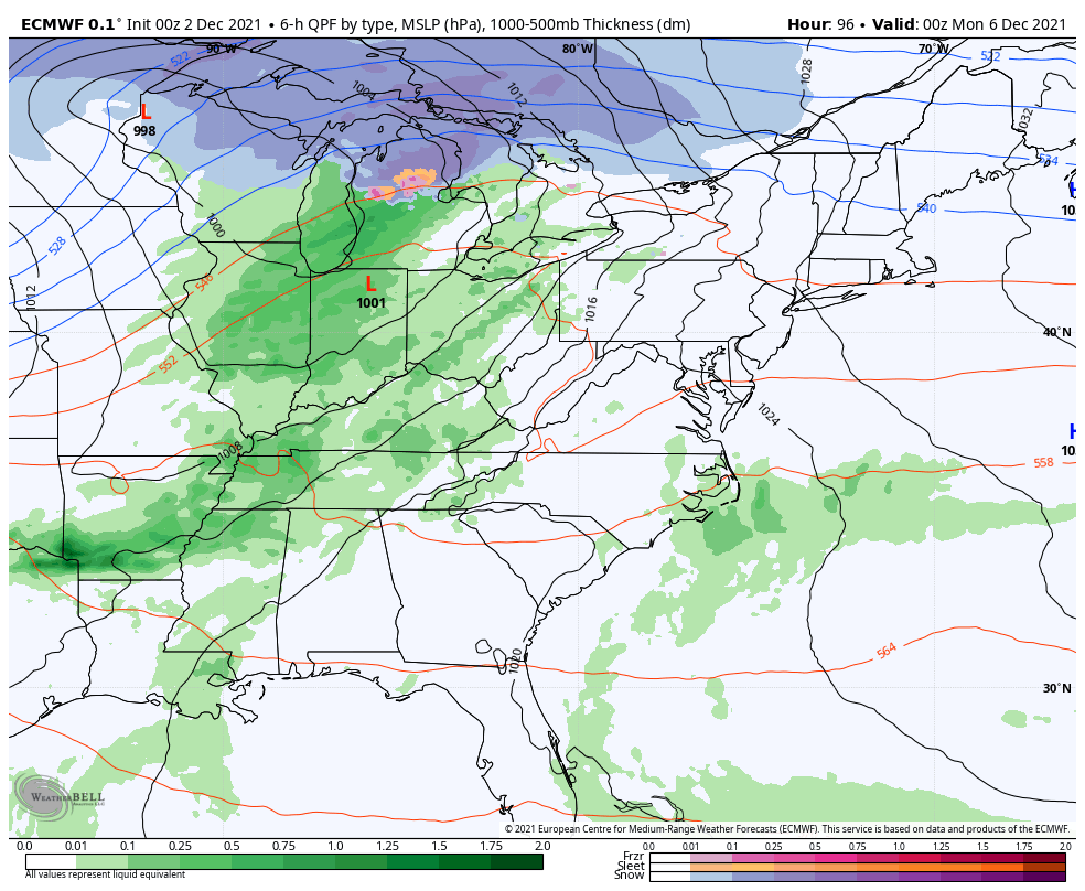
Animation Sunday Evening To Wednesday Evening
I want to be clear with my thoughts: Model guidance has been POOR for storm systems one week away. I have refrained from showing systems until within 5 days recently.
I am showing this as we are now officially in winter season, and want to follow along with you.
Here the European Model is showing showers Sunday night, then a larger storm systems on Wednesday with a track farther south.
Will there be enough cold air?
As of now, the snow line is close, but well NORTHWEST. I have seen systems track faster AND south of initial calls. If that is the case, the adjusted outlook could become interesting. I am leaving that vague for now, but will continue to show this for reference to prove this is NOT the final solution, but we can see the trend in some direction.


Last Winter Recap: My Old Outlook And Your Grades Of My Storm Forecasts


