


April 24 Weather: Some Showers Then Another Push Of Cold Air Followed By Summer Heat Sunday
Wednesday, April 24 Morning Report A milder start today with most areas in the 50s to near 60ºF along parts of the Bay. There is a push of colder air…
Wednesday June 26 2019
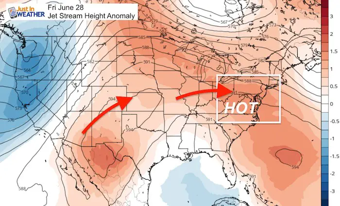
If you were wondering where summer has been, I think we’ve got the answer. We’ve already hit the 90s and three days in a row in that mark qualifies a heat wave. The ling readings outlook shows a ridge in the jet stream that will bring us the 90s through next week. There is strong support that the humidity will not be too bad in the short term, but the high heat and uncomfortable temperatures will be next week in time for the holiday.
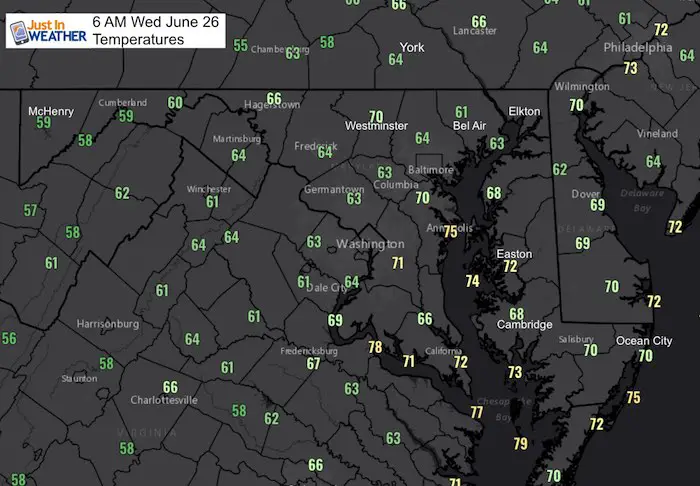
Morning Temperatures
Kids Trek Too!
Bring Your Kids To Join My Team This Summer
Click the logo for more information
![]()
Average High: 86ºF
Record High: 99ºF in 1954
Average Low: 65ºF
Record Low: 52ºF in 1986
Sunrise: 5:41 AM
Sunset 8:37 PM
*Daylight = 0:16 shorter than yesterday
*Bay Water Temperature = 77ºF at Thomas Pt. Light House
Just in case you don’t get all posts on your social media feed, stay up to date with the latest info…
Click here to sign up for email alerts…. Be the first to hear any new weather.
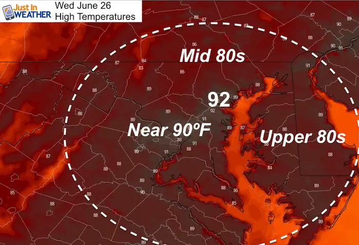
High Temperatures Today
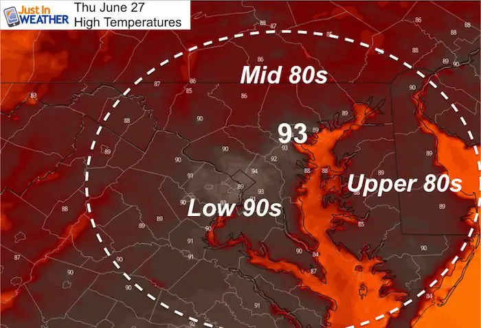
High Temperatures Thursday
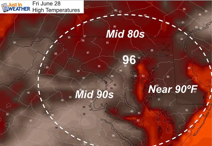
High Temperatures Friday
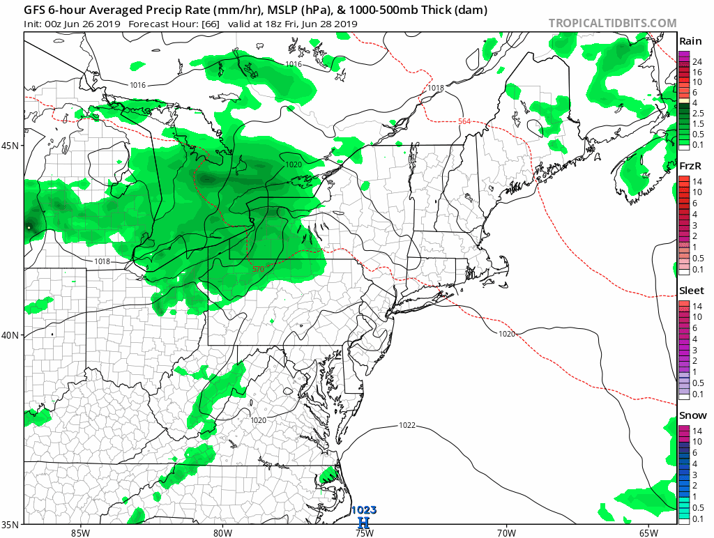
Weekend Thundershowers
Join My Team: Maryland Trek 6
Our look got an upgrade, but we have the same purpose. Please click the logo take a look at our new page.

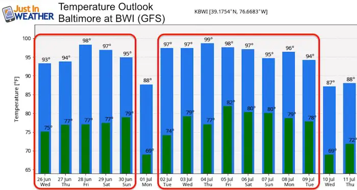
Temperature Outlooks
The GFS Model is most aggressive with the heat this week and lock us in the upper 90s next week. Compare to the Euro below.
Note the cool down early next week, then a stronger surge of heat next week.
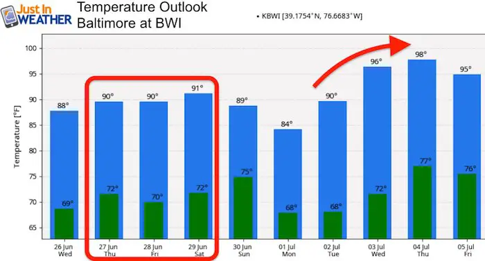
Euro Outlook
This model holds us in the lower 90s for this phase, and gives us a cooler weekend. But next week it agrees with the GFS to bring us the upper 90s.
Support Our Nonprofit:
Proceeds go to our programs Providing FREE holistic care for kids in cancer treatment and up to 5 years post treatment and caregivers.
![]()
Shine On
Proceeds from all sales go to Just In Power Kids. Click the image to shop and show your support.

Love Maryland Shirts and Hoodies
This shirt was designed by my ‘bonus’ daughter Jaiden. The hoodie has been the biggest hit, so our promotion has been extended until the end of this week.
|
||
|
Show your love for Maryland and make this 14 year old artist and her mom extra proud
|
Please share your thoughts, best weather pics/video, or just keep in touch via social media
Related Links:
Was Your County Not Included?
Click this map for more on the regional forecast zones
