


April 19 Showers Later Today Then Strong Winds Usher In Colder Air Tomorrow
Friday April 19 Morning Report The pattern is about to change. The sunny and mild days we have had will be replaced with a colder-than-average outlook into next week. This…
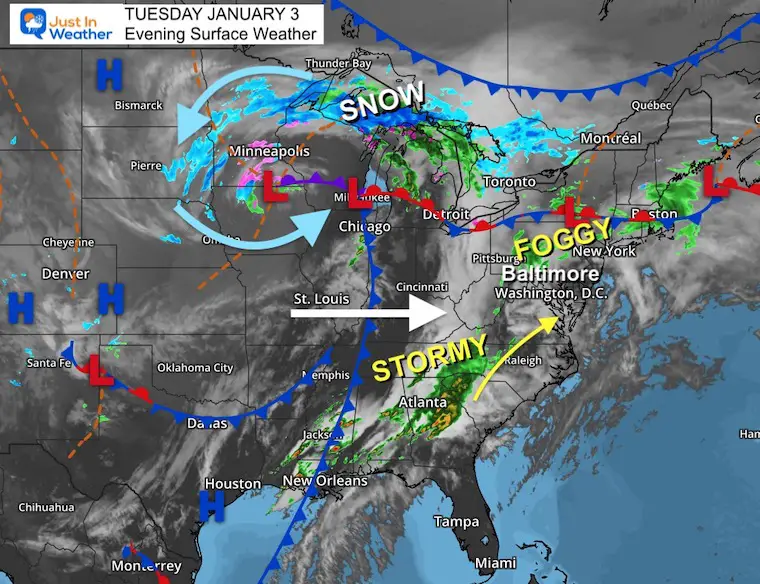
Tuesday Evening January 3, 2023
Big changes are underway for the week ahead. Often in winter when we have a surge of warm air, it is accompanied by some severe weather and will be followed by a strong return to cold air. We may see that underway over the next 5 days.
I must repeat the Winter Weather Folklore I’ve been sharing for the past week. I will continue to remind us again for posterity: “If in winter there is thunder, snow may fall in one week or under”. It is somewhat common to have extremes in winter where it may seem like we have out of control warmth or warm storms, followed by a return to reality quickly.
Baltimore set a new record high temperature today at BWI reaching 70ºF at 5:20 PM. The preliminary report was published earlier timing the mark of 68ºF set in 2000. The final reset should reflect the higher number. Note: In a prior report I mentioned this year with record high temps, followed by two record snowfalls in the last 10 days of January. FITF!
Just one year ago today, Baltimore started a busy winter season with a record 6.8 inches of snow. This may seem far fetched now, but the winter season will work to return this week. It is important to keep in mind that the mention of snow falling is not a promise for stickage or accumulation, especially after a few warm days in the 60s.
Locally today, where it rained there is fog forming. A Dense Fog Advisory has already been issued for Southern Pennsylvania and this may be expanded to affect the commute Wednesday morning.
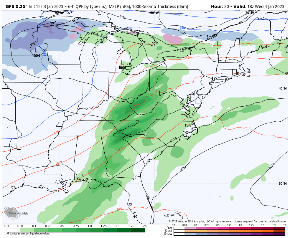
That large storm in the Great Lakes has locked up snow and cold air to the north from Michigan’s Upper Peninsula to Minnesota. The trailing cold front across the Mississippi River Valley had ignited a long line of thunderstorms and severe weather from Tennessee to Georgia and Alabama. It has faded a bit this evening, but will carry some of that energy with it tomorrow as it reaches the Mid Atlantic.
This is the line we will watch for showers on Wednesday that may bring in some rumbles of thunder into Maryland.
Here we see a band of rain and possibly some thunderstorms with the cold front moving through mid to late afternoon. It will be out of here by the evening.
This model has been running slow, so the arrival time could be earlier. Let’s safely call it an afternoon event.
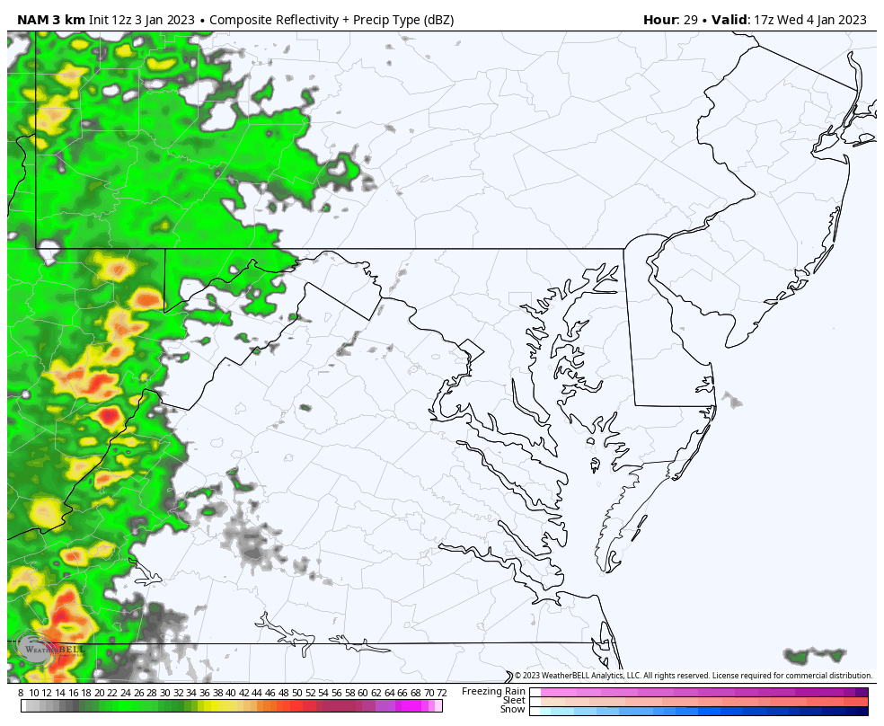
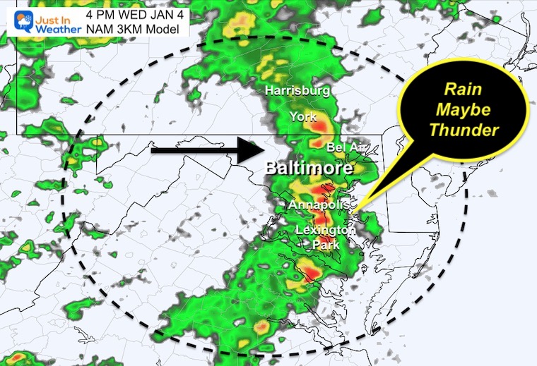
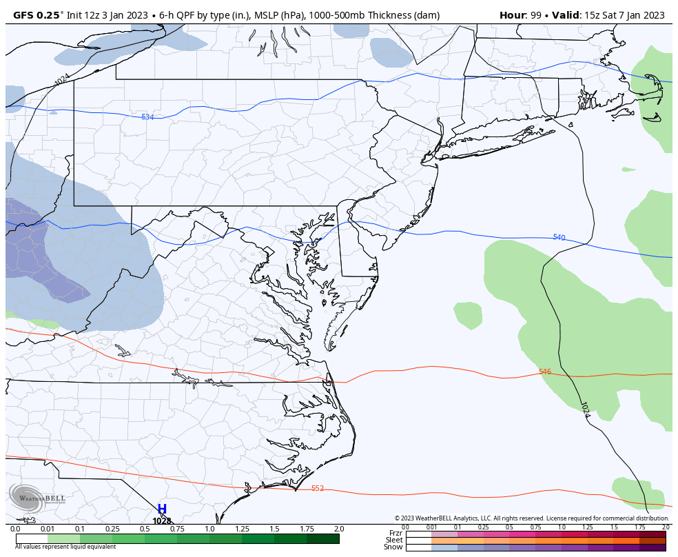
Here we see the potential line of moderate to heavy rain with some thunder. Given the prior model error, we should consider this to move through as early as 2 PM, or up to 2 hours faster than shown here.
Storm Simulation 1 PM Wed Jan 3 to 7 PM Sat Jan 7
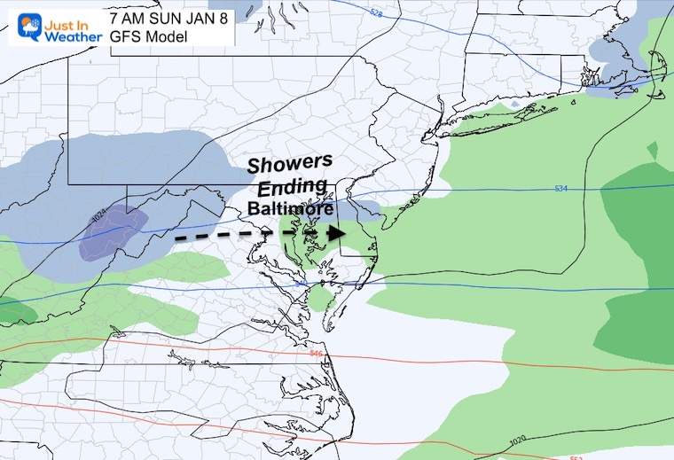
After the cold front, we still may have some spotty showers later on Thursday, then watch a short wave develop in the Mid West and ride along the fast jet stream.
I’ve been showing ‘something’ in the atmosphere trying over the weekend, but the modeling has had trouble putting the ingredients together. What was earlier shown to be a Friday event, now looks like to be Saturday.
Note that these are model suggestions, but we have seen a validation a little earlier. So the actual timing may appear to speed up as we get closer…
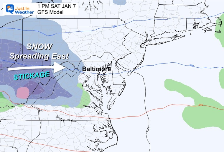
The snow moving into the mountains will be a travel issue. It will produce accumulating snow for the ski resorts…. Some slushy snow will reach metro areas by the afternoon.
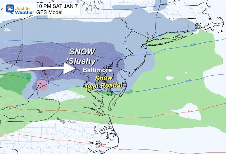
This appears to show a larger swath of steadier snow across central Maryland and metro areas. I’ve highlighted ‘Slushy’ north and “Wet Roads” south. This is based off forecast temperatures AND surfaces retaining warmth.
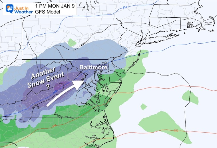
I want to share this Saturday night forecast to highlight the minimal cold air. This is not to say we can’t generate colder temps, But with marginal temps following a week with many days in the 60s, I think road stickage will be hard to come by.
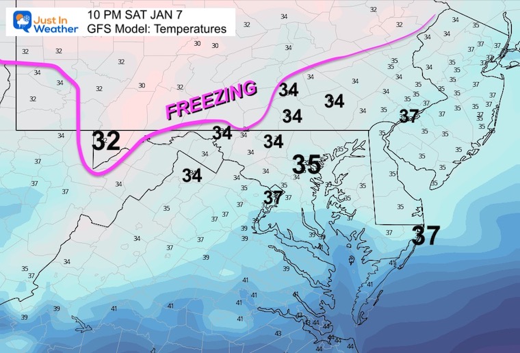
The caveat: Moderate to heavy snow can overtake warmer ground for a slushy accumulation. Also, snow falling at night has a better chance to stick, especially on the grass.
However, there may be an elevation event with locations above 1,500 Ft or 2,000 Ft that could get stickage compared to valleys below.
10 AM Sat to 7 PM Mon
I do not want to put too much weight into this yet, but we see an active jet stream trying to push out a second system. I am only showing for posterity. If this continues to show up on tomorrow’s run, we can give it more respect.
January 5 to January 10
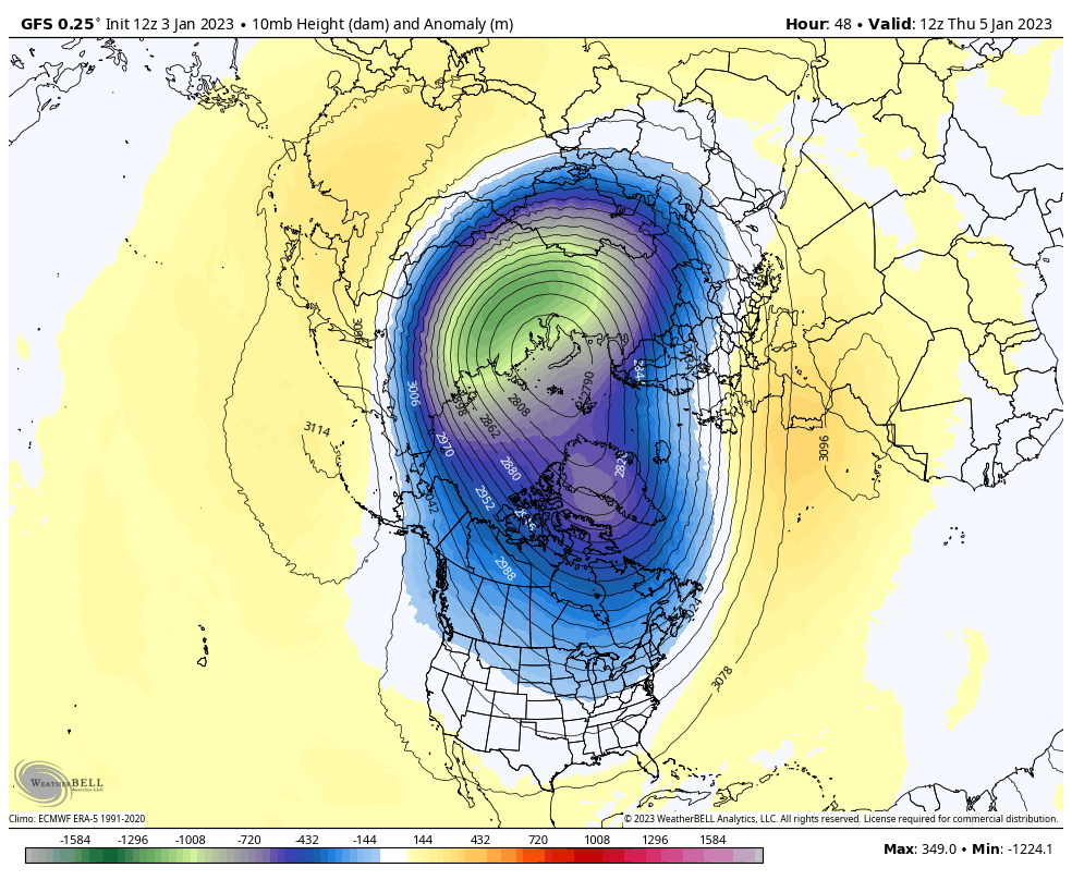
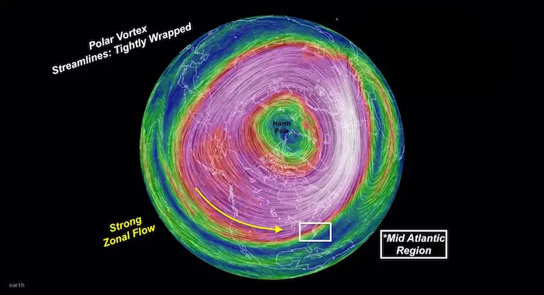
The Polar Vortex will remain around the Arctic Circle, but the cold air will get elongated and stretch into the eastern US. This is the blimp of colder air we expect to build in early next week. It has been trending colder!
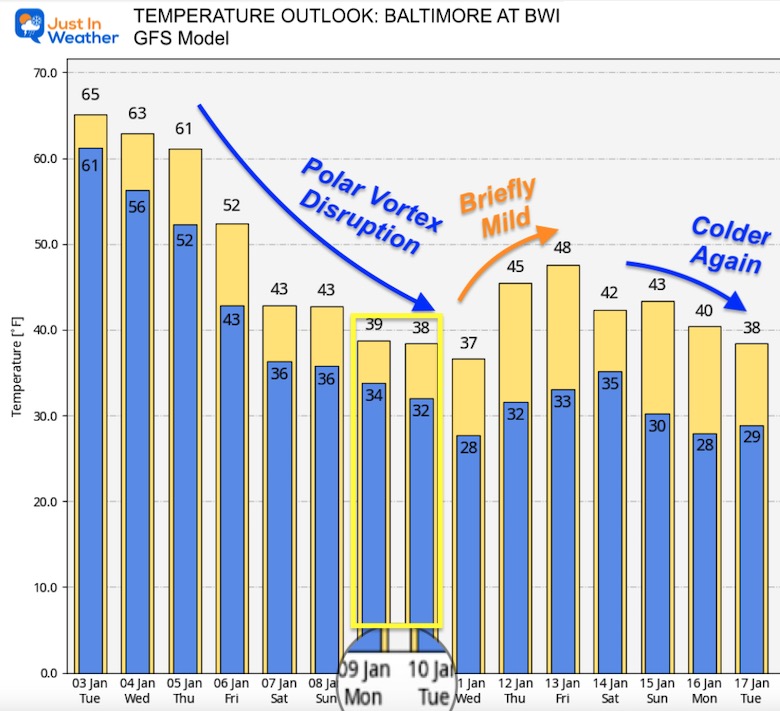
These are numbers for Baltimore at BWI. Inland suburbs will be colder than this… and on the border of the freezing. Looking at these marginal temps, it is easy to suggest that urban areas will not get road stickage with the proposed snow events. We will still need to watch inland.
I’ve highlighted the second snow event Monday into Tuesday with highs in the upper 30s and lows near freezing. This is a case where inland areas need to be watched for more likely impact on roads.
The Polar Vortex Disruption next week has trended colder than what we saw yesterday. I also want to point out that a brief warm up will be followed by a more seasonal cold trend, mid to later part of the month.
Explore More: I explain the stable circulation now and disruption forecast by mid January. Compare to 3 recent winters that were similar: Record warmth was followed by record snow. Click here or the image below to see more.

December 5th Snow In Baltimore And The Start Of Faith In The Flakes FITF

Click to see more and ‘Book’ a visit to your school

I see many factors to support colder influence with multiple systems. Early and later in winter. Check it out.
Winter Outlook 2023 For Snow Not Typical La Niña Plus Polar Vortex Disruption
Atmospheric Memory Suggests Active Winter Storm Pattern Outlook
Winter Outlook 2023 From NOAA Very Different Than Farmers Almanacs
Winter Outlook 2023 Early Look At Snow From Two Farmers Almanacs
If you want a snowy winter, this is what you might want to look for in the rest of the tropical season. (You might be seeing a lot of commercial snow removal people out this Winter).
Record August For No Named Tropical Storms: Closer Look At Snow Following
Winter Weather Folklore Top 20 And More Outlook Signals From Nature For Cold And Snow
