December 27, 2021
The NOAA Storm Prediction Center has updated the Severe Storm Outlook for today’s event in the Deep South. This has expanded the potential risk for a larger area.
I want to note I am writing this from the Mid Atlantic region, and this is not our storm. However it may become destructing and headline news for another nighttime event. Plus some of that energy will feed into the rain we will get tonight as well.
We can’t rule out some rumbling thunder.
Below is a look at the Outlook Maps for severe weather parameters AND a look at the HRRR Model radar simulation for the Deep South and Mid Atlantic.
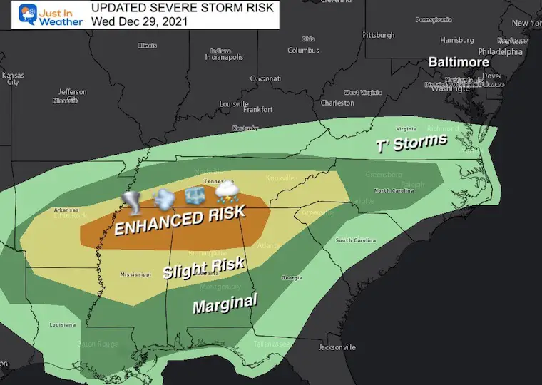
Severe Storm Outlook- Updated
The Enhanced Risk is a ranking of 3 out of 5. It does not promise severe storms for the entire region, but the likelihood is increased.
This includes: Eastern Arkansas, northern Mississippi, Alabama, and Georgia, plus central Tennessee.
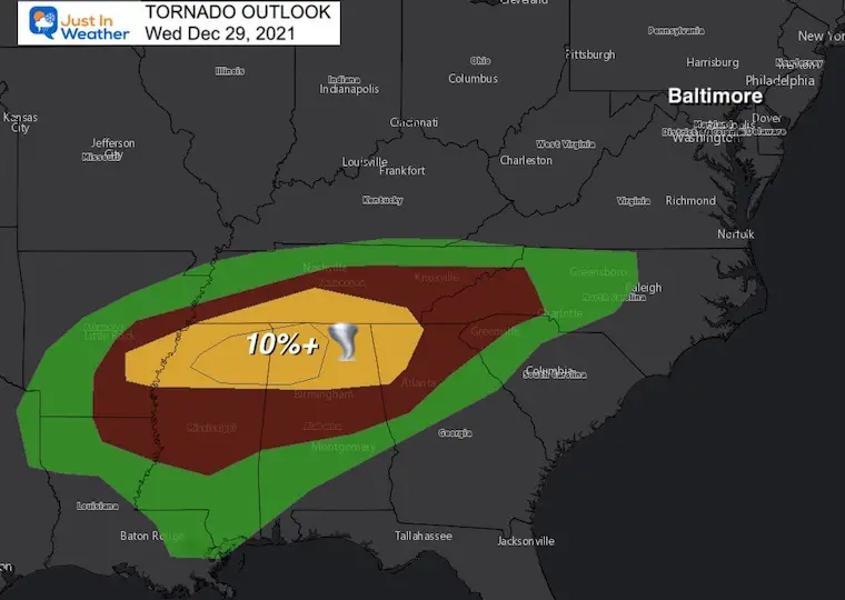
Tornado Outlook
Highest Chance: Huntsville, AL…Chattanooga, TN…Decatur, AL…Southaven, MS…Collierville, TN..
Also Included:
Memphis, TN…Atlanta, GA…Birmingham, AL…Jackson, MS…Knoxville, TN…Charlotte, NC…Nashville, TN…New Orleans, LA…Greensboro, NC…Durham, NC…

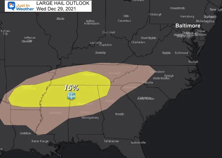
Large Hail:
Over 1 inch in diameter is considered severe and can cause damage.
Highest Chance: Memphis, TN…Birmingham, AL…Little Rock, AR…Huntsville, AL…Chattanooga, TN…
Damage Winds:
Over 58 mph is considered severe and can cause structural damage to homes, power lines, and trees.
This is the most likely form of storm damage.
Includes: Huntsville, AL…Chattanooga, TN…Decatur, AL…Madison, AL…Cleveland, TN… Memphis, TN…Atlanta, GA…Birmingham, AL…Little Rock, AR…Jackson, MS.. Charlotte, NC…Nashville, TN…New Orleans, LA…Raleigh, NC…Greensboro, NC…
Storm Experts Directory

Contractors: Sign Up
To be part of our growing team with credentials and qualified claims adjusters.
Our goal is to assure and support policy holders with storm damage claims
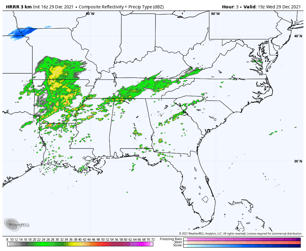
Radar Simulation:
3 PM Wednesday 5 AM Thursday
This afternoon the storms will fire in Arkansas, Mississippi, and Tennessee.
A second surge overnight is the concern in the dark 6 PM will enhance the front line and push into Alabama and Northern Georgia.
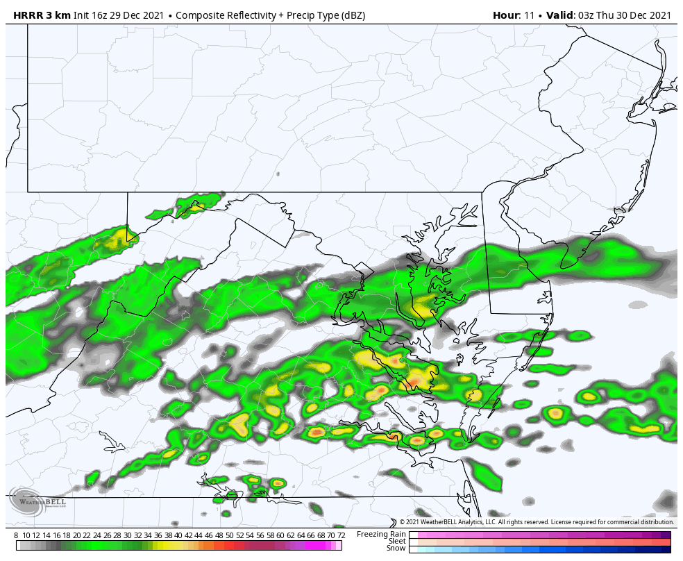
Local Radar Simulation
10 PM Wednesday to 5 AM Thursday
The push of rain into Virginia and Maryland will be tonight. Some heavier cells may produce downpours and rumbles of thunder around midnight. This is all residual energy from the southern severe storms that could transfer in the low level jet.
ALSO SEE
Winter Outlook Series:
My Call For Snowfall

Last Winter Recap: My Old Outlook And Your Grades Of My Storm Forecasts


Please share your thoughts, best weather pics/video, or just keep in touch via social media


