


April 24 Weather: Some Showers Then Another Push Of Cold Air Followed By Summer Heat Sunday
Wednesday, April 24 Morning Report A milder start today with most areas in the 50s to near 60ºF along parts of the Bay. There is a push of colder air…
October 1, 2022
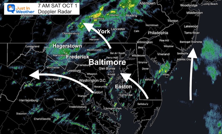
Saturday Morning Update
Post Tropical Storm Ian is located between the border of North Carolina and Virginia. It has transitioned to a Mid Latitude Low that is cut off from the jet stream. What that really means is this:
This is affecting the Mid-Atlantic to Southern New England.
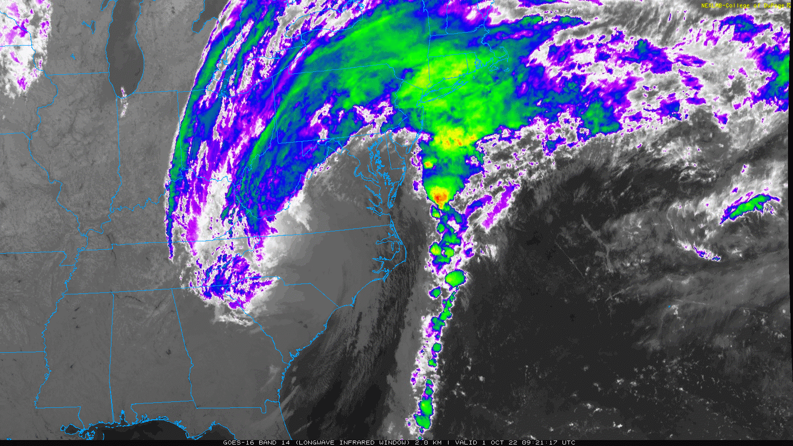
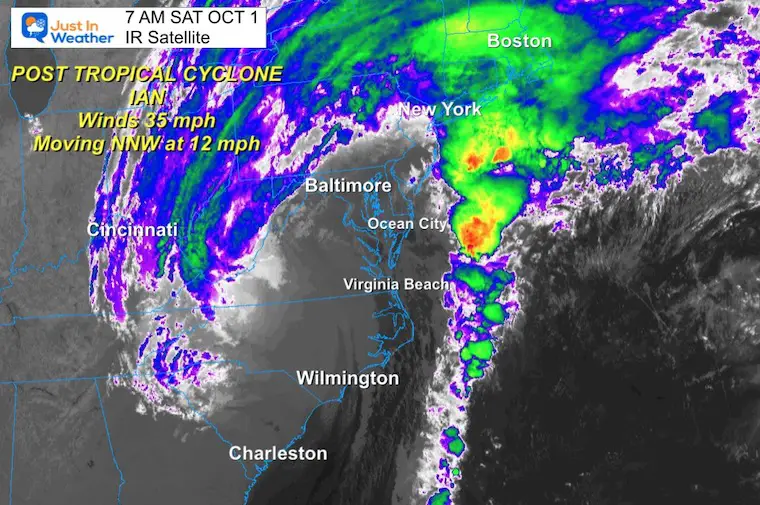
Post Tropical Cyclone Ian
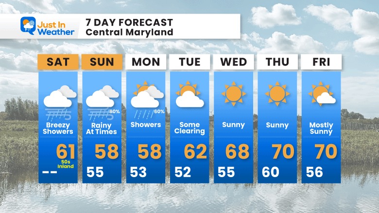
Quick Stats at 5 AM Saturday
Fort Myers Landfall Update: A person was in that floating house…
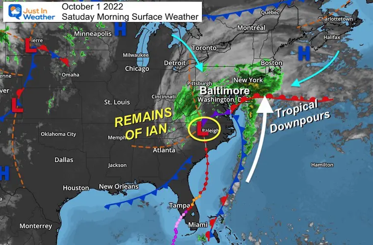
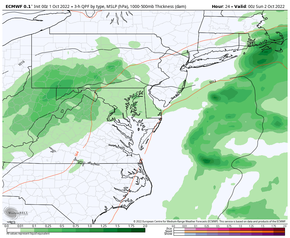
Low Pressure from what was once Ian will continue to spin out and keep the weather unsettled. Gusty winds will diminish as the day progresses while the heaviest rain is now streaming off the coast to metro New York.
This Low Pressure is being blocked by High Pressure to the North, which will prevent it from moving much… It will crawl east to the coast and redevelop over the next few days.
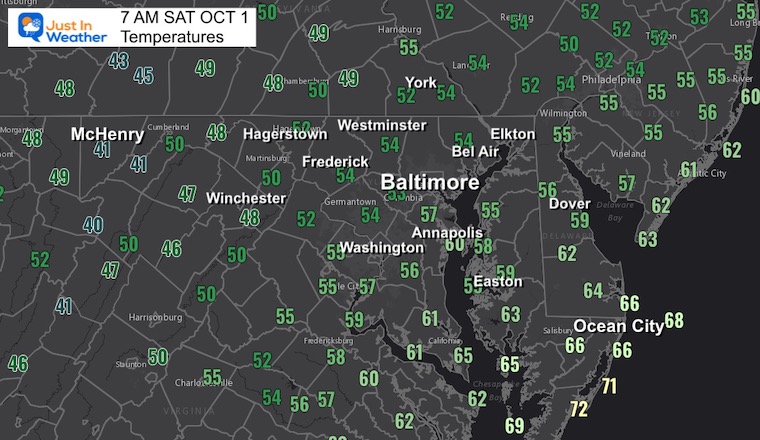
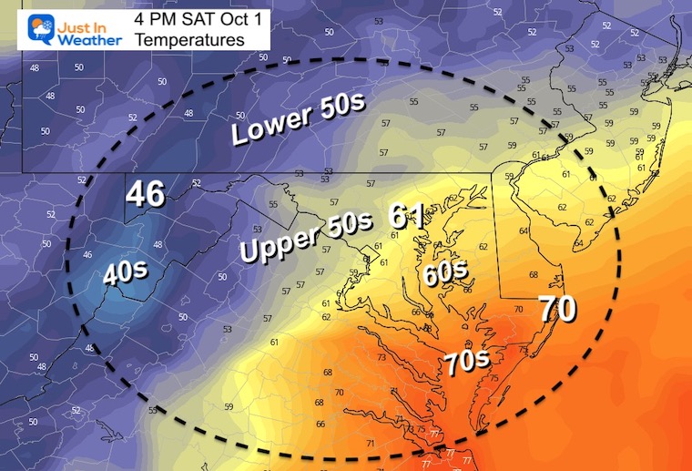
Look at the spread from lower 40s in the western Maryland mountains, most of the region in the 50s, then mid 60s to near 70ºF from Ocean City to coastal Virginia.
Rain is pivoting to the Northwest around the Ian Remnant Low, while rain along the coast is pushing North.
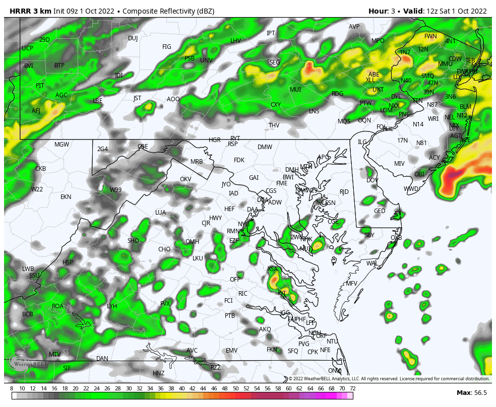
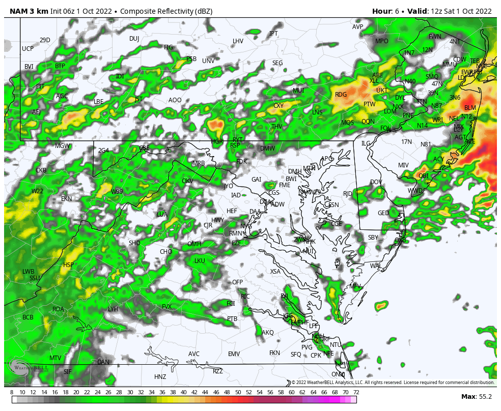
The good thing I see is agreement with the HRRR and NAM Models. They both continue to show the steady rain breaking up and holding together in the mountains.
Metro and coastal areas: Rain showers redevelop and linger through the day. We can’t spot specific times as the rain will be scattered on and off all day, with more numerous showers in the afternoon and evening. You might still get lucky with a few dry hours at your location.
HRRR Model
NAM 3 Km Model
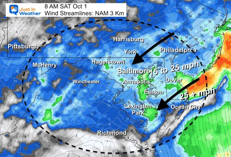
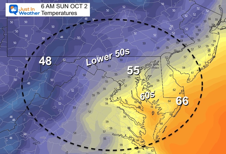
Chilly breeze this morning, but winds ease during the day.

4 PM – It will be a chilly day to kick off October.
Normal Low in Baltimore: 53ºF
Record 36ºF in 1947
Normal High in Baltimore: 74ºF
Record 91ºF 1941
ECWMF Model
Watch the upper level Low generate more showers, then organize off the coast by Monday and Tuesday… when it finally pulls away.
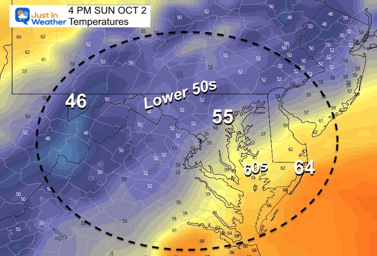
We remain unseasonably chilly until that storm moves away. Then the sun will warm us back close to 70ºF later in the work week.
Hurricane Ian May Help Cooler Pattern Change: Monitor For Atmospheric Memory This Winter
If you want a snowy winter, this is what you might want to look for in the rest of the tropical season.
Record August For No Named Tropical Storms: Closer Look At Snow Following
NOAA 2022 Hurricane Forecast- Above Normal Again

NOAA Study: Reducing Air Pollution INCREASED Tropical Storms

Atlantic Tropical History: Maps of Origin Regions Every 10 Days

Click to see more and ‘Book’ a visit to your school
