


April 19 Showers Later Today Then Strong Winds Usher In Colder Air Tomorrow
Friday April 19 Morning Report The pattern is about to change. The sunny and mild days we have had will be replaced with a colder-than-average outlook into next week. This…
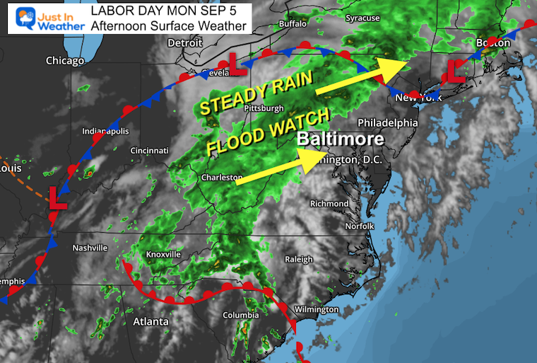
Monday Afternoon Update
September 5, 2022
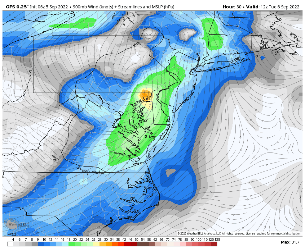
The slow-moving system continues to crawl to the east. The net result will be heavy rain for some areas, a few thunderstorms forming ahead of the main rain shield, and also some missing out of the much-needed drink for the lawns.
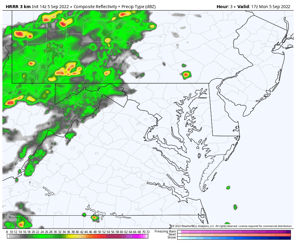
This update has two radars to compare to the live radar widget. I need to point out that the models have their flaws, but they do suggest that more rain will be northwest and west of Baltimore, while much less will fall to the south and east across Delmarva and towards the beaches.
We have had inconsistent rain over the last month, leaving some areas parched with brown lawns, while other areas have had flooding. Getting needed rainfall does not necessarily mean the heaviest or all at once. In fact, a light rain for many hours is the best thing for parched soil. This is because it needs time to prepare for absorbing the water.
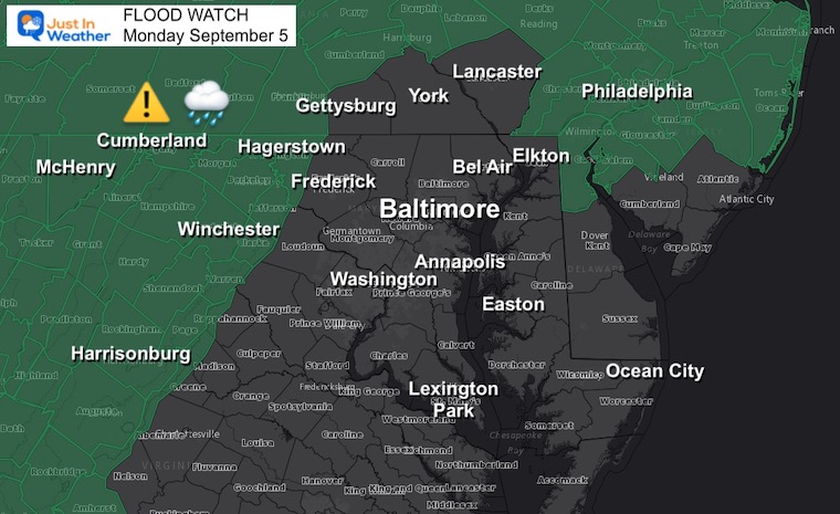
This was issued earlier and posted in my morning report. I still expect the watch to be expanded east to include southern PA and perhaps north central Maryland counties.
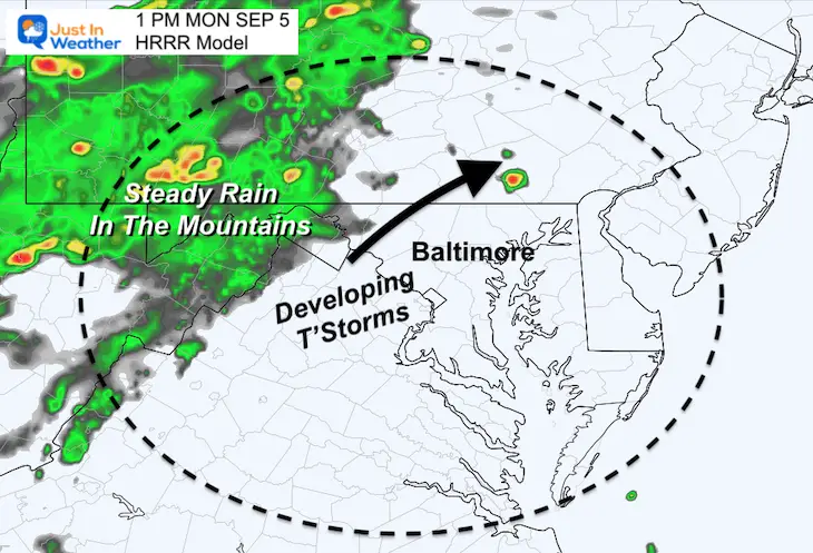
Note: The model bias has been slow and underplaying rain events. Please consider the rain may arrive 1 hour earlier and cover more areas than shown here.
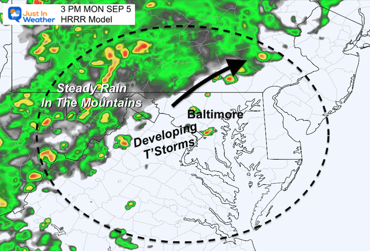
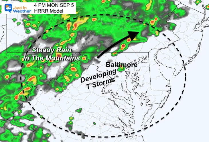
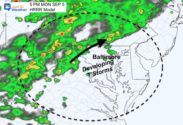
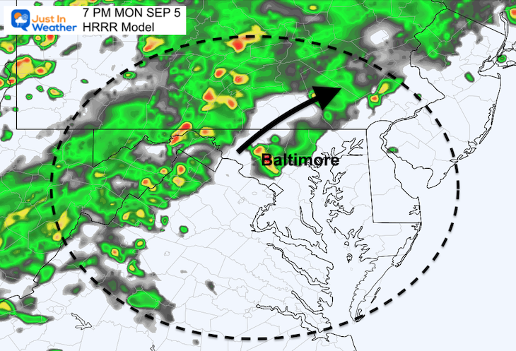
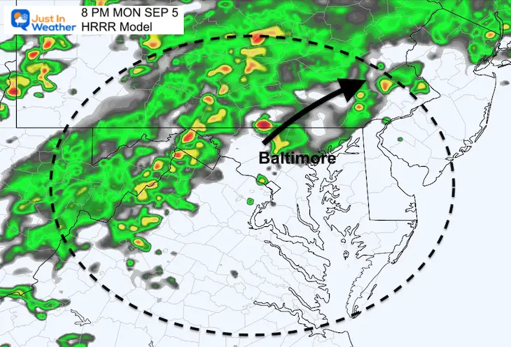
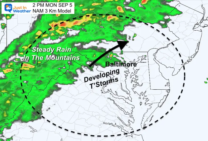
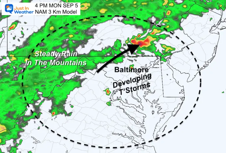
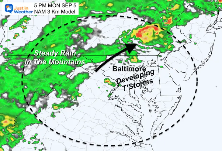
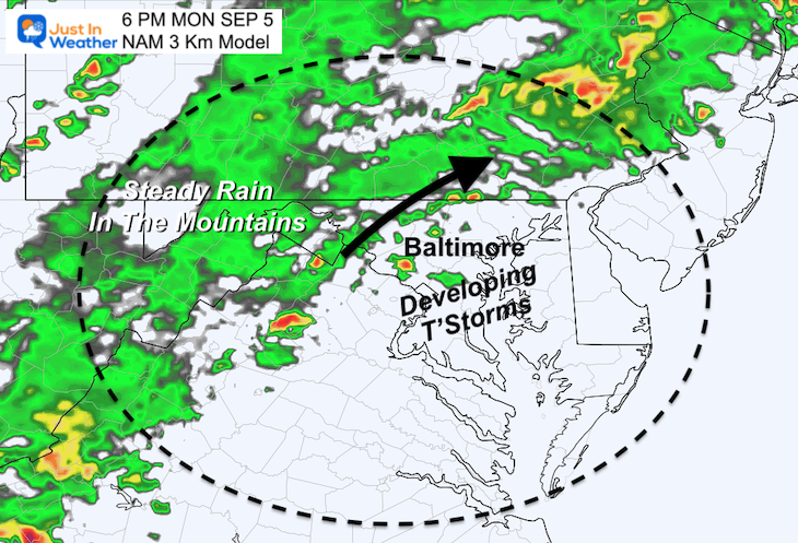
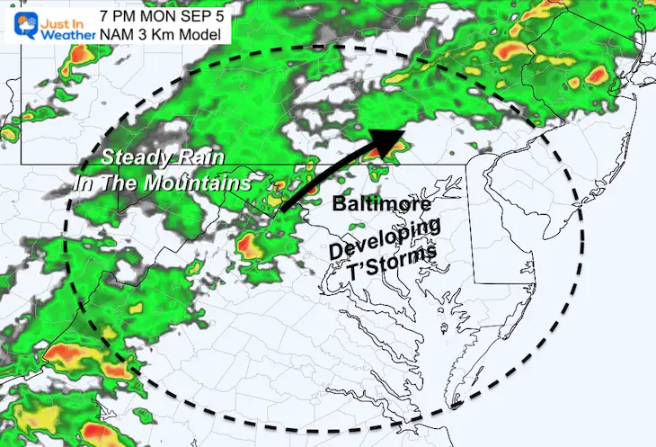
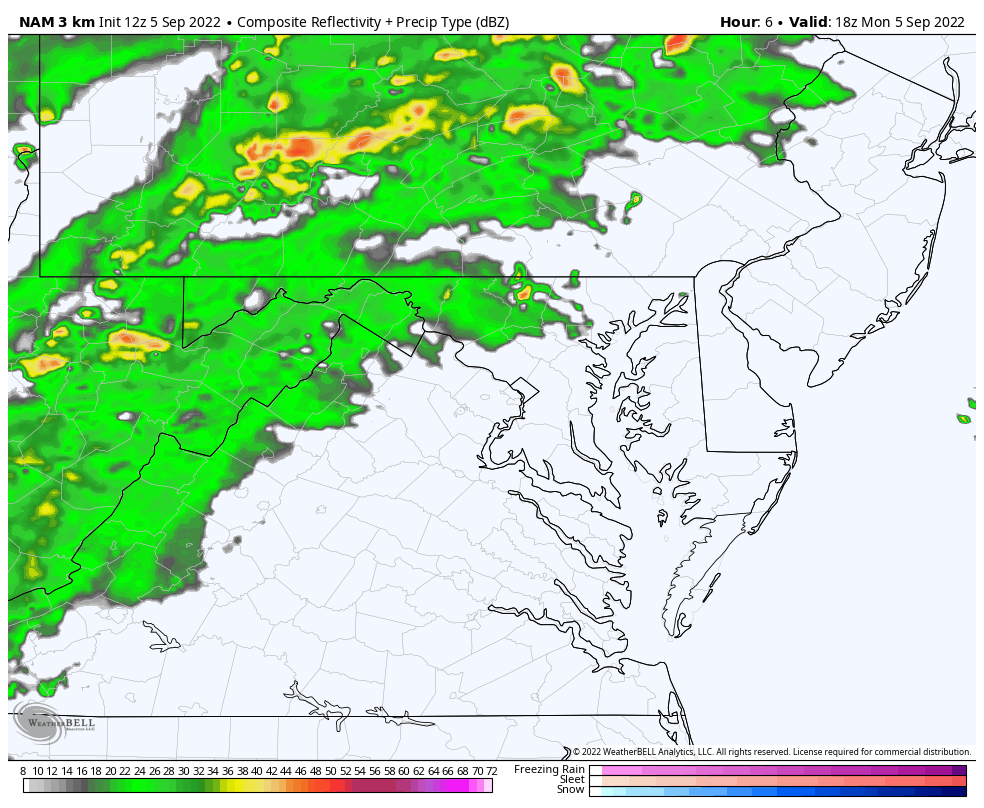
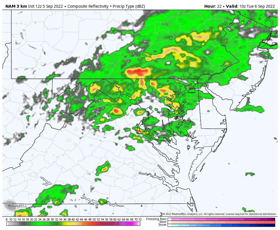
Here we see the rain remaining in the mountains, while pop up thunderstorms should begin to develop between 1 and 3 PM in central Maryland.
The movement of the cells will be to the Northeast, while the main shield of rain will be slow to move to the East.
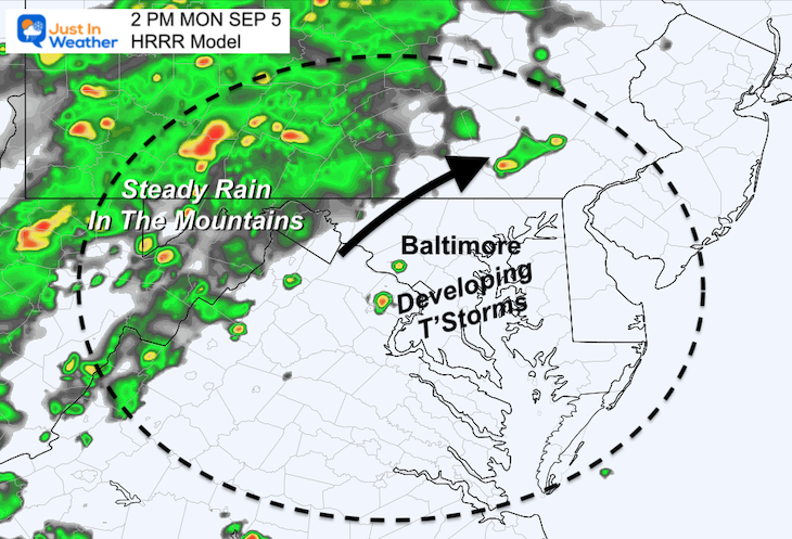

COMPARE TO
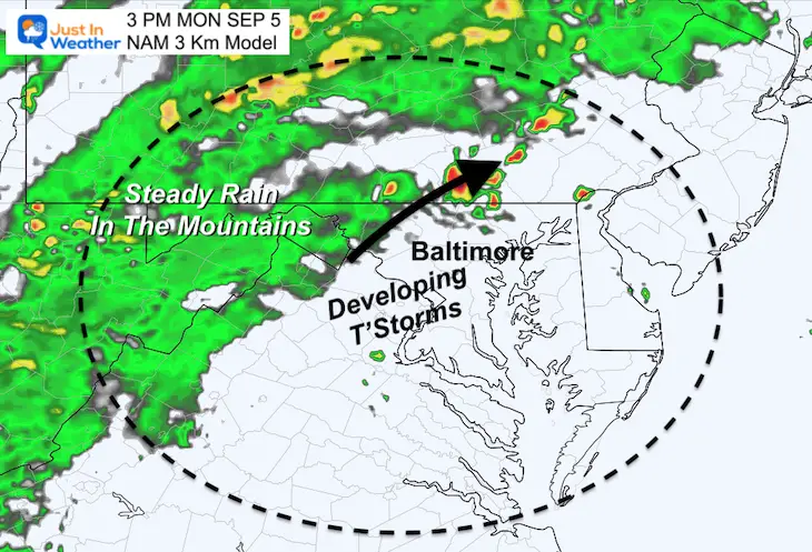
This shows a similar development of storm cells in central Maryland moving to the Northeast.
Slider —> 2 PM to 7 PM
The main event should end in the morning, then rain showers will continue to linger with a cool and unsettled trough aloft hanging on for a few days.
This is the most likely result of the event. 1 inch or more just north of Baltimore, and less to the south.
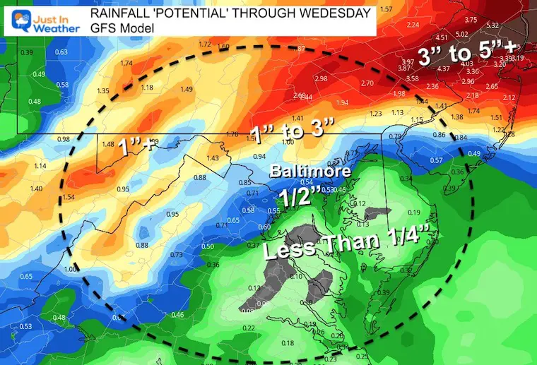
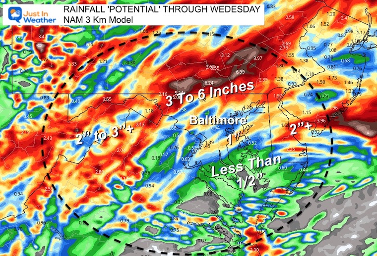
This model does tend to overdo precipitation. Here it shows a lot more rain under slow moving storms north of Baltimore. I would not band too much on the 6 inch plots, but some locally heavier downpours are possible.
This does expand the heavier rain deeper into central Maryland including metro Annapolis.
Unsettled Through Wednesday
Watch closely and see the circulation develop and move off the coast. This will keep us with a cool and damp Northeasterly wind into Thursday. However, the risk of rain showers will last into Wednesday.
Climate Data/Weather Stats For The Month
September Starts Meteorological Autumn: Weather Climate Stats For Maryland at Baltimore
Click to see more and ‘Book’ a visit to your school

COMPARE TO THE PAST
If you want a snowy winter, this is why you might want to look for in the rest of the tropical season.
Record August For No Named Tropical Storms: Closer Look At Snow Following
NOAA 2022 Hurricane Forecast- Above Normal Again


NOAA Study: Reducing Air Pollution INCREASED Tropical Storms

Atlantic Tropical History: Maps of Origin Regions Every 10 Days


Rainbow Ice Cave In Mt. Rainier A Very Rare Find: Photos And Video