


April 19 Showers Later Today Then Strong Winds Usher In Colder Air Tomorrow
Friday April 19 Morning Report The pattern is about to change. The sunny and mild days we have had will be replaced with a colder-than-average outlook into next week. This…
Thursday July 1 2021
A Severe Thunderstorm Watch has been issued for much of our region until this evening. The potential is for Damaging Winds, Large Hail, and even Isolated Tornadoes. Any storm not severe can still produce dangerous lightning and flash flooding.
If you get a ‘Warning’ that means there is a storm occurring and being tracked. That will be issued for a local area with towns listed in the path usually within a 30 to 45 minutes.
Once the line of storms moves through, this region will end earlier than stated from west to east.

Temperatures at 1 PM
The rain has cooled the temps on the north side, which will take the sting out of storms.
But the heat is back to near or above 90ºF from metro Washington to lower Delmarva. That is where the flare up of the most active severe weather will be later today.

Recap So Far….
This morning ended up a little more active on the west and north side of Baltimore. This confirms the issue I have been mentioning with the computer model guidance under performing lately.
The places where storms hit this morning, have cooler temps and less likely for the severe outbreak this afternoon.
Morning Radar: 7 AM to 10 AM

Surface Weather At Noon

Storm Expectation
As I mentioned, the short range modeling has been under performing. I’ve compared a snapshot for 2 PM to show how different the HRRR and NAM models play out.


Storm Animation (NAM)
I still see this model as the better performing, but the activity may be more extensive than shown here.

Live Radar and Lightning
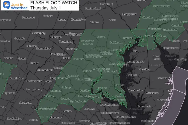
Flood Watch
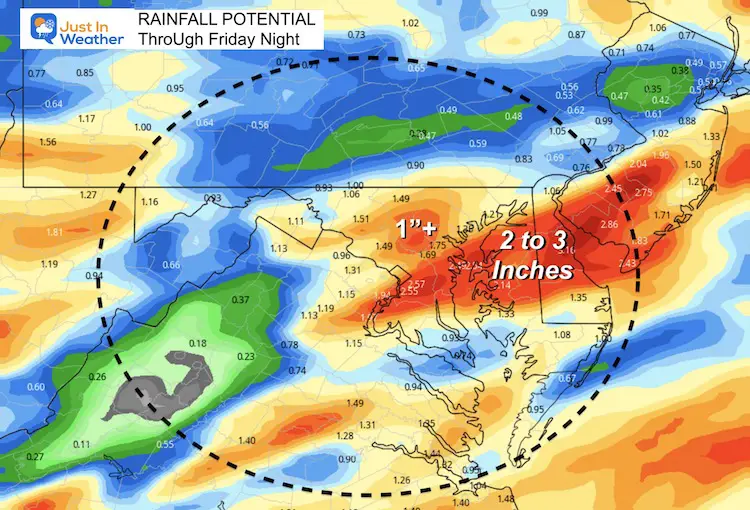
Rainfall Potential
My concern is the slow moving front. Storms may train over some areas, and crawl through the region. This is where some really heavy rain and local flooding may develop.
In Case You Missed It:
Amazing Video of Baltimore Lightning and Storm Photos
Earthquake in Woodlawn, MD on Friday
Sunshine State Of Mind
I am done with the cold and snow (for the season). I am embracing my wife’s mantra of Sunshine State of Mind.
This was designed by Shannon Berk and we will be wearing it through spring and to the beach.
Double Benefit: Proceeds will be split between our nonprofit Just In Power Kids and the development of my new weather website. That has been scheduled to be ready to launch in May.

14 Local Maryland Pages (and York PA)
We have made a page for Maryland Weather which gives you the current conditions for 14 present area locations.
Please share your thoughts, best weather pics/video, or just keep in touch via social media