


April 19 Showers Later Today Then Strong Winds Usher In Colder Air Tomorrow
Friday April 19 Morning Report The pattern is about to change. The sunny and mild days we have had will be replaced with a colder-than-average outlook into next week. This…
Wednesday January 12 2022
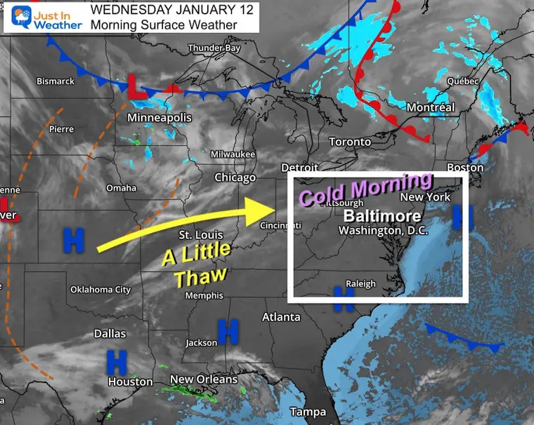
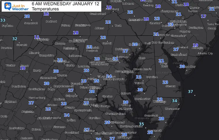
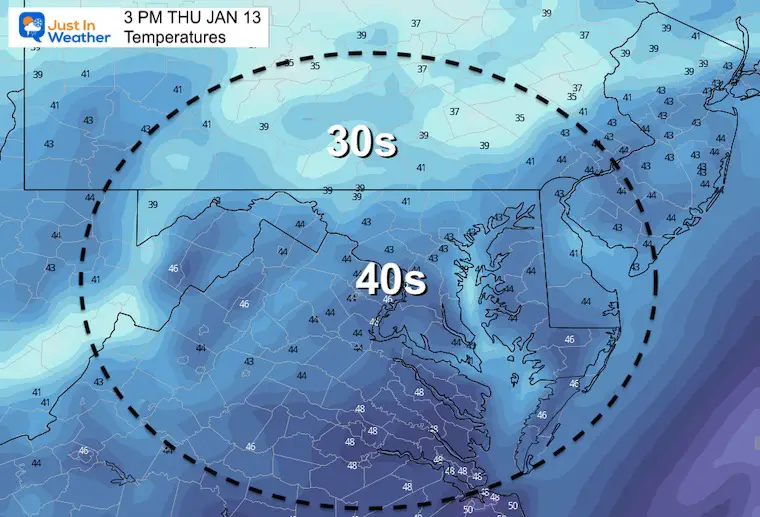
This morning is still cold, but with light wind it should feel better. In fact, a little warming to the 40s for many areas over the next couple of days may help take the sting out of the air.
Next Up: That strong storm is expected at the end of the weekend. It looks more likely there will be an event, but still a big split on track and resulting snow or rain.
Not much action on the map. A cold start, but High Pressure is dominating much of the Eastern US.
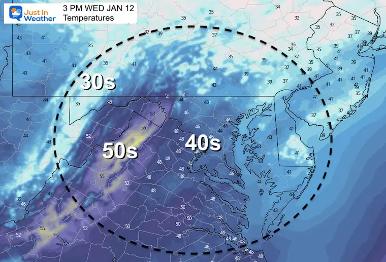
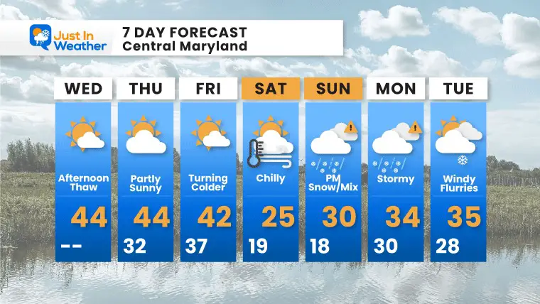
Temps will thaw for most of the region into the upper 30s to mid 40s.
Normal Low in Baltimore: 24ºF
Record 1ºF in 1981
Normal High in Baltimore: 41ºF
Record 70ºF 2020
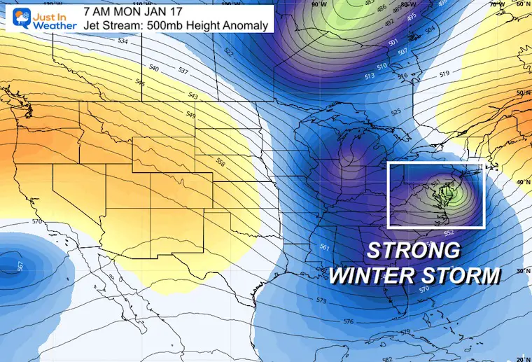
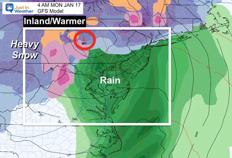
This snapshot shows the deep trough and Upper Level Low right over our region Monday morning.
The signal is there for a storm. The specifics of the track are less certain.
Friday to Monday
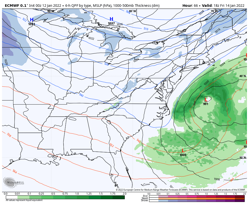
This looks VERY IMPRESSIVE. It develops a storm that rides up The Chesapeake Bay Monday morning.
Note: The energy is currently over the Pacific Ocean and this particular storm has not formed yet.
This is only one solution, and a closer looks highlights how much the results can vary.
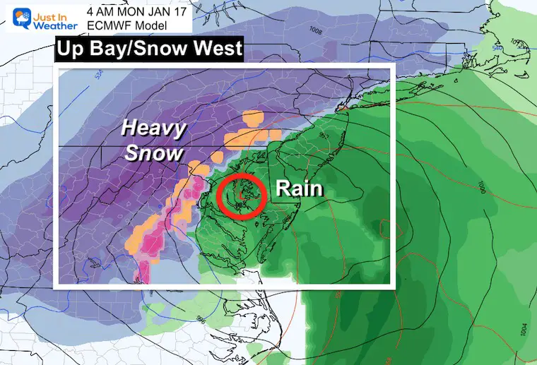
Early Monday morning we can see this latest solution bringing heavy snow inland and rain along and east to the Bay. In between could be anything from a slushy snow to icy mix.
Yesterday this model had the storm well off the coast. I expect there will be more fluctuation in plots over the net few days.
It’s still too early…
This Model also changed a lot and now brings the Low well inland for a rain event.
Also expect this to vary widely.
Still NOT in agreement and still too early for specifics.
This is the time frame to pay attention and start a backup contingency plan for Sunday and Monday events.


Last Winter Recap: My Old Outlook And Your Grades Of My Storm Forecasts


