One thing I can say about this month is the ample supply of cold air. Baltimore seems to really like the number 15ºF, as BWI hit or dropped below that mark five times this month.
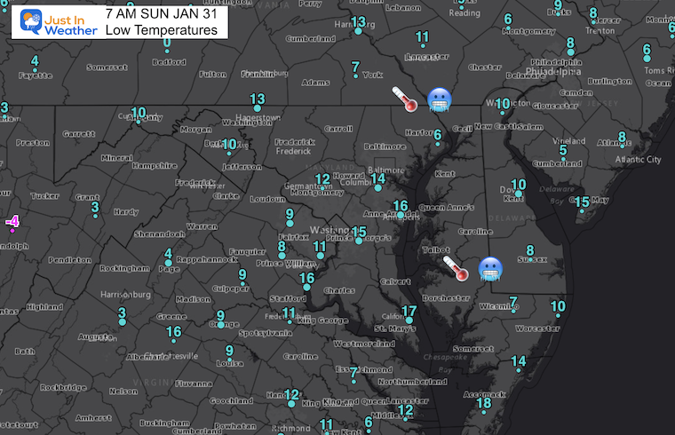
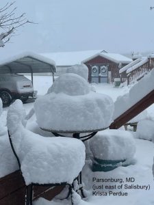
Even more impressive: With deep snow pack it is was colder on Delmarva this morning. Yes, Salisbury and Ocean City have had more snow and now colder than Baltimore. Check out these numbers.
Morning Low Temperatures
Yes, single digits on Delmarva! It was actually just as cold in Salisbury as York, PA (our regional cold spot)
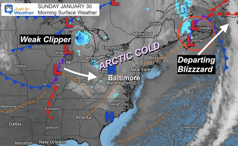
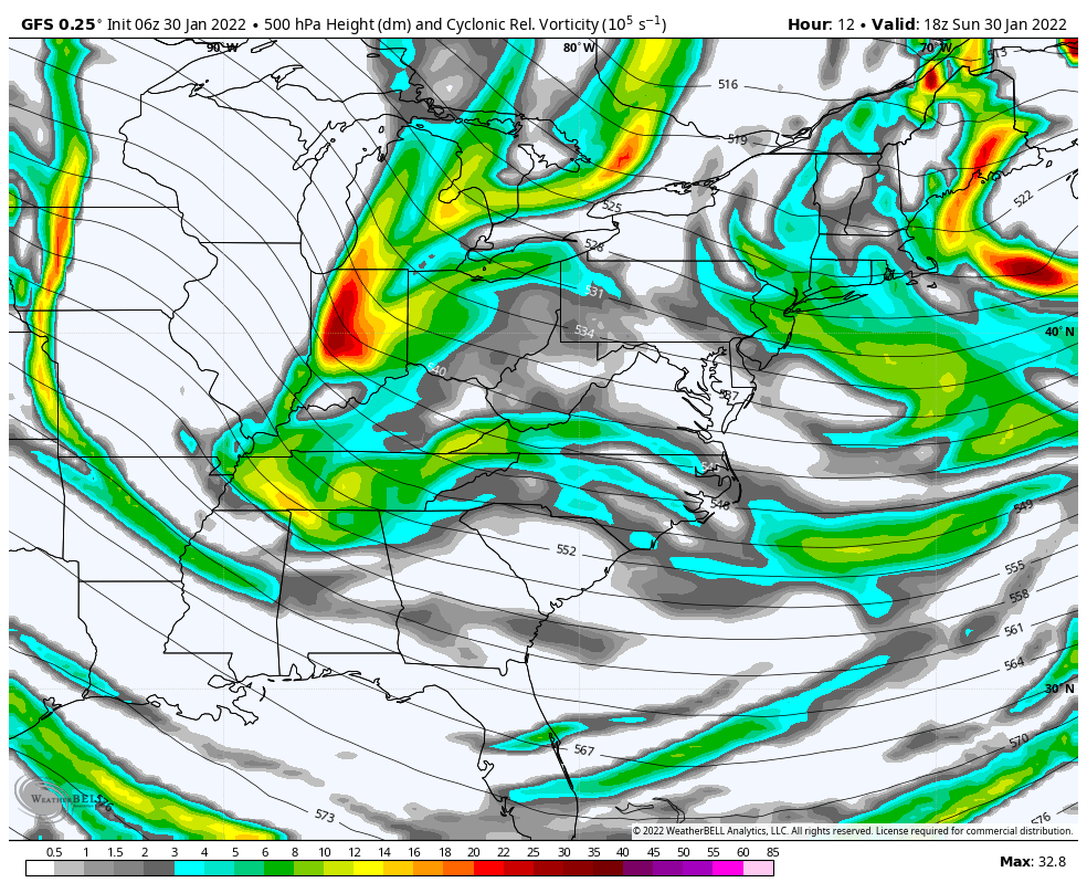
Morning Set Up
High Pressure is in control with the Arctic Air in place.
The Blizzard is departing in Eastern Canada.
To our west, a weak clipper. This will bring snow showers to the mountain later, and perhaps some flurries across central areas tonight and tomorrow.
There will be a few pieces of energy aloft that will produce clouds, and perhaps a few flurries.
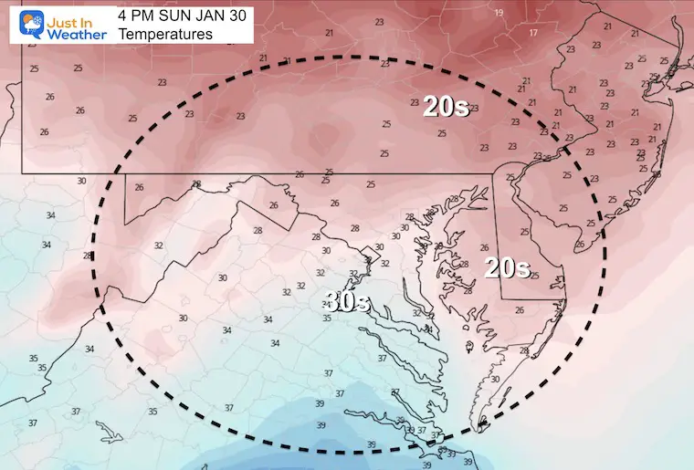
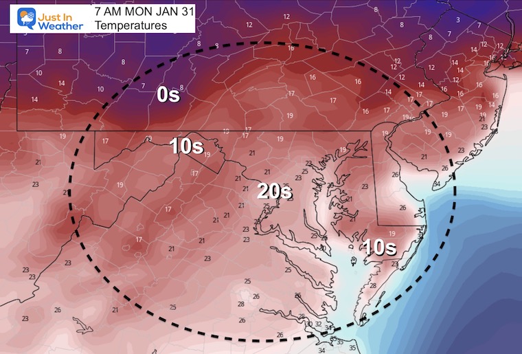
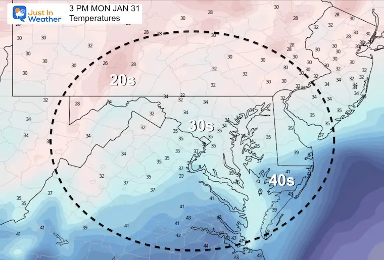
Monday Temperatures
Jumping Ahead….
Wednesday to Friday
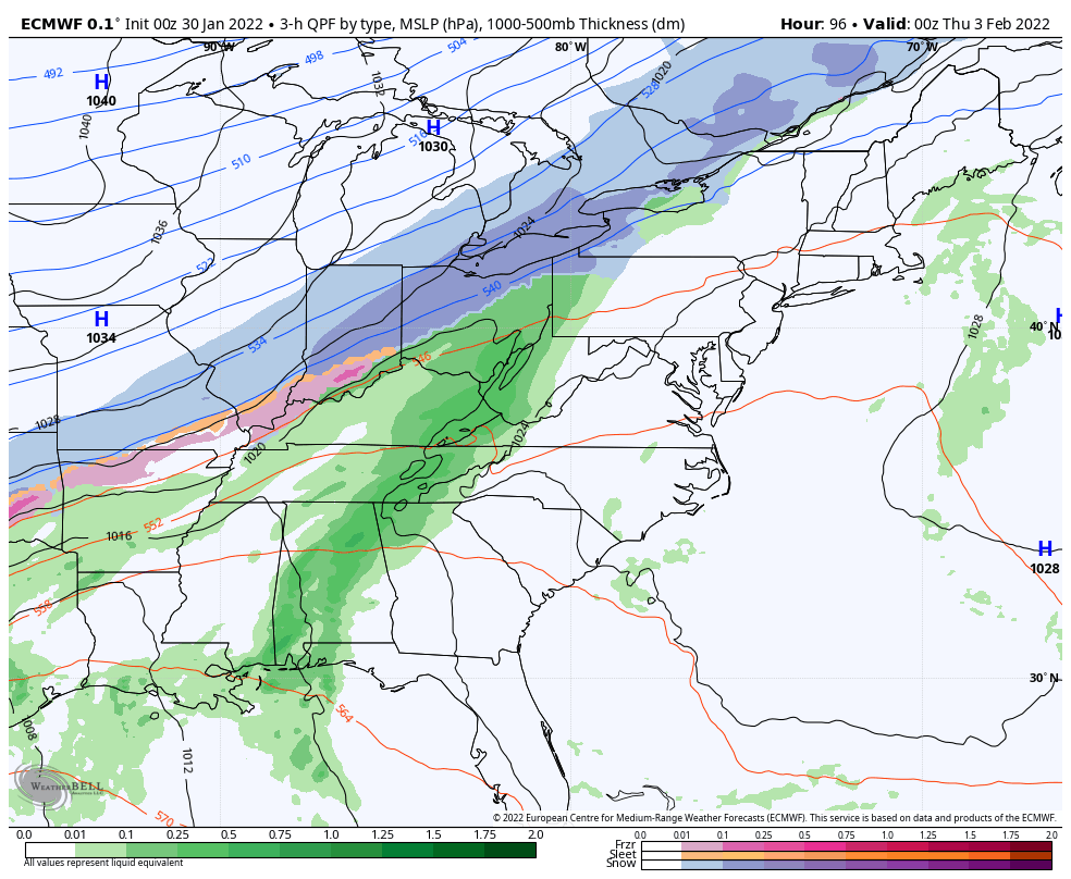
The next system will take a track well west.
This will warm us up ahead of it, and bring in rain Thursday. That may end with a mix on Friday, with the next round of cold air.
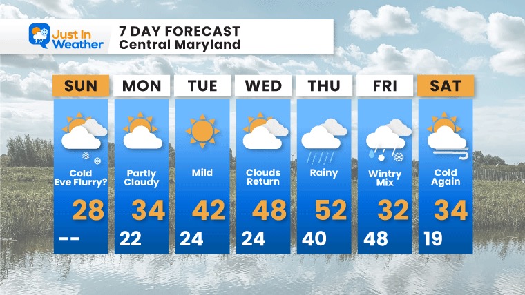
7 Day Forecast
Based on Baltimore at BWI
More clouds and perhaps some flurries tonight and Monday. Then warming ahead of the next storm.
Rain arrives Wednesday night into Thursday, with temps into the 50s.Arctic air is expected to follow the storm Friday. This may end with a windy mix. It is too early to speculate if this will be a travel impact…
I am aware there are some spelling and grammar typos. I have made a few public statements over the years, but if you are new here you may have missed it:
I have dyslexia, and found out at my second year at Cornell. I didn’t stop me from getting my meteorology degree, and being first to get the AMS CBM in the Baltimore/Washington region.
I do miss my mistakes in my own proofreading. The autocorrect spell check on my computer sometimes does an injustice to make it worse.
All of the maps and information are accurate. The ‘wordy’ stuff can get sticky.
There is no editor that can check my work when I need it and have it ready to send out in a newsworthy timeline.
I accept this and perhaps proves what you read is really from me…